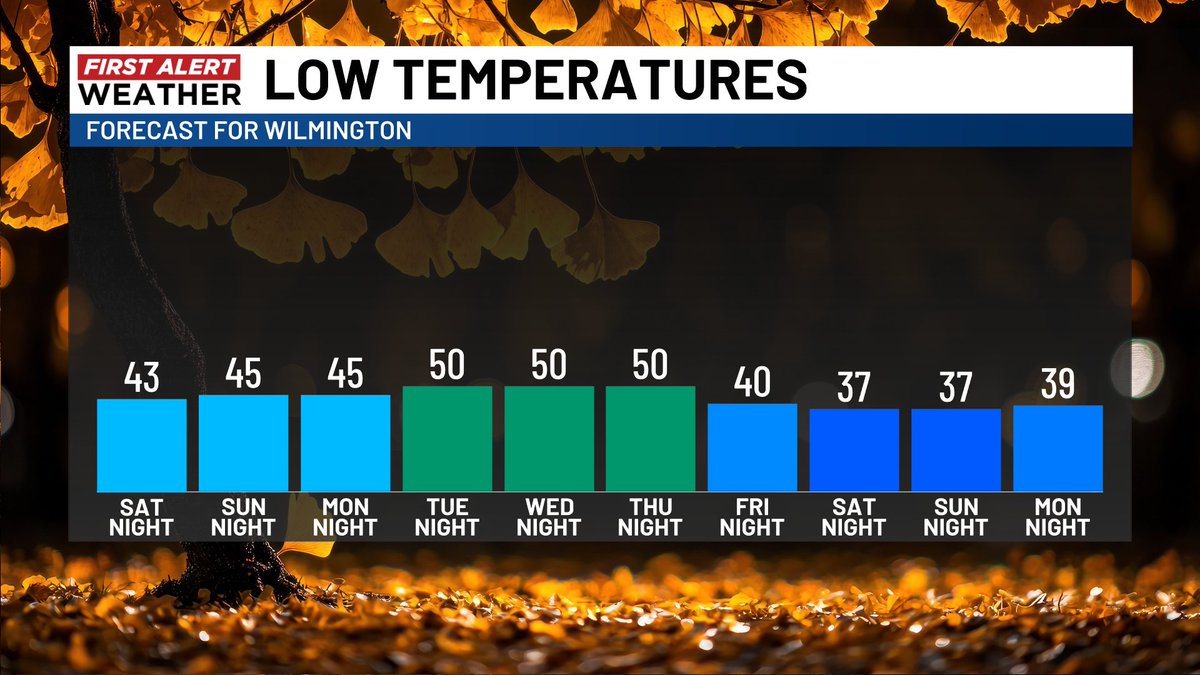
Some chilly lows early in the new week but take a look at next weekend. Some parts of southeast NC could see their first frost or even a freeze in a few spots. We are First Alerting you now! #WECTwx#ILMwx
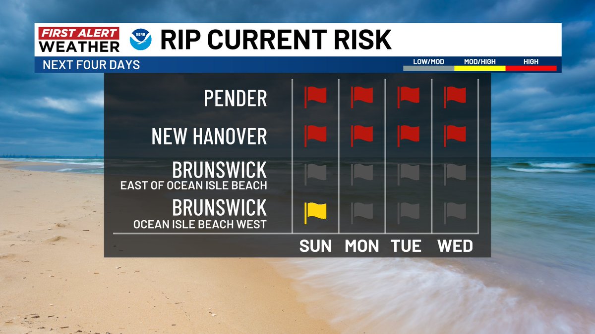
A sunny but brisk Sunday ahead for southeast NC. There will be issues near the coast with wind gusts up to 30 mph, some minor coastal flooding, and a high rip current risk on east facing beaches. #WECTwx#ILMwx
Subtropical #Josephine has formed as of 5 p.m. Wednesday. It could strengthen a bit more as it tracks away from the Carolinas in the coming days. #WECTwx#ILMwx
After falling just short on Wednesday, Thursday and Friday feature two more shots at record highs. Temperatures crash this weekend behind a fall cold front. #WECTwx#ILMwx
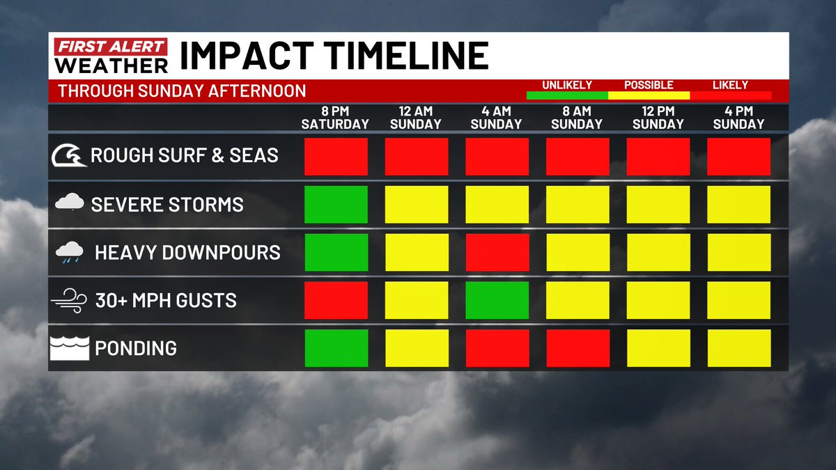
Here is the latest timeline for the weekend storm through Sunday afternoon. The severe weather window opens overnight. Watch out for ponding on roads first thing tomorrow morning. #WECTwx#ILMwx
As we head into Sunday the biggest risk shifts from localized flooding to a growing severe weather risk, especially late morning into the afternoon. Make sure you have a way to receive warnings and react quickly. #WECTwx#ILMwx
Tropical moisture from #Isaias well to our west pushes in on Saturday. The heaviest rain and highest flooding risk is Saturday afternoon into Saturday evening. The highest risk of isolated rotating thunderstorms is overnight into Sunday morning. Make sure you have a way to receive warnings before bed Saturday night. #WECTwx #ILMwx
The latest EURO run still shows 2-4+ inch rainfall totals over southeast NC through Sunday evening. Isolated spots could see even more. There is a severe weather window Saturday night into Sunday morning. Expect some 30+ mph gusts and minor to moderate marine impacts. #WECTwx #ILMwx
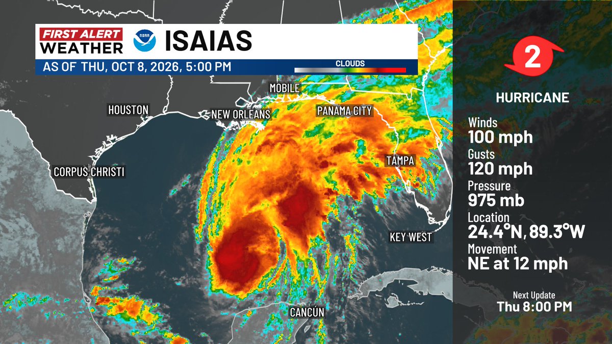
#Isaias will soon reach hurricane status and is on track for an early Saturday landfall along the central Gulf coast. A squeeze between Isaias and a strong high to the north could bring heavy rain, high tides, some coastal flooding, and a small tornado threat late Saturday into Sunday to southeast NC. #WECTwx #ILMwx
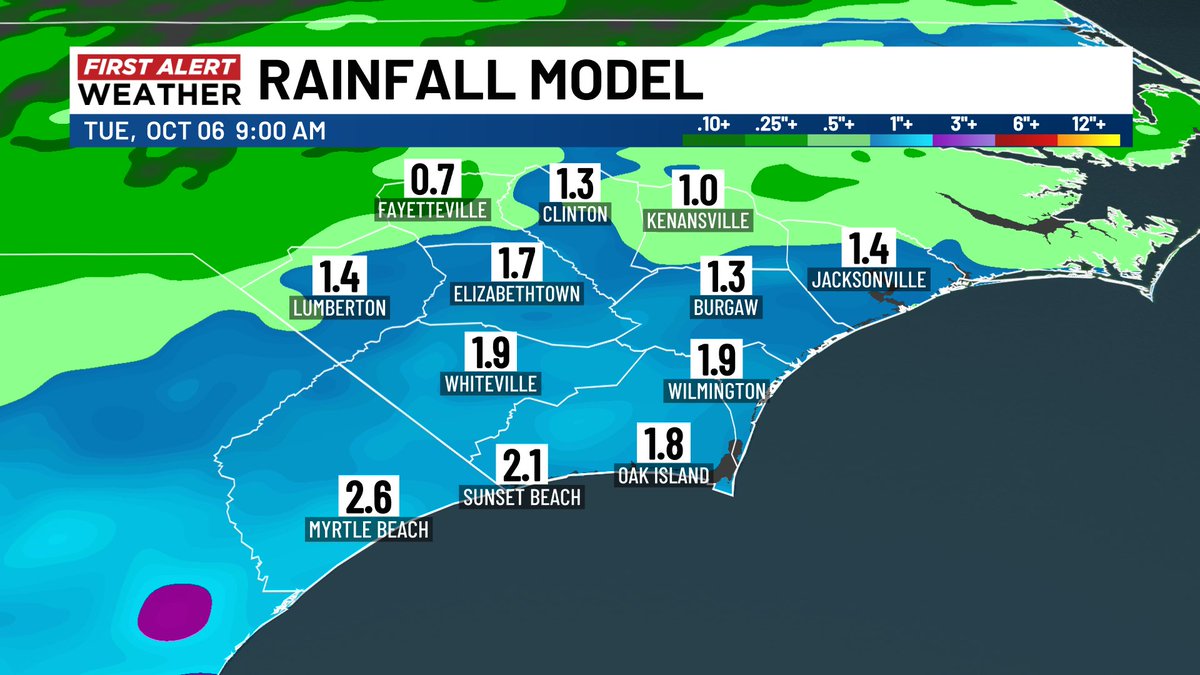
Sunday will be a wet one in southeast NC with off and on rain and embedded storms. Widespread 1-2 inch totals are likely. Expect ponding on roads and possibly some minor flooding issues. Rain should be heaviest in the morning. #WECTwx#ILMwx