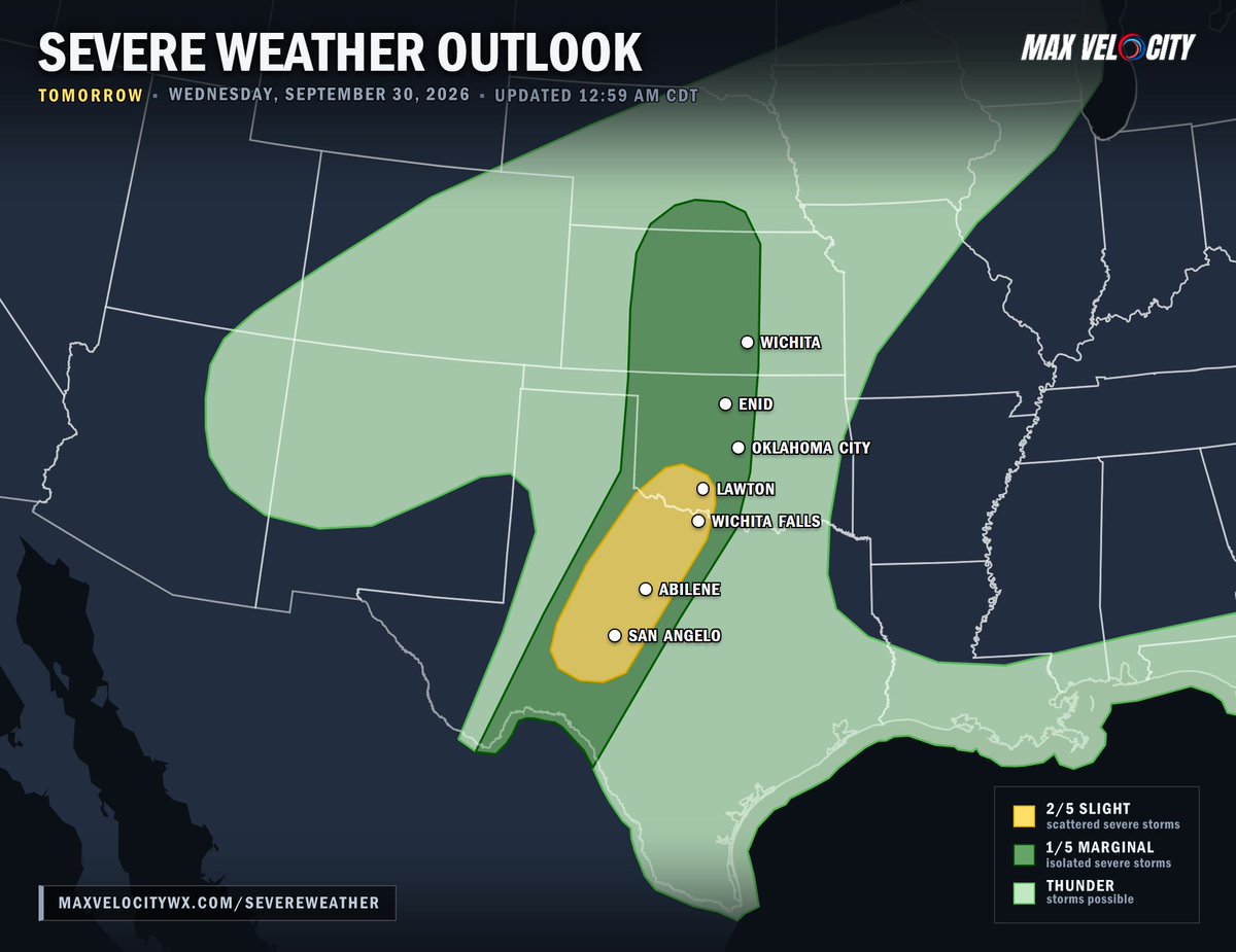
Severe thunderstorms packing large hail, damaging winds, and an evening tornado threat will target the Southern Plains tomorrow!
As a potent storm system swings out of the Rockies on Wednesday, it will spin up a surface low over Kansas and sharpen a dryline down into West Texas. Ahead of this boundary, warm and humid air will pool across the region, setting the stage for explosive thunderstorm development by late afternoon.
Storms are expected to erupt initially as individual supercells across west-central Texas and southwest Oklahoma. These early, discrete storms will carry a major threat for large hail and severe wind gusts. As the evening progresses, these cells will expand in coverage and merge into a powerful squall line pushing eastward.
As the sun sets, increasing wind shear in the lower atmosphere will add extra spin to the environment. This means any rotating storms embedded within the advancing line could produce an isolated tornado. This severe wind and tornado threat will continue into the mid-evening as the squall line sweeps across the region, while a separate, more isolated threat for severe wind and hail stretches north through Kansas and into southern Nebraska.
STANDOFF UNDERWAY
PLEASE AVOID 28th St. N. and Kenosha Ave. -- Officers are involved in a standoff.
Suspect shot at an Officer (but did not hit him), then retreated into a home.
More information as we get it.
#TulsaPolice
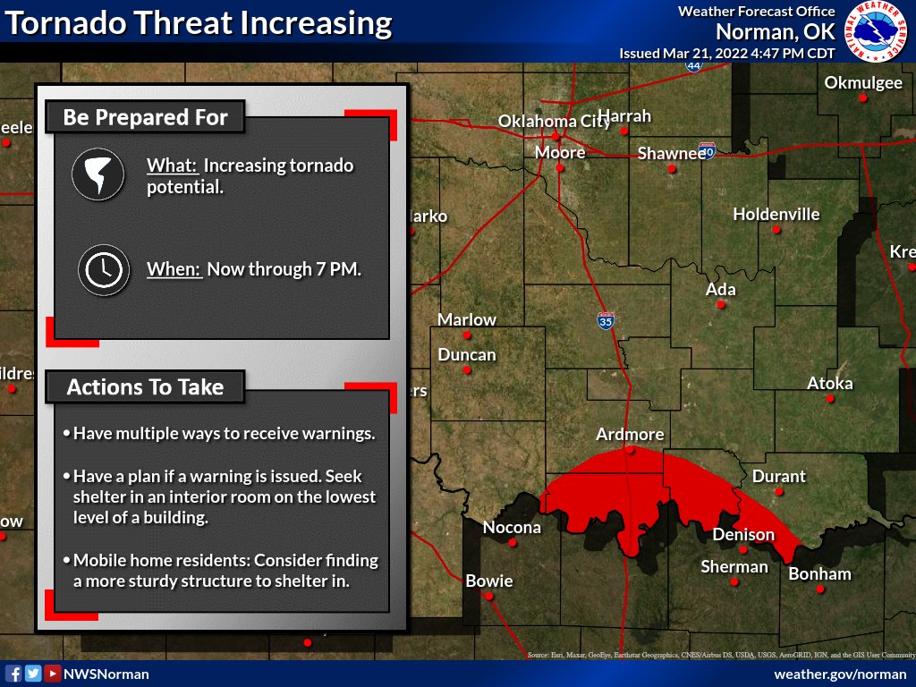
Heads up for those in south-central Oklahoma. Risk for tornadoes will increase over the next couple hours as the environment becomes more favorable and storms move into the area from Texas. Be prepared to move to shelter if a warning is issues for your location! #okwx