This has to be the most incredible video ever shot from a Hurricane Hunters flight inside the eye of a Category 5 #Hurricane. Check out this thread of videos from multiple passes inside the eye documenting the “stadium effect” of Hurricane Melissa.
Hurricane Wilma slammed into South Florida 19 years ago today, on October 24, 2005. I documented the chaos in Miami Beach and captured extreme wind gusts wreak havoc on the beachfront including flipping vehicles just before penetrating the calm eye. https://t.co/BGATSy44G8
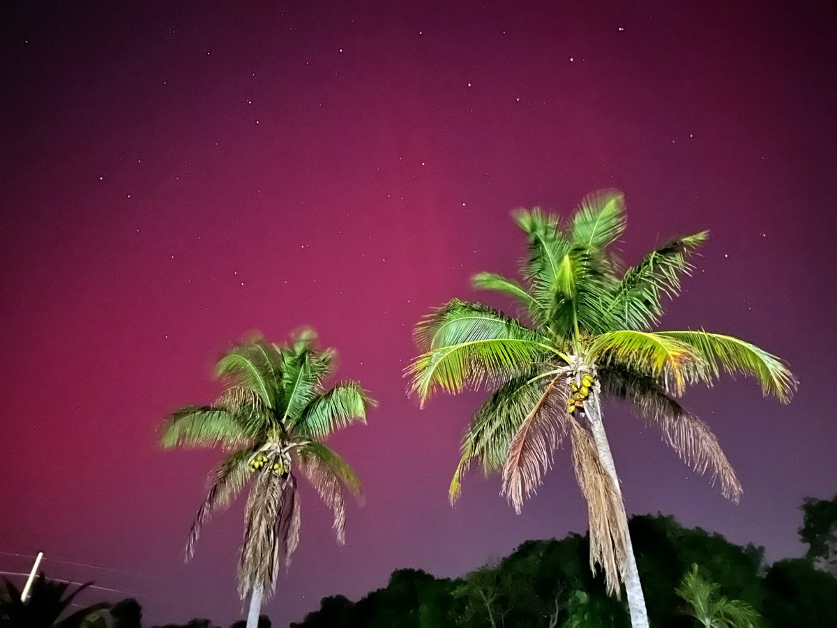
Tonight is the second time this year we witnessed the #northernlights in Key Largo, Florida. It’s extremely rare to see the aurora so far south. These photos were taken from Latitude 25°6′24″N
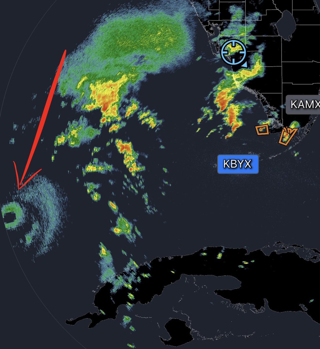
The small eyewall and eye of Hurricane #Milton is coming into range of the Key West radar site. This destructive ring of compacted thunderstorms is less than 300 miles from the coast of Florida. Now we can closely monitor any sudden change in direction or wobbles with precision.
We are making final preparations to deploy the H.E.R.V. Hurricane truck on the west coast of Florida directly in the path of Category 5 Hurricane #Milton. Our mission is to measure the wind speeds located inside the intense eyewall as it makes landfall. Notable measurements from past missions: Hurricane Laura 154mph, Hurricane Michael 128mph, Hurricane Irma 120mph, Hurricane Helene 108mph.
The H.E.R.V. hurricane truck measured a max wind gust of 108mph in the eyewall of Hurricane Helene in Perry, Florida. Personally, at my location in Perry the “wind” didn’t feel like a Category 4 hurricane. The most destructive impacts was the extreme storm surge on the coast and inland flooding. #Helene
The new (H.E.R.V. 2.0) Hurricane truck is fully operational and will deployed into #HurricaneHelene later today. Our mission is to penetrate the right front quadrant of the eyewall and document the powerful onshore wind gusts as #Helene makes landfall in Florida.
Watch the video until the end, the extreme wind blast lasts for about 20 seconds just before breaking into the tiny calm eye and measuring a low barometric pressure of 942mb in Charlotte Harbor, Florida.
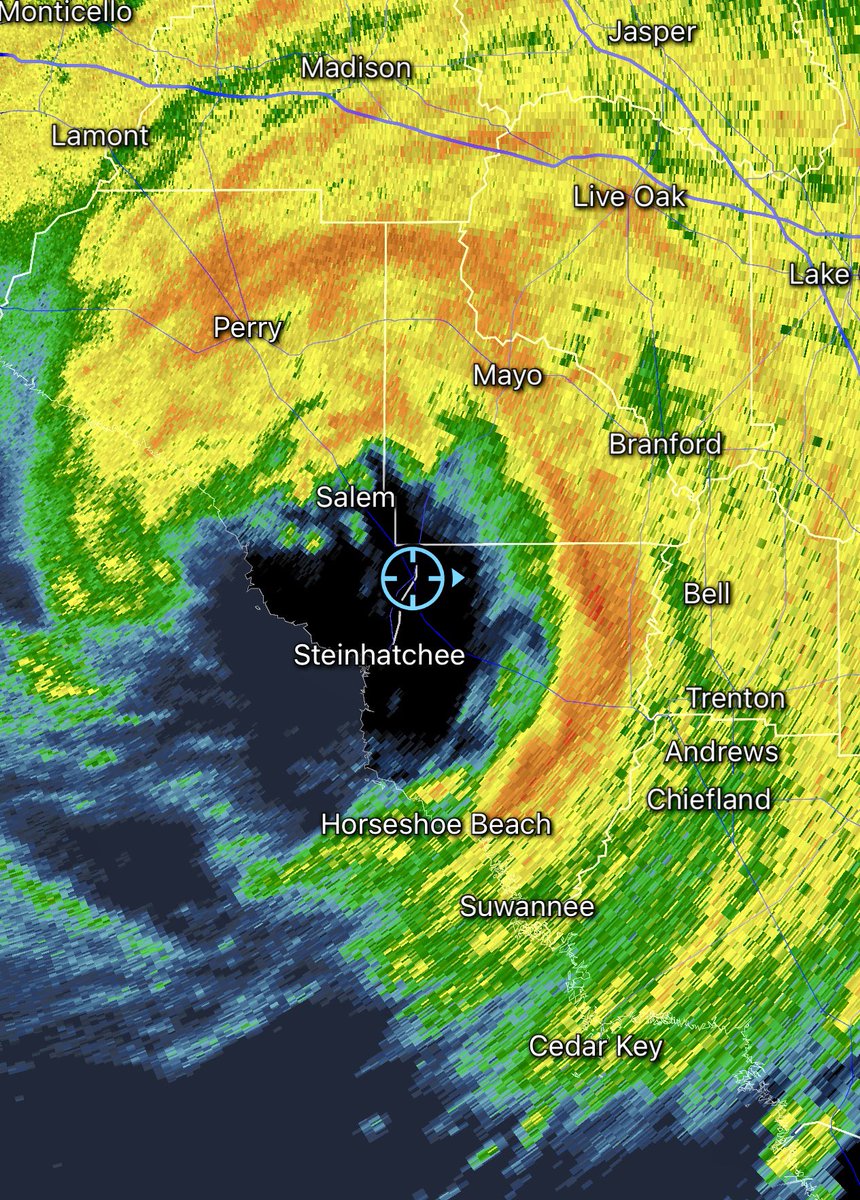
Intercepted the eye of #HurricaneDebby near Steinhatchee, Florida. The lowest barometric pressure measured was 979.9mb at 7:10am eastern time. @NHC_Atlantic
Intercepting the intense outer bands of #Debby on my way out of the Florida Keys in route to document the landfall of #HurricaneDebby tomorrow morning.
Incredible pink Aurora Borealis with light pillars at 11:00pm in Key Largo, Florida. This has to be some kind of record this far south. Coordinates: (25° 07' 56" N) (80° 24° 19" W)
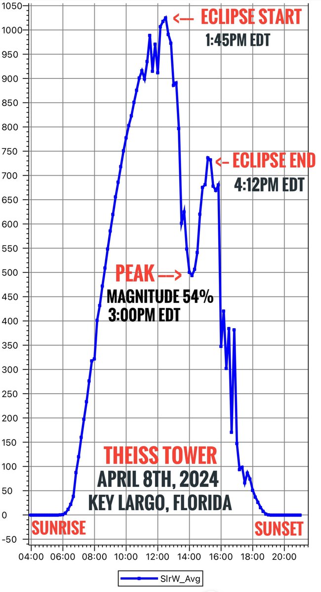
The @TheissTower in Key Largo captured interesting data from partial #SolarEclipse using a Pyranometer sensor. We were not in the path of totality, but we were still able to document a dip in solar radiation during partial coverage of the sun. Check out this line graph.
@NWSKeyWest This is the rain gauge that measured 14.92 inches of rain over a 16 hour period of thunderstorms this week. It’s located at the Theiss Tower at mile marker 103 in Key Largo. Could this be a new rainfall record for #KeyLargo ?
Wild Weather in #KeyLargo last night. The @TheissTower documented a peak wind gust of 55mph at 2:36am, the same exact time of this radar image, the tower is located inside the green circle. The tower also recorded an astonishing 14.92 inches of rain over a 16 hour period and a 6mb pressure drop from 1008mb to 1002mb in less than 15 minutes !!
Hurricane #Idalia’s outerbands with embedded thunderstorms spiraling over Gainesville, Florida. Idalia’s eye should make landfall on the coast around sunrise tomorrow morning. This will be my 65th Tropical Cyclone intercept since 1987 !!