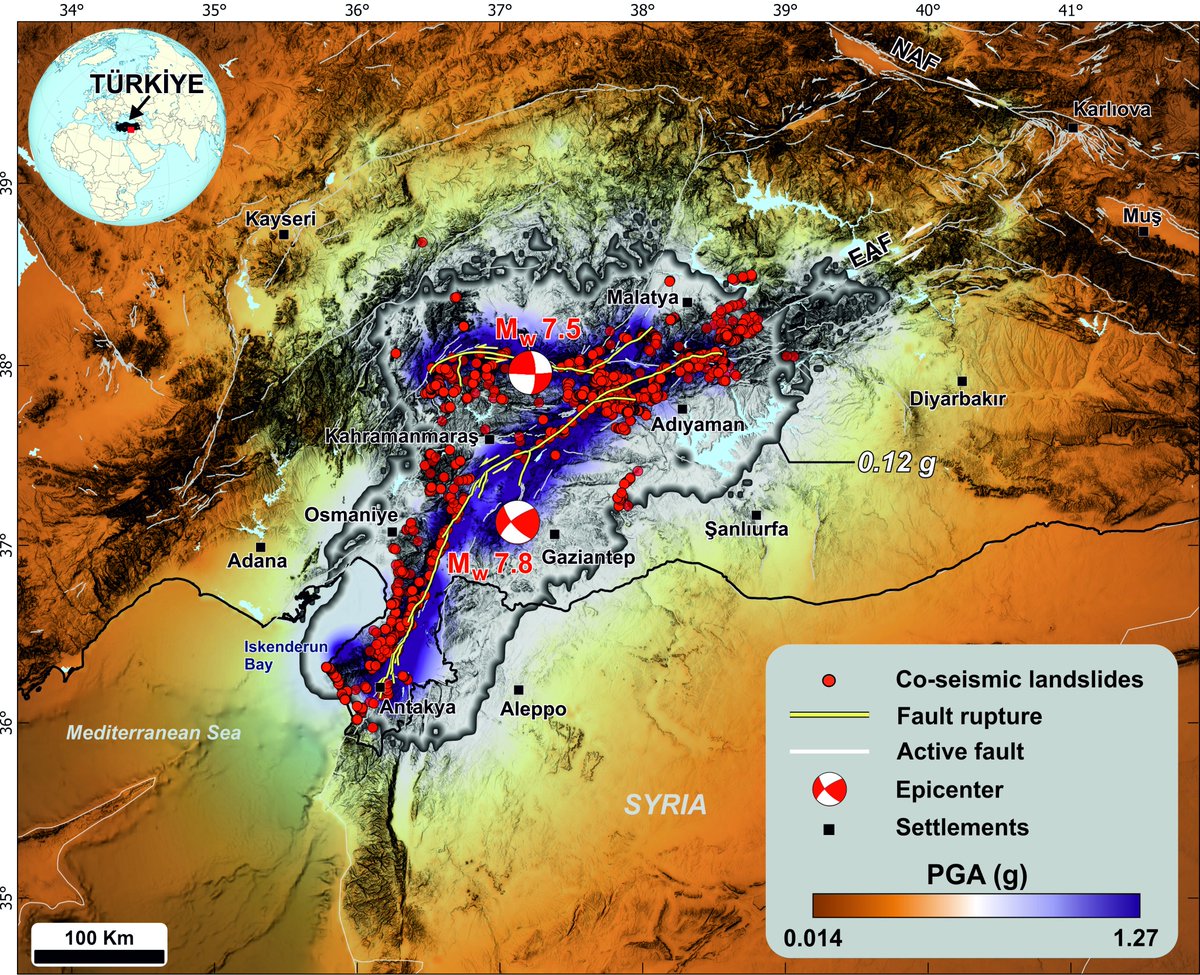
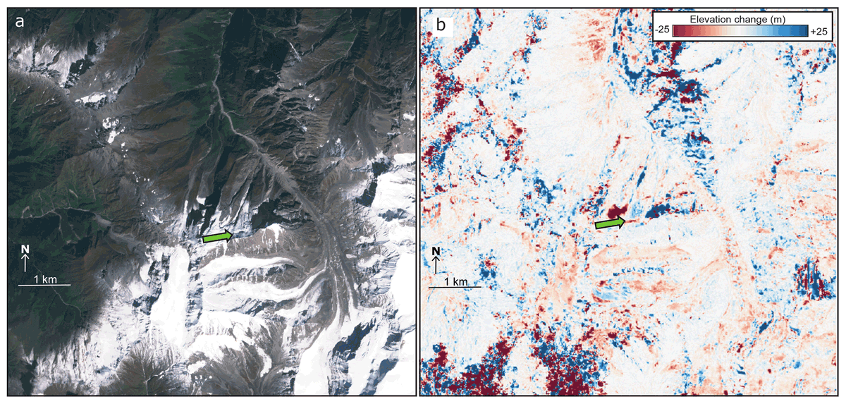
Our article on earthquake-triggered landslides has been published. You can access the article and landslide data by clicking on the link.
https://t.co/Fx6NX793aH
This map estimates the impact of the landslide and mudslide in the Oni District of Georgia: https://t.co/Pzvmk9tY22
WorldView-2 and #Pleiades images are used to compare the area before and after the disaster. The inset shows a closer view of Shovi.
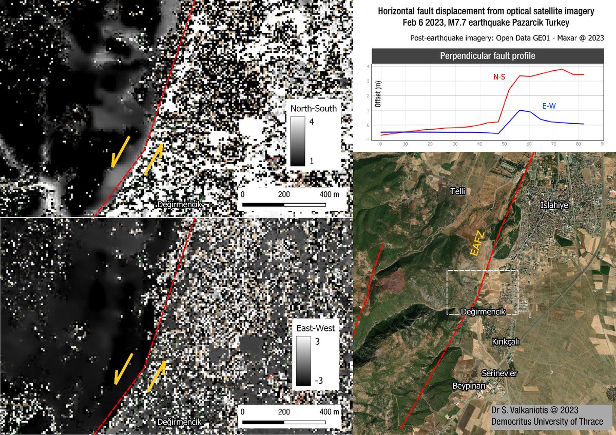
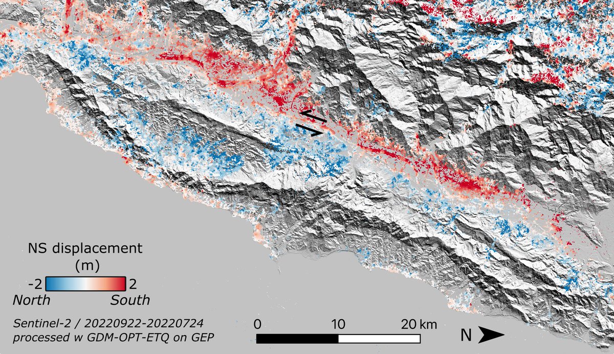
A very crude first look of surface fault offset along the East Anatolian Fault trace from the Feb 6 M7.7 #earthquake. ~3m of North-South displacement & ~1m of East-West displ. Fast run with post-eq imagery from @Maxar satellite imagery #SatelliteImagery#Earthquake#Turkey#Syria
On the Blog: displacement time series over the region of Joshimath, currently facing a major gravitational instability.
@CopernicusEU Sentinel-1 ascending track 129 (150 scenes, Jan'18 to Dec'22), processed with GEP SNAPPING PSI Full Resolution service
https://t.co/vmnDM4mYh5
Landslide in a haystack: in our new paper we track metre scale movement on the Chamoli rock-ice avalanche several years prior to collapse. However, detecting this movement without any prior knowledge (for monitoring/mitigation) remains very difficult.
https://t.co/4Msk2QlziK
On the Blog: new branding for the MPIC-OPT services, now GDM-OPT !
Ground Motion monitoring with OPtical image Time series
Read more:
https://t.co/LeZGSllNrz
Débâcle de la banquise aux abords de Dumont d'Urville #TerreAdelie 🇦🇶 depuis 48h, engendrée par une puissante houle de nord-ouest (6m50, période 15 secondes), avec la mer qui gagne dans le chenal du Lion. #SummerIsComing 📽️ Loïc Dagorn
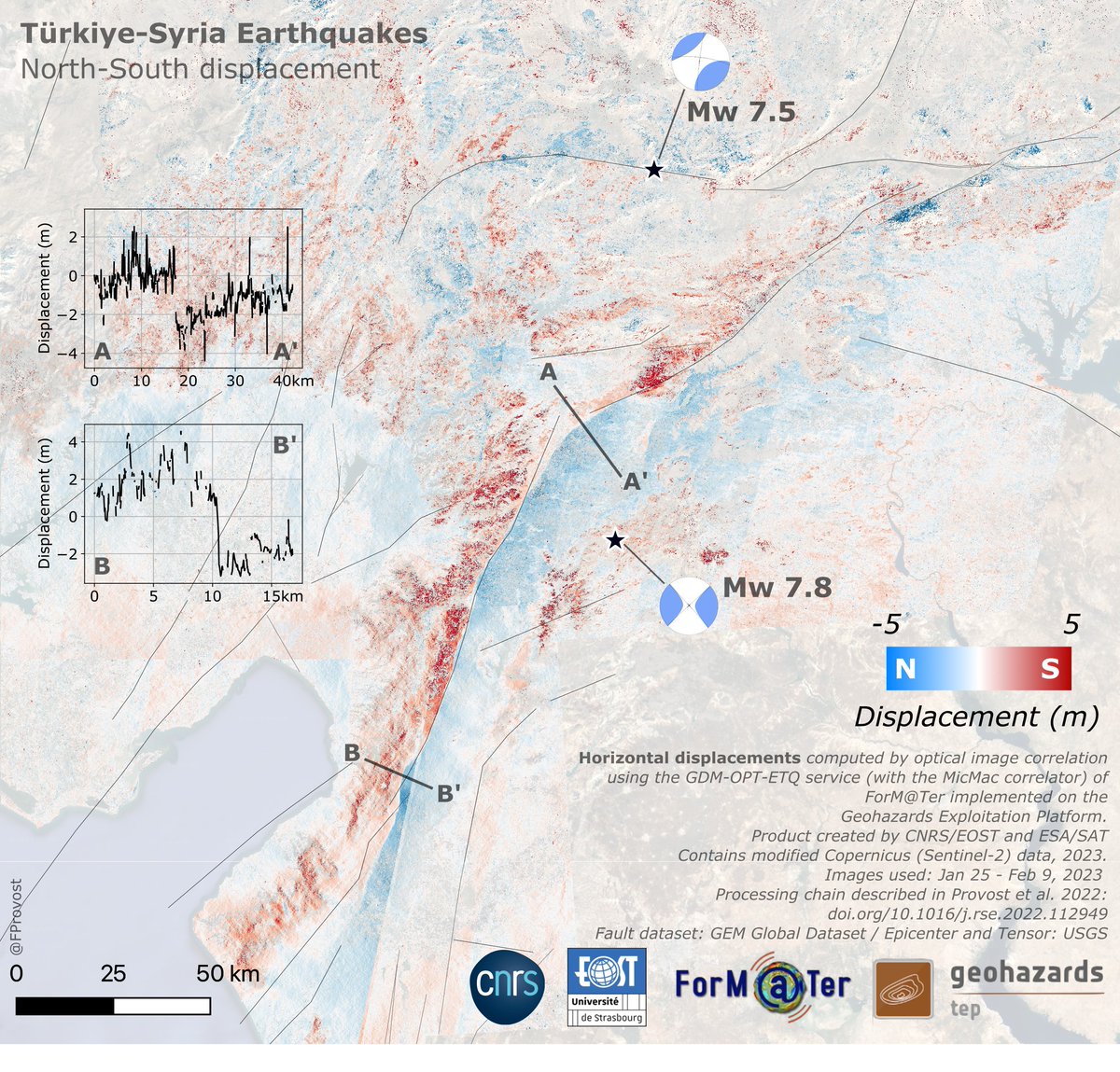
Co-seismic displacement from #Sentinel2 images over the region of the Mw6.9 #Taiwan earthquake. Computed with GDM-OPT-ETQ on GEP using MicMac. NS and EW displacement maps here : https://t.co/szzTwExOYo
We have just announced with the European Commission that the @CopernicusEU#Sentinel1 B satellite can no longer deliver radar data.
This were the conclusions of the Anomaly Review Board:
https://t.co/N1CBYtxZw3
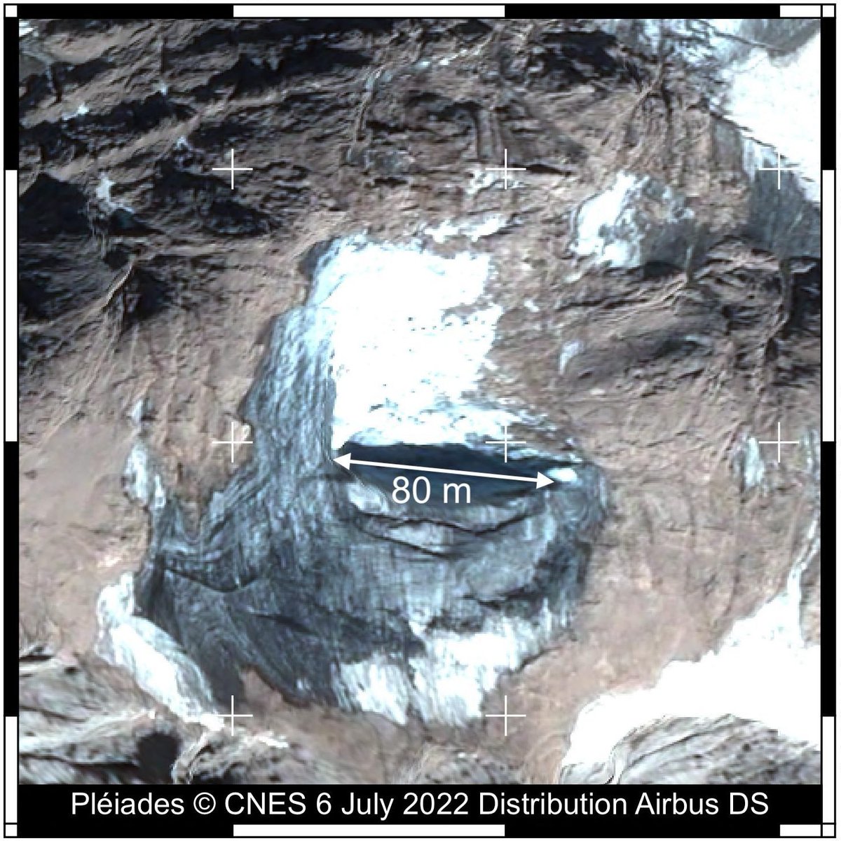
How big was the Marmolada glacier collapse? Read our blog post with @EtienneBerthie2 "Estimation of #Marmolada glacier collapse volume using Pléiades imagery" https://t.co/1pxs3QTLMB
Co-seismic #Sentinel1 interferogram (June 22 - July 4) of the recent cluster of moderate-strong earthquakes in southern Iran; clear (cumulative?) deformation lobe at the center, BUT the real interesting part is the noisy area over Mehran river delta, east of the ruptures --> 1/3
On the Blog: Sentinel-1 PSI-SBAS InSAR inter-comparison & accuracy of vertical + east-west displacement velocities against geodetic data
A contribution posted by @ESA_EO NoR sponsored GEP user @FraCigna 👏
https://t.co/6SUct9JaZg
Felt that one‼️
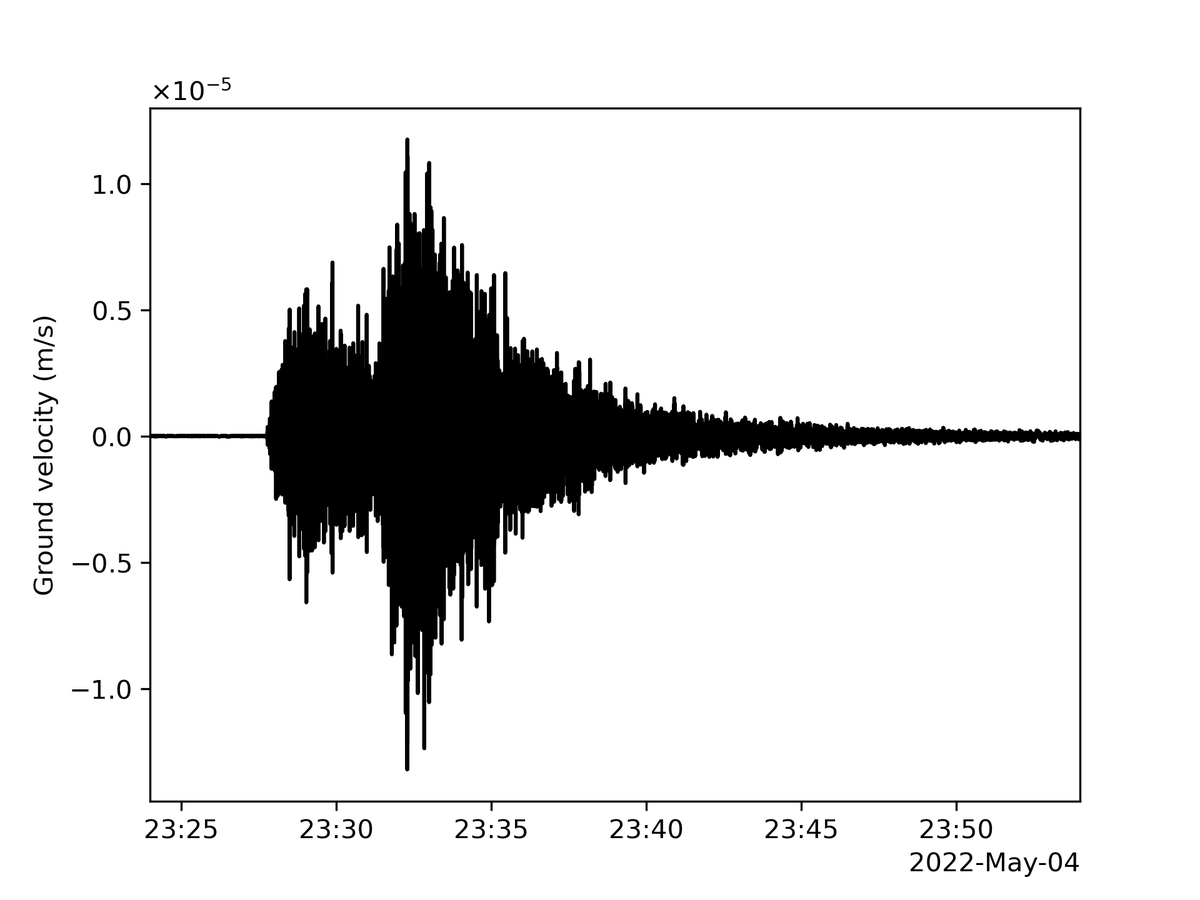
After more than three years of listening to the soft rumbles of Mars, I just felt by far my biggest “marsquake” yet: looks like about magnitude 5. My team is studying the data to learn more. Science rewards patience!
More details: https://t.co/DKVy8tUrxU
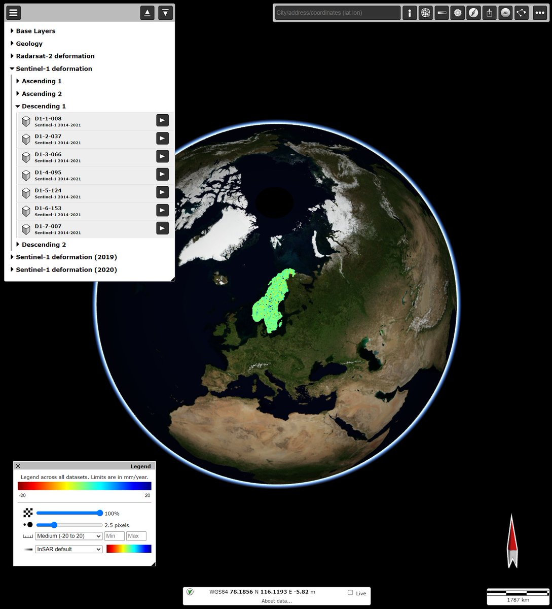
With this year's update, #InSAR Norway more than doubled in area last week to include Sweden. Now including #Sentinel1 data from 2021, the datasets now show seven years of cumulative displacements.