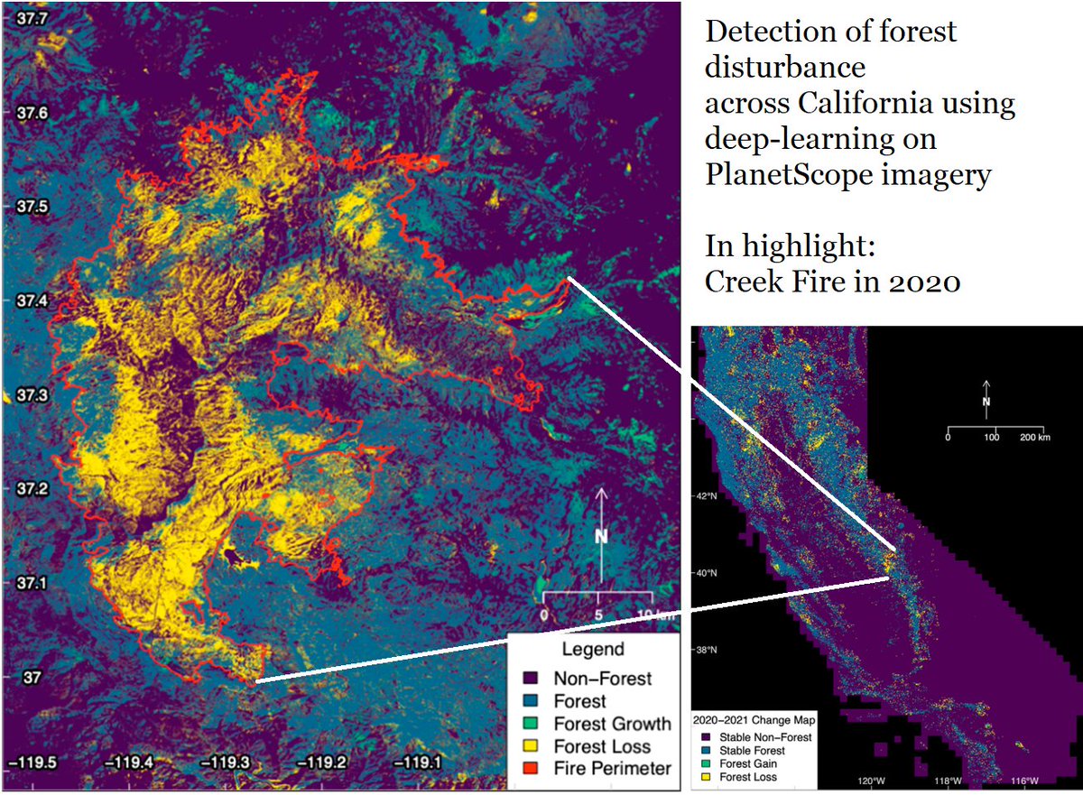
🌲Our new paper maps state-wide tree cover and forest change using high resolution remote sensing data and a deep ConvNet🧠
"Detection of forest disturbance across California using deep-learning on PlanetScope imagery"
https://t.co/a206e0UNti
I had the pleasure of working with @RicardoDalagnol, @FabienWagner, and the @CTrees_org team who helped guide me and bring this project to life😁 Looking forward to more interesting science and deep learning!
🌲Our new paper maps state-wide tree cover and forest change using high resolution remote sensing data and a deep ConvNet🧠
"Detection of forest disturbance across California using deep-learning on PlanetScope imagery"
https://t.co/a206e0UNti
📢🌲Sharing our new paper led by Griffin Carter @gc_sci : "Detection of forest disturbance across California using deep-learning on PlanetScope imagery"
🔍Creek Fire in 2020 w/ CALFIRE map (red) and our 3x3 m detection (yellow)
📎 https://t.co/3HfURdukEA
@UCLAIoES@CTrees_org