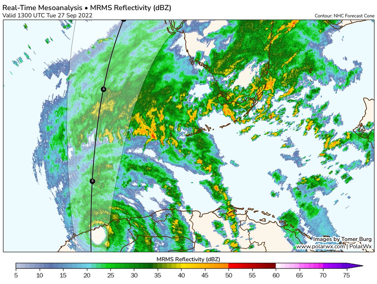
Despite what some fear mongering social media posts going around say, it is highly unlikely that a hurricane is going to form in the Gulf or Caribbean in the next 2 weeks. https://t.co/TQ9qrezRsy
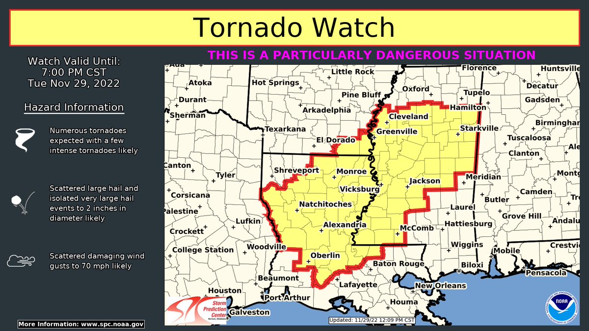
A rare Particularly Dangerous Situation (PDS) tornado watch has been issued for parts of Louisiana, Arkansas, and Mississippi until 7 PM CST. Strong tornadoes, damaging winds and hail will be possible.
There is potential for a significant severe weather event to unfold across parts of Louisiana, Mississippi, Arkansas, and Tennessee Tuesday. https://t.co/XiONpNy0LE
Hurricane Ian has made landfall in southwest Florida near Cayo Costa at approximately 3:05 PM EDT as a category 4 hurricane with maximum sustained winds of 150 mph.
The City of Naples has issued an emergency citywide curfew to protect and safeguard the health, safety, and welfare of City of Naples residents, visitors, and first responders. The curfew is effective immediately until further notice.
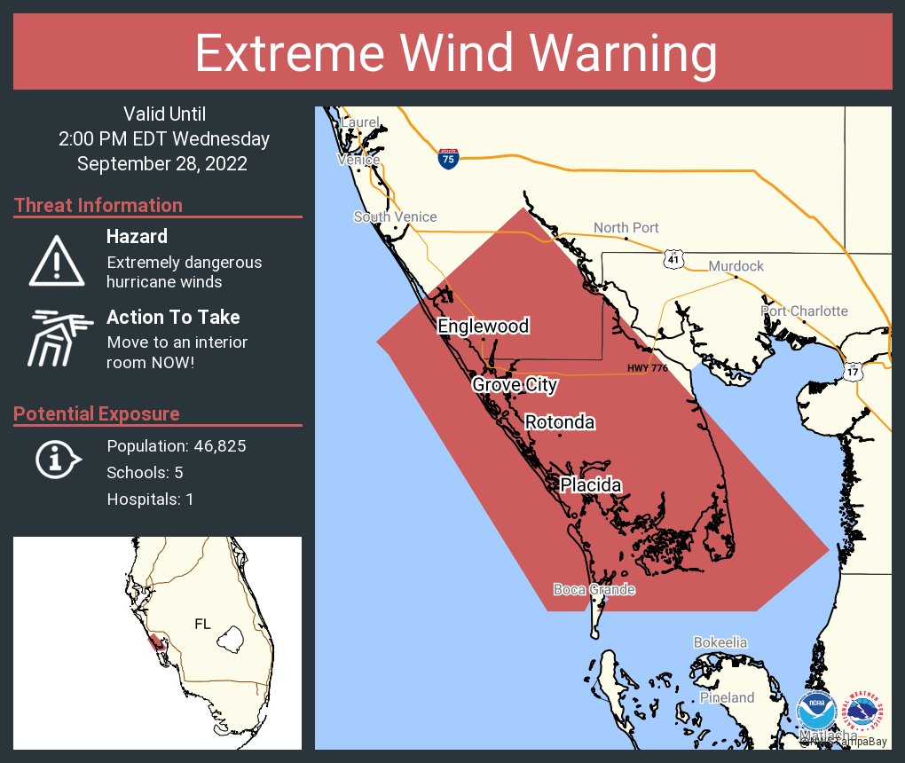
An extreme wind warning is in effect for Englewood FL, Rotonda FL, Grove City FL until 2:00 PM EDT for extremely dangerous hurricane winds. Treat these imminent extreme winds as if a tornado was approaching and move immediately to an interior room or shelter NOW!.
11AM SEPT 28th: The latest impact levels of Hurricane Ian in South Florida. For more information: https://t.co/gP886cNKC9 & https://t.co/G8MQSeb1jX
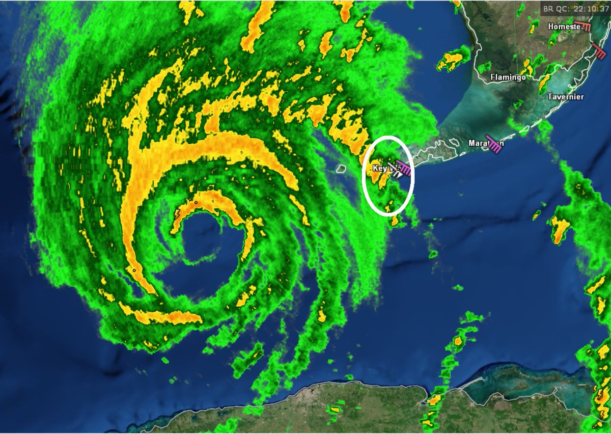
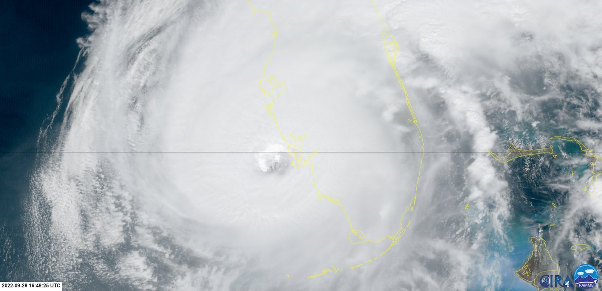
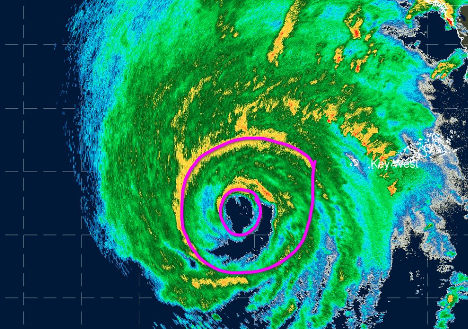
The eyewall of Hurricane Ian is beginning to come onshore in southwest Florida. Maximum sustained winds remain at 155 mph, but Ian could still become a category 5 hurricane hurricane before landfall this afternoon.
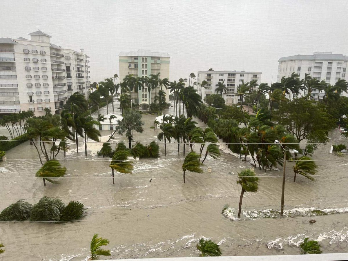
Surge is coming in crazy fast in #Naples#FLwx.
A rate of a little more than a foot per 10 minutes.
Don't think this is over just because winds are lessening as the eye moves to your north! #Ian
Ian has rapidly intensified to near category 5 intensity overnight and this morning. The pressure has dropped to 937 mb and maximum sustained winds are now 155 mph. https://t.co/6vHX8Dnpeg
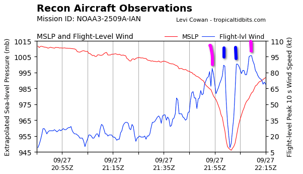
New plane has penetrated Hurricane #Ian, and is finding evidence that the secondary wind max observed earlier is intensifying, and evolving into an outer eyewall that now has stronger winds than the inner eyewall, at least in the SE quadrant. Eyewall replacement cycle underway.
It is now likely that Ian is going to make landfall tomorrow afternoon or evening near Cape Coral/Port Charlotte as a category 3 or 4 hurricane.https://t.co/3ovP1FM71Y
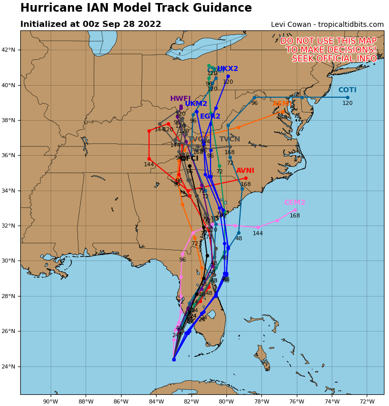
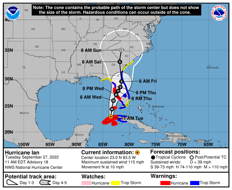
Following Ian deviating right of the forecast track this morning, NHC nudged the forecast south/east.
Since then, Ian continued to deviate even further to the right of NHC's forecast track - if this persists, it may make landfall earlier, stronger & farther south than forecast.
11 AM EDT track for Ian now brings the center onshore just south of Tampa Wednesday night. Models have been trending south and Ian has been tracking on the east side of the cone this AM.
Ian is tracking on the east side of the cone this AM. Could have downstream implications (i.e. a landfall south of Tampa). Model guidance is already trending that way.
Given eastward shifts in model guidance and in #Ian's actual movement this morning, folks especially down towards #Naples/#FtMeyers#FLwx need to be preparing for the high end of current impact estimates.
Coming forecasts may move in the wrong direction down there!