10a-2p (M-F) on The Weather Channel. M.S./Ph.D. Atmospheric Dynamics, UW-Madison. Post-doc Tropical Cyclones. Drummer 🥁, swammer. Goin’ Back to Nassau Hall 🎶.
Preliminary Hurricane Isaias Results Are In 🌀
Our team deployed 44 StickNet platforms along the AL and FL coast for #Isaias. The strongest peak 3-sec gust was 116.6 mph, and 3 other platforms also topped 100 mph! #FlWx#AlWx
An early look at forecast high temperatures on Halloween shows well above normal departures in shades of pumpkin orange across much of the central and eastern U.S. Check your local forecast at https://t.co/o5cxJlONPR
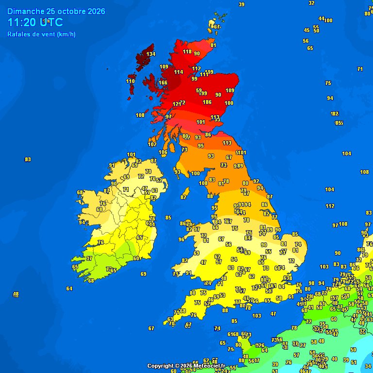
Appears #StormBoelo peaked around 948mb, exceptionally close to the UK's October record of 947.9mb set just last year.
Maybe somewhere set a new record?
Morning all!
As #StormBoelo pulls away and pressure rises, we're seeing some big gusts (80+ Stornoway, 123 mph over Cairngorm) out of the NW.
Fair amount of damage with road and bridge closures.
Take care!
Taiwan shut down schools and offices and grounded hundreds of flights as Typhoon Champi brushed by the island Friday, packing strong winds and torrential rains.
Read more: https://t.co/oDZTpw62cV
Back in Princeton this weekend for the GFDL 71st anniversary symposium. I'll be presenting tomorrow morning on the last 10 years of FV3/HAFS development and goals for the future. It's fun to catch up with colleagues from my postdoc time here, several of whom we collaborate with still.
Also enjoying the chance to see some fall color! Not much of that in Miami.
Mesoscale analyses and model interpolations of the kinematic and thermal structure of the storm off the East Coast ... strongly suggest it never lost its frontal ties.
From my experience, the use of "subtropical storm" confuses the picture in public discourse.