📢 Press Release
Exciting news in the world of geospatial analytics! Descartes Labs has acquired all operating assets of Geosite, a leading SaaS provider of #geospatial intelligence for property and casualty #insurance companies.
Read more: https://t.co/10gem5HcCv
Delighted to announce @_rachelolney as a speaker at NORTH51!
Rachel, the Founder and CEO of @GeositeInc, brings a wealth of expertise in innovation frameworks and national security to our diverse markets panel.
Join us, register here: https://t.co/lRI3bIOCSr
In the latest #BTI ep. with Rachel Olney, CEO of @GeositeInc, get insights about creating harmonious collaborations between colossal #insurance carriers, akin to mighty ships & startups who are like agile pirates. 🚢🏴☠️ Tune in! 🎧👉https://t.co/RAmhYnCRJm
#insurtech#geospatial
We are thrilled to welcome Rachel Olney, Founder/CEO at Geosite @GeositeInc to #DIGINEvent to speak on a panel of women entrepreneurs who have successfully launched insurtechs and share what the keys to success are. Register now. https://t.co/WaDptnPHvE
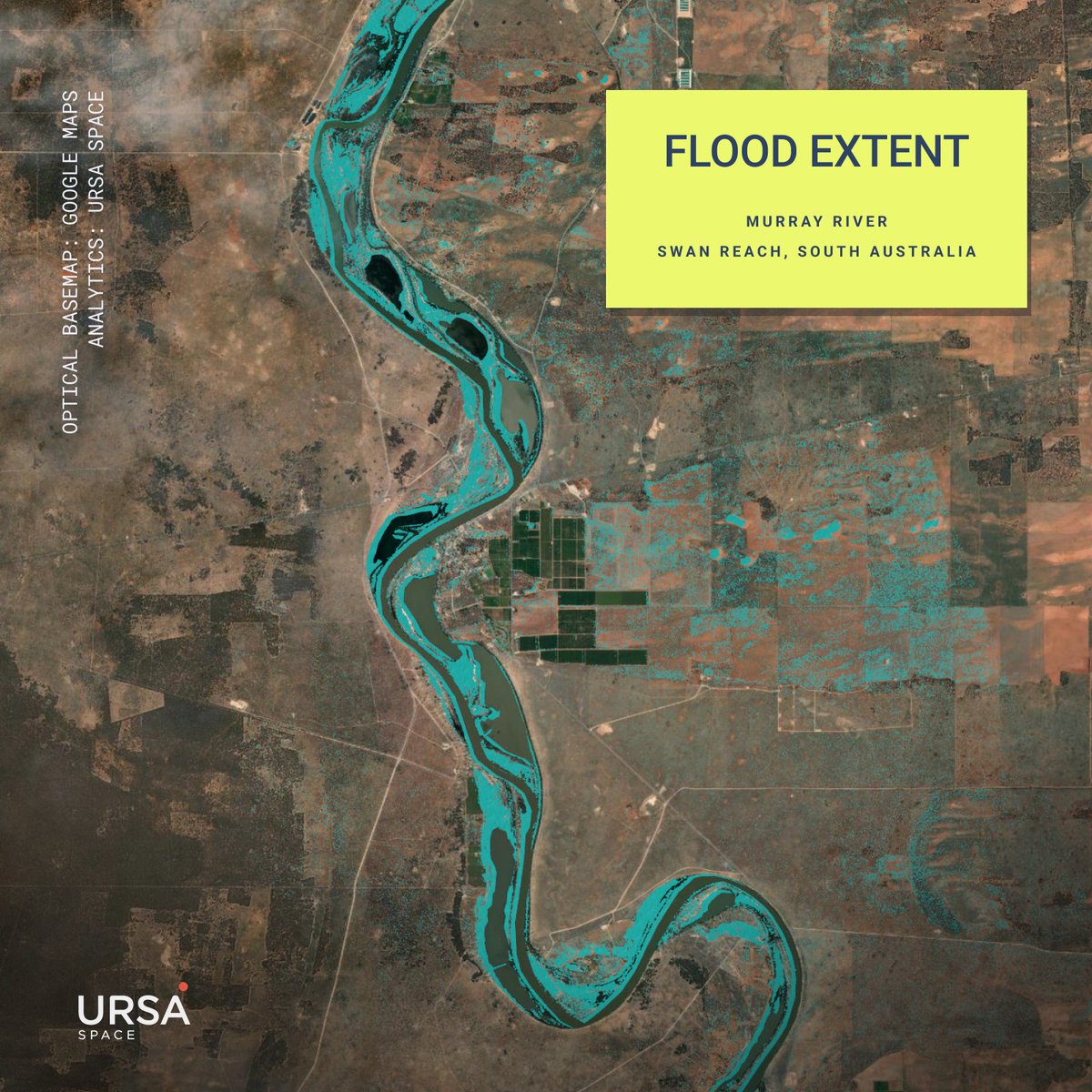
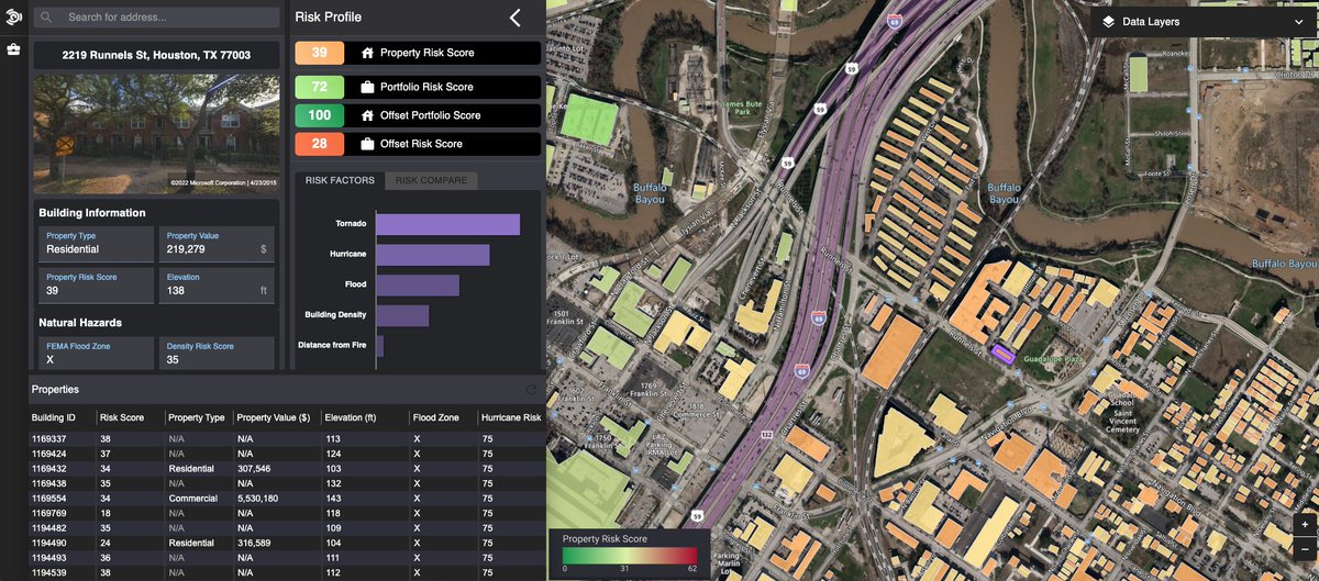
When flood levees failed along the Murray River, Geosite's insurance client needed rapid identification of affected areas. @GeositeInc and Ursa Space used satellite data to create flood extent maps, delivering results in a matter of days. https://t.co/jk9TYLjzmz
Processing insurance claims immediately after a flooding event is critical for those affected by the flood.
Together with @GeositeInc, the Ursa Space team was able to pinpoint the exact locations where flooding occurred in a matter of days, not weeks.
https://t.co/8FETGRXtBG
Yes, we're #hiring for a #GIS Analyst and Senior Software Engineer! Apply here: https://t.co/KhZNaYp1FO
Thanks @Spatial_Punk for the shout out
#gischat 🌎🌍🌏
QBE Ventures is excited to announce our investment in @GeositeInc! Geospatial data platforms are increasingly important to understanding major events as they occur, and ensuring better outcomes for our customers. Read more at https://t.co/spfFwvks6I
Beyond excited to join the @GeositeInc team and help unlock the power of multimodal/multi-resolution geospatial data for the insurance industry and beyond.
@GeositeInc is now the geospatial engine behind @SocotraTech
We are extremely excited that Socotra users can now automatically leverage spatial data in #claims and #underwriting from all the best sources in the world 🔥
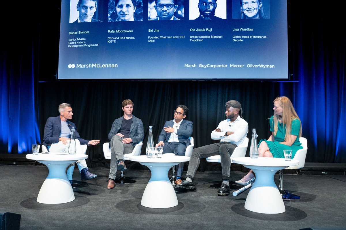
"We have to be nonlinear in our approach so that we don’t view our role as simply replacing or swapping out parts of the #insurance process," said @wardlawm3 at @MarshMcLennan's Rising Professionals' Global Forum, with leaders at @UNDP, @iceyefi, @ArbolMarket, and @FloodFlash_Ins
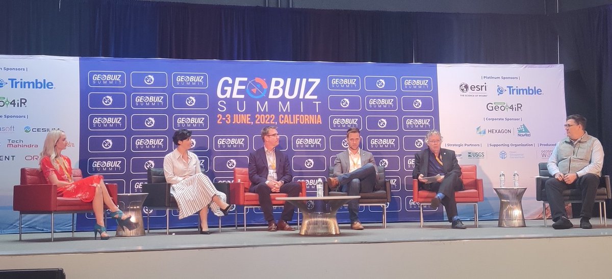
#GeoBuiz2022 | The session delved deep into collaborative opportunities and partnerships for satellite date companies and organizations in downstream sector for building a resilient geospatial value chain.
“Using the Geosite platform, with the satellite and aerial data and the property attributes capabilities, we are confident that we can dramatically reduce time, more than 50 percent for sure.” -Jack Toyama from MS&AD Ventures
Full story:
https://t.co/LpA1SQPwhP
#insurancenews