Mike Sena has a vision for a next-level geographic approach to crime fighting to not only create maps but also provide an up-to-date shared awareness of the location of public safety threats to all fusion centers and their partners across America. https://t.co/oIaAoHFENB
We have a new GIS solution! With Crime Problem Management you can identify crime problems, manage evidence-based responses, and evaluate effectiveness. Learn more here: https://t.co/6lsAcDJbw4
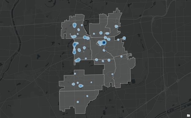
Robberies in Philadelphia can be chains of events, such that robberies in one location increase the likelihood of nearby robberies (near repeats). But these are short-lived and difficult to action unless police move quickly.
https://t.co/2jl7M8NyMh
In my latest #esri blog learn how #Berkeley Police Department are using #arcgis community engagement hub technology to connect with citizens and promote #policetransparency
The Berkeley Police Department unveiled a Transparency Hub as part of its effort to reimagine policing. Dashboards display data on stops, calls for service, and use of force. Anyone can unlock trends. https://t.co/Hp2GrXm1i8
If you are at the #cites conference come join myself and my colleague David Gadsden tonight as we discuss #GIS tools for fighting wildlife crime #CITESCoP19#esri#esripanama
Thank you to the Crime and Intelligence Analysts across the country! We are thankful for your diligent work in solving crimes and bringing justice to victims.
All UC attendees! Don't miss the #LawEnforcement SIG: Location Strategies for Modern Policing. Guest speakers include San Bernardino County, & Redlands Police Department.
🔹Tues, July 12, 11:30 AM - 12:30 PM PDT | SDCC - Room 32 AB
https://t.co/aC6iqiOAH9
@GISCop@cdelaneygis
Always nice to reunite with individuals that our team has housed! Originally met in 2014, after several years she wanted help and was housed! Now she is talking with other homeless to encourage them to get assistance and work with the Hope team!
Crime Analysis with ArcGIS Pro Video Blog Series: Part 5—Basic Hot Spot Analysis, now available! Read the newest edition & view the rest of our #CrimeAnalysis blog series by following the link below.
Read the blog: https://t.co/4AYgbyqExi
@cdelaneygis@GISCop#PublicSafety
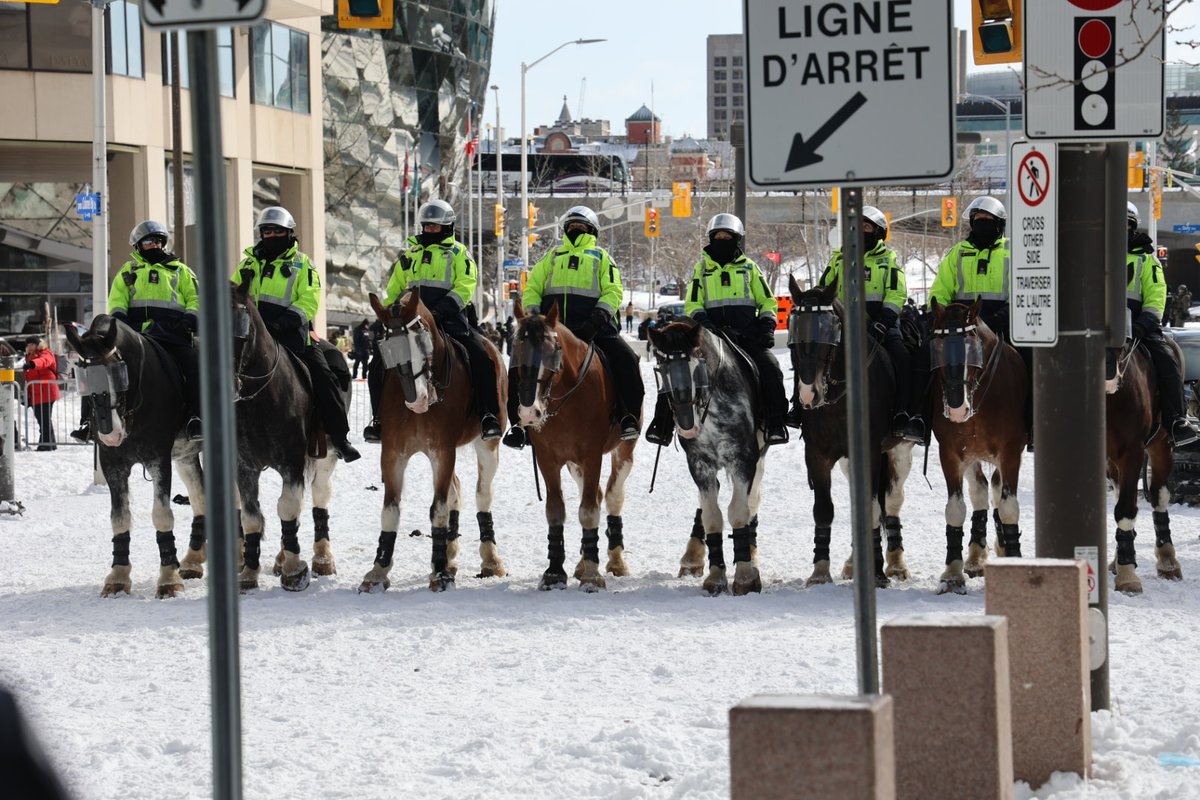
We hear your concern for people on the ground after the horses dispersed a crowd. Anyone who fell got up and walked away. We're unaware of any injuries. A bicycle was thrown at the horse further down the line and caused the horse to trip. The horse was uninjured.
GIS staff at Cobb County aided in World Series security with a digital twin of the stadium, crowd awareness, live traffic, and the real-time shared locations of roaming officers. https://t.co/LwSvZcgduF
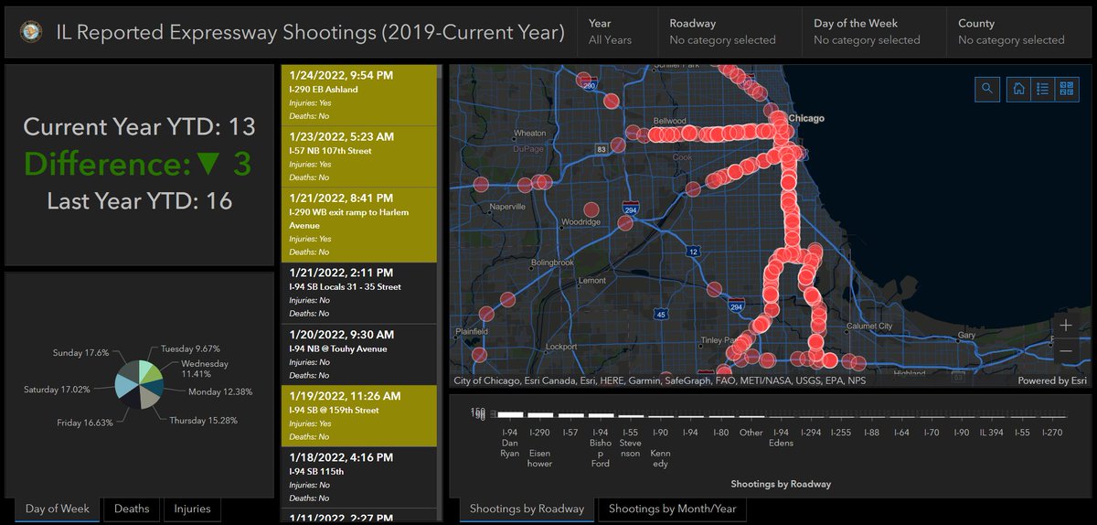
The @ILStatePolice has implemented a new dashboard to track statewide expressway shootings and share the most current incident data.
Learn more: https://t.co/gD9txUDxMl
Calling for papers! We are now accepting #PublicSafety#GIS user abstract submissions through February 25th for our upcoming Safety & Security Summit @ Esri UC. We look forward to seeing your great work!
Review submission instructions & more information: https://t.co/Sxc5gexXZx