Meet our Silver Sponsor, @giskosllc🎉
With expertise in tech strategy, design, and delivery, they're a leading geo-information house. 💻 They've specialized in software development, data management, location intelligence, and mapping.🌐
#FOSS4G2023 appreciates their support. 🙌
What a shame! It’s like Führer saying, “We shouldn’t have killed them in gas chambers, but with lethal injections instead.” This has crossed into outright Nazism.
Serbian Minister Snežana Paunović has now “corrected” her statement about the ethnic cleansing of Albanians. She said: “I should have said ‘deportation,’ not ‘ethnic cleansing,’ simply to avoid being crucified over it.”
If she is not dismissed from the Government, then the European Union should also impose sanctions on President Vučić and puppet Prime Minister Macut, who would be assuming political responsibility for keeping her in office.
GeoLibre v2.0.0 is here!
GeoLibre is a free and open-source geospatial platform that runs everywhere: as a native desktop app, in the browser, on Android, and embedded right inside Jupyter notebooks. It brings modern web mapping, cloud-native data formats, and a full processing toolbox together in one place, all built on MapLibre and https://t.co/Iu3zs18eJk with no proprietary lock-in.
Our first major release adds a true 3D globe, takes mapping beyond Earth to Mars and the Moon, lets styles round-trip with QGIS, and turns loaded vector layers into editable, save-back-to-source data.
What's new in v2.0.0
- Planetary mapping: explore Mars, the Moon, and other bodies with the OpenPlanetaryMap basemaps, a per-project ellipsoid, and a planet switcher right in the Layers panel.
- CesiumJS 3D globe: switch any map pane to a photorealistic 3D globe that stays camera-synced with your 2D maps and mirrors the layer stack.
- True 3D data: render vector layers with Z coordinates, load TIN/MultiPatch 3D shapefiles, and display KML/KMZ Collada (.dae) 3D models.
- Symbology interchange: import and export vector styling as OGC SLD, QGIS QML, and Mapbox GL style JSON, so styles round-trip between GeoLibre, QGIS, and the Mapbox/MapLibre ecosystem.
- Editable source layers: edit vector layers and write the changes back to their source, including GeoPackage and GeoJSON files and PostGIS database tables.
- Weather and sky: a new Weather menu with live cloud and precipitation radar overlays (RainViewer), plus a Google Earth-style sun position simulation for realistic lighting.
- Terrain and lighting: double-click the terrain control to set vertical exaggeration, and view any scene in true 3D relief.
- Smarter data import: bring in CSV without coordinates as an attribute table, split GPX track points and route points into separate layers, and load macOS-zipped and projected-CRS shapefiles.
- Raster in the browser: build normalized-difference indices for any HTTP COG and extract COG/WMS/XYZ bounding-box subsets client-side.
- Field Calculator upgrades: compute geometry length and area directly on your features.
- Attribute table: multi-select rows with Ctrl and Shift, plus faster navigation.
- Google Earth-style extras: "View in Google Maps / Google Earth" actions, camera-reset keyboard shortcuts, and a UTM easting/northing grid mode for the Gridlines overlay.
- New plugins: a Mapillary coverage and street-level image viewer, a Historical Imagery panel, and an Elevation Profile tool.
- Fully localized: all 13 language catalogs are complete, so the entire UI is translatable.
Try it out
- Launch GeoLibre Web: https://t.co/8gMtkVtfnm
- GitHub: https://t.co/VXq8c1o2Nd
- Documentation: https://t.co/7VA2AQoCUc
- Release notes: https://t.co/M0kRTsFXR0
#GIS #GeospatialData #OpenSource #RemoteSensing #DataVisualization #MapLibre #GeoLibre
Google Earth Pro will be ending support and will be unavailalbe for new downloads after June 25, 2027!
If you are looking for an alternative, try out GeoLibre. It is a free and open-source, lightweight, cloud-native GIS platform for visualizing, exploring, and analyzing geospatial data. It runs everywhere you do, in the web browser, on the desktop, on mobile, and inside Jupyter notebooks, all while keeping your data local and private.
GeoLibre works across platforms:
- Windows: Microsoft Store / winget
- macOS: Homebrew
- Linux: AUR, COPR, Flatpak (FlatPark), .deb / .rpm / AppImage
Try it out:
- Launch GeoLibre Web: https://t.co/8gMtkVtfnm
- GitHub: https://t.co/VXq8c1o2Nd
- Documentation: https://t.co/7VA2AQoCUc
- Video tutorial: https://t.co/nmlHL8HAbq
#GIS #Geospatial #OpenSource #RemoteSensing #DataVisualization #MapLibre #GeoLibre
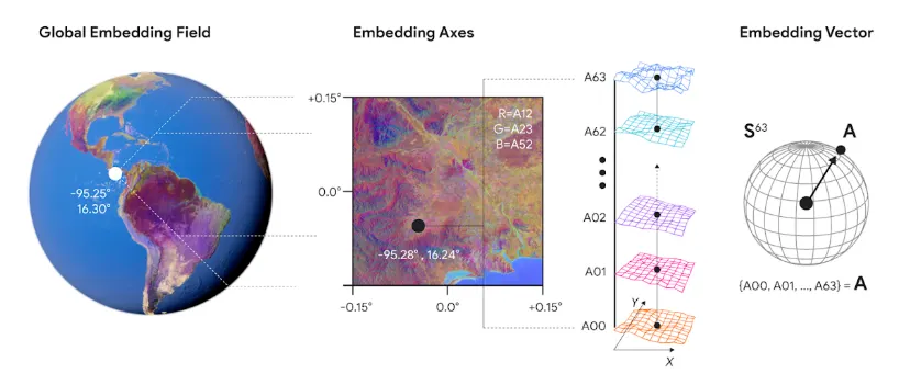
Satellite embeddings are lowering the barrier to building with Earth observation data. Discover how to build scalable, native vector search applications using Google DeepMind's AlphaEarth Foundations, Google Earth Engine, and BigQuery.
Learn from our expert partners at Spatial Informatics Group and Earth Resources Technology, Inc as they walk you through seamless Extract, Load, Transform (ELT) workflows to bring powerful geospatial insights to any app. 🚀
Read the full guide here: https://t.co/z13gtwzVlF
@BiplovBhandari@sig_gis
A concerning development emerged from yesterday’s meeting between the Serbian Orthodox Patriarch and Vladimir Putin in Moscow. The Serbian Orthodox Church has long played an active political role, but the explicit alignment in the meeting’s transcript is revealing—especially ahead of Aleksandar Vucic’s upcoming visit in May.
The Patriarch called for a broader geopolitical realignment under Russian leadership, reiterating that the [Serbian] "small boat, sailing on rough seas, should always be tied to a big Russian ship" He also suggested that Serbia’s stance on its neighbors—Kosova, Bosnia and Herzegovina, and Montenegro—is contingent on Russia’s global position.
This is not religious diplomacy, it's a strategic partnership of authoritarian regimes, placing the region at serious risk.
Kosova, however, stands firm in its democratic principles and aspirations and unequivocally rejects revisionist agendas driven by authoritarian powers
Transcript: https://t.co/oaobxrwmE8
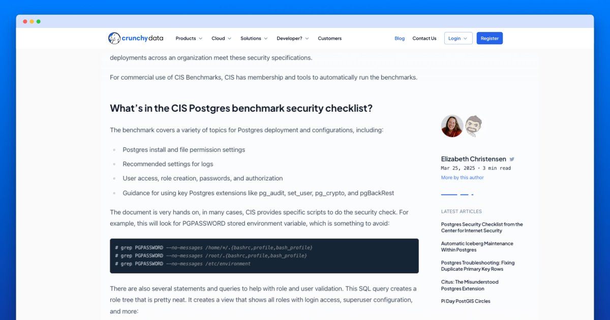
The PostgreSQL CIS Benchmark for PostgreSQL 17 is out.
This is a freely available, community driven, security checklist for Postgres.
Crunchy Data is proud of our work with Center for Internet Security (CIS) on each new Postgres release.
• All about the checklist:
https://t.co/a0wYGvEPDz
• Download the checklist here: https://t.co/ageCDu9aUs
From the Bronx to Queens, Albanians have shaped many of our neighborhoods and shared much of their culture with our city.
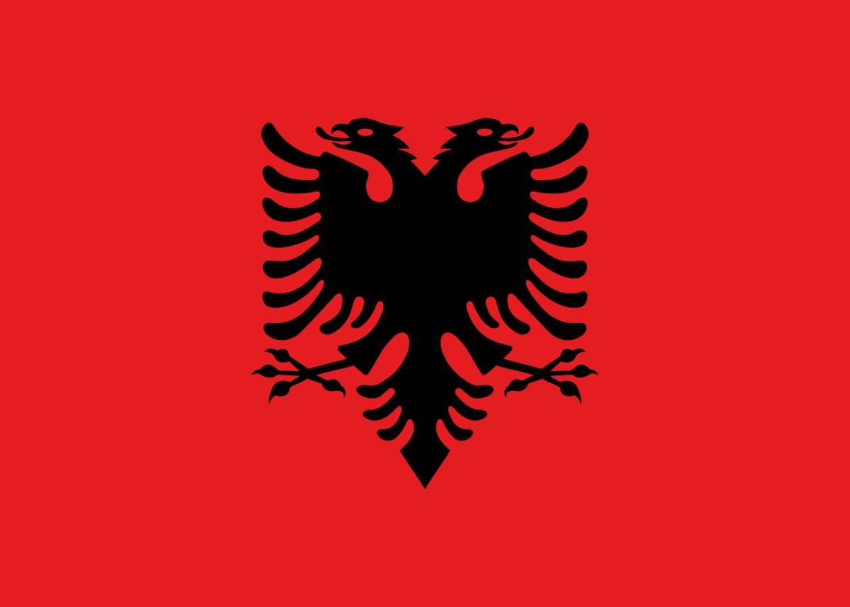
Today, ahead of Albanian Independence Day, we raised their flag as a symbol of our bond as New Yorkers and the spirit of Getting Stuff Done together!
Today, Albanians around the world celebrate🇦🇱Independence Day and Flag Day.
A deep love of freedom and remarkable resilience characterize Albanians. Never wanted what is not ours but determined to protect our right to exist and thrive in our ancestral home.
Gëzuar 28 Nëntorin!
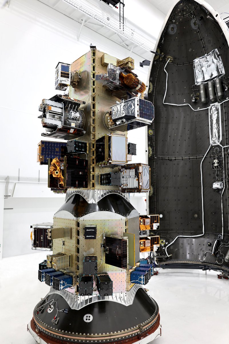
Another SpaceX Transporter rideshare mission, another important milestone for the Earth observation sector.
Here's a breakdown of the EO satellites onboard and launching tomorrow 🧵
[Events] DjangoCon US: Early-bird tickets now on sale!
Early-bird individual tickets are $160 off, and early-bird corporate tickets are $100 off through May or until they sell out. Buy your ticket sooner and save a little before they are all gone!
https://t.co/wLhXWtahXh
The Django Project is looking for a new Django Fellow! If you're a strong Python/Django developer or know someone who might be interested in the role, please reach out. https://t.co/7PsSxIECz2
The wailing of VC-backed "open source" companies about AWS, followed by their demonstrating their commitment to open source by ... closing their source. It's all such a sideshow.