This essay has been months in the making and leverages everything I have learned about Earth observation over nine years of consulting in the sector across EO companies, enterprises using EO and investors.
It is the longest piece I've written and likely the most controversial.
Less than 3 weeks until EO Summit 2026 in London!
We will have two tracks:
- Enterprise Track discussing commercial applications of EO across insurance, finance, energy, utilities, agriculture and environment
The audience includes EO satellite companies, geospatial solution providers, end-users from various sectors, non-profits, investors and researchers.
Book your tickets now!
https://t.co/yHa4uJS3qw
Less than 3 weeks until EO Summit 2026 in London!
We will have two tracks:
- Enterprise Track discussing commercial applications of EO across insurance, finance, energy, utilities, agriculture and environment
French Earth observation solution provider Kayrros being acquired by two companies is an interesting case study in the business of EO.
Why was one EO company bought by two separate buyers in different sectors?
Context: Safran, the French defense firm acquired the geospatial intelligence part of Kayrros and Energy Aspects, one of the leading market analytics providers, bought the EO-based energy analytics business.
The reason? I think it might be because Kayrros built one geospatial capability properly: to monitor assets and activities around them with satellite data.
That single foundation extended across markets from oil tanks and methane plumes for the energy sector to targets and strike impacts for the defence sector - in other words, the same tech stack served both sectors.
In general, breadth could be considered a dilution of focus in scaling EO businesses. But in this case, the breadth across markets derived from the same foundational EO capability became the reason for the outcome.
So much so that two major players in completely different sectors each wanted a piece of the same underlying technology. For me, that is an important market signal, regardless of what either of them paid.
I find it fascinating how a few NewSpace (mostly Earth observation) companies play the dual-hat game so well - American when the announcement needs it and European when needed.
- Loft is both American and French.
- Planet is both American and German.
- Spire Global is American, British and Luxembourgish.
Not easy to pull off, but masterclass in transatlantic positioning!
Announcing the Asset Monitoring panel at EO Summit in which our panelists will discuss the value of satellite data for monitoring infrastructure across utilities and energy sectors and the challenges involved in making EO operational.
Thanks to Orbital Eye for sponsoring this session and Esri for being a Gold sponsor of the conference.
Join us at EO Summit in London on June 22 to learn about applications of remote sensing!
We are looking for volunteers for @EOSummitConf in London on June 22.
Volunteers will be expected to help with registration, guide attendees, facilitate Q&A sessions, support speakers, and ensure sessions run smoothly throughout the conference.
All selected volunteers will receive a complimentary pass and have the opportunity to attend a few sessions as regular attendees.
Express your interest here: https://t.co/O1qyE8hAe6
Parametric insurance, in simple terms, is an automatic payout model based on a threshold on one or more remote sensing measurements - more efficient and scalable than needing someone to come and verify damage in person.
Earth observation is really the engine of parametric insurance with it s ability to provide remote sensing measurements at scale.
Every time a satellite gains the ability to measure a new variable at a new resolution at a new frequency, a new type of risk becomes parametrically insurable.
Soil moisture, vegetation health, flood extent, burn severity, sea surface temperature etc. - each of them is a trigger for a new insurance policy somewhere in the world, because some satellite(s) is measuring it.
The visual below illustrates, in a simplified manner, how parametric insurance works in practice:
A satellite measures the crop's health over the growing season. If the crop is healthy, then nothing happens. If the crop seems stressed beyond an agreed threshold, the policy pays out automatically, without anyone visiting the field.
We wrote a detailed deep-dive on EO for parametric insurance covering the use cases, the role of satellite data, the commercial landscape and the limitations.
Announcing the Nature Monitoring panel at EO Summit in which our panelists will discuss the value of satellite data for ecosystem and biodiversity monitoring carbon markets, the state of the carbon markets and use of EO for nature risk reporting.
- Alessandro Baccini from @ChlorisGeo
- Phil Platts from @BeZeroCarbon
- Caio Miranda from @PixxelSpace
- Nell AT from @HSBC
- Luisa Doughty from @SatAppsCatapult [Moderator]
Thanks to Chloris Geospatial for sponsoring this session.
Join us at @EOSummitConf in London on June 22 to learn about applications of remote sensing!
Parametric insurance, in simple terms, is an automatic payout model based on a threshold on one or more remote sensing measurements - more efficient and scalable than needing someone to come and verify damage in person.
Earth observation is really the engine of parametric insurance with it s ability to provide remote sensing measurements at scale.
Every time a satellite gains the ability to measure a new variable at a new resolution at a new frequency, a new type of risk becomes parametrically insurable.
Soil moisture, vegetation health, flood extent, burn severity, sea surface temperature etc. - each of them is a trigger for a new insurance policy somewhere in the world, because some satellite(s) is measuring it.
The visual below illustrates, in a simplified manner, how parametric insurance works in practice:
A satellite measures the crop's health over the growing season. If the crop is healthy, then nothing happens. If the crop seems stressed beyond an agreed threshold, the policy pays out automatically, without anyone visiting the field.
We wrote a detailed deep-dive on EO for parametric insurance covering the use cases, the role of satellite data, the commercial landscape and the limitations.
The great thing about @benthompson is that he’s never afraid to tell it like it is amid all the banker and insider propaganda.
“In all seriousness, the numbers are obviously absurd, but then again, everything about this IPO is absurd. SpaceX is seeking a $2 trillion valuation on a mere $18.67 billion in revenue with $4.9 billion in losses last year, and growth actually slowed from 35% to 33%. That slowdown happened despite the addition of xAI (and thus also X), which tipped the company from a small profit to that massive loss, thanks to $5.1 billion in AI R&D expense. That R&D, keep in mind, went towards building a model that is in 5th place, and whose entire founding team recently left the company. But sure, $26.5 trillion AI opportunity!”
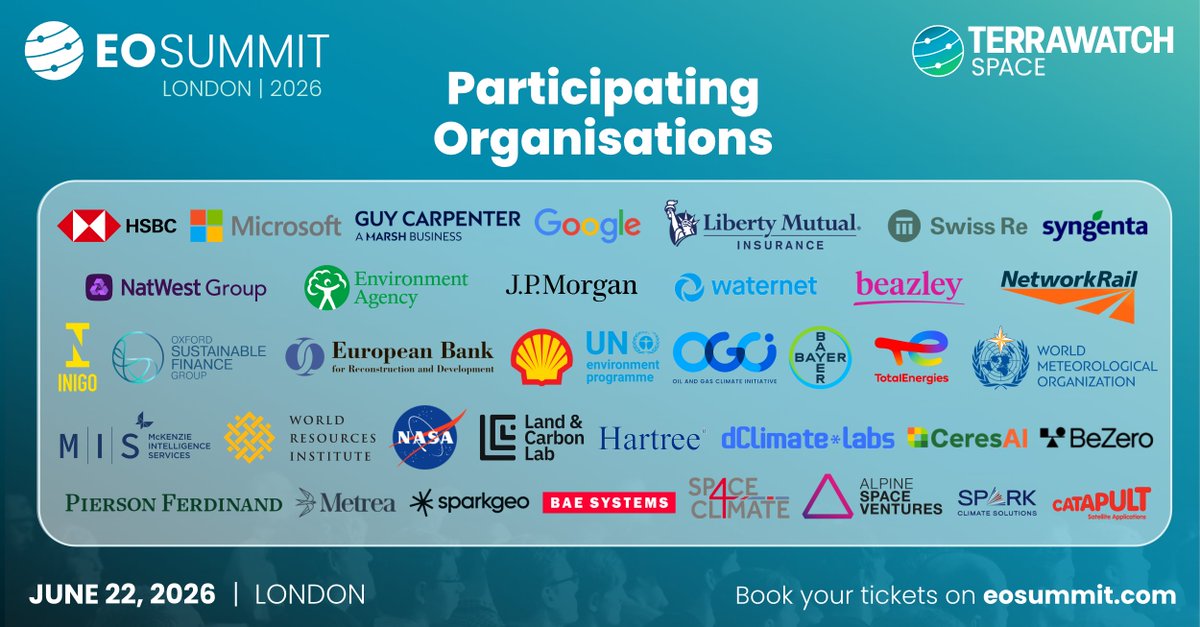
Meet the participating organisations for EO Summit 2026 - spread across insurance, finance, energy, utilities, agriculture, environment, government and defence sectors, who will present real-world case studies Earth observation through presentations and panels.
We conceived @EOSummitConf as a user-focused, application-driven conference - one that was missing in the EO and space event calendar. For the third straight year, we continue to deliver on our promise.
Come meet the users of satellite data and geospatial on June 22!
I spent the long weekend playing around with the new Weather Replay tool from @CopernicusECMWF. Using ERA5 reanalysis weather data, they have launched a visualisation tool that lets you look at weather conditions anywhere on Earth, dating back to 1940.
I decided to look up the famous D-Day landings, where weather forecasting famously changed the entire outcome of World War 2.
Short story: On June 5, 1944, rough seas and strong winds led Dwight D. Eisenhower to postpone the massive invasion by 24 hours. The German meteorologists looked at the exact same conditions and concluded a cross-channel invasion would be impossible for at least a week.
But the Allies spotted a small, clear window during the storm, landed on June 6, caught the Nazis off guard, and the rest is history.
For history and weather enthusiasts, this is a good way to spend some time.
Check it out: https://t.co/MwBAJyYQwn
PS. This story is coming soon as a movie called "Pressure" (I wish they used this for their promos)


![terrawatchspace's tweet photo. Announcing the Nature Monitoring panel at EO Summit in which our panelists will discuss the value of satellite data for ecosystem and biodiversity monitoring carbon markets, the state of the carbon markets and use of EO for nature risk reporting.
- Alessandro Baccini from @ChlorisGeo
- Phil Platts from @BeZeroCarbon
- Caio Miranda from @PixxelSpace
- Nell AT from @HSBC
- Luisa Doughty from @SatAppsCatapult [Moderator]
Thanks to Chloris Geospatial for sponsoring this session.
Join us at @EOSummitConf in London on June 22 to learn about applications of remote sensing!](https://pbs.twimg.com/media/HJZq1TFWgAYwYY5.jpg)