https://t.co/4F0j2uWpug: COVID-19 public dataset program: Making data freely accessible for better public outcomes.
https://t.co/11ippPk1Bv
via @GoogleNews
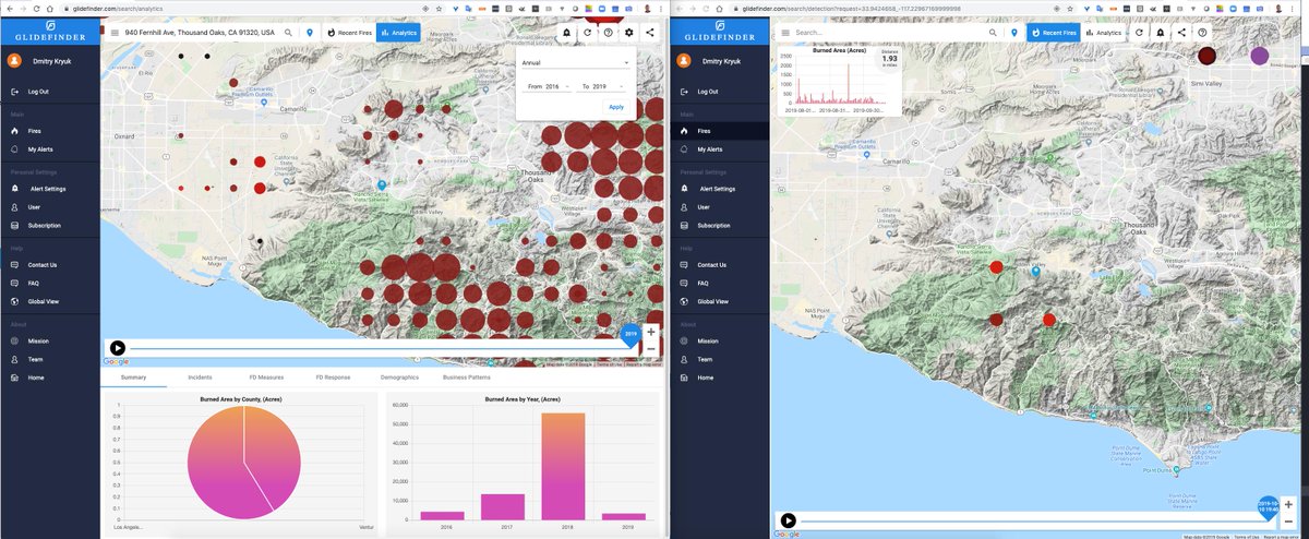
@RSFireNerd@intterra Hi Krista, not sure if this is what you are looking for, here's 17 years from #VIIRS and #GOES starting this year.
You can adjust the number of years and aggregation level (annual/monthly/daily).
https://t.co/CDmtkc7BKv
@MappingSupport This is the output from Fire/Hot Spot Characterization (HSC) algorithm of GOES-R Advanced Baseline Imager (Level 2 product), nominal/high probability fire pixels. Here's the manual: https://t.co/JdaGF5m918
We also approximate location depending on the zoom level.
@MappingSupport FYI: We process data from geostationary satellites #GOES17 and #GOES16 that make scans every 5 min, and the new data is streamed to Google cloud in real time. It appears 90 sec later on our maps. Check it out for #KincadeFire https://t.co/Y8jILC47Ne
WOW... we were discussing just yesterday that it would be great to join Census/BLS data in BigQuery with fire data, to analyze the impact of denied insurance on defaults on mortgages.
Great work and thank you!
Major announcement alert: The Census Bureau's American Community Survey (ACS) data is now available in the #BigQuery as part of the Cloud Public Datasets Program! #googlepublicdata https://t.co/PZHle9bSFQ
See how hotspots from #GOESWest satellite where confirmed by #NASA Suomi #VIIRS at 2:40pm PST. This is active #SaddleridgeFire#wildfire.
Subscribe to get real-time alerts from https://t.co/24V0RVaCPR
Note: location of hotspots are approximate.
It's interesting that #SaddleridgeFire started near Sunshine Canyon Landfill, which is frequently picked up by satellite IR sensors as a source of heat. See the purple circles over it in August-September. Anybody knows what it is?
https://t.co/HC0FhFHrpp
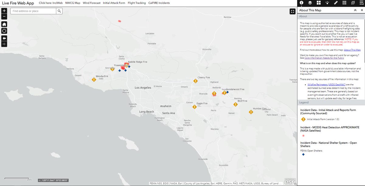
Recent fire reports across SoCal on a map with traffic and open shelters. Map: https://t.co/jmnsOegdu7
#SaddleRidgeFire#SandalWoodFire#RecheFire are already active today. Remember this is not an evacuation map and should not be used in this manner. Follow local agency orders.
@ai6yrham This is interesting - #GOES satellite was picking up the same hotsposts for #WendyFire from 19:23 to 20:29, then stopped.
https://t.co/6vIdGkxTN9
@VictorB123@Revkin@ryanweather@PGE4Me Here are 2 snapshots of Redding area and Paradise since 2002. The area is calculated from #VIIRS satellite only for selected part of the map. The numbers are biased depending on aggregation level.https://t.co/jY96el2tvP
https://t.co/sW95V27SVK