Does the land of Ukhrul rightfully belong to the Meiteis or the Tangkhuls?
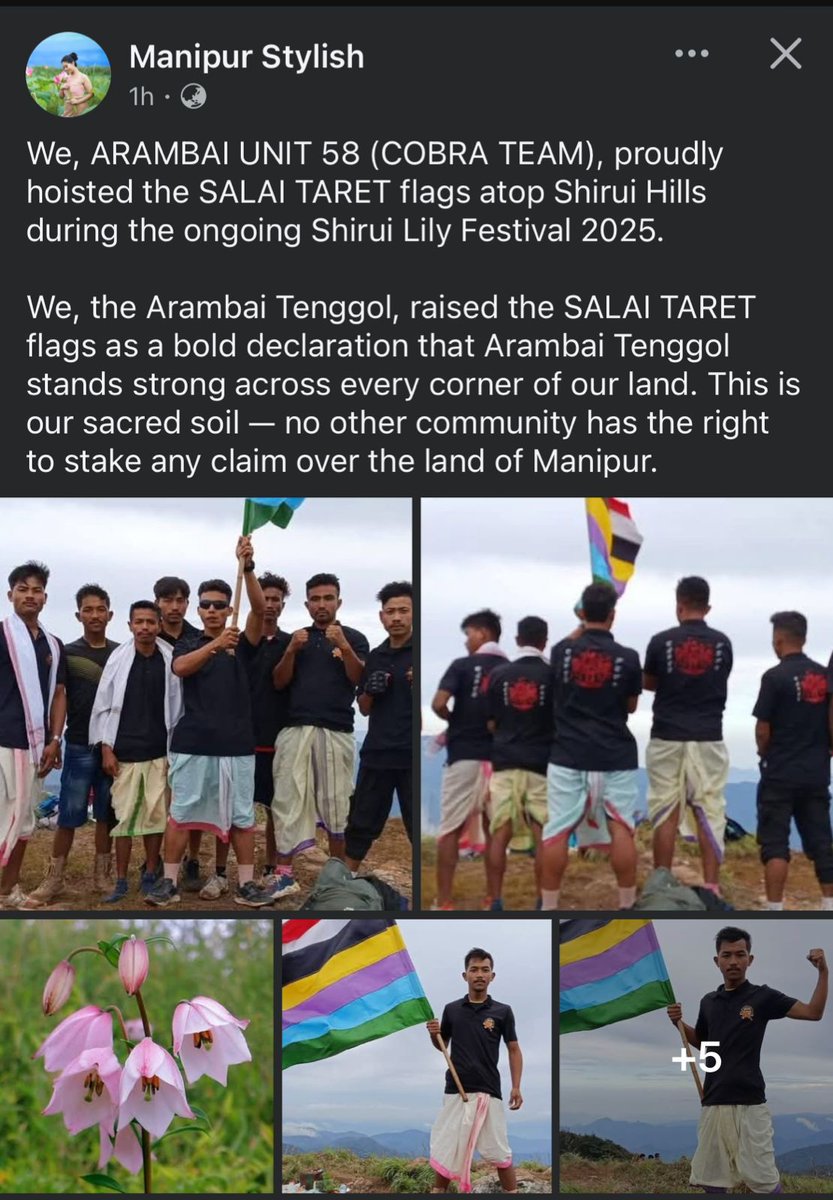
Arambai Tenggol hoisted the SALAI TARET flag on Ukhrul's Shirui Hills-aclear message: Meitei heritage runs deep in these lands. But will the Tangkhuls accept this truth?
@ukhrultimes@ImphalFreePress
Manipur:When Kukis raised the same alarm, they were called names. Now that non-Kukis like Rongmeis have woken up to the same threat which threatens their survival and existence, let’s see if Meiteis would hurl the same insults like forest encroachers, illegal immigrants, etc.
National security will be served with Union Territory for nationalist Kuki Zo people, not with appeasement for secessionist communities. @timesofindia@the_hindu@htTweets@thewire_in
The use of drones for bombings is rampantly huge amongst the Valley Based Insurgent Groups (VBIG’s), in Myanmar and India.
This uncontrolled terrorism on the part of Meitei Terrorists is virtually and practically enabled by CM N Biren Singh in Kangleipak (700sqm) and by the Military Junta in Myanmar.
The Meitei VBIG’s, along with the Military Junta are up against pro-democracy fighters such as People’s Defence Force(PDF), Kuki National Army-Burma (KNA-B) etc., who are fighting for reinstating democracy in Myanmar under the National Unity Government (NUG).
Meanwhile, Meitei VBIG’s in Kangleipak are fighting against Indian Kukis, who are Indian freedom fighters. The VBIG’s ultimate goal is to take control of the tribal Kuki Land, which surrounds the 700 sqm Kangleipak in India, and to push to secede from the Union of India.🇮🇳
Granting #UnionTerritory4KukiZo will be a step in the right direction to ensure Justice to a freedom fighting Kuki community and to protect the territorial integrity of the Union of India.
@NIA_India@CBIHeadquarters@rashtrapatibhvn@VPIndia@HMOIndia@PMOIndia@thewire_in@newslaundry@Resonant_News@majoramitbansal@adgpi@ThePrintIndia@scroll_in@BDUTT@themojostory@TheQuint@News9Tweets@newstrackdaily@nlhindi@EastMojo@IndianExpress@the_hindu@afridahussai@sardesairajdeep@frontline_india@republic
Historical Maps Prove the Hills Were Independent 🗺️
The 1825 Map of the Burmese Empire by the Surveyor General of India shows:
A. "Munnypoor" (Manipur) as only the valley.
B. The surrounding hills labeled as "Kookies" (Kuki) lands, independent of Manipur.
Lt. Col. J. Shakespear’s detailed map of 1912 further identifies the various Lushei-Kuki clans inhabiting these hills, confirming their autonomy.
Ref:
1. 🔗 https://t.co/cHEMA0Mi1X
2. 🔗 https://t.co/o7rZag2cWI
Manipur was never a unified or independent kingdom 📜
The Meitei narrative claims Manipur has always been a unified , independent Kingdom, with the hills as loyal subjects of the Meitei Raja. This is false.
A) Burmese and British records consistently refer to Manipur as only the valley, approximately 650 square miles and subject to the King of Ava (Burma)
B) The hills surrounding the valley were independent territories, inhabited by tribes like the Kuki-Zo, who were never under Meitei rule.
Ref: Burma Gazetteer by A. Williamson (🔗 https://t.co/yzJxjVjZoo)
Ref: The Meitei (Kathe) Crown Service groups in Myanmar by Dr. Nwe Ni Hlaing
(🔗 https://t.co/HVAFh70nDH)
Ref: Memoir of a Map of Hindoostan by J Rennell (🔗 https://t.co/75XAbCa9hP)
Voice sample analysis by Truth Lab confirms 93% match with voice of @NBirenSingh in his secret audio tapes case. This is sufficient for prima facie presumption to order investigation for his role in planning and orchestrating #ManipurViolence#birentapes
https://t.co/bQTGq3Pt6C