

Top Tweets for #90l

Remember & Salute , Son of Sil , 29th October
- Lt Col Shahid Sabir Shaheed
#90L/C #AAQMG #ASC centre #29 Oct2016 #PeshawerMotorway


#90L TCFA(HIGH)
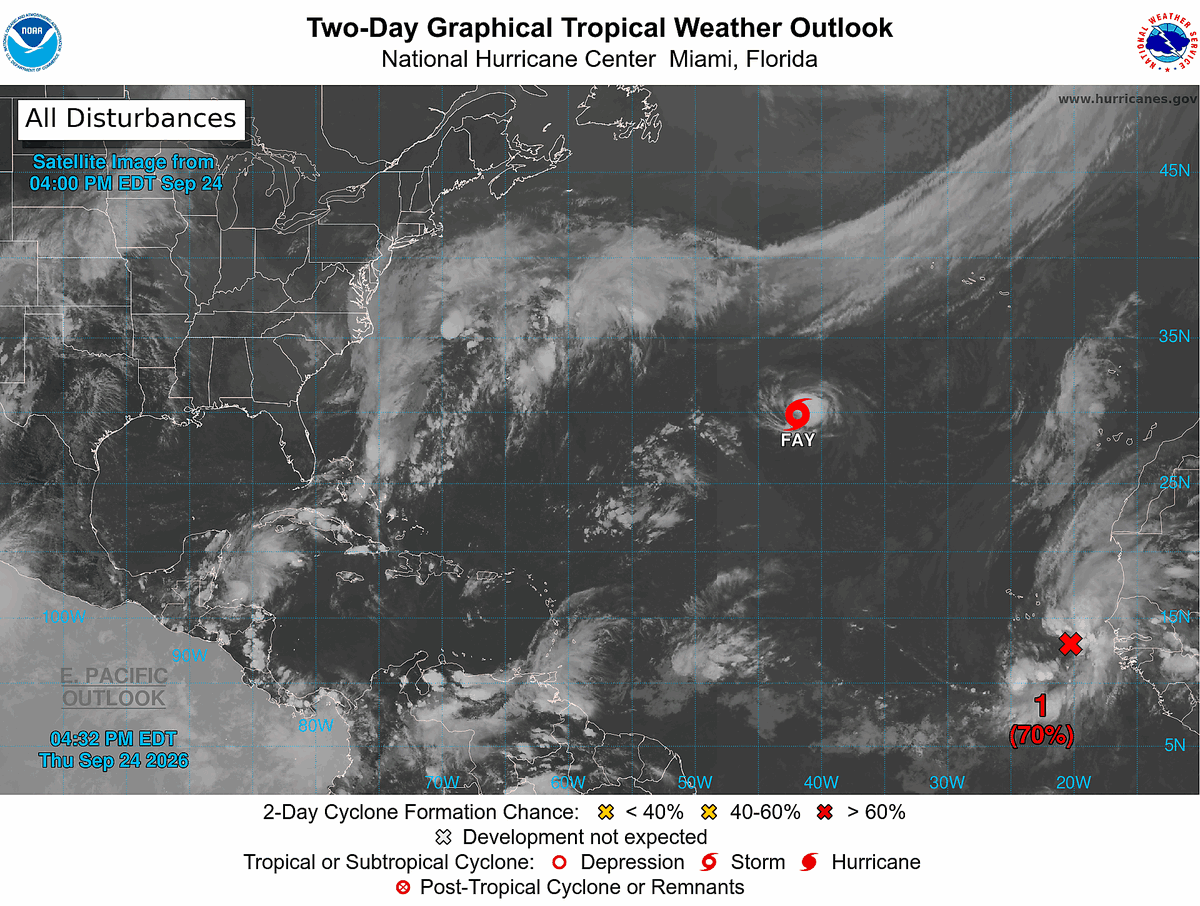

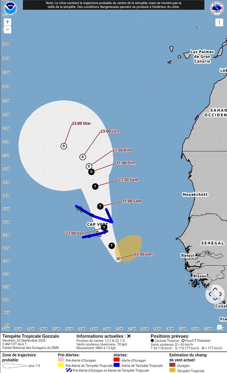
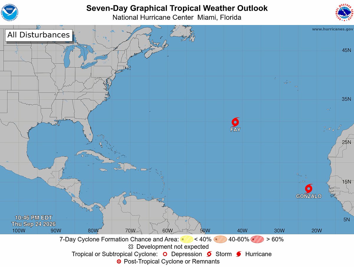

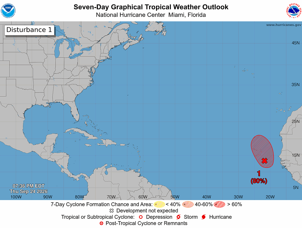
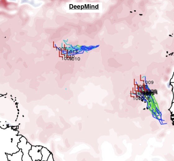
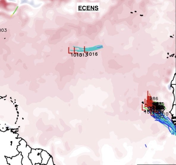
We likely have another Tropical Storm on the way in the Atlantic, as Invest #90L is up to an 80/80 chance this evening of development. Satellite data is already reporting 45 mph winds, so this would get named straight away if designated.
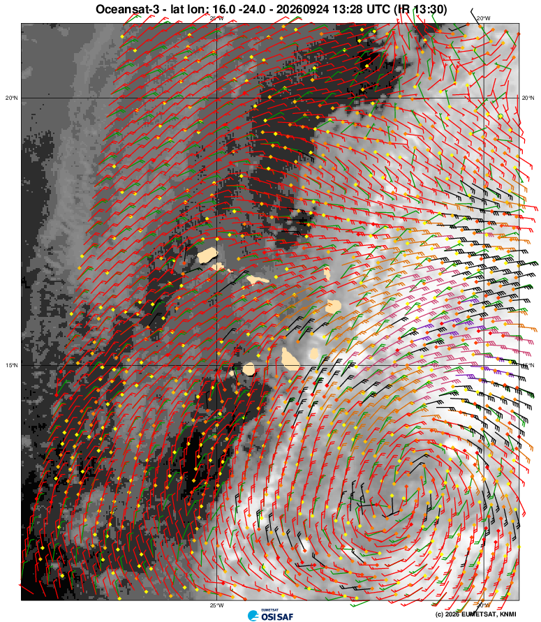

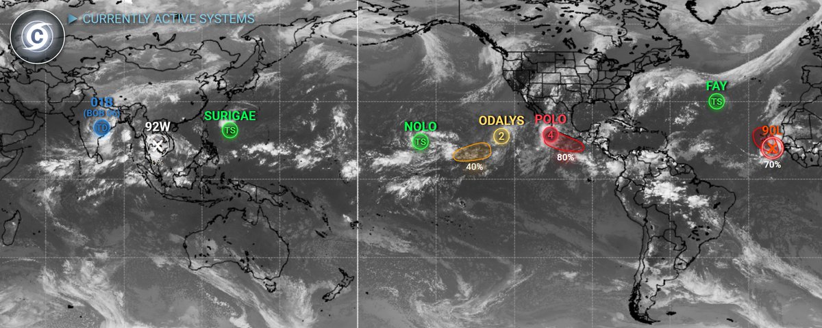

#FAY; 50mph 1005mb- Fay strengthens to 50mph. A little more strengthening is possible. Fay is looking nice on satellite.
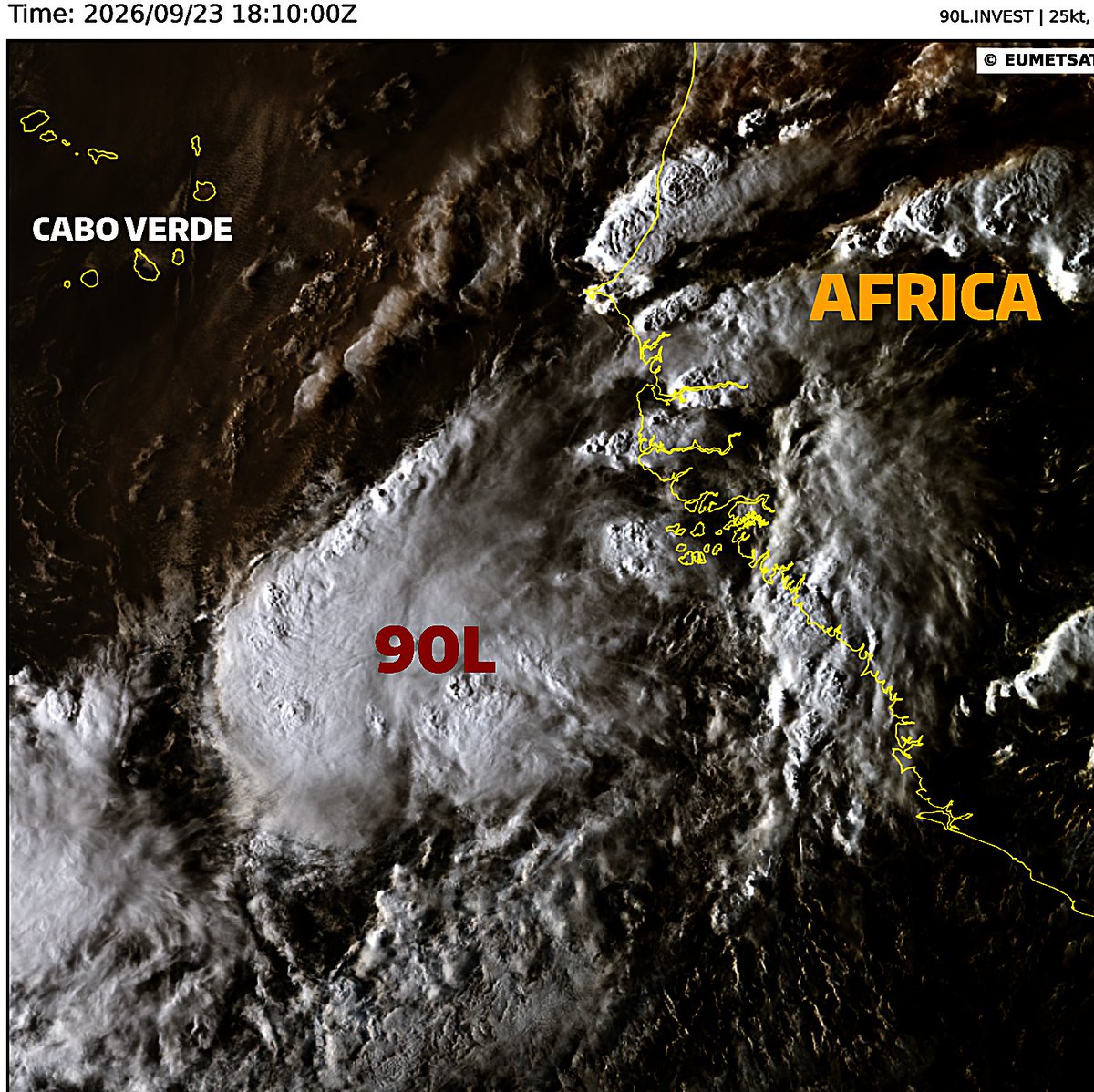
#90L (70/70); A depression or storm may form today or tomorrow. Regardless, heavy rainfall and strong winds to occur in the Cape Verde Islands.
#wxtwitter
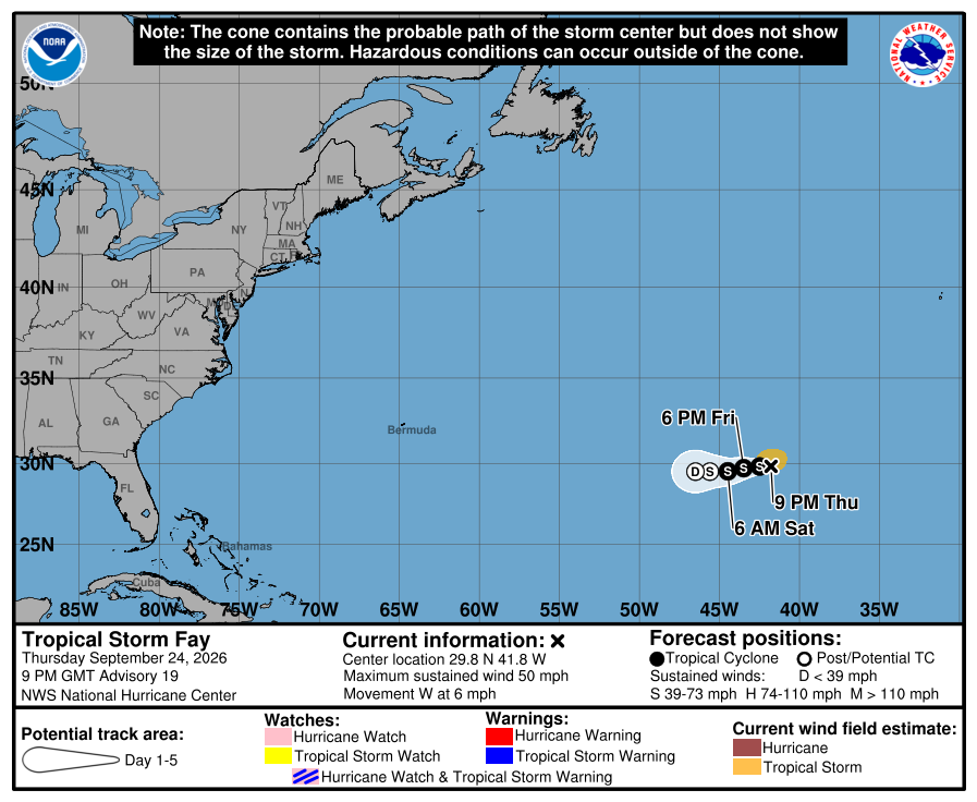
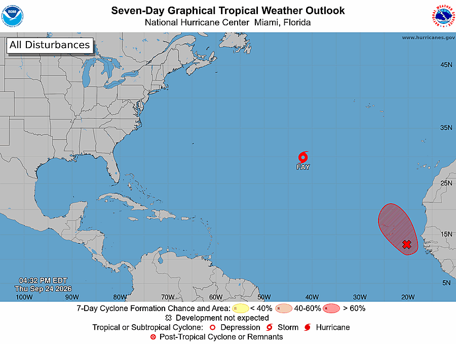

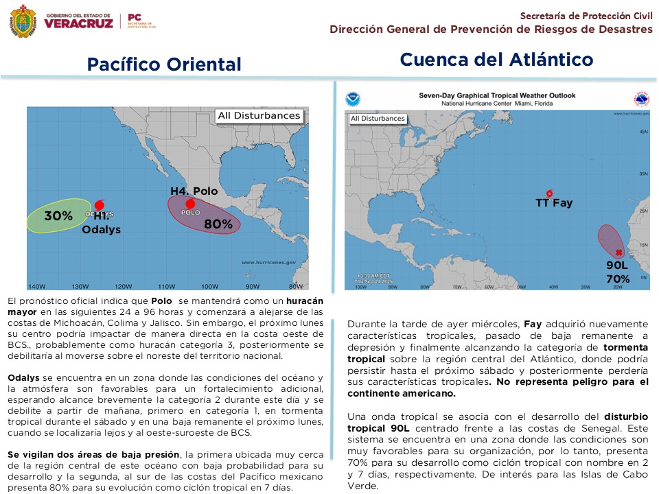
#BoletínTropical, 24/09/2026
#PacíficoOriental
*#Polo se mantiene como un huracán mayor de categoría 4.
*#Odalys evoluciona en huracán de categoría 1.
*#OT41
#Atlántico
*Tormenta tropical #Fay y disturbio tropical #90L.




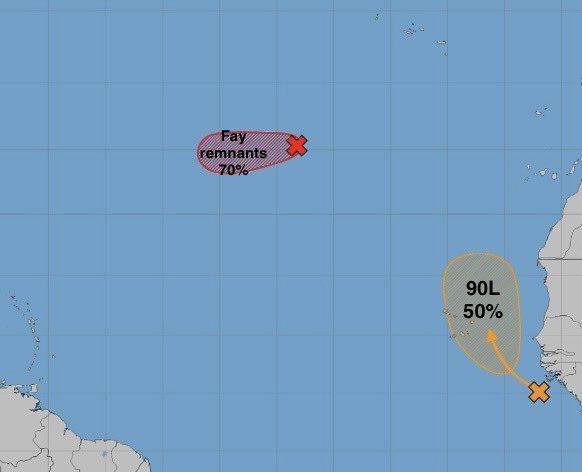
#Fay simply refuses El Niño’s rule, found a rare pocket of low shear, and is actually strengthening, and forecast to continue to do so for the next 12 hours or so. Meanwhile, Invest #90L is up to a 70% chance of formation with shear and dry air to deal with.
#Tropics #Tropicalwx

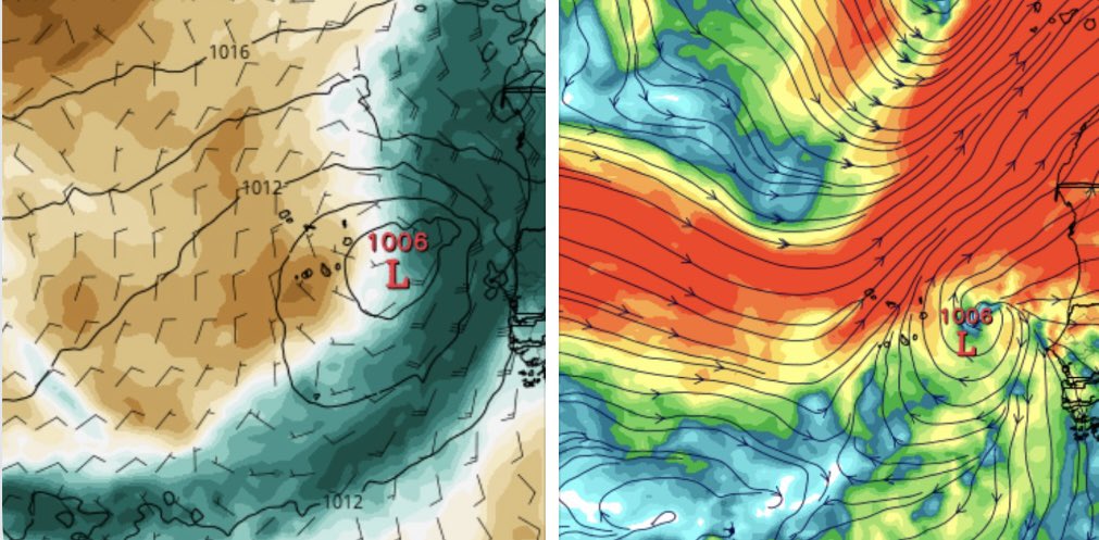
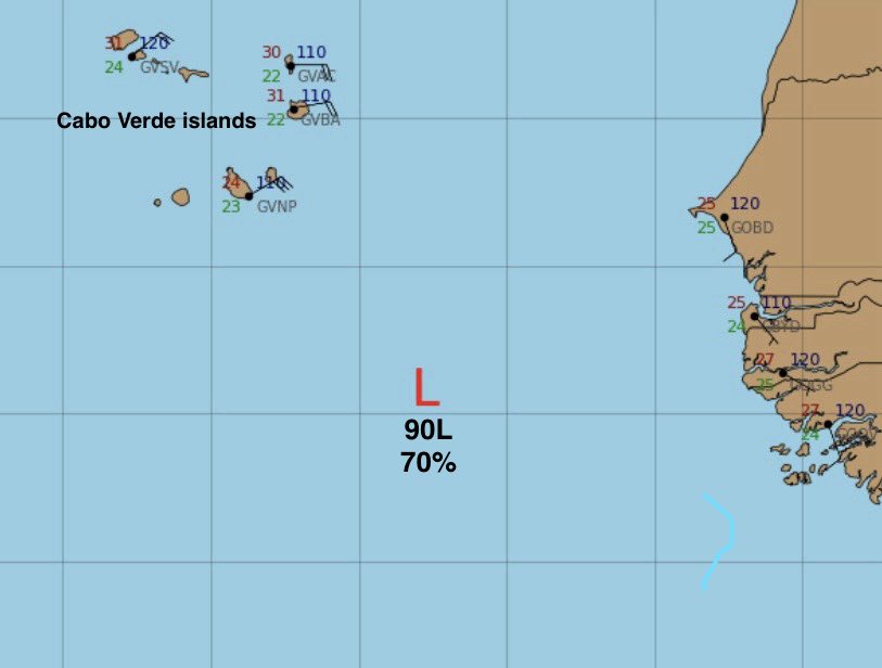
Le NHC suit l'évolution de la perturbation #90L au SSE du Cap Vert, qui pourrait devenir une dépression ou une tempête de courte durée d'ici vendredi en se déplaçant vers le NW à N
Probabilité de développement à 48h: 70%
Probabilité de développement à 7 jours: 70%


El Centro Nacional de Huracanes @NHC_Atlantic vigila a la tormenta tropical #Fay y al Invest #90L, posible tormenta tropical #Gonzalo .
https://t.co/v93vuRgpkm

TROPICS: @NHC_Atlantic is monitoring two disturbances in the Atlantic as of Wednesday night - neither of which pose a risk to the US!
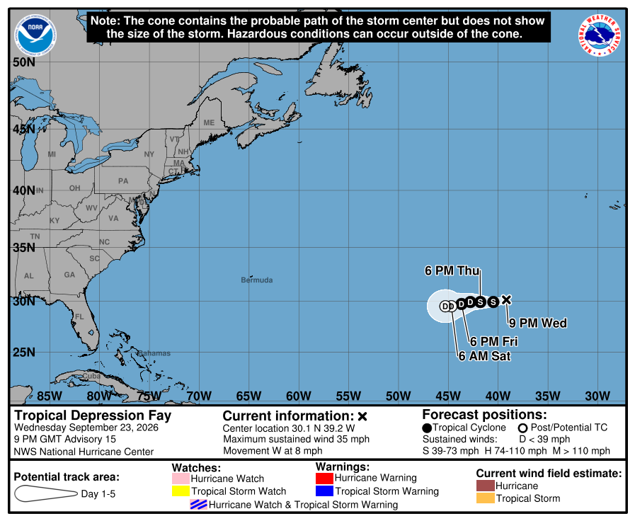
(1) #Fay: Redeveloped Wednesday, and will be short-lived (again).
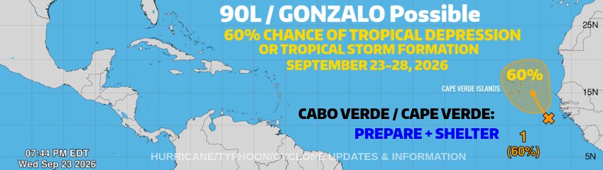
(2) #90L: Medium (60%) chance of development through early next week. #Tropics
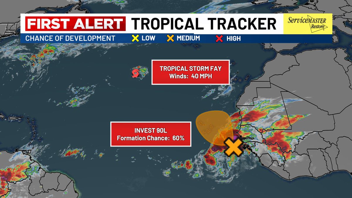

#90L #Gonzalo #CaboVerde
NWS National Hurricane Center Miami FL
800 PM EDT Wed Sep 23 2026
For the North Atlantic...Caribbean Sea and the Gulf of America:
Active Systems:
The National Hurricane Center is issuing advisories on newly formed
Tropical Depression Fay, located several hundred miles southwest of
the Azores.
1. Far Eastern Tropical Atlantic (AL90):
An area of low pressure located a few hundred miles southeast of the
Cabo Verde Islands is accompanied by a large area of disorganized
showers and thunderstorms. This system could become a short-lived
tropical depression on Thursday or Friday while it moves
northwestward to northward. However, strong upper-level winds
should end the opportunity for development by the weekend.
Interests in the Cabo Verde Islands should monitor the progress of
this system as gusty winds, areas of heavy rain and flash flooding
are possible there by Friday.
* Formation chance through 48 hours...medium...60 percent.
* Formation chance through 7 days...medium...60 percent.
Respectfully,
Roshin
#90L #Gonzalo #CaboVerde
NWS National Hurricane Center Miami FL
800 PM EDT Wed Sep 23 2026
For the North Atlantic...Caribbean Sea and the Gulf of America:
Active Systems:
The National Hurricane Center is issuing advisories on newly formed
Tropical Depression Fay, located several hundred miles southwest of
the Azores.
1. Far Eastern Tropical Atlantic (AL90):
An area of low pressure located a few hundred miles southeast of the
Cabo Verde Islands is accompanied by a large area of disorganized
showers and thunderstorms. This system could become a short-lived
tropical depression on Thursday or Friday while it moves
northwestward to northward. However, strong upper-level winds
should end the opportunity for development by the weekend.
Interests in the Cabo Verde Islands should monitor the progress of
this system as gusty winds, areas of heavy rain and flash flooding
are possible there by Friday.
* Formation chance through 48 hours...medium...60 percent.
* Formation chance through 7 days...medium...60 percent.
Respectfully,
Roshin
#FAY; 40mph 1010mb- FAY BECOMES A TROPICAL STORM AGAIN OVER THE ATLANTIC. It was a remnant low just 30 hours ago, came back on the TWO at 8AM (20/20), 6hrs later -> 70/70, a TD at 21Z, & back to TS status.
#90L (60/60); Heavy rainfall coming to the Cape Verde Islands.
#wxtwitter

#Fay trying to come back to life. Up to a 70% chance to do so. We rollover in invest numbers as the Cabo Verde piece is tagged Invest #90L. Models still liking it.
#Tropics #Tropicalwx

The @NHC_Atlantic is now issuing products for "Potential Tropical Cyclone One," which means Invest #90L may become a tropical depression but has not done so yet.
This allows Tropical Storm Watches to be issued for the northeast #Texas and western #Louisiana coastlines. Flash flooding remains the primary hazard expected from this system.


🌀 Invest #90L is manifesting as weak rotation over south #Texas this morning in radar and satellite imagery. Interaction with a frontal boundary draped across the southern US is creating a swath of heavy rains, which has triggered localized flash flood warnings from the NWS.
🌀 90L will move northeastward, skirting the Texas coastline between Corpus Christi and Galveston before moving permanently inland Wednesday afternoon. It is possible the National Hurricane Center will briefly classify the system as a tropical depression, but impacts to the Gulf Coast states wouldn't change. A wide swath of heavy rainfall and localized flooding risks will continue. Wind shear will increase as 90L approaches the front, limiting development. Excessive rainfall will remain the primary hazard.


Se ha designado como Potencial Ciclón Tropical Uno al disturbio #90L, actualmente sobre el sur de Texas y alejándose de #NuevoLeón. Se espera que se convierta en la Tormenta Tropical #Arthur el miércoles por la mañana antes de tocar tierra en Louisiana. #TXwx

🌀 Invest #90L is manifesting as weak rotation over south #Texas this morning in radar and satellite imagery. Interaction with a frontal boundary draped across the southern US is creating a swath of heavy rains, which has triggered localized flash flood warnings from the NWS.
🌀 90L will move northeastward, skirting the Texas coastline between Corpus Christi and Galveston before moving permanently inland Wednesday afternoon. It is possible the National Hurricane Center will briefly classify the system as a tropical depression, but impacts to the Gulf Coast states wouldn't change. A wide swath of heavy rainfall and localized flooding risks will continue. Wind shear will increase as 90L approaches the front, limiting development. Excessive rainfall will remain the primary hazard.

Last Seen Hashtags on Sotwe
mnwo
Seen from Japan
bbcincest
Seen from Turkey
Daddykink
Seen from Mexico
kaw
Seen from Netherlands
chudia
Seen from Italy
mgai()**********************************************filter:videos since:28-02-2026
Seen from United Arab Emirates
diyarbakırgay
Seen from Germany
sex
Seen from Netherlands
فويسًً
snaphack
Seen from Germany
Most Popular Users

Elon Musk 
@elonmusk
240.7M followers

Barack Obama
@barackobama
118.7M followers

Cristiano Ronaldo
@cristiano
114.5M followers

Donald J. Trump
@realdonaldtrump
111.9M followers

Narendra Modi
@narendramodi
107M followers

Rihanna
@rihanna
98.7M followers

NASA
@nasa
92.2M followers

Justin Bieber
@justinbieber
91.8M followers

KATY PERRY
@katyperry
90M followers

Taylor Swift
@taylorswift13
84M followers

Lady Gaga
@ladygaga
75.5M followers

Virat Kohli
@imvkohli
73.4M followers

Kim Kardashian
@kimkardashian
70.8M followers

YouTube
@youtube
68.7M followers

Neymar Jr
@neymarjr
66.4M followers

Bill Gates
@billgates
65.2M followers

Selena Gomez
@selenagomez
63.1M followers

The Ellen Show
@theellenshow
62.1M followers

CNN
@cnn
61.7M followers

X
@x
60.6M followers