Top Tweets for #GeologicMap

The Moon isn’t just grey dust… 🌓
This detailed #GeologicMap by the United States Geological Survey reveals billions of years of impact & volcanic history:
👇 👇
https://t.co/gEAZVkvZIS

Hey #Teachers! Looking for a fun, easy way to teach about the #Mars2020 Perseverance rover? Check out this #GeologicMap coloring sheet activity! Students color their own geologic map and learn about the geology of #Mars! https://t.co/8NrWyVTvEr

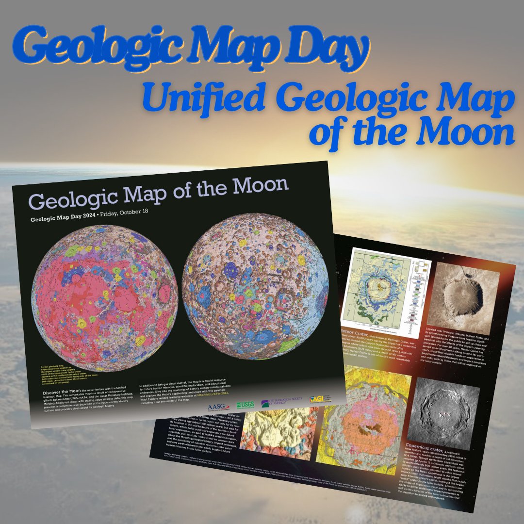
Happy #GeologicMapDay! Enjoy this downloadable poster for the Unified #GeologicMap of the Moon! https://t.co/nr0CUNZFXr
Find more Earth Science Week resources and a back page to the poster on the Earth Science Week webpage: https://t.co/nUftgeqE31
#EarthScienceWeek

I think this would be a GREAT Adult Coloring Book! #jezero #geologicmap #mars #USGS_AstroGeo! Thanks for sharing...
Hey #Teachers! Looking for a fun, easy way to teach about the #Mars2020 Perseverance rover? Check out this #GeologicMap coloring sheet activity! Students color their own geologic map and learn about the geology of #Mars! https://t.co/8NrWyVTvEr
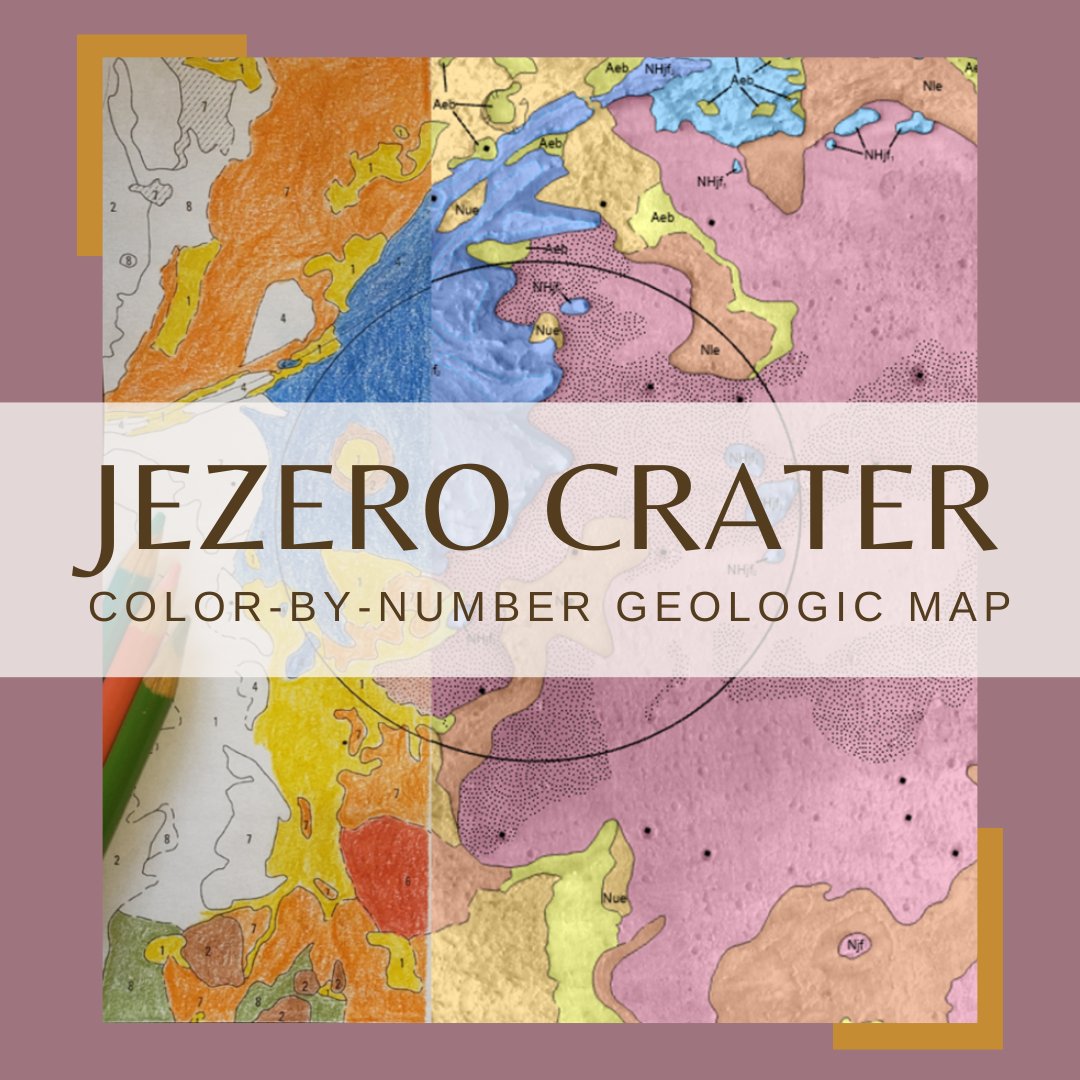
Hey #Teachers! Looking for a fun, easy way to teach about the #Mars2020 Perseverance rover? Check out this #GeologicMap coloring sheet activity! Students color their own geologic map and learn about the geology of #Mars! https://t.co/8NrWyVTvEr

This annotated photograph is of the Mowry Shale and the Frontier Formation (Belle Fourche Member, Emigrant Gap Member & Wall Creek Member), Oil Mountain quadrangle in Natrona County.
2022 geologic map report: https://t.co/KtqRGrWqMs
#Wyoming #geology #geologicmap #map

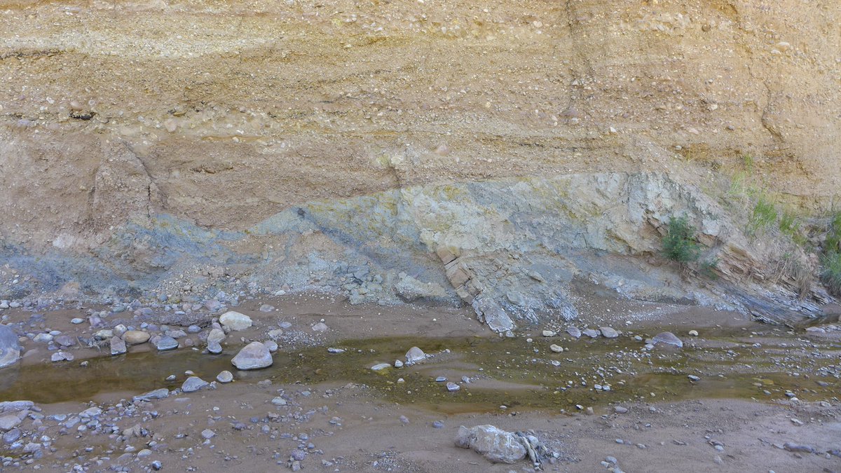
This cut bank exposure is in an active channel of Red Creek revealing older alluvial deposits overlying Fort Union Formation bedrock, Richards Gap quadrangle in southern Wyoming. Preliminary geologic map of the quad➡️ https://t.co/FodRnARU5u.
#Wyoming #geology #geologicmap #map

Custom framed Geologic Map of Colorado using acid-free materials and wood frame! #art #denver #colorado #pictureframing #customframing #5280customframing #geologicmap #map #topographicmap


[PUB] #OTD in 1908, Teddy Roosevelt proclaimed the @GrandCanyonNPS a national monument. Check out this geologic map of the area and order a hard copy or download a PDF through the USGS Store: https://t.co/8tfnx5wewO 🗺️
#TBT #GeologicMap #GrandCanyon
![USGS's tweet photo. [PUB] #OTD in 1908, Teddy Roosevelt proclaimed the @GrandCanyonNPS a national monument. Check out this geologic map of the area and order a hard copy or download a PDF through the USGS Store: https://t.co/8tfnx5wewO 🗺️
#TBT #GeologicMap #GrandCanyon https://t.co/GZLMs3vvT7](https://pbs.twimg.com/media/GDmNHMgXYAAkaM5.jpg)
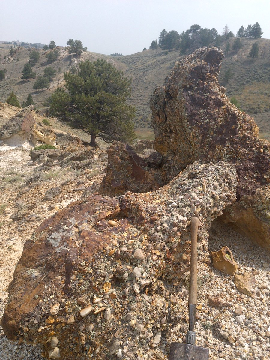
Geo-Note! A rusty yellow and orange conglomerate layer of the White River Formation and underlying Pierre Shale, Goat Mountain quadrangle in southeast Wyoming. A minor slump can be seen just right of center.
#geologicmap: https://t.co/9w8YPZBcQw
#Wyoming #geology

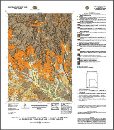
Earlier this year, we published a surficial #geologicmap of the west half of The Ramshorn 30' x 60' quad, Fremont & Park counties. A report w/the #map includes this📸of basalt boulders that are up to 1.5 m in diameter & rest directly on claystone of the Tepee Trail Formation. 1/2

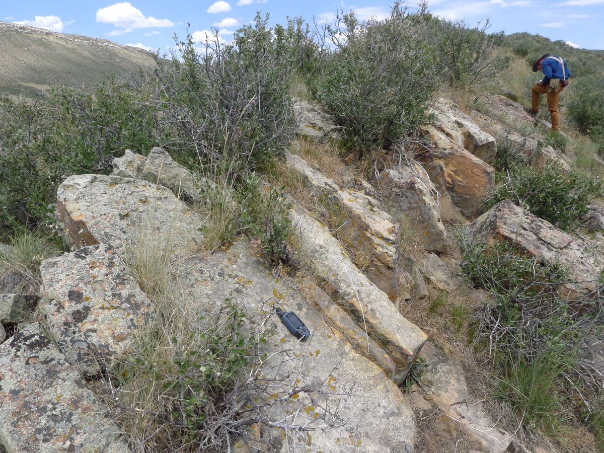
Geo-Note! The Cloverly Formation on the Goat Mountain quadrangle in southeast #Wyoming forms prominent ridges like this sandstone ridge in the northwestern Iron Mountain syncline area of the quadrangle.
Goat Mountain #geologicmap: https://t.co/CgVJ7fVR7X
#geology #geologic #map
Bridger Pass quadrangle geologic map mentioned in previous post can be found here:
https://t.co/SxL9quySf9
#Wyoming #geology #geologicmap #map
Find the geologic map of the King Mountain quadrangle (mentioned in the previous post) at: https://t.co/Xz5GmxdVAY
#Wyoming #geology #geologicmap #map
Cliffs in the Wiggins Formation (above) & underlying slope in the Tepee Formation (below) on the south ridge of Ramshorn Peak on The Ramshorn quadrangle, NW #Wyoming. The @WyGeoSurvey recently mapped the west half of the quad: https://t.co/yIfKLRnyay
#geology #geologicmap #map

Upper Fort Union Formation ferruginous pebble conglomerate #outcrop, on the Oil Mountain quadrangle in central #Wyoming.
The Oil Mountain quadrangle #geologicmap can be found here: https://t.co/27a295I4GA. #geology #map
The cliffs in the photograph are part of the Wiggins Formation, which is prone to multiple types of mass wasting along the steep valley sides and headwalls of the Absaroka Range.
NEW surficial #geologicmap of the west half of the quad ➡️ https://t.co/yIfKLRnyay
1/2
Hey #Teachers! Looking for a fun, easy way to teach about the #Mars2020 Perseverance rover? Check out this #GeologicMap coloring sheet activity! Students color their own geologic map and learn about the geology of #Mars! https://t.co/8NrWyVTvEr

Photo taken in 2019 while mapping the Pickle Pass quadrangle in western Wyoming: https://t.co/1vLPwqwaeH
#Wyoming #geology #geologicmap #map
2/2
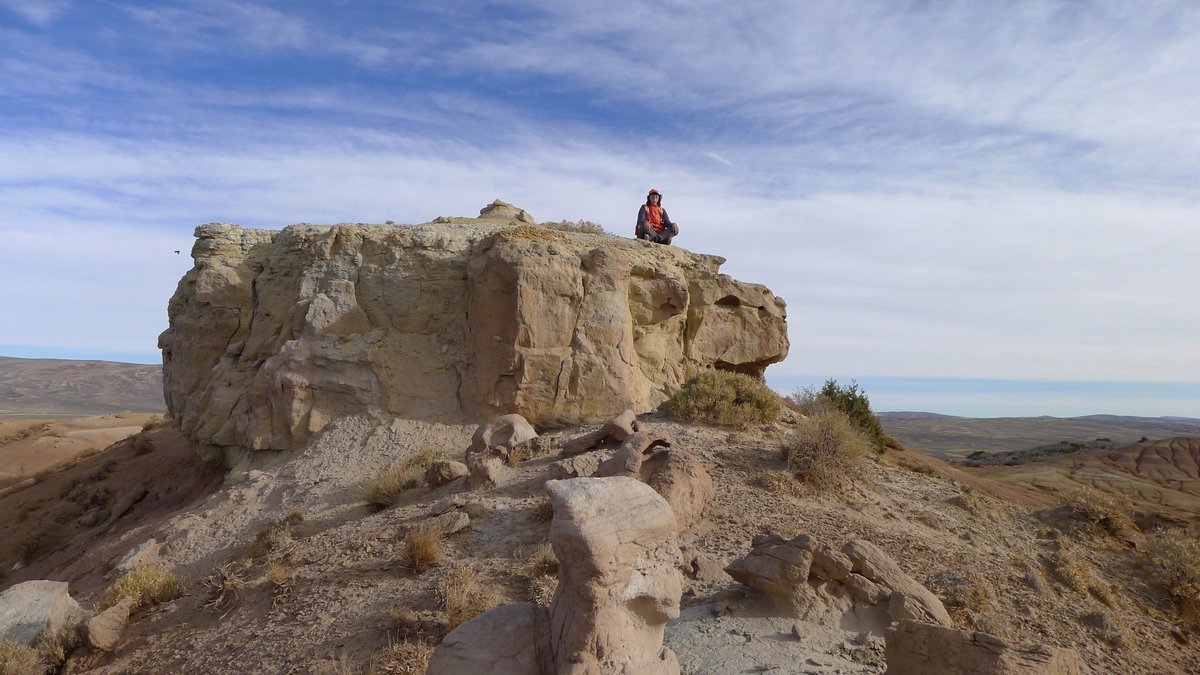
Geologist Kelsey Kehoe contemplates the structure of the Red Creek syncline from atop a river channel sandstone in the Eocene Wasatch Formation, SW #Wyoming. 📸was taken while in the field collecting data for a #geologicmap that you could win—just fill out our survey! 1/2
Trends for you
Most Popular Users

Elon Musk 
@elonmusk
240.2M followers

Barack Obama
@barackobama
119.3M followers

Donald J. Trump
@realdonaldtrump
111.6M followers

Cristiano Ronaldo
@cristiano
108.9M followers

Narendra Modi
@narendramodi
107M followers

Rihanna
@rihanna
97.3M followers

NASA
@nasa
92.1M followers

Justin Bieber
@justinbieber
90.6M followers

KATY PERRY
@katyperry
86.8M followers

Taylor Swift
@taylorswift13
80.6M followers

Lady Gaga
@ladygaga
72.2M followers

Kim Kardashian
@kimkardashian
69.4M followers

YouTube
@youtube
68.6M followers

Virat Kohli
@imvkohli
68.5M followers

Bill Gates
@billgates
63.4M followers

The Ellen Show
@theellenshow
62.5M followers

CNN
@cnn
61.9M followers

Neymar Jr
@neymarjr
61.1M followers

X
@x
60.9M followers

Selena Gomez
@selenagomez
59.9M followers