Top Tweets for #LPDAAC


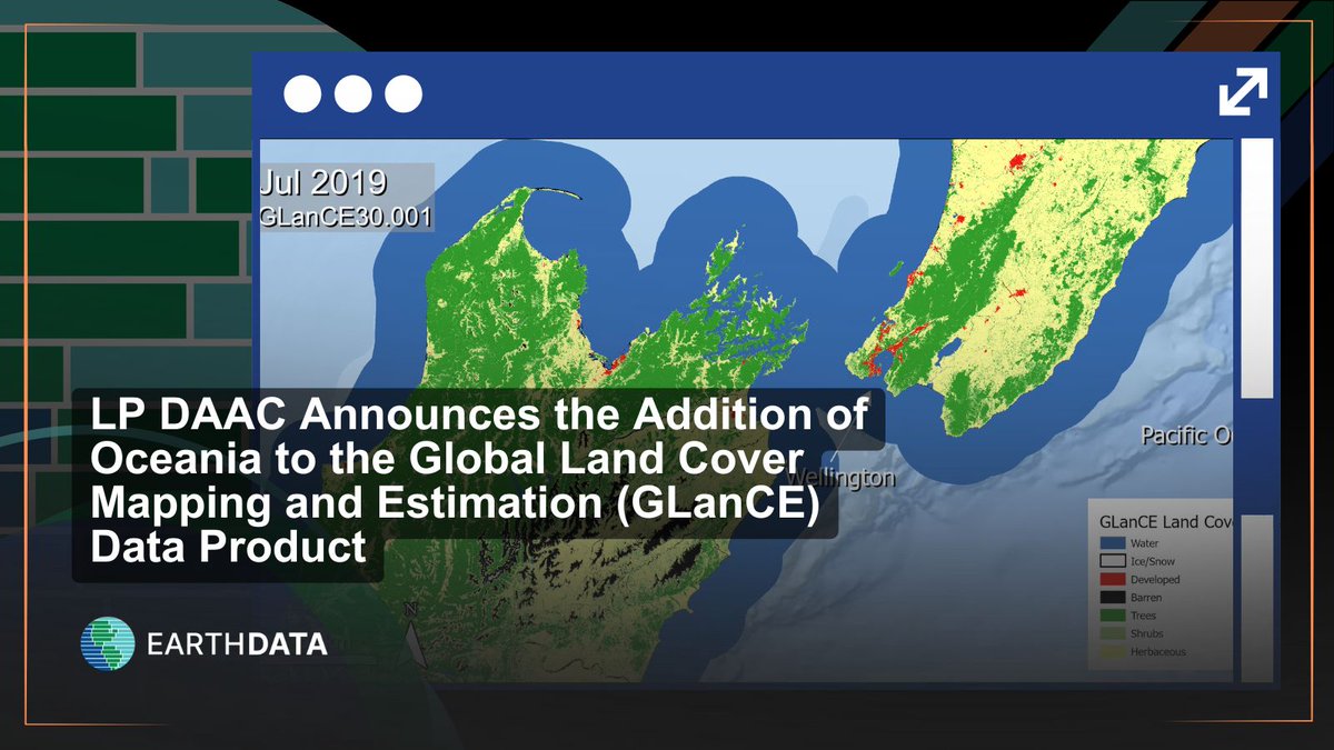
GLanCE is growing! The Landsat-derived Global Land Cover Mapping and Estimation product now includes data over Oceania. Use a greenness index (EVI2) or explore seven land classes, as shown in this image over New Zealand. Learn more at NASA #LPDAAC: https://t.co/Hdca82eYGW
#Landsat #EarthData #Oceania

Did you know a @NASA archive calls EROS home? The #LPDAAC manages data from NASA sensors that monitor the Earth’s land surfaces from space. Learn more about the connections between EROS and its NASA archive partnership: https://t.co/3aFwiiDE5A
#EarthObservation #EarthData
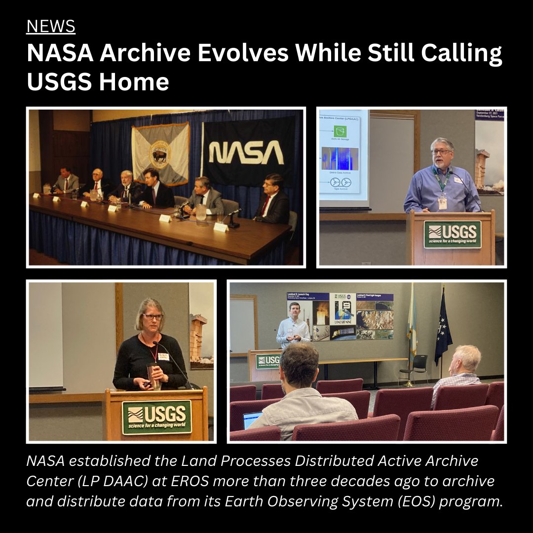
Did you know a @NASA archive calls EROS home? The #LPDAAC manages data from NASA sensors that monitor the Earth’s land surfaces from space. Learn more about the connections between EROS and its NASA archive partnership: https://t.co/3aFwiiDE5A
#EarthObservation #EarthData

Now Available: NASA’s Land Processes DAAC (#LPDAAC) released VIIRS Version 2 Land Surface Phenology data products from the Suomi-NPP satellite.
Learn more about the products and access data: https://t.co/R4UTIkNxKK

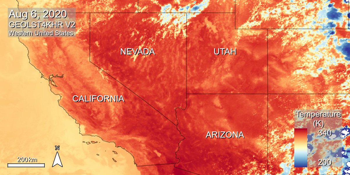
🚨 New Data Alert! 🚨 NASA’s #LPDAAC just added 7 more years of NASA MEaSUREs Geostationary Earth Orbit Land Surface Temperature (GEOLST4KHR) Version 2 data, covering 2017–2023! 🌍📊
Discover and access the updated dataset here: https://t.co/qHPt9xTjto


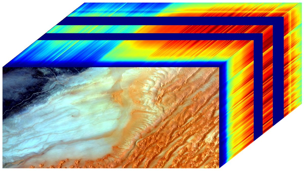
Find webinars, tutorials, and video tips at NASA's #LPDAAC for accessing and working with land processes data from missions like EMIT, GEDI, and ECOSTRESS using a variety of software, web applications, custom tools, and scripts.
➡️Access resources: https://t.co/CZxw9Tbq5P


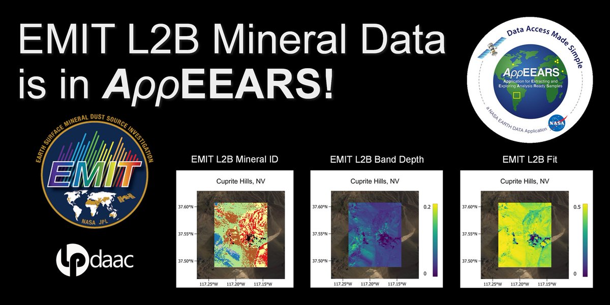
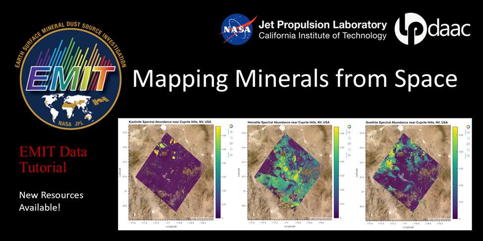
NASA's Application for Extracting and Exploring Analysis Ready Samples (AρρEEARS) now provides a “Spectral Comparison” tab allowing visualization of point samples from the Earth Surface Mineral Dust Source Investigation (EMIT) mission. #LPDAAC
Learn more: https://t.co/BMLhcHHL08
NASA #LPDAAC's GEDI Version 2 Level 1B Geolocated Waveform, Level 2A Elevation and Height Metrics, and Level 2B Canopy Cover and Vertical Profile Metrics products are now available in the NASA Earthdata Cloud. Basemap: USAID NAIP 2020
Learn more: https://t.co/WEgV71iyjJ


New #ECOSTRESS data in #AppEEARS! ECOSTRESS Version 2 Level 3 Tiled #Evapotranspiration and Level 4 Tiled Evaporative Stress Index and Water Use Efficiency products are now available! #LPDAAC @NASAJPL
➡️Start exploring at: https://t.co/Hm1uzoihhv

New capability! Subset GEDI Version 2 data products in NASA’s Earthdata Cloud using Earthdata Search and the Harmony API. This capability allows users to request spatial, temporal, and variable subsets of data.
Learn more at NASA's #LPDAAC: https://t.co/CZTJYvkcbJ

Most Popular Users

Elon Musk 
@elonmusk
240.1M followers

Barack Obama
@barackobama
119.3M followers

Donald J. Trump
@realdonaldtrump
111.6M followers

Cristiano Ronaldo
@cristiano
108.7M followers

Narendra Modi
@narendramodi
106.9M followers

Rihanna
@rihanna
97.2M followers

NASA
@nasa
92.1M followers

Justin Bieber
@justinbieber
90.5M followers

KATY PERRY
@katyperry
86.7M followers

Taylor Swift
@taylorswift13
80.5M followers

Lady Gaga
@ladygaga
72.1M followers

Kim Kardashian
@kimkardashian
69.3M followers

YouTube
@youtube
68.6M followers

Virat Kohli
@imvkohli
68.4M followers

Bill Gates
@billgates
63.3M followers

The Ellen Show
@theellenshow
62.5M followers

CNN
@cnn
61.9M followers

Neymar Jr
@neymarjr
60.9M followers

X
@x
60.9M followers

CNN Breaking News
@cnnbrk
59.9M followers