Top Tweets for #MappingTechnology

Lixel K1 is redefining smart city scanning with high-precision 3D data capture.
Smarter cities start with smarter mapping.#SmartCities #GeospatialTechnology #LiDAR #3DScanning #Surveying #Geomatics #UrbanPlanning #DigitalTwin #InfrastructureDevelopment #MappingTechnology

LiDAR-enabled drones capture precise terrain and structural data, supporting detailed aerial mapping and analysis.
#GarudaAerospace #LiDAR #AerialMapping #DroneSurvey #Geospatial #DroneTech #MappingTechnology

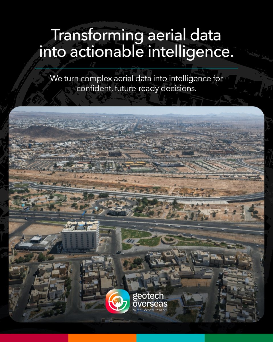
Transforming aerial data into intelligence that drives smarter and more confident decisions. 🌎
#GTO #GeotechOverseas #GeospatialIntelligence #AerialSurvey #RemoteSensing #Photogrammetry #LiDAR #DataProcessing #GeoData #MappingTechnology

नहीं भटकना होगा द्वार-द्वार, मैप पर मिलेगा आधार
गूगल मैप की नई पहचान, आधार केंद्र का सटीक ज्ञान
#GoogleMaps #AadharCenter #TechInnovation #NewFeatures #MappingTechnology #AadharKnowledge #GoogleMapUpdate #TechForPublic #LocationServices #primenews
@singhaditya029 @PrimeNewsInd

Advanced mapping technologies like LiDAR allow us to see what the eye cannot, offering new perspectives to better understand and protect fragile ecosystems.
#LiDAR #DroneMapping #Geospatial #InnovationInConservation #AerialSurvey #MappingTechnology #FutureOfMapping #DroneTech

Vervotech Partners with ZealConnect to Bring Reconfirmation Automation to the World
@vervotech #ZealConnect #Automation #mappingtechnology #traveltechnology #traveldata
https://t.co/vApsTt5fVP


"#EngineersWithoutBorders: Using #MappingTechnology for #SustainableWater Access!"
https://t.co/NBeNSqUp59
#PLI #Trimble #Geospatial #GeospatialTech #Surveying #SurveyLife #LandSurveying #GPS #GIS #GNSS #Mapping #Engineering #EngineeringLife #CivilEngineering #Water #NSPS #PLS


SLAM200 On A Drone 🚁
Aerial LiDAR scanning made simple.
📡 High-precision 3D point clouds
🗺️ Accurate slope & terrain measurement
🚀 Flexible airborne mapping
#SLAM200 #DroneLiDAR #AerialMapping #3DMapping #PointCloud #Surveying #UAV #MappingTechnology #DroneTech

There’s far more to a drone than a camera.
From EO/IR imaging to multispectral insights and precision mapping, every payload transforms raw airspace into actionable data.
#GarudaAerospace #DronePayloads #AerialData #MappingTechnology #DroneSensors #ThermalImaging #Multispectral


Google Maps is unleashing a groundbreaking suite of Google Maps AI tools that will completely transform how developers and users create interactive mapping experiences. #AIdevelopment #DeveloperTools #GEMINI #GoogleMaps #mappingtechnology
https://t.co/KbsrX2J7bP


Opus IVS Announces Major Milestone for ADAS Map
#OpusIVS #ADAS #AutonomousDriving #AdvancedDriverAssistance #MappingTechnology
https://t.co/4W1r5lbFVj


LiDAR in Mapping Market.
Have more insights into this article by FMI: https://t.co/75XfyzmWHi
#LiDAR #MappingTechnology #TechInnovation #GeographyTech #MappingInsights

LiDAR Data Processing with 3D Pointshot.
Contact Us:
🌐: https://t.co/cYXdqeqsN7
📞: +91 9978330070
#3DPointshot #LiDARDataProcessing #GeospatialSolutions #DroneSurveying #MappingTechnology #DigitalMapping #TerrainModeling #GeospatialInnovation

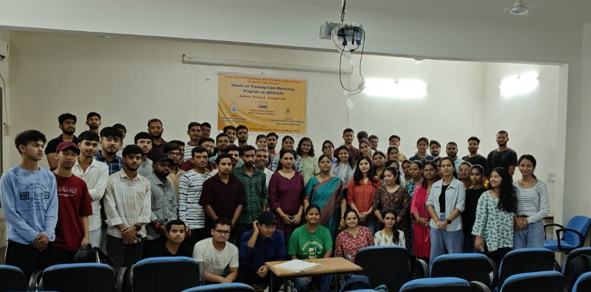
GIS Training Concludes at BU Geology Department
https://t.co/KWAG2NrN5Q
#BUGeology #GISTraining #Geoscience #SkillDevelopment #MappingTechnology #GeologyEducation #BhopalUniversity

QGIS-GIS Training at BU Geology Department
https://t.co/UG2CqWc1sW
#BarkatullahUniversity #GeologyDepartment #QGIS #GIS #GeospatialTraining #BhopalEducation #MappingTechnology #HigherEducation

We're Spoiled: Phone Navigation vs. Ancient Map Skills
#ModernConvenience #NavigationTech #PaperMaps #HistoryOfNavigation #TechEvolution #SpoiledGeneration #GPSvsMaps #TravelHistory #MappingTechnology #ThenAndNow

🚨 Last Call! Our webinar, Mapping Rail from Above, starts tomorrow! 🚆 Learn how Geotrilho used Helimap + TopoDOT. Register now or catch it on YouTube!
https://t.co/duAmlfexNu
#AerialLiDAR #GeospatialTech #RailCorridors #MappingTechnology

🤓 Fun Fact Friday! The first aerial photo for mapping was taken in 1858 from a hot air balloon! 🎈📷 Today, modern cameras let us create 3D models, extract measurements, and complement LiDAR.
#FunFactFriday #AerialPhotography #MappingTechnology #3DModeling


Take your career to new heights with Midtown! We’re looking for a GIS Developer in San Antonio, TX! Apply now: https://t.co/P0E4CYnfgJ
#gisdeveloperjobs #geospatialjobs #mappingtechnology #techjobs #giscareers #spatialdata #developerjobs #geospatialdevelopment

Trends for you
Most Popular Users

Elon Musk 
@elonmusk
240.1M followers

Barack Obama
@barackobama
119.3M followers

Donald J. Trump
@realdonaldtrump
111.6M followers

Cristiano Ronaldo
@cristiano
108.8M followers

Narendra Modi
@narendramodi
107M followers

Rihanna
@rihanna
97.2M followers

NASA
@nasa
92.1M followers

Justin Bieber
@justinbieber
90.5M followers

KATY PERRY
@katyperry
86.7M followers

Taylor Swift
@taylorswift13
80.6M followers

Lady Gaga
@ladygaga
72.1M followers

Kim Kardashian
@kimkardashian
69.4M followers

YouTube
@youtube
68.6M followers

Virat Kohli
@imvkohli
68.5M followers

Bill Gates
@billgates
63.4M followers

The Ellen Show
@theellenshow
62.5M followers

CNN
@cnn
61.9M followers

Neymar Jr
@neymarjr
61M followers

X
@x
60.9M followers

CNN Breaking News
@cnnbrk
59.9M followers