

Top Tweets for #NAEFS

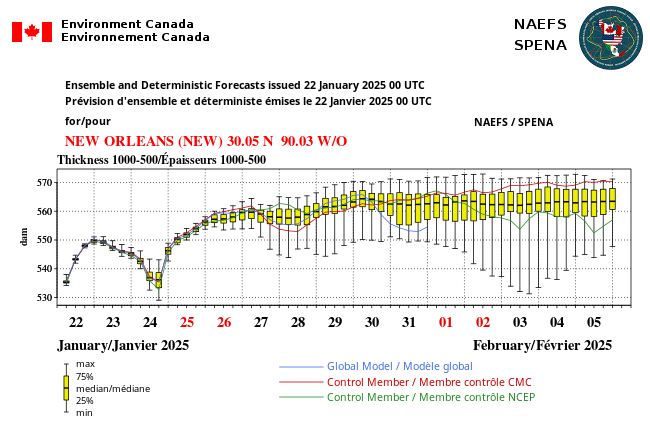
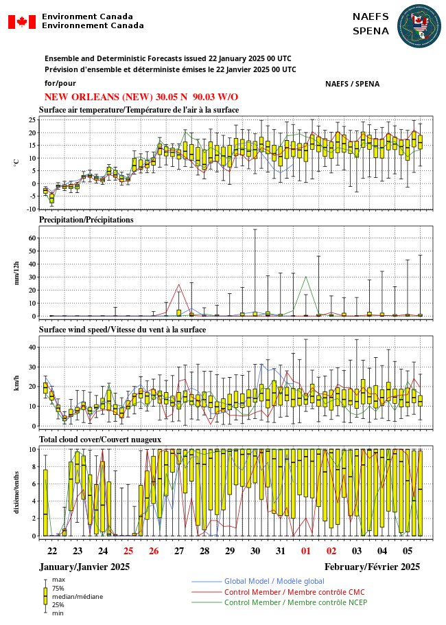
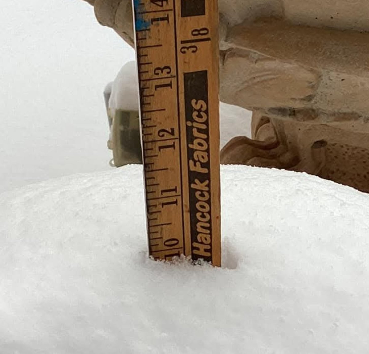
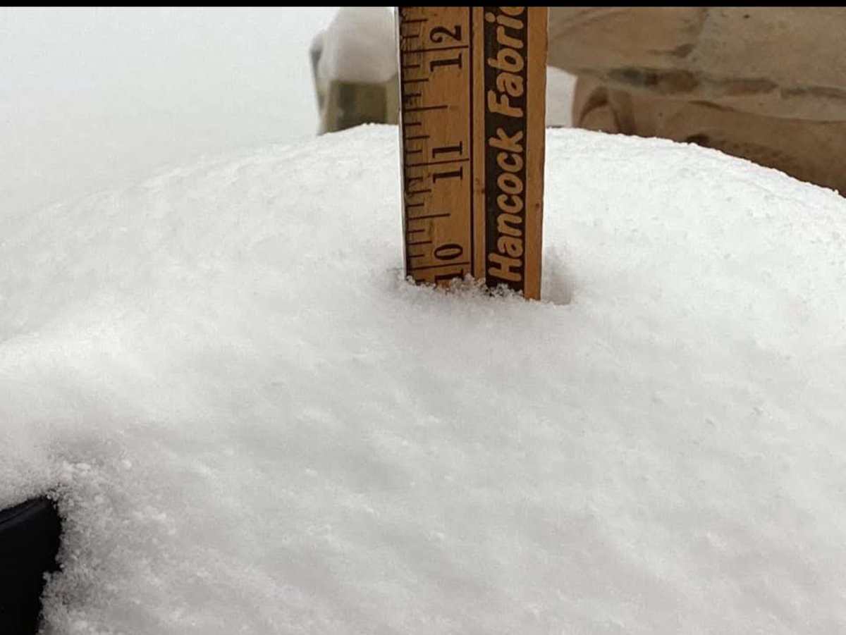
Photos taken Tuesday Jan 22 in #Lafayette, #Louisiana. #LAWX 10 Inches (25 cm) of storm total #snow on ground. #SOG WOW. Well go big or go home! If you're going to smash a record, do it in style!! By Sunday the snow melts to a warm memory. #NAEFS suggests winter's not over yet
Yes, very strong winds going into the northeastern Pacific. This is #NAEFS chance of hurricane force or greater winds in next two weeks. Yikes. Those winds will whip up big swells and pump ridge over AK.. which could help dig a deep trough down stream and send "arctic" air south

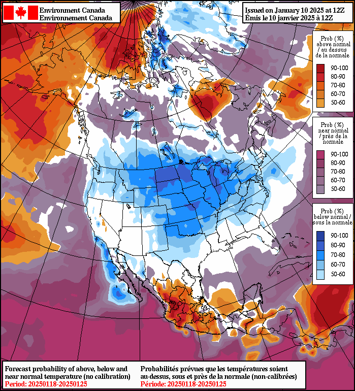

The Gulf of Alaska swell machine keeps plugging away. Nothing significant aimed at Vancouver Island but there is plenty of overhead surf in the water and on the charts coming our way. #BCwx
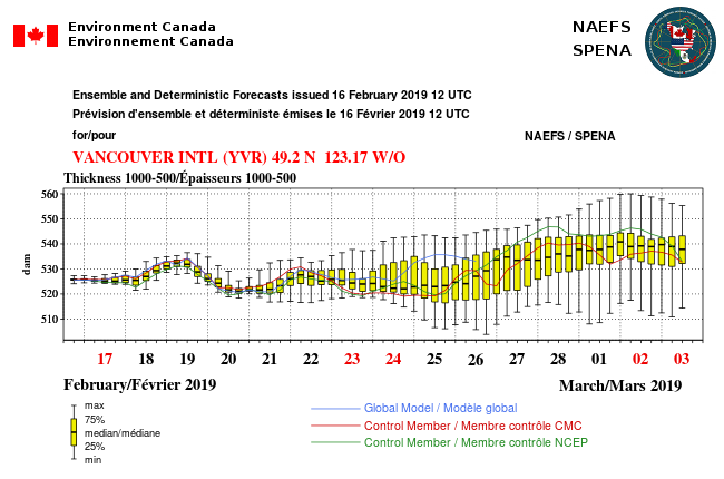
Yup..aftr Feb 25th, the signal is there for a cooler PacNW/BC, but that's so far out in the extended tis NOT reliable. Interesting to watch though. #NAEFS trends chilly by end of Feb to early March but zippo confidence. Still, don't put your winter happy box away quite yet!


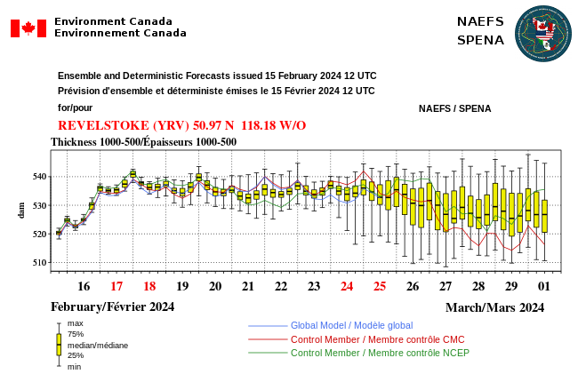
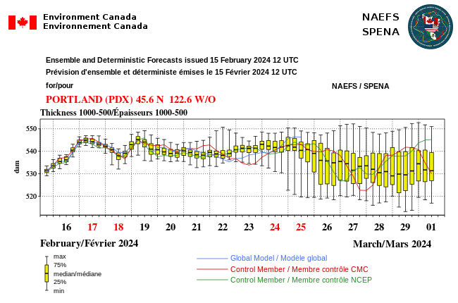

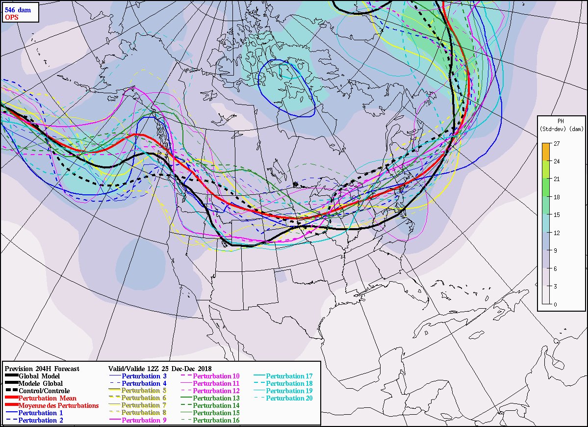
Euro control is a snow lovers dream in late Feb. deep northwest flow, with very cold lows, would mean more snow than rain with those system. With night time precip being all snow in this pattern. This is fantasy land but northwest flow is not unlikely now starting 25th.

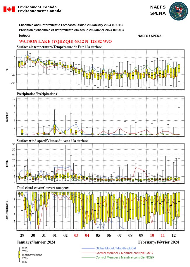


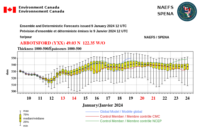
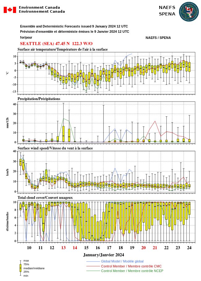
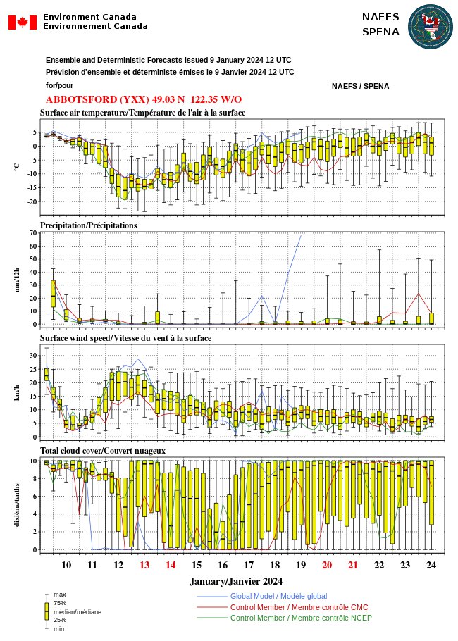

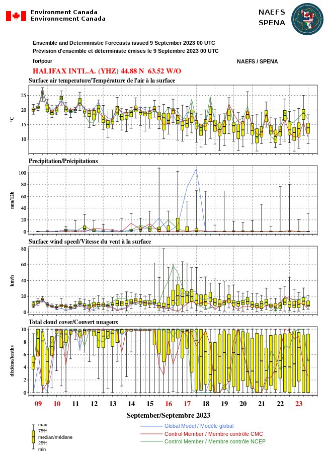
#NAEFS suggests possibility between Sept 15-19 #Lee might impact somewhere between New York to Nova Scotia and Newfoundland. Good to watch. Most ensembles say Lee will be offshore but not all. No one can be certain of a 10-day outlier forecast, however amazing our new models are.



#LEE MODELS 🌀 I want to reaffirm my message for Florida this will stay well east. I hope that will lower any anxiety and worry you might have about the storm. Models have been consistently away from Florida and have not changed...all 82 possibilities below. Even NHC noted in their recent discussion a poleward (north) turn next week. Florida East Coast will still see larger waves and the potential of dangerous rip currents. Long Island to Canada should closely monitor Hurricane Lee. Best case scenario is out to sea! I'll keep you posted on @WINKNews.


For #ABWX such at #Edson the warm up although potentially brief May 13-16, is fcst by #NAEFS to be exceptional for May..with low humidities. Let's hope firefighters can get a handle on these terrible #fires in #Alberta and parts of #BC before upcoming Mother's Day weekend
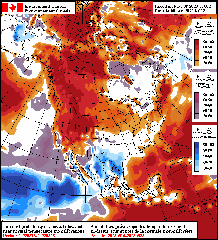
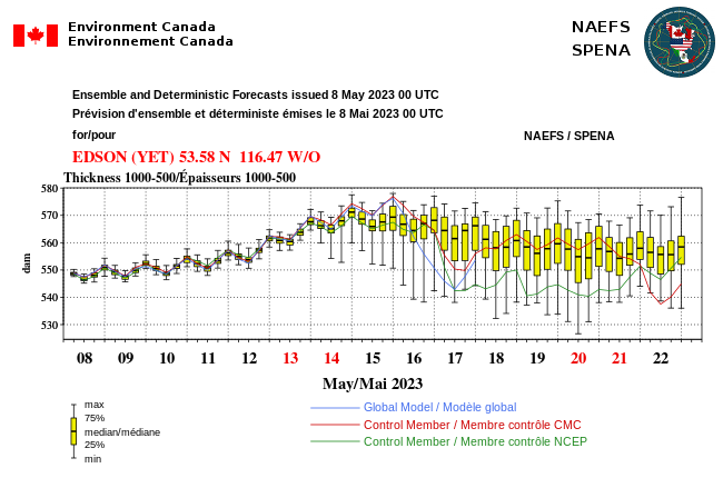
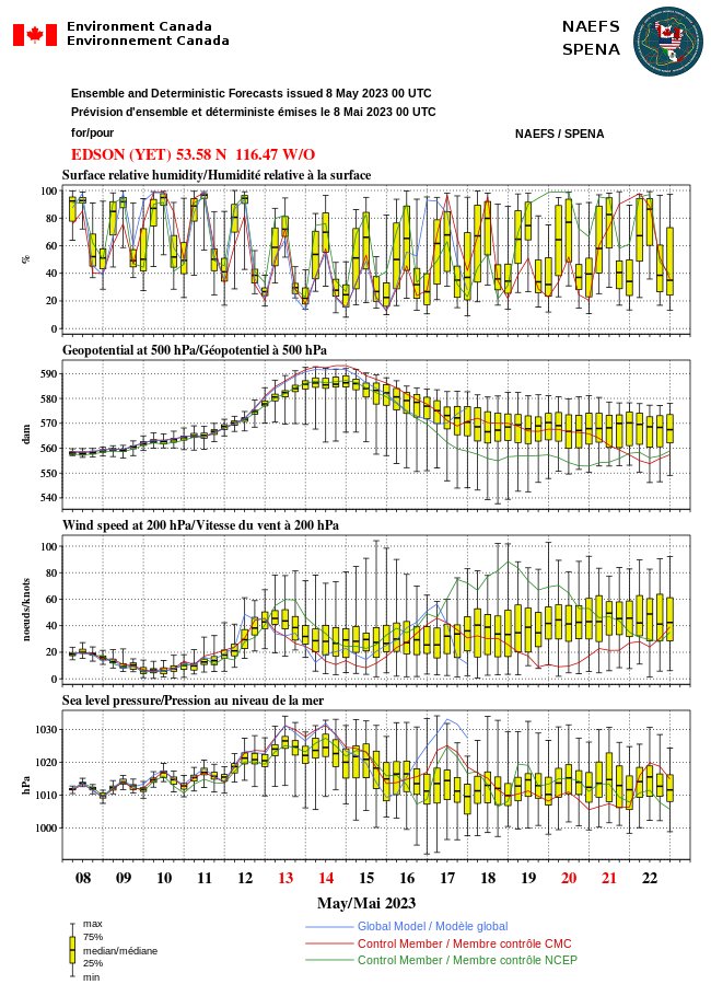


@Climatologist49 This doesn't look quite as extreme as June 2021, but...it's a *strikingly* similar pattern considering most assumed the 2021 event was an exceptionally rare/theoretically impossible event. Would expect potentially very serious fire weather impacts in Alberta/BC interior... #ABwx
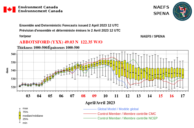
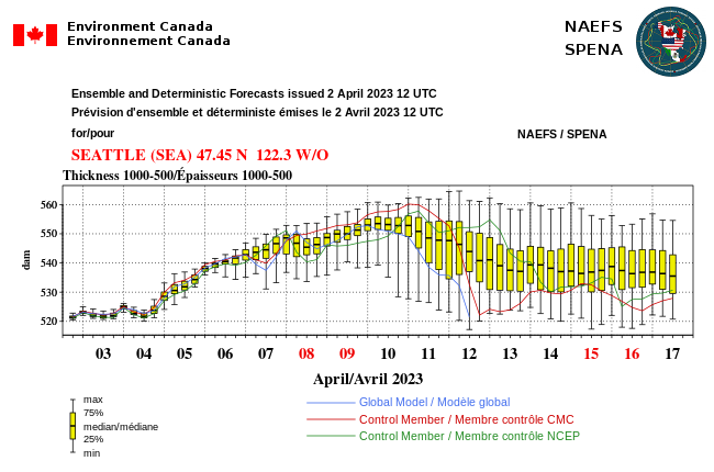


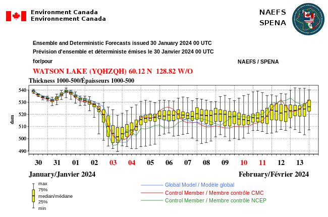
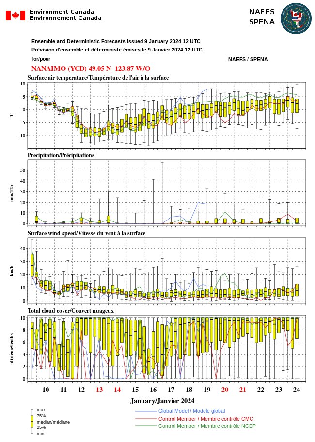
Sky Daddy says nope.. hang on till Jan 20 or so says #NAEFS.. then a ridge fcst to build a warm drying trend. (Fcsts past 5 days unreliable). Big NE Pacific Mother Low hooking up w/ juicy Trans Pacific #AR tap fm W TropPac giving #CAwx below belt punches. https://t.co/hbAuVdLBkD
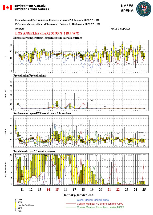
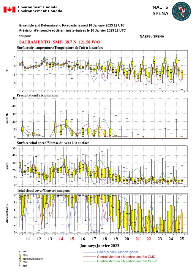

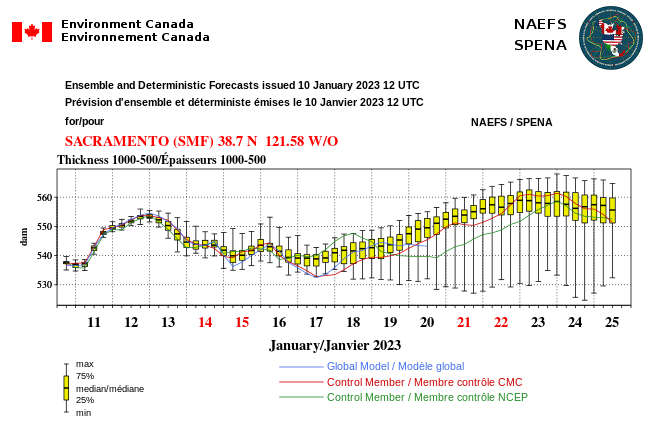

Listen Sky Daddy, we have had enough in Nor-Cal. Can we have a small break in natural disasters? #CAwx #AtmosphericRiver #Californiastorm #takeabreak
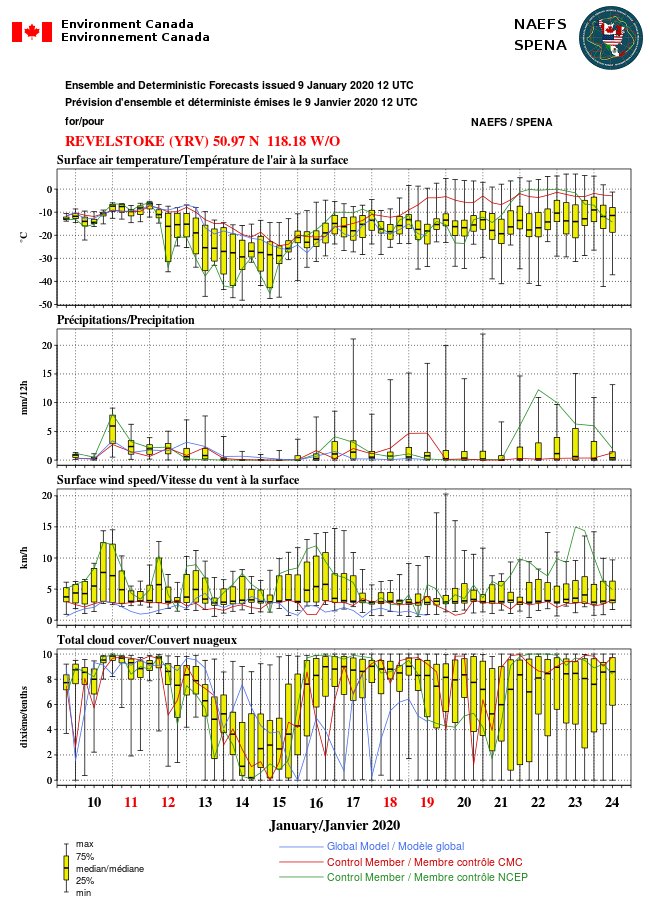
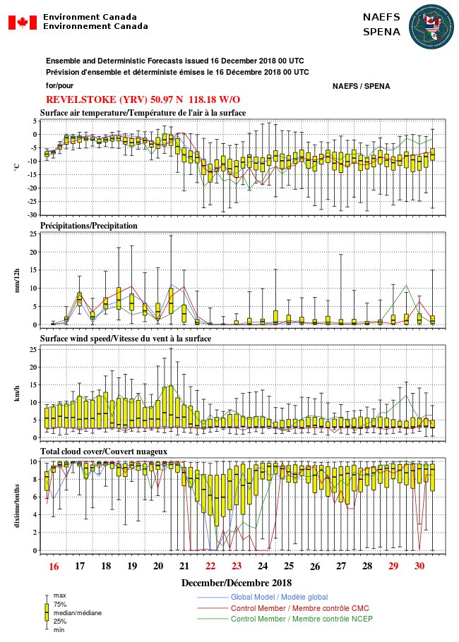
Sunny -3C calm #Revelstoke just the dusting of #snow yesterday. #NAEFS suggests more precip is coming next week. We could do with it. Snowfall has been quite low this year so far but no complaints. Been good to get fall jobs done. #BCStorm


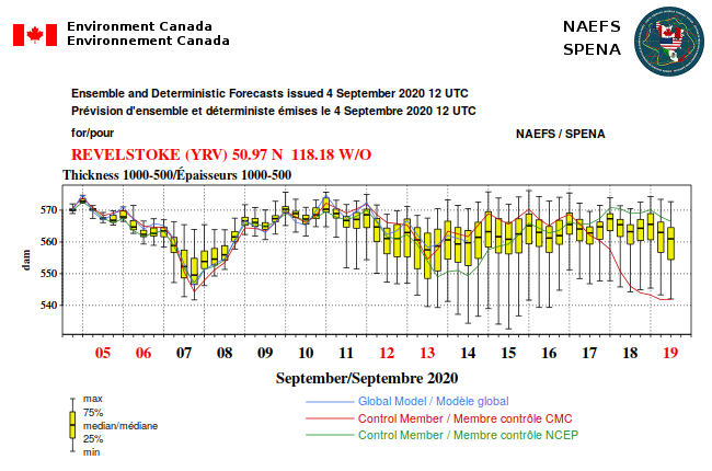
This major AR storm sequence affecting BC, fm AK to OR is phenomenal. #NAEFS 500-1000mb thckness dives precipitously fm a tropically tapped moist jet Sun- Mon as #snowlevels 1500-3000 msl fall to near sea level later Mon to Tuesday. YIKES. Impressive #PineappleExpress ! #BCStorm
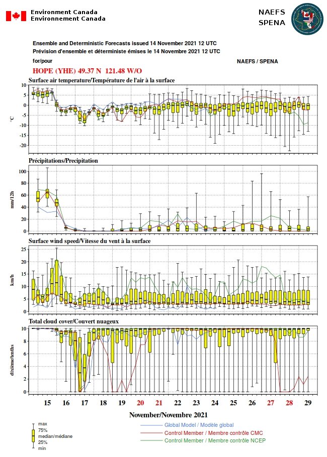


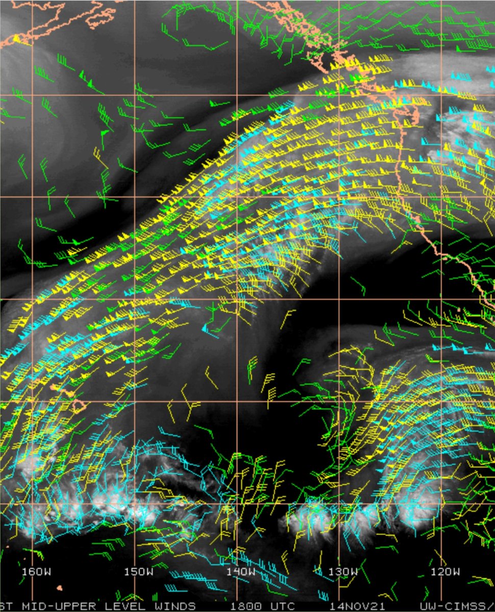
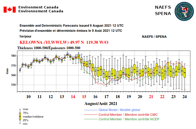


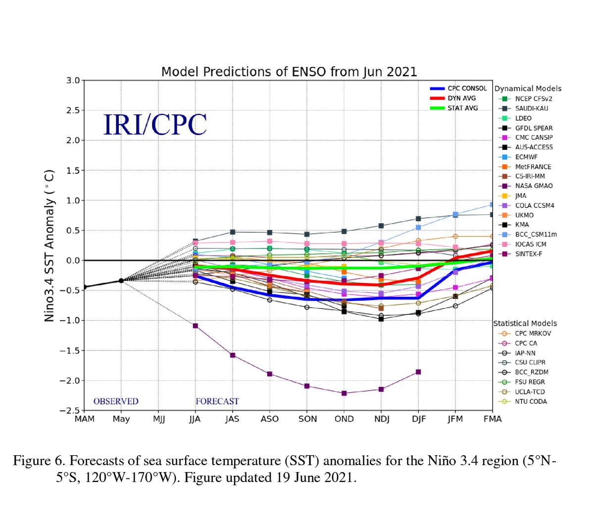
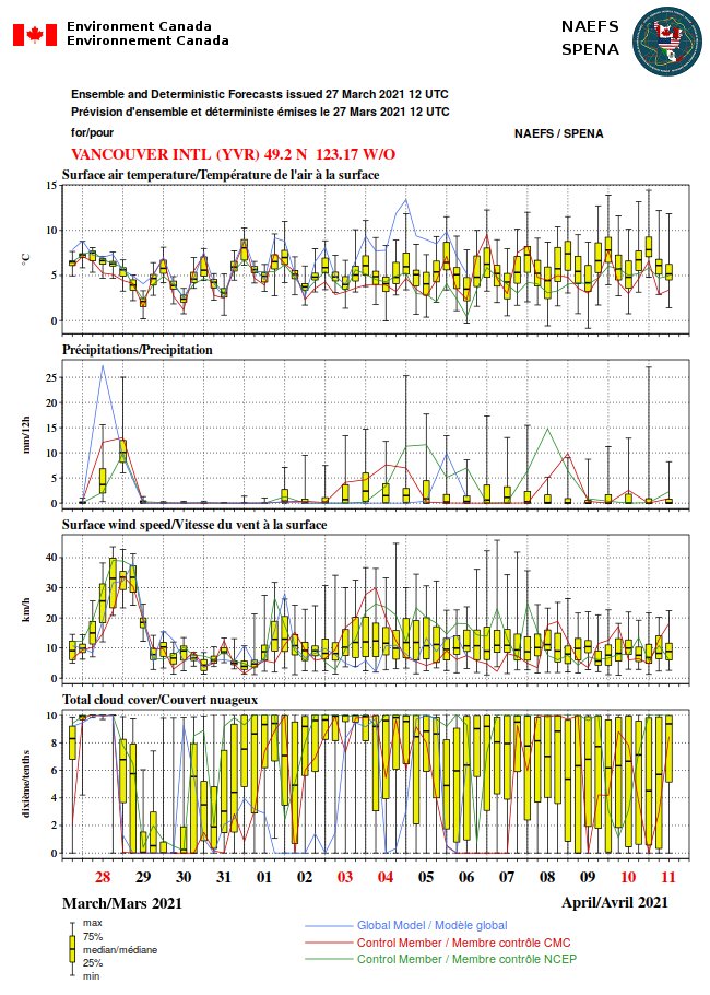
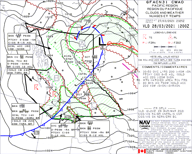
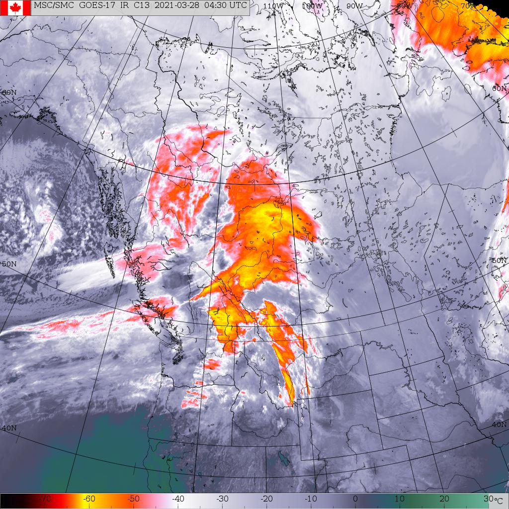
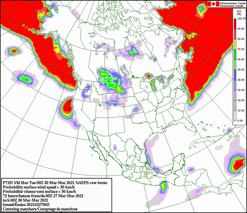
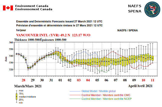
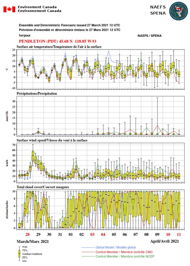
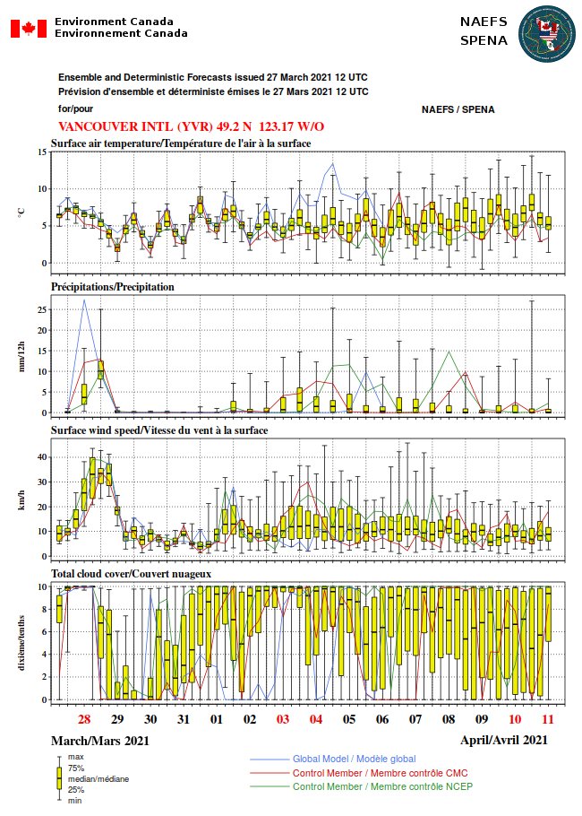
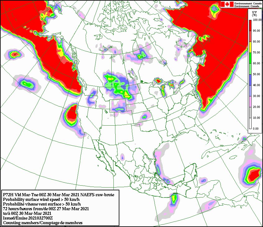
The BC interior will have an interesting cold front on Monday. It looks dry and windy. #NAEFS I guess that's wintertime knocking at our door. Please keep it out for a while longer. #Revelstoke



Very dry esp srn Vrisl. #NAEFS suggests continued dry in SW BC and lee BC Coast range and south in US through June 23. Showers days 5-10 BC srn interior. Comox on edge of rain shield. Plot is chance of 25 mm or more precip next 10 days. Looks like early July! #BCWX #WAWX #AKWX


Comox Airport, recorded only 74 mm of rain, 34.4 per cent of its normal average. That breaks all records going back to 1895, when records began.
“That’s an astounding statistic to break,” | Times Colonist https://t.co/OEEiJ2f5Bk





Last Seen Hashtags on Sotwe
تحرررررـيمني
Seen from United States
sakaryatravesti
Seen from Turkey
EdBegleyJrInterview
Seen from United States
minichat
Seen from France
anxiouspanda
Seen from Singapore
giaderza
Seen from Turkey
マジデジマ
Seen from United States
abdl
Seen from France
pieds de beurette
Seen from France
GalaAPROQUEN2016
Seen from United States
Trends for you
Most Popular Users

Elon Musk 
@elonmusk
241.5M followers

Barack Obama
@barackobama
118.9M followers

Cristiano Ronaldo
@cristiano
114.6M followers

Donald J. Trump
@realdonaldtrump
111.8M followers

Narendra Modi
@narendramodi
107.1M followers

Rihanna
@rihanna
98.7M followers

NASA
@nasa
92.3M followers

Justin Bieber
@justinbieber
91.8M followers

KATY PERRY
@katyperry
90M followers

Taylor Swift
@taylorswift13
84M followers

Lady Gaga
@ladygaga
75.5M followers

Virat Kohli
@imvkohli
73.5M followers

Kim Kardashian
@kimkardashian
70.9M followers

YouTube
@youtube
68.8M followers

Neymar Jr
@neymarjr
66.5M followers

Bill Gates
@billgates
65.2M followers

Selena Gomez
@selenagomez
63.1M followers

The Ellen Show
@theellenshow
62.2M followers

CNN
@cnn
61.8M followers

X
@x
60.7M followers