

Top Tweets for #Spot6


#spot5
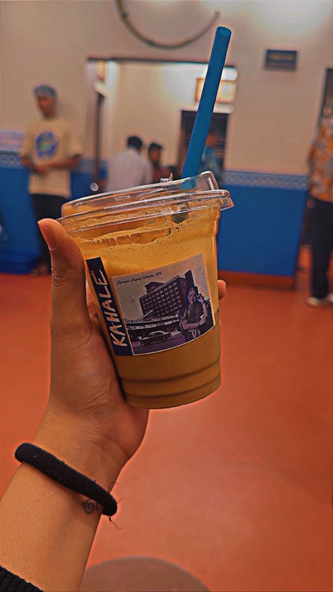
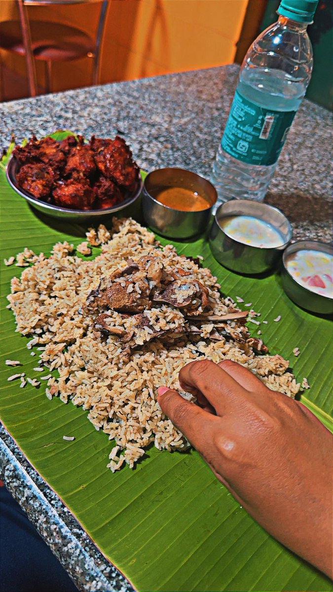
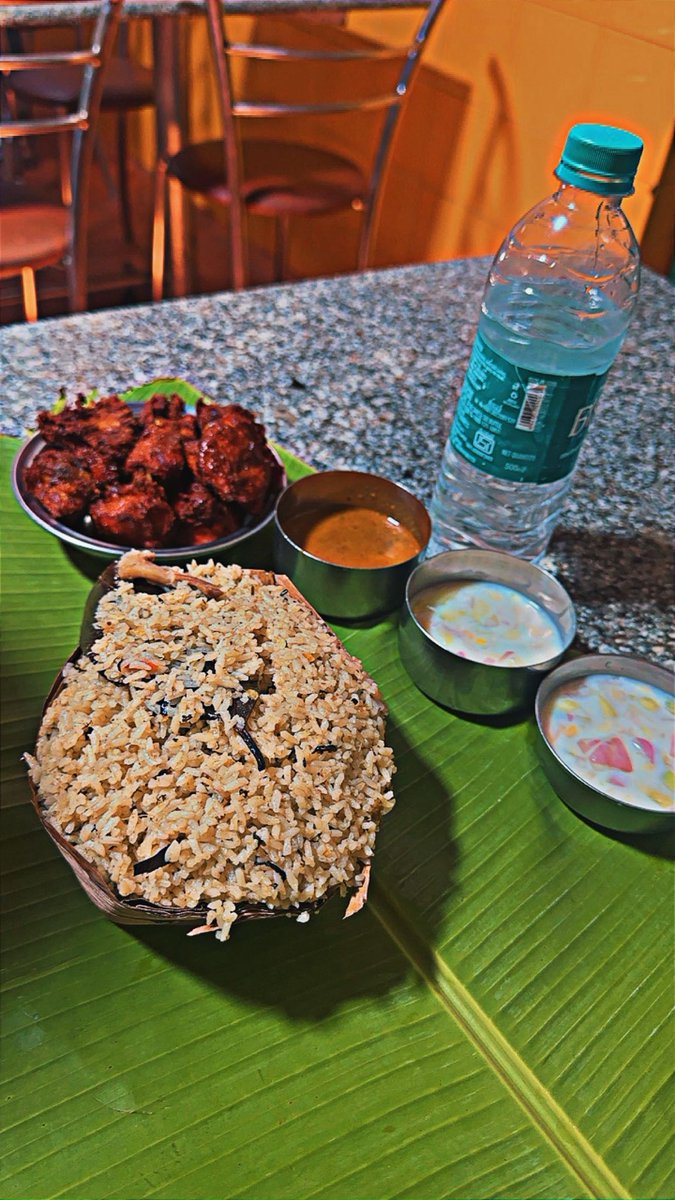
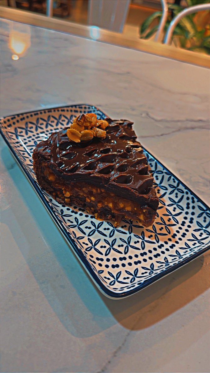
📍Kahale, Jayanagar
A happening coffee place where the interiors really define its character. Been regularly visiting this place
My picks:
Kaapi – Filter Coffee
Salted Caramel Cold Coffee
Shunti Kaapi
Didn’t really enjoy their savouries or the tiramisu






Ayooo @JaeTips you making The Bronx look good kid. Keep applying pressure. We ain’t cross paths but #SPOT6 need to be on something in the future. #IRemember #IWasThere #KillazRecognizeKillaz

There’s the release date for you guys

new #dataset #researchdata : Rousset, Guillaume, 2023, "#SPOT6 #satellite #imagery, #landcover and #landuse classification of 5 areas in the South Province of #NewCaledonia", https://t.co/guNK4G7HyV, #DataSuds, V1

We are excited to collaborate with our partners in Poland for @ExplPuckLagoon project & help them filling the gap in #seafloor #mapping of the most valuable area on the Polish #coast of the Southern #Baltic using #SPOT6+#Sentinel2 images processed with #deeplearning #SDB methods!


🛰️ Les images acquises du satellite #Spot6 de @AirbusSpace le 11 août ont permis de faire cette carte très détaillée et rapidement des incendies près de #Landiras
Plus d'info : https://t.co/WLyUloG4Dm

#EMSR619 Forest fire in #Landiras #Hostens 🇫🇷
Last night our #RapidMappingTeam delivered its Delineation Product based on @AirbusSpace VHR 🛰️imagery
The burnt🔥area (as of 11 August at July at 10:32 UTC) was 5,801.4 ha
A new monitoring 🗺️ is planned for today


#Acquisition 🔵 Zoom sur les #incendies de la #DuneduPilat de 1,5m de résolution spatiale avec #Spot6 jusqu'à 30 cm de résolution avec #PléiadesNeo. Des #satellites à très haute résolution au service de la prévention et la lutte contre les #risques liés au #changementclimatique.

1⃣ #SPOT6 image shows the extent of the burned forest & the 2 fires that are still in progress.
2⃣ The #PléiadesNeo one shows that the fire was brought under control at the foot of the Dune. The burnt areas are in brown & the green are the trees saved from the fire.
#DuneduPilat


1⃣ #SPOT6 image shows the extent of the burned forest & the 2 fires that are still in progress.
2⃣ The #PléiadesNeo one shows that the fire was brought under control at the foot of the Dune. The burnt areas are in brown & the green are the trees saved from the fire.
#DuneduPilat
1⃣ #SPOT6 image shows the extent of the burned forest & the 2 fires that are still in progress.
2⃣ The #PléiadesNeo one shows that the fire was brought under control at the foot of the Dune. The burnt areas are in brown & the green are the trees saved from the fire.
#DuneduPilat

Siguen las malas noticias 😢 en 🔥 #IFJubrique #IFEstepona #IFSierraBermeja 🔥 tras el nuevo mapa de delineación de @CopernicusEMS sobre imagen #SPOT6 de 12/09/2021 10:48 UTC
👉 5.954 Ha afectadas
👉 3.273 Ha de bosque
https://t.co/YvyAvikBqj
#VamosInfoca 💪💪


What happens when a bunch of scientists decide to map everything from seismic lines to dugouts across #Alberta?
Read @Esri's latest blog to find out: https://t.co/0VlsjMLWGO
@esricanada @Alberta_Enviro
#GIS #Geospatial #monitoring #mapping #SPOT6 #remotesensing #Esri

We’ve just headed to #Spot6 in Gbogome Akome - not yet a Spot but potentially a Spot of the future!
@eduspots volunteer Divine, an Assembly Man is setting up a literacy club to support local students.
#Literacy #Reading #JoinOurJourney


#DYK that we create a Wall-to-Wall Human Footprint Inventory for the the province? It's a comprehensive digital representation of anthropogenic disturbances (e.g., agriculture, forestry, energy) in #Alberta: https://t.co/DwWvInMc89
#SPOT6 #GIS #Geospatial #FabPhotoFriday


A Semi-Empirical #Chlorophyll-a Retrieval Algorithm Considering the Effects of #Sun Glint, Bottom Reflectance, and Non-Algal Particles in the #Optically Shallow #Water Zones of Sanya Bay Using #SPOT6 Data
by Yan Yu, Shengbo Chen et al
👉https://t.co/ig2h0GSh5h
#remotesensing


@admanfree @mapbliss I like @planetlabs #PlanetScope data because of the high temporal resolution. Do you need infrared bands, or just visible? You can also check out #SPOT6 and #SPOT7.
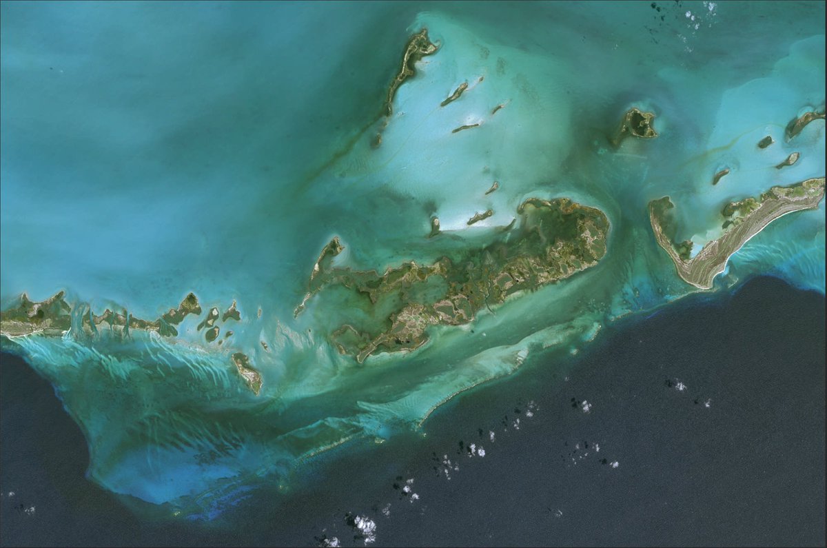
The below #SatelliteImage has been taken by #SPOT6🛰
Can you guess the location❓
Comment under the post!
ℹ️Hints:
👉Located in the Northern Caribbean where the Caribbean Sea, Gulf of Mexico and Atlantic Ocean meet
👉Largest island in the Carribbean

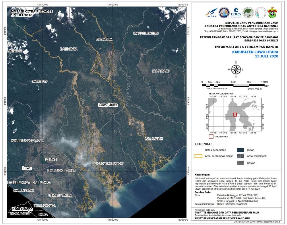
La charte @DisastersChart mobilise ses ressources pour estimer les inondations dans le district de North Luwu : cette 1re carte utilise les images des satellites #Pleiades et #SPOT6.

Our first map of the flash #flood in #Indonesia uses #Pleiades and SPOT-6 imagery to estimate flooding in North Luwu Regency: https://t.co/UoswMRxRxS


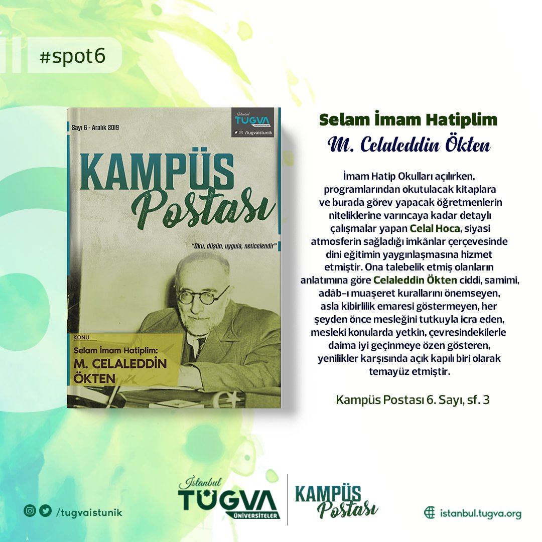
Yoksa sen hala Kampüs Postası'nı keşfetmedin mi? 😮
O zaman #KampüsPostası 6. sayısından bir kesite göz atalım. #Spot6
📚 Tüm sayılarımız için👇
https://t.co/ScLgu8zc4E
#ÜlkeniçinEvindeKal 🏠
Last Seen Hashtags on Sotwe
Trends for you
Most Popular Users

Elon Musk 
@elonmusk
241.5M followers

Barack Obama
@barackobama
118.9M followers

Cristiano Ronaldo
@cristiano
114.6M followers

Donald J. Trump
@realdonaldtrump
111.8M followers

Narendra Modi
@narendramodi
107.1M followers

Rihanna
@rihanna
98.7M followers

NASA
@nasa
92.3M followers

Justin Bieber
@justinbieber
91.8M followers

KATY PERRY
@katyperry
90.1M followers

Taylor Swift
@taylorswift13
84M followers

Lady Gaga
@ladygaga
75.5M followers

Virat Kohli
@imvkohli
73.5M followers

Kim Kardashian
@kimkardashian
70.9M followers

YouTube
@youtube
68.8M followers

Neymar Jr
@neymarjr
66.6M followers

Bill Gates
@billgates
65.3M followers

Selena Gomez
@selenagomez
63.1M followers

The Ellen Show
@theellenshow
62.2M followers

CNN
@cnn
61.7M followers

X
@x
60.7M followers