Top Tweets for #TopoMap

Nothing beats a well-detailed topographic map! Clean contours, precise elevation data, and a layout that tells the land’s story at a glance. #LandSurveying #GIS #Mapping #TopoMap #Surveying


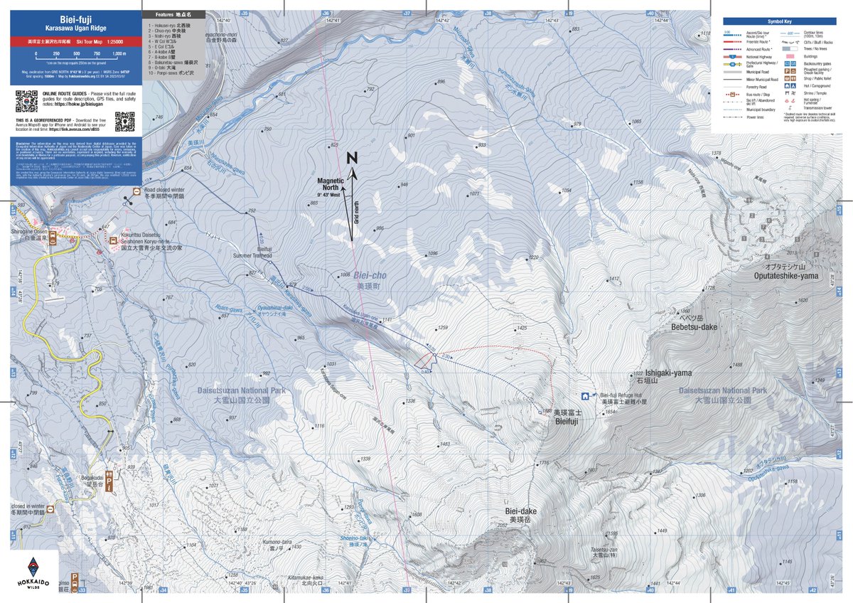
Topo Map Reading pt. 2/10: Overview & Map Collar. Find what’s around the edge of a topographic map: Title, vicinity map, quad index, north arrow, scale, and projection information #mytopo #hiking #usgs #topomap #topographicmap #mapreading #outdoorskills #navigation #cartography

A quality point cloud is a great starting point for a GIS workflow analyzing and modeling the topography of an area. Learn how to create one using Global Mapper in this blog: https://t.co/lDpbhJ7f0H
#GlobalMapper #topography #topomap #pointcloud

In Global Mapper Pro, you can create a topographic map from a point cloud! Learn how to create your own in our latest vlog: https://t.co/gJWYW6RRhR
#GlobalMapper #topography #topomap


That Land Navigation Course is finally going to come in handy.
#TopoMap


Past and Present Practices of Topographic Base Map Database Update in Nepal https://t.co/N8oDRf3B2a #mdpiijgi via @ISPRS_IJGI #GISchat #EOchat #Geospatial #Nepal #Map #topomap #basemap #database #update #review #citations #library @Wagle1996 @MDPIOpenAccess


My second attempt at producing a topographic map
Study Area: Lagos State, Nigeria.
How did I do??🫠🫠
Played around and produced a slope map of the state too
#GIS #TopoMap #TopographyMap #ArcGIS #DEM #Slope #Mapping #RemoteSensing


Michael Nau, a Geospatial Engineer at Idaho Army National Guard produced this modern hillshade map of Idaho using a georeferenced topo map from 1909.
You can access the project on Spatialnode using this link: https://t.co/CAbEFhpuiC
#topomap #arcgis #projectshowcase


Past and Present Practices of Topographic Base Map Database Update in Nepal https://t.co/N8oDRf3B2a #mdpiijgi via @ISPRS_IJGI #GISchat #EOChat #Map #TopoMap #geospatial #nepal #Survey #Surveying #citation #library #Database #update #basemap #land #landcover #landuse

Check out the first of a long line of topographic maps our CEO @bre is machining using the Bantam Tools Explorer™ CNC Milling Machine. He used Touch Terrain and Blender to prep his model and then dropped it into Fusion 360 to program his toolpaths. #bantamtools #CNC #topomap

In the 1980s, I worked summers at Bar-41 Dude Ranch and Summer Camp. Despite being in the middle of the desert, it was beautiful terrain and I milled a memory of the place on the @bantamtools Explorer.
https://t.co/hR2Att1txJ

Check out these instructions on making 3D terrain maps on #CNC.
https://t.co/swP3NBLmTg
#MPCNC #topomap #map #geography #maker #instructables #contest

Original 1749 antique copper-plate engraved map of western Tartary, centered on the Gobi Desert, by Jacques Nicolas Bellin.
$189.99
Get a closer look:
https://t.co/0HnQ82k4nV
#Tartary #GobiDesert #BellinMap #SilkRoad #history #GiftIdeas #decor #cartography #topomap #maps

Topographic Base Map Update in Nepal: A Preliminary Update on Challenges and Solutions is available on @ResearchGate #GISchat #EOchat #geospatial #Map #Topomap #updates #challenge #solutions #Nepal @PratikDhungana3 @Wagle1996 https://t.co/oLqi7BEJs8

![USGS's tweet photo. [FAQ] - Why is the orthoimage (air photo) layer not available for some US Topo maps and OnDemand Topo maps?
https://t.co/suE6m0eJBT
#USTopo #Topomap https://t.co/SVonXx22j4](https://pbs.twimg.com/media/FXFqU-CXgAIgoJA.jpg)
Happy #MapMonday!
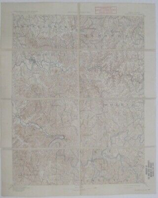
Genuine original color lithographed fold-out dissected topographical reconnaissance map of Beattyville, Clay, Irvine, and vicinity, eastern Kentucky, printed more than 89 years ago.
$22.99
https://t.co/FZjs6WiNrm
#CyberMonday #TopoMap #AntiqueMap #GiftIdeas
Genuine original color lithographed fold-out dissected topographical map of part of #PikeCounty, #Kentucky, and small portions of #Dickerson and #Buchanan counties, #Virginia, printed more than 89 years ago.
$22.99
https://t.co/joDJ0uViQp
#TopoMap #FieldMap #AntiqueMap #antique

[FAQ] - Can I donate a map that isn't already in the USGS Historical Topographic Map Collection?
https://t.co/IVxqqqhmcu
#FAQ #TopoMap #TopographyTuesday
![USGS's tweet photo. [FAQ] - Can I donate a map that isn't already in the USGS Historical Topographic Map Collection?
https://t.co/IVxqqqhmcu
#FAQ #TopoMap #TopographyTuesday https://t.co/HJAUCQJDQh](https://pbs.twimg.com/media/E73mj8IX0AE9GPc.jpg)

The perfect journal for all your summer adventures. 🌲
#topopino #themountainsarecalling #adventuretime #topopinocampcollection #topomap #handcrafted #letterpress #timeinnature #adventure #hikethewhites #tothesummit #whitemountains #camping #glamping #getoutsidenh #mountainl

Last Seen Hashtags on Sotwe
Most Popular Users

Elon Musk 
@elonmusk
240.2M followers

Barack Obama
@barackobama
119.3M followers

Donald J. Trump
@realdonaldtrump
111.6M followers

Cristiano Ronaldo
@cristiano
109.3M followers

Narendra Modi
@narendramodi
106.9M followers

Rihanna
@rihanna
97.4M followers

NASA
@nasa
92.1M followers

Justin Bieber
@justinbieber
90.6M followers

KATY PERRY
@katyperry
87M followers

Taylor Swift
@taylorswift13
80.8M followers

Lady Gaga
@ladygaga
72.4M followers

Kim Kardashian
@kimkardashian
69.5M followers

Virat Kohli
@imvkohli
68.9M followers

YouTube
@youtube
68.6M followers

Bill Gates
@billgates
63.5M followers

The Ellen Show
@theellenshow
62.5M followers

CNN
@cnn
61.9M followers

Neymar Jr
@neymarjr
61.5M followers

X
@x
60.9M followers

Selena Gomez
@selenagomez
60.1M followers