Top Tweets for #droneMapping


Turn data into powerful insights 🌍📊
Join our Mapping & Survey Course and learn how to capture, process, and analyze aerial data for real-world applications—from land surveys to construction planning.
#DroneMapping #Surveying #Geospatial #AerialData #GIS #DroneTraining


🚀 Admissions Open!
Join the 6-Month Professional Certificate Course in Geoinformatics by AHSIS Pvt. Ltd.
📅 Starts: 1 July 2026
🔗 Apply: https://t.co/d2YdBENnZP
#GIS #Geoinformatics #RemoteSensing #DroneMapping #GeoAI #PythonGIS #AHSIS


Turn your drone into a mapping powerhouse 🗺️
Learn aerial data capture & analysis in our 2-day Mapping Course – £299 + VAT
📍 Rotherham | 📞 0114 4055 007
👉 https://t.co/HQsnwz2zZD
#DroneMapping #Photogrammetry #DroneTraining #Iprosurv #Dronesforgood #CAAApproved #Surveying


"#GeoCue Offers a Full Range of #AerialLiDAR!"
https://t.co/vrSc3LzKY1
#PLI #DroneSurvey #DroneSurveying #DroneMapping #UAV #UAVSurvey #UAVSurveying #UAVMapping #Geospatial #Construction #UtilityMapping #Transportation #Farming #Mapping #EngineeringLife #Infrastructure #NSPS


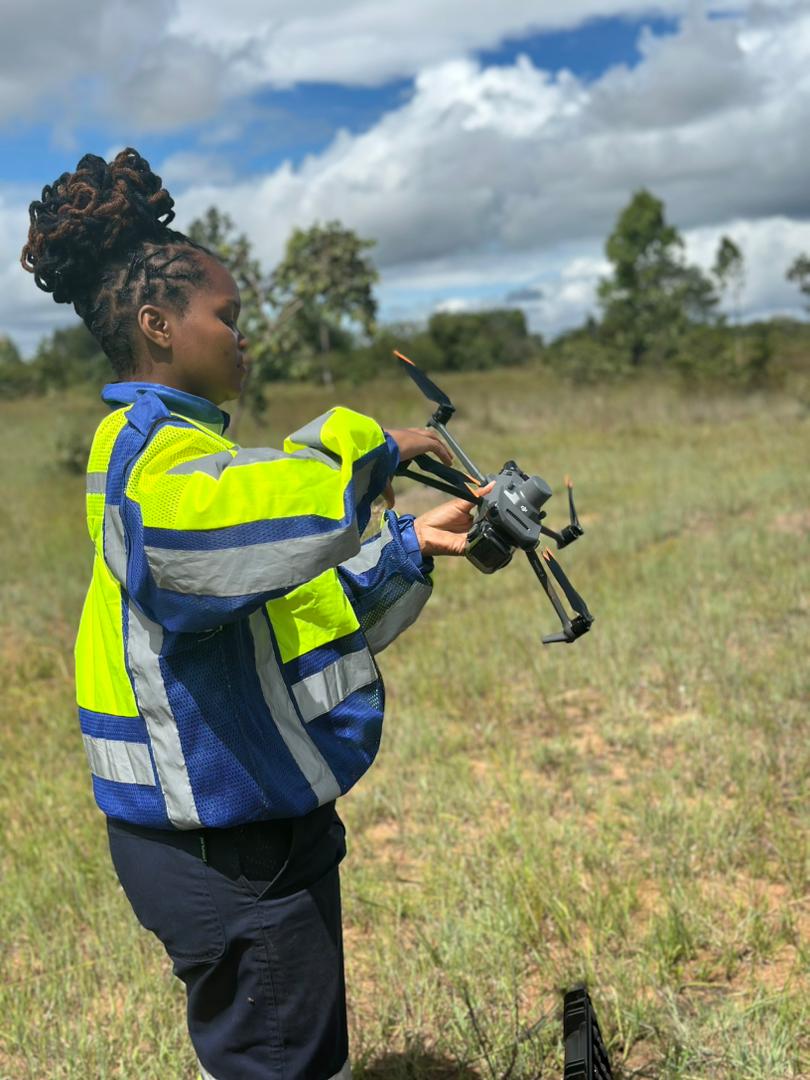
Drone mapping is helping businesses collect accurate geospatial data faster than ever. From construction and mining to agriculture and infrastructure, UAV-powered mapping improves visibility, planning, and decision-making.
https://t.co/0blMkzuQjZ
#DroneMapping #UAV

Transform mining operations with GIS, drone mapping, and GeoAI. Join our webinar on Aug 12, 2026, 9:30 AM and learn how to optimize workflows and turn data into actionable insights. Register now: https://t.co/Ccj6TTdLka
#GISforMining #GeoAI #DroneMapping


YOLOv8-Based Object Detection from UAV Aerial Imagery | Computer Vision & Artificial Intelligence. Tutorial Link: https://t.co/1MCMnkT7iN
#YOLOv8 #ComputerVision #ArtificialIntelligence #DeepLearning #UAV
#DroneMapping #RemoteSensing #GeospatialAI #ObjectDetection


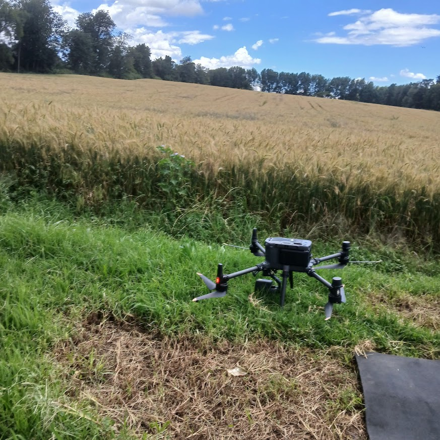
Drone mapping over wheat fields using UAVs enables precision agriculture through high-resolution geospatial data for better farming decisions.
#DroneMapping #GIS #PrecisionAg #UAV #Surveying

Mapped an entire solar farm in a day 🚁
Now the team can see exactly where grass needs reseeding—no boots on the ground needed.
Overlay + zoom = zero guesswork.
Learn more: https://t.co/0xKXLT7fu0
#solar #dronemapping #solarenergy #dronedata #drones

StockpileStudio with PixElement auto-detects stockpiles from terrain, lets you refine boundaries fast, and generates volume reports. Assign material, density, and cost to convert volumes into mass and value.
#DroneMapping #Photogrammetry #Surveying #Mining #StockpileMeasurement

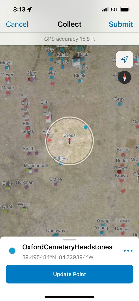
Students mapped 6,000+ headstones using phones and drones — in half the usual time 📱🚁
Learn more:
https://t.co/52XGMctc3O
#Geoawesome #GIS #DroneMapping #Cartography

Expose Now Exclusive: सीकर में माफिया का 'पत्थर' वाला खेल; सरकार को 132 करोड़ की चपत, ड्रोन ने खोली पोल!...
#SikarNews #MiningScam #RajasthanMafia #BreakingNews #ExposeNow #DroneMapping


🚧 Are you getting the most value from your drone program?
👉 Discover how leading infrastructure teams are scaling their drone programs.
🔗 https://t.co/wjKhPPwXpR
#ConstructionTechnology #DroneMapping #DigitalConstruction

🔹 Pix4D = The Industry Standard for surveying
Whether you're mapping in Lagos, Abuja, or Port Harcourt, we’ve got you covered. Get your official licenses today.
🔗 https://t.co/h81Y7qEz4T
#DroneMapping #GeospatialNigeria #SurveyingLagos #GeoStore #Abuja #GIS #SB19 Elenga
How to Process Drone Imagery Data for Free – Step-by-Step Guide?
Tutorial link: https://t.co/Q7DvPiz24W
Registration link: https://t.co/O4AcVIerFn
#dronemapping
#UAV
#dronedata
#photogrammetry
#gis
#remotesensing
#Geospatial
#dronesurvey
#DroneProcessing
#EarthObservation

Accurate land use mapping helps farmers and developers understand the full potential of their land and plan more effectively.
#dronemapping #agriculture
🚧 Are you getting the most value from your drone program?
👉 Discover how leading infrastructure teams are scaling their drone programs.
🔗 https://t.co/tTuNROL0Au
#ConstructionTechnology #DroneMapping #DigitalConstruction

Learn more about drone property surveys and how the ZenaDrone 1000 can make your inspections accurate, reliable, and cost-effective.
Book a demo now: https://t.co/imbNwdlwMV 🔗
#ZenaDrone #PropertySurvey #DroneMapping #AerialSurvey #RealEstateTech

📦 Real-World Application
A drone fleet in the Philippines now uses GeoPulse to map landslide-prone zones.
On-chain GPS = faster response, verifiable evidence.
#GeoPulse #DisasterTech #DroneMapping

Last Seen Hashtags on Sotwe
braveheart
Seen from United States
momson or #exny or #nolimit() +filter:native_video
gangbang
Seen from Indonesia
Janda
Seen from Indonesia
inspiration
Seen from United States
2次絵ぶっかけ em
Seen from Japan
Teenagers
Seen from Indonesia
ScottMemorial
Seen from United States
evachintiadevi
Seen from Indonesia
เย็ดคาผ้าถุง
Seen from Thailand
Trends for you
Most Popular Users

Elon Musk 
@elonmusk
240.3M followers

Barack Obama
@barackobama
119.3M followers

Donald J. Trump
@realdonaldtrump
111.6M followers

Cristiano Ronaldo
@cristiano
109.5M followers

Narendra Modi
@narendramodi
107M followers

Rihanna
@rihanna
97.4M followers

NASA
@nasa
92.1M followers

Justin Bieber
@justinbieber
90.7M followers

KATY PERRY
@katyperry
87.1M followers

Taylor Swift
@taylorswift13
81M followers

Lady Gaga
@ladygaga
72.5M followers

Kim Kardashian
@kimkardashian
69.5M followers

Virat Kohli
@imvkohli
69.1M followers

YouTube
@youtube
68.6M followers

Bill Gates
@billgates
63.6M followers

The Ellen Show
@theellenshow
62.5M followers

CNN
@cnn
61.9M followers

Neymar Jr
@neymarjr
61.7M followers

X
@x
60.9M followers

Selena Gomez
@selenagomez
60.2M followers