Top Tweets for #mastermap

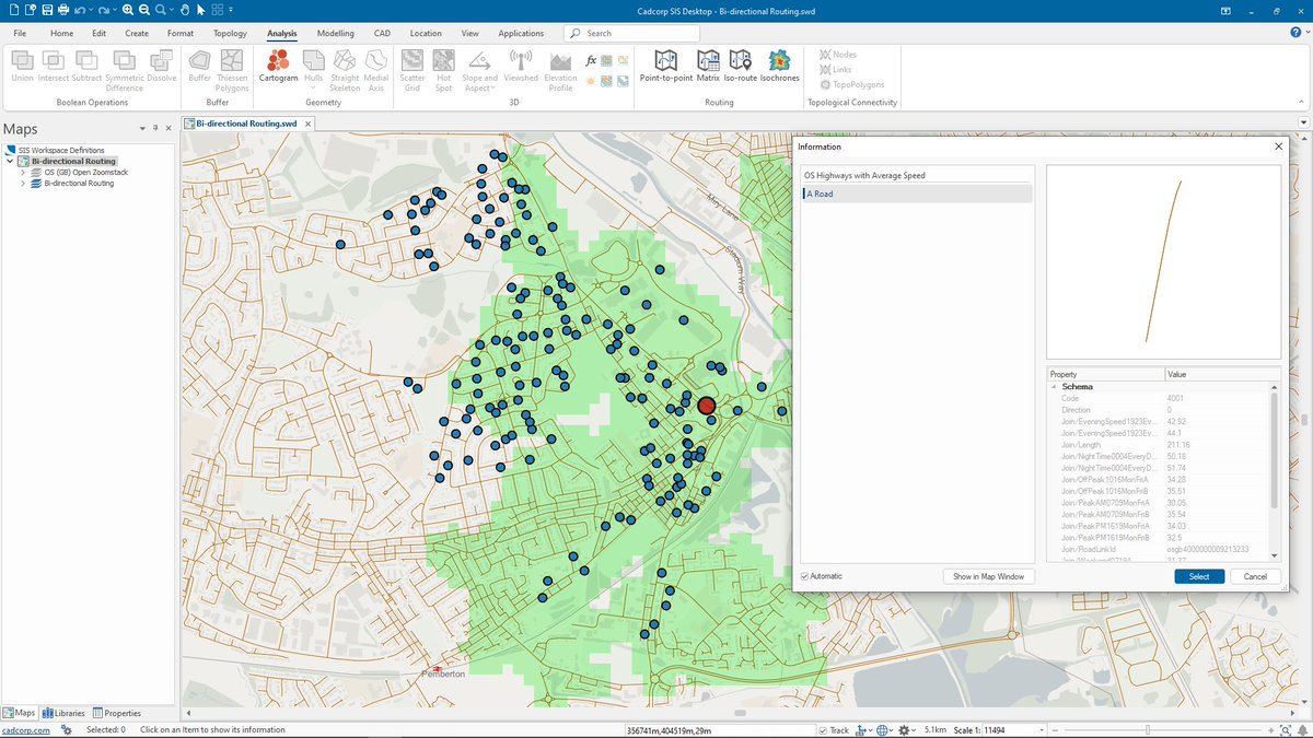
Cadcorp SIS 9.1 is here | #SISDesktop free route-finding tools now include bi-directional route costs and can be used with @ordnancesurvey #MasterMap Highways Network with speed data. What else is new? https://t.co/04Fscd5UCe #SIS9.1 #MakingSenseofPlace #spatialinsight #GIS

Thought I'd try moving my @OrdnanceSurvey #Mastermap upload to @PostGIS processes to @SafeSoftware....but it doesn't like the feature collection format of the changehistory field.
Surely there are #FME models for this somewhere?
Any ideas #gischat?
#gis #geo #geoautomation

We provide a vast range of digital mapping services. We work with a network of suppliers, including Ordnance Survey, to ensure we can offer a choice of content and formats: https://t.co/bKg6byc7mw
#digitalmapping #mappingservices #ordnancesurvey #mastermap #addressdata


🇪🇺 #MyEUSpace : +200 ideas submitted | 43 selected | 11 winner🏆 3 🇫🇷 awarded 👍 #MasterMap a solution of road status #SaNGENE an integrated GNSS-based radar for detection of obstacles #EO4ART an application for artistic products @France_CZ @EU4Space

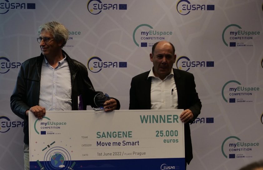
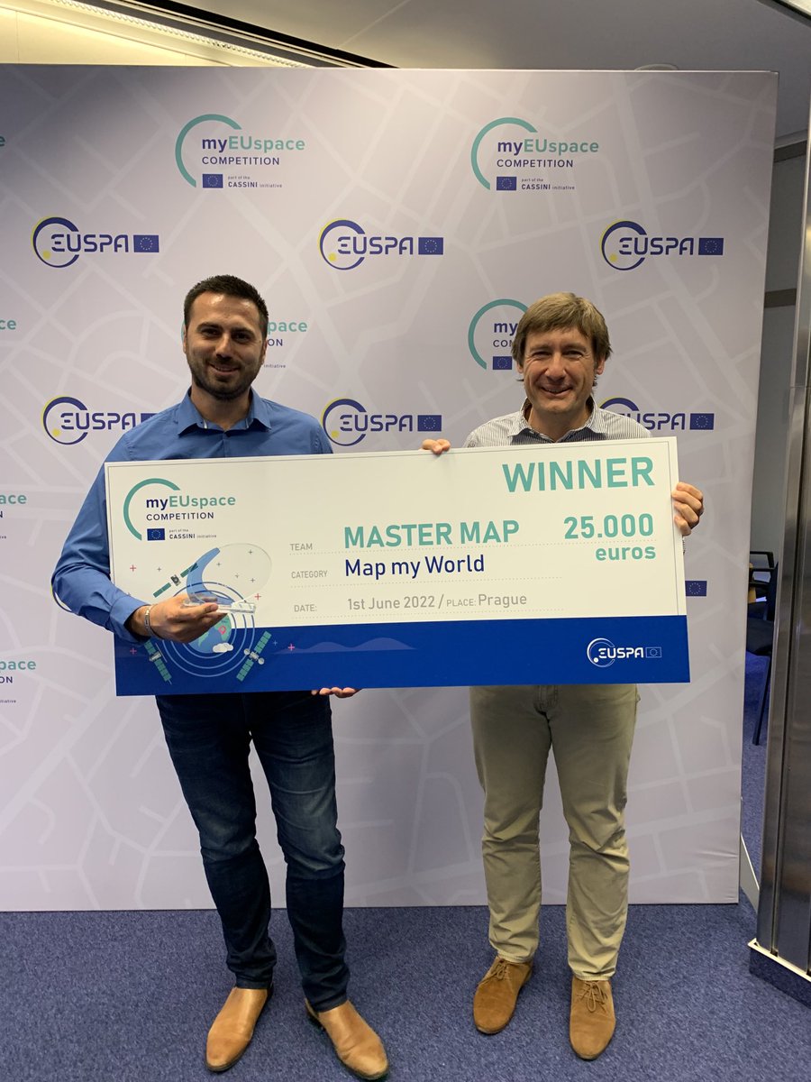

#MasterMap, a solution for automatic mapping of road status for maintenance optimization, is the winner of the "Surveying Solutions to shape the future of geomatics" area from #myEUspace Track 1!
Well done, congratulations!


Next week is going to be huge!! 🎮 Who's ready for the very 1st @Mastermind_MGT medium article release?! On top of that, the #MasterPlan could be out any moment! 😍 Oh, and I hear there's a #MasterMap and it leads to #TReaSuRe!!🏴☠️
@BubbleTea1110 @loopeyRV

When purchasing @OrdnanceSurvey MasterMap from emapsite, you have the flexibility to download multiple formats for use in different software at no additional cost
https://t.co/efRluHyeIM
#dwg #shp #cad #gis #mastermap #detailedmapping #planning #analysis

Did you know that you can view @OrdnanceSurvey MasterMap on our website for FREE? We don't charge our clients viewing fees, saving you time & money by ensuring you can select the exact data you need! https://t.co/iBG4bmBMto
#data #cad #gis #dataviz #mapping #location #mastermap


@OrdnanceSurvey launches OS #DataHub platform. Named the #OSDataHub, it will give users free access, up to a threshold, to #OS #MasterMap #data with access via multiple free #APIs via @UKAuthority #geospatial #mapping https://t.co/WqCAqtXuv7

We have integrated the new @OrdnanceSurvey Open Identifiers with our data! You can find out more in our June #newsletter - https://t.co/GS9YnciYru
Image below shows OS #MasterMap buildings coloured by building AGE.
#News #OpenData #UKBuildings #UKMap


Explore our wide range of #maps and use the ones most suitable to your project. Edozo can provide all the #mapping solutions you’ll need including #MasterMap, #City, #Street, #Town and #Aerial.
Find out more https://t.co/XtmjEGP3Ne
#commercialproperty #realestate #OSmaps


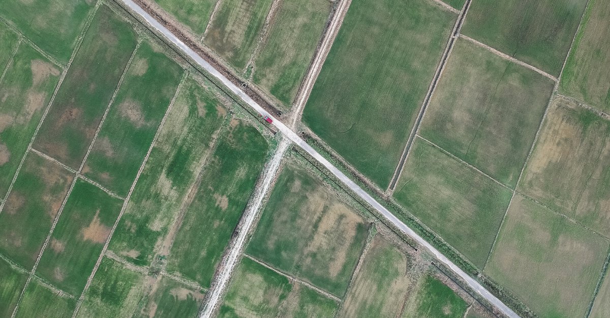
The full GB pavement width data service in @ArcGISOnline derived from @OrdnanceSurvey #mastermap is available to any PSGA customer and now also under the OS Mapping for emergencies program to any organisation responding to the #covid19 crisis in the UK https://t.co/yWuwTH9m1x

A great Media Map feature in the @guardian, looking at pavement widths and how local authorities can help prepare for social distancing https://t.co/nYxNb1X1UG


Interested in serving @OrdnanceSurvey #MasterMap in @GeoserverO ? Our team is preparing a read-to-use data dir plus other instructions which we will release shortly for free. Stay tuned!
@OSGeo @foss4g @planetosgeo #geoserver @GeoNode @mapstore2 @foss4guk #sld #mapping #maps
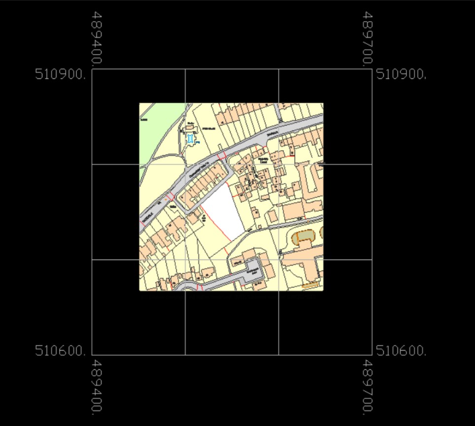
Have you tried our @OrdnanceSurvey MasterMap in DWG format plus Grid? The 100m grid gives a quick visual guide to location and scale when using Mastermap in CAD
Click here for more info and samples: https://t.co/x91bGtpV8L
#CAD #MasterMap #DataViz
With a full range of maps including #MasterMap, City, Street, Town and Aerial Edozo can provide all the #mapping solutions you’ll need.
#FridayQuiz - Can you guess where this is? Image shown is @OrdnanceSurvey #MasterMap in DWG format with Building Heights! #CAD #Location #FridayFeeling
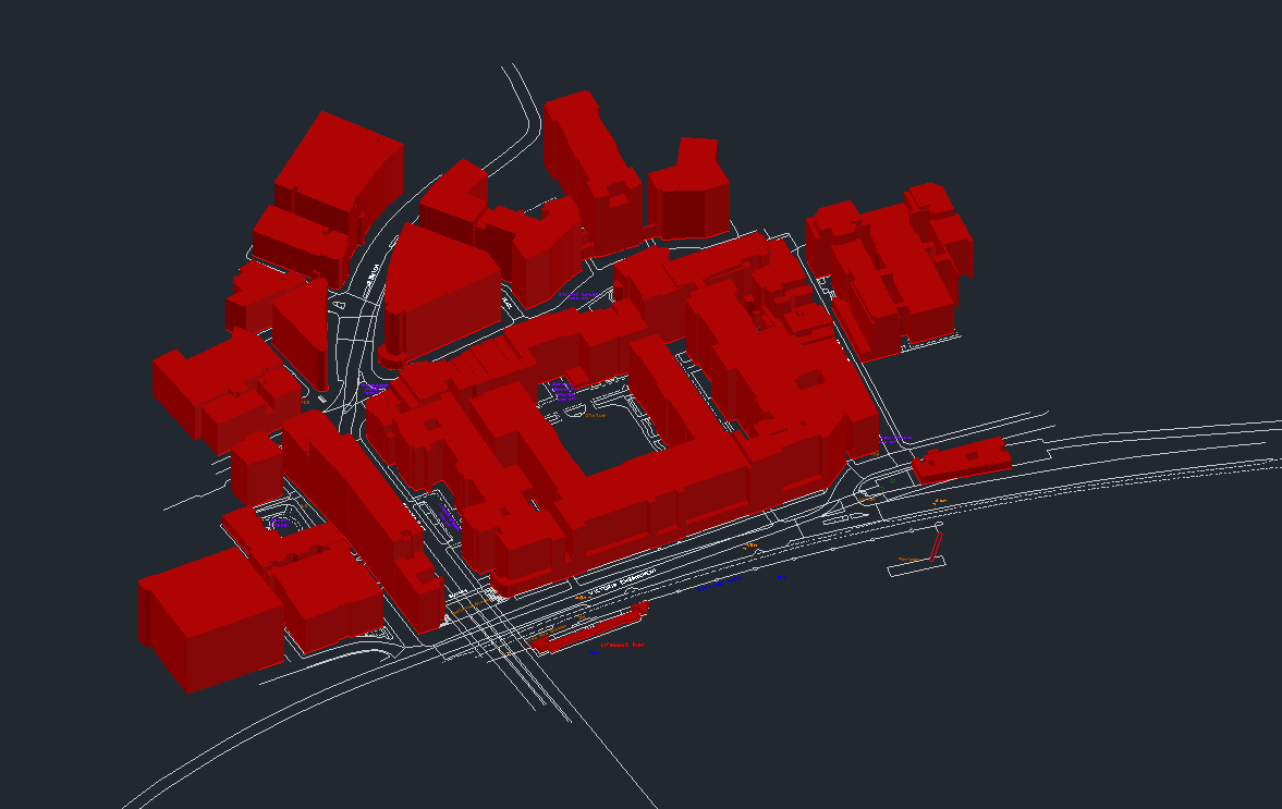
#FridayQuiz - Can you guess where this is? Image shown is @OrdnanceSurvey MasterMap in DWG Standard, including Building Heights #CAD #FridayFeeling #MasterMap


@OrdnanceSurvey on the stage talking #Maps and #MasterMap at the #RoSFutureFocus event in #Inverness. @RegistersOfScot

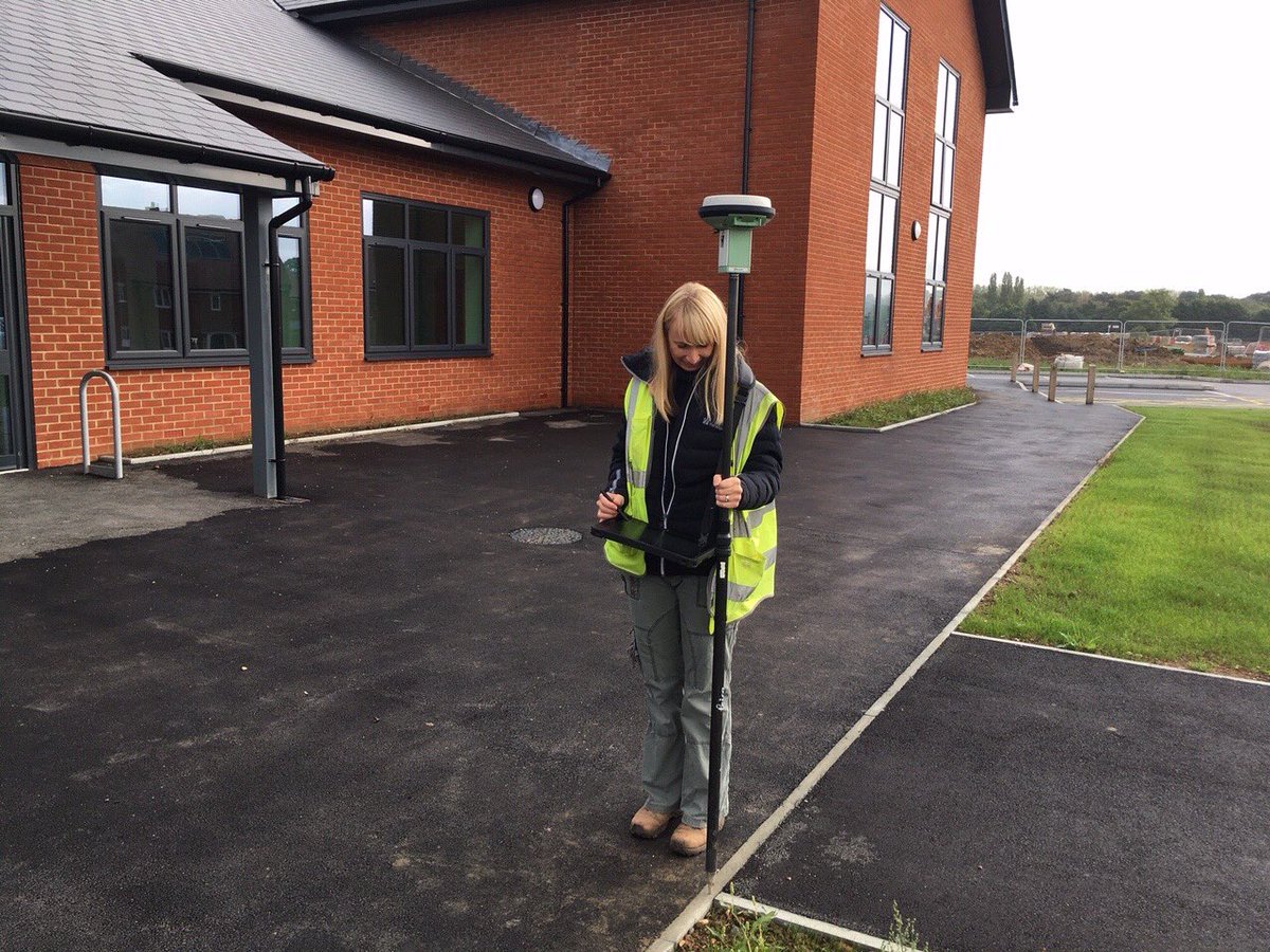
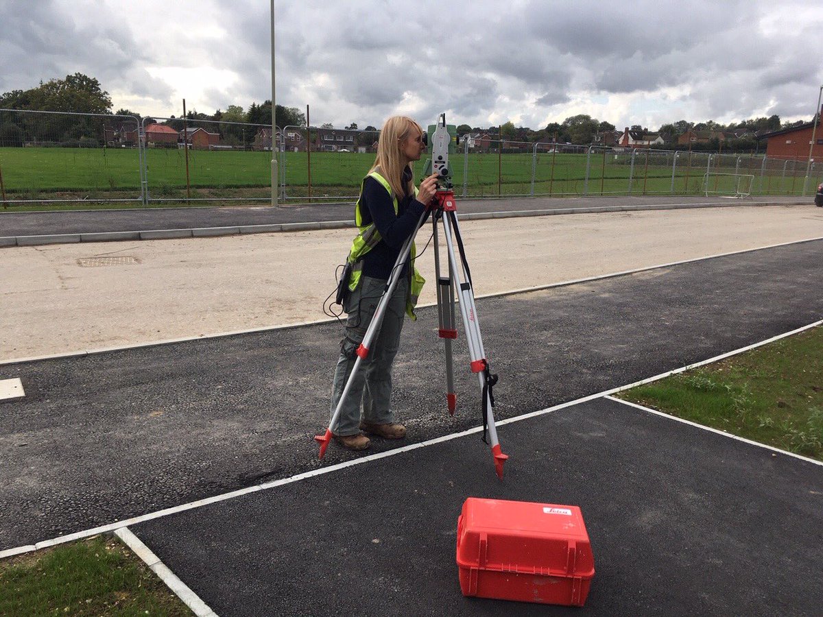
Brilliant day out with an @OrdnanceSurvey surveyor. Got to see the detailed work that goes into making our data and maps so detailed and trusted! Proud to contribute to #MasterMap
#FridayQuiz - Can you name this castle? Shown below on
@OrdnanceSurvey
#MasterMap #Imagery? To find out more about the Aerial Imagery we provide, please visit our website: https://t.co/gVEwZOVlOw #FridayFun #FridayFeeling #aerialphotography #CAD #GIS

Last Seen Hashtags on Sotwe
Most Popular Users

Elon Musk 
@elonmusk
240.2M followers

Barack Obama
@barackobama
119.3M followers

Donald J. Trump
@realdonaldtrump
111.6M followers

Cristiano Ronaldo
@cristiano
108.9M followers

Narendra Modi
@narendramodi
107M followers

Rihanna
@rihanna
97.3M followers

NASA
@nasa
92.1M followers

Justin Bieber
@justinbieber
90.6M followers

KATY PERRY
@katyperry
86.8M followers

Taylor Swift
@taylorswift13
80.6M followers

Lady Gaga
@ladygaga
72.2M followers

Kim Kardashian
@kimkardashian
69.4M followers

YouTube
@youtube
68.6M followers

Virat Kohli
@imvkohli
68.5M followers

Bill Gates
@billgates
63.4M followers

The Ellen Show
@theellenshow
62.5M followers

CNN
@cnn
61.9M followers

Neymar Jr
@neymarjr
61.1M followers

X
@x
60.9M followers

Selena Gomez
@selenagomez
59.9M followers