

Top Tweets for #nlcd


The Annual #NLCD now contains data from 2024, extending the land cover record to 40 years. One land cover change in the update is revealed in this animation of the Smith River Complex Fire that burned nearly 95,000 acres in 2023. Learn about the update: https://t.co/m01musi3dJ.

To improve the accuracy of land cover mapping in large, complex geographic regions like #Alaska, scientists at EROS have developed a novel approach for generating reliable and accurate training data. Learn more here: https://t.co/pxWihMoR32
#MachineLearning #NLCD #LANDFIRE


هذا اصدار #NLCD السنوي! يمثل هذا الإصدار قاعدة بيانات الغطاء الأرضي الوطنية (NLCD) معلمًا هامًا في رسم خرائط الغطاء الأرضي من خلال تقديم منتجات سنوية للغطاء الأرضي ومنتجات علمية تغيير الأراضي للولايات المتحدة المتقربة من عام 1985 إلى عام 2023
المزيد هنا👇
https://t.co/gfUmr28H23


The new Annual #NLCD release is scheduled for later this month.....watch @USGS_EROS for information.
Annual NLCD, slated to be released #Fall2024, will revolutionize #LandCover and #LandCoverChange assessments by providing a suite of six annual data products for the conterminous United States from 1985 to 2023. Stay tuned for more details! #ImperviousSurfaces #Innovation




While we patiently await the release of the new and exciting Annual NLCD update in the fall, check out how the #CDC has used existing #NLCD data to develop a #HeatAndHealthIndex that helps communities prepare for #ExtremeHeatEvents. Learn more here: https://t.co/8LEk7O0a7B

Abstracts for #AGU24 are due by July 31! Consider submitting a presentation under Session B010 – Advances in Understanding Land System Change to showcase your #LandChangeScience and #RemoteSensing research. Learn more here: https://t.co/GTqUCmEvie

Exciting news for #NLCD users! We are working hard to bring you a major update: Annual NLCD. Coming this fall, annual #LandCover products will be released for the conterminous #UnitedStates from 1985 to 2023. Learn more here: https://t.co/3z5NeGvcU3
#LandCoverChange #DataRelease
Exciting news for #NLCD users! We are working hard to bring you a major update: Annual NLCD. Coming this fall, annual #LandCover products will be released for the conterminous #UnitedStates from 1985 to 2023. Learn more here: https://t.co/3z5NeGvcU3
#LandCoverChange #DataRelease

#MapPromptMonday | Week 27 - 2024 | Forests
Forest as the subject matter ✅
Map title pun ✅
Homestate ✅
Featuring #NLCD data from 2021
#qgis


Shocking results from our NLCD Tree Cover data analysis: a 5% reduction in tree cover from 2019 to 2021 in California. The GIF illustrates a transition disappearing tree cover. @ucrbcoe @usgslandsat #satellite #nlcd #landscape #tree #wildfire #California #datascientist


👀 New Pub! Thematic accuracy assessment #NLCD 2019 CONUS land cover paper has published! Overall results are consistent with previous NLCD land cover accuracy assessments. Have a look at this research article by Wickham et. al. 2023 to find out more! https://t.co/g4SgxXNAmW

Tree Canopy Cover (TCC) layers for the continental United States, coastal Alaska, Hawaiian Islands, Puerto Rico, and the U.S. Virgin Islands for the years 2011-2021 are on the MRLC #NLCD Map Viewer. Check it out! https://t.co/8w22MiWI4v

Now there are three new ways to download your data on the MRLC #NLCD Map Viewer plus tutorials! In addition to drawing a simple box on the map, you can draw your own shape, use a shapefile you upload, or enter a GeoJSON string that defines your area. https://t.co/rjOWNONSql

Here’s to 30 more years #NLCD! Building on this legacy through recent advancements in artificial intelligence and high-performance computing, the next generation will release annual land cover maps to support long-term land resource monitoring capability. https://t.co/aYx9l5GSEs

Coming soon! With each new NLCD product suite delivered, a team of #NLCD scientists performs statistically rigorous accuracy assessments to compare land cover maps with reference data labels. Look for the NLCD 2021 Accuracy Assessment to be available later in 2024.
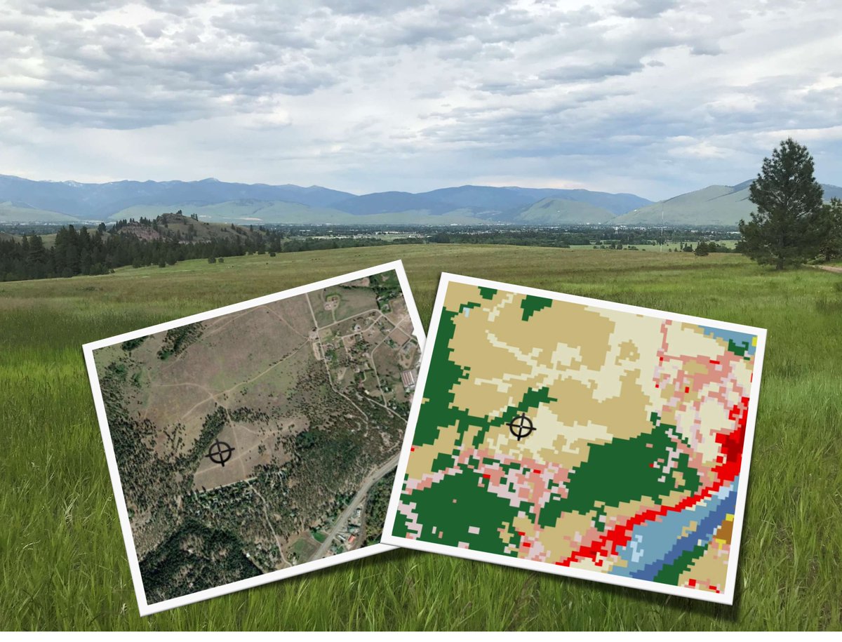
The independent variables, land cover type and proximity to roads, derived from #NLCD 2019 are used to develop a generalized prediction model to predict the relative abundance of invasive yellow sweetclover in suitable habitats across western South Dakota. https://t.co/DhaqJ41eml

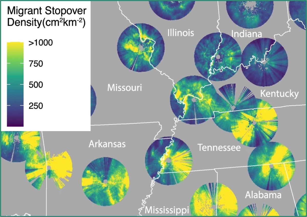
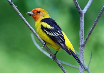
Fun Fact: Percent forest type and canopy cover were top 10 predictors of bird migration stopover density in this new study. National Land Cover Data – #NLCD 2016 and 2019 supports research into why migrating birds stop in some areas and not others. https://t.co/7j2ER7a1Wj
Last Seen Hashtags on Sotwe
ozangüven
Seen from Turkey
desi #big ass
Seen from India
Cicibabam
Seen from Turkey
omegle
Seen from Algeria
viralvídeo
Seen from Mexico
mom and son real
Seen from Turkey
HelenaBaill
Seen from France
IncestoMadreHijo
Seen from Argentina
periscopeifşa
Seen from Germany
momson filter:videos
Seen from Israel
Trends for you
Most Popular Users

Elon Musk 
@elonmusk
240.9M followers

Barack Obama
@barackobama
119.2M followers

Donald J. Trump
@realdonaldtrump
111.8M followers

Cristiano Ronaldo
@cristiano
111.4M followers

Narendra Modi
@narendramodi
107M followers

Rihanna
@rihanna
97.9M followers

NASA
@nasa
92.2M followers

Justin Bieber
@justinbieber
91.1M followers

KATY PERRY
@katyperry
88.1M followers

Taylor Swift
@taylorswift13
82M followers

Lady Gaga
@ladygaga
73.5M followers

Virat Kohli
@imvkohli
70.6M followers

Kim Kardashian
@kimkardashian
70M followers

YouTube
@youtube
68.7M followers

Bill Gates
@billgates
64.1M followers

Neymar Jr
@neymarjr
63.4M followers

The Ellen Show
@theellenshow
62.4M followers

CNN
@cnn
61.9M followers

Selena Gomez
@selenagomez
61.2M followers

X
@x
60.8M followers