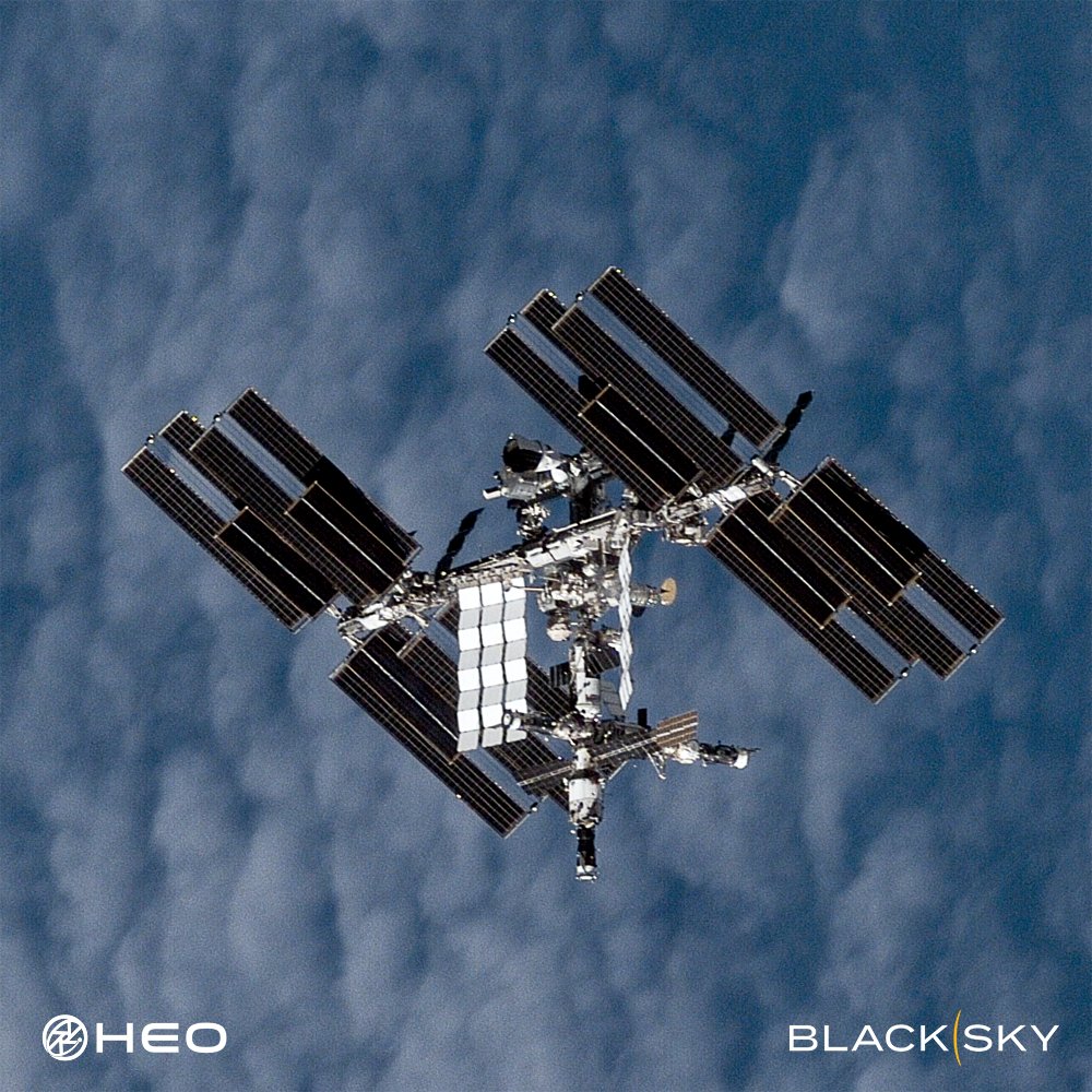
We’ve captured one of our best images of the @Space_Station yet.
The number of satellites in orbit is set to increase tenfold in the next decade. At the same time, space-to-space threats are rising and the need to inspect and maintain satellites is accelerating faster than anyone expected.
Resolution alone won't deliver what's needed. True understanding comes from observing satellites frequently, from multiple angles and orbits, so you can see how they behave, respond to their environment, and what they're capable of across time and geography.
That's why HEO focuses on high-frequency Non-Earth Imaging. Our technology is built for speed, scale, and adaptability, operating across multiple orbits with diverse satellite providers to deliver more coverage, more data, and faster insights into thousands of satellites. This approach will get us to a future where satellite inspection is truly on-demand. You tell us you want an image of your satellite and we deliver imagery and analysis when you need them.
Image of the ISS captured with our partner @BlackSky_Inc.
What happens when the satellites driving the global economy need attention?
At the Resilience Summit in Sydney yesterday, HEO's CEO Dr William Crowe joined the Above the Noise panel to discuss what the growth of the space economy demands of the industry.
He highlighted HEO's plans to use our non-Earth imaging technology to enable the emerging inspection and maintenance layer in space, operating in Low-Earth Orbit today, with Geosynchronous Orbit firmly in our sights.
This is the rideshare adapter that carried 143 satellites on Transporter-1.
On January 24, 2021, SpaceX's Falcon 9 launched 143 spacecraft to orbit on a single vehicle, setting a record that still stands today.
HEO's Continuum-1 imaged the adapter from 60km away, at 13cm/pixel resolution, over the Arctic Ocean.
Two years ago, @esa and @JAXA_en launched EarthCARE to improve our understanding of how clouds and aerosols affect our climate.
HEO collected this image from ~100 km away at a resolution of 22 cm/pixel, close enough to resolve individual structural features of EarthCARE. The solar array is visible, fully deployed and sun-facing, alongside the deployed cloud profiling radar.
Congratulations to all of the teams involved on two years of climate science in orbit.
When HEO acquired Continuum-1, we committed to using it to catalogue objects in low-Earth orbit (LEO). Part of that work means turning attention to derelict hardware.
As noted in the recent issue of the @IntegrityISR Flash, CZ-6A upper stages are a growing concern to the sustainability of LEO as they have produced some of the largest fragmentation clouds in LEO in recent years. These rocket bodies are left in orbits that will take years to decay, with no means of manoeuvre and no plan for removal.
This is one of them.
Continuum-1 imaged this CZ-6A rocket body in orbit. It is the upper stage from the October 31, 2023 launch that carried the Tianhui 5A and 5B satellites. It appears largely intact and is gravity-gradient stabilised.
Images like these establish a baseline. If the object's state changes, that deviation is observable and comparable against something real. Attribution is rarely straightforward after a fragmentation event. A prior record can make the difference between knowing something happened and knowing why.
Reference: https://t.co/gQsYA6QNFc
HEO has a #NoUFOPolicy.
Objects we image leave with an identity and characterisation, as it is critical to identify space objects to maintain space and Earth safety.
For example, this object is currently listed as Object A in public tracking databases, a designation assigned to newly launched objects pending formal cataloguing.
HEO has imaged and characterised it as the Lingxi 03 communications satellite, a designation corroborated by publicly available information on the mission.
When identities and capabilities in orbit remain obscure, whether by cataloguing lag, sparse public data, or the absence of independent characterisation, operators work with an incomplete understanding.
Unknown no longer has to be a permanent state.
*Measured in the 2D image plane. Any extension into the image plane is not captured, so this figure represents a minimum. The true length may be greater.
This is how we make space transparent.
Most space activity has never been visually observed. No image, no confirmation, no clear record of what happened or why.
Despite rapid advancements in satellite technology, the ability to see what’s up there remained largely absent.
To meet the moment, we need persistent, scalable, autonomous visual awareness of space. That's why we built HEO Inspect.
HEO Inspect is the web app and API interface to our core non-Earth imaging and insights that tasks our constellation, processes every collection automatically, and delivers finished insights.
Underpinning it is our proprietary software that runs NEI operations autonomously at scale, replacing what would otherwise require significant manual effort from specialised engineers.
Make space transparent.
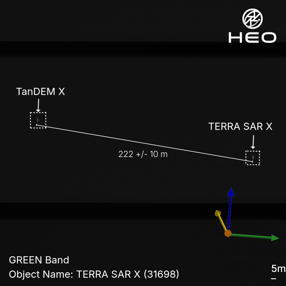
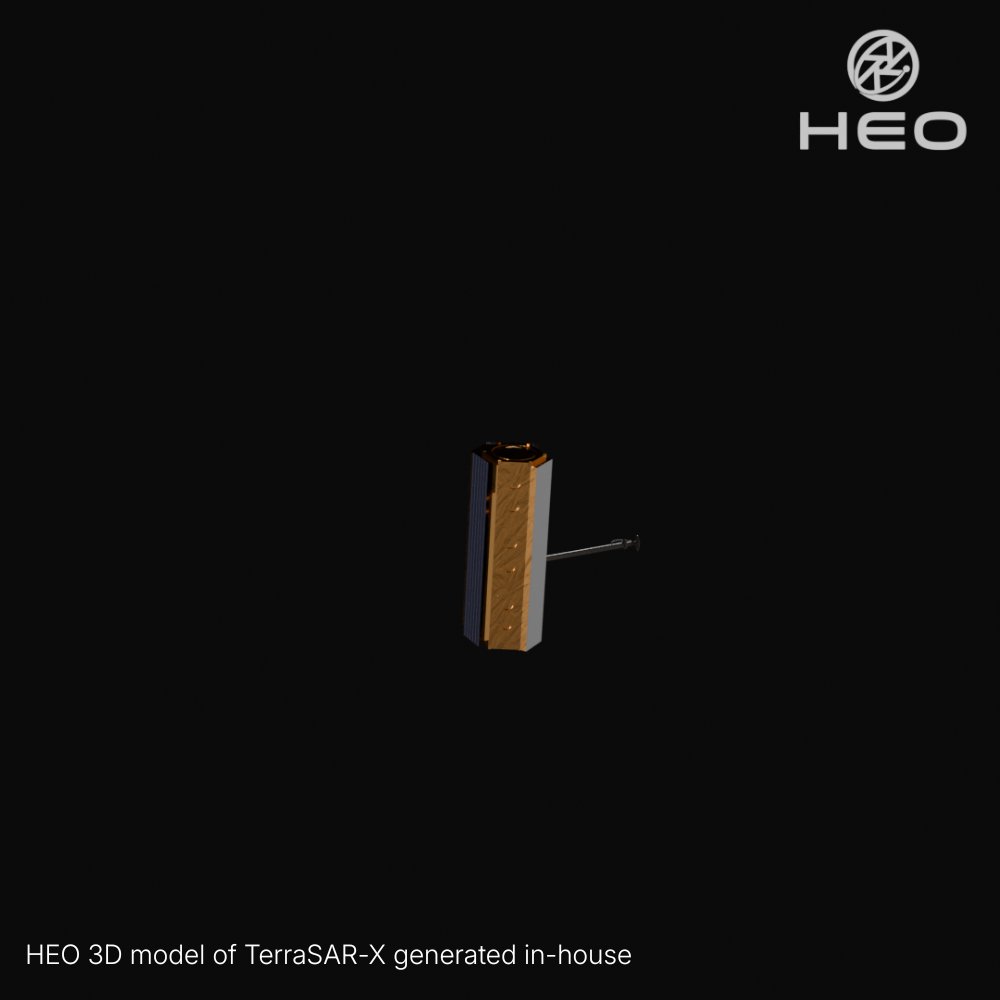
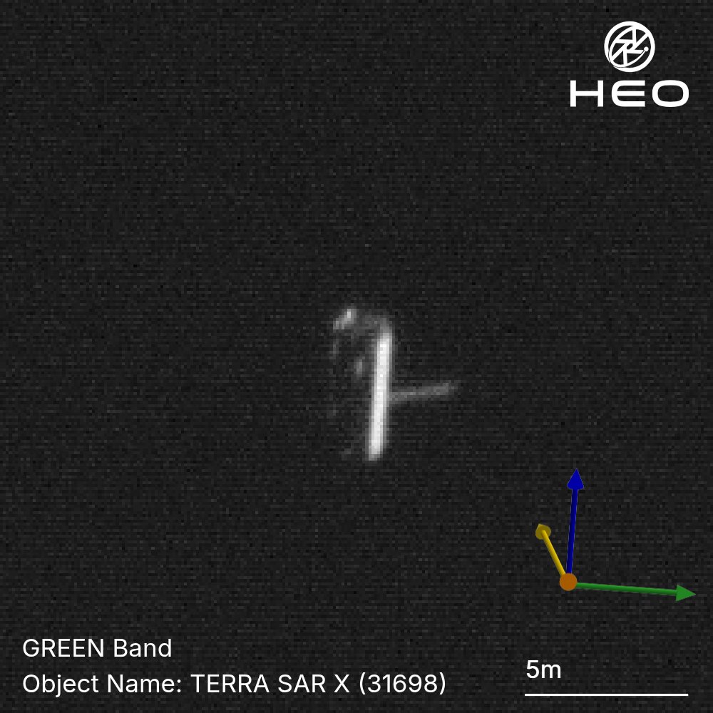
Most satellites operate alone. These two are a duet.
TerraSAR-X and TanDEM-X are among the most precisely coordinated formation-flying satellites ever operated. Launched three years apart, Germany's TerraSAR-X in 2007, TanDEM-X in 2010, they orbit in lockstep at ~508 km altitude, separated by just hundreds of metres while travelling at over 27,000 km/h.
Together, one transmits and both receive, forming a large single-pass SAR interferometer that has produced a high-precision global digital elevation model (DEM) of Earth's entire land surface.
Here, we captured both satellites in a single frame, at least 222 metres apart.
While a single image shows what a satellite looks like at a moment in time, by imaging it repeatedly, we build a deeper understanding of how it operates, how it's configured, and how it behaves in space.
*Measured in the 2D image plane. Any separation into the image plane is not captured, so this figure represents a minimum. The true distance may be greater.
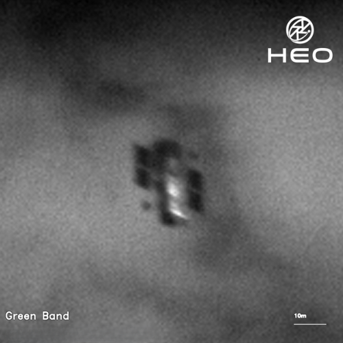
We imaged this rocket body in orbit and you can make out the logo.
Can you identify it?
Below is what our sensors captured, plus the measurements our analytics pulled from the image.
Drop your answer below and we'll share it in the comments. Bonus points if you can name the payload it brought to space.
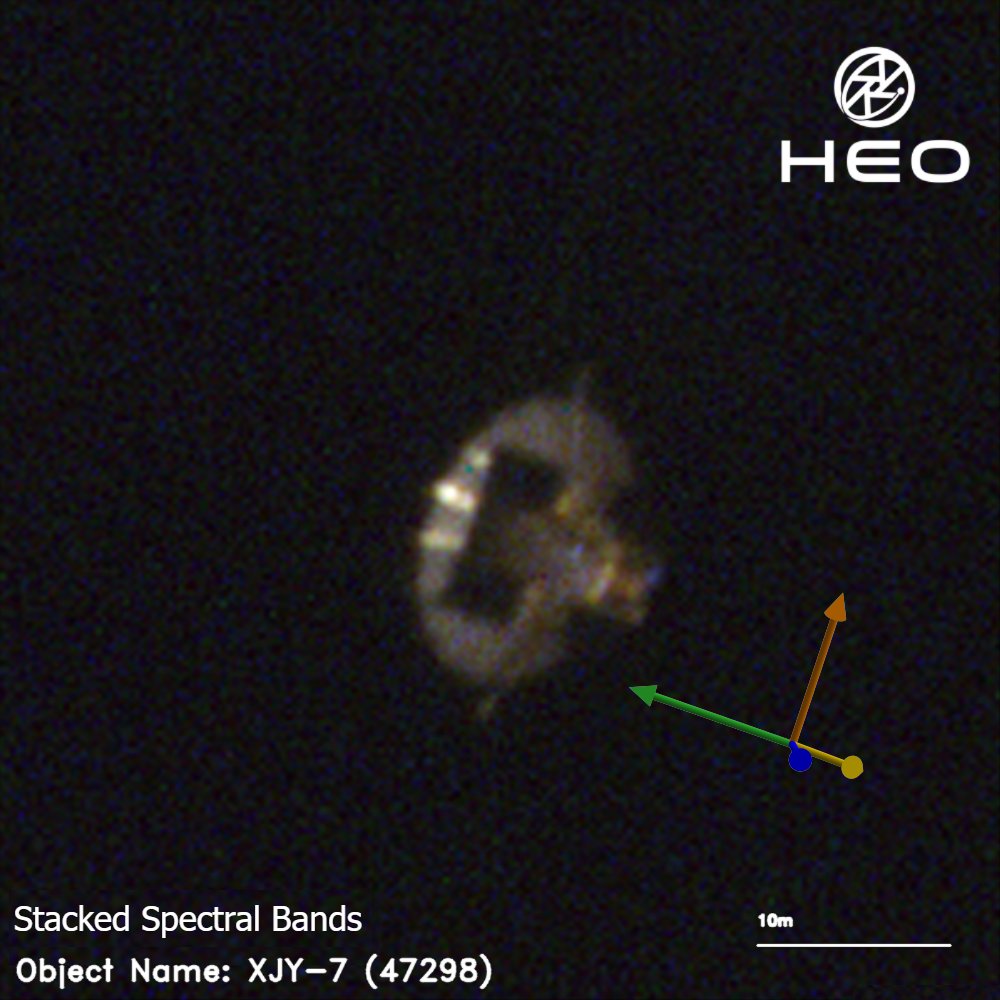
A technology verification satellite spent 5 years in orbit and most relied on a single render to guess its capabilities.
HEO analysed XJY-7 with high-frequency Non-Earth Imaging, building a 3D model from multiple angles and orbits. We verified it as a SAR satellite with a large dish antenna and two fixed solar panels that required full-body rotation to charge.