.@Rice_Eccles was earth shaking last night. Literally.
Our scientists with @UUSSquake measured the seismic impact of @Utah_Football and our legendary fans during the home opener. #GoUtes
📰 https://t.co/MaG2O4TfTp
“The disturbing silence left by the missing and the mourned souls tells of a disaster that's unnatural, shaped by the human hand—a byproduct of the dangerous dance between climate change and centuries of colonial greed.” https://t.co/psATa1d6j7
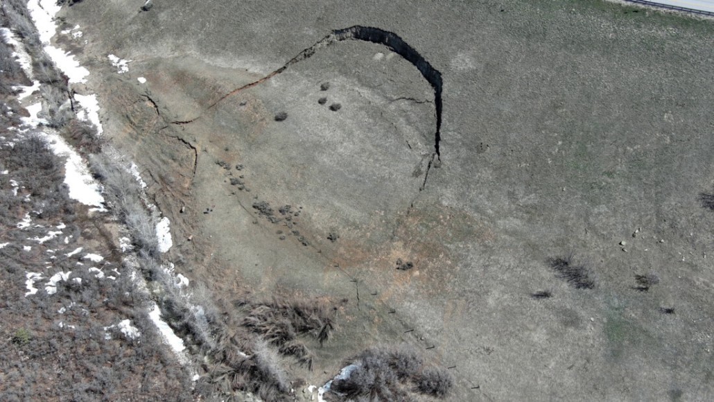
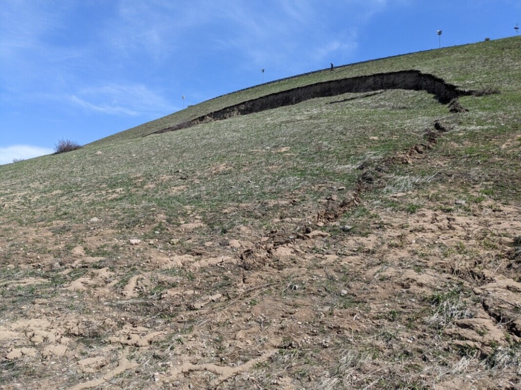
The UGS Geologic Hazards Program conducted a reconnaissance to evaluate two landslides along and near Trappers Loop Bend (SR-167) in Morgan County on May 3rd. There is one large landslide and a secondary landslide. Details of these landslides here–https://t.co/BnusVmztvJ
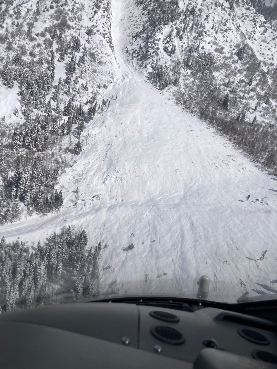
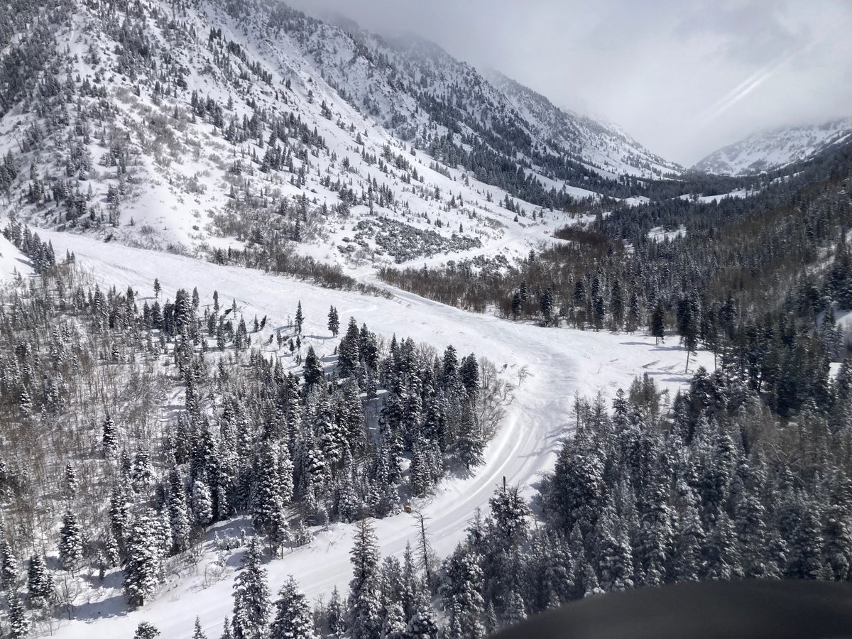
📸 Here’s an aerial view of Little Cottonwood Canyon showing some of the recent avalanche activity and the debris buildup along #SR210.
Photos from this morning show some massive slides in the White Pine area.
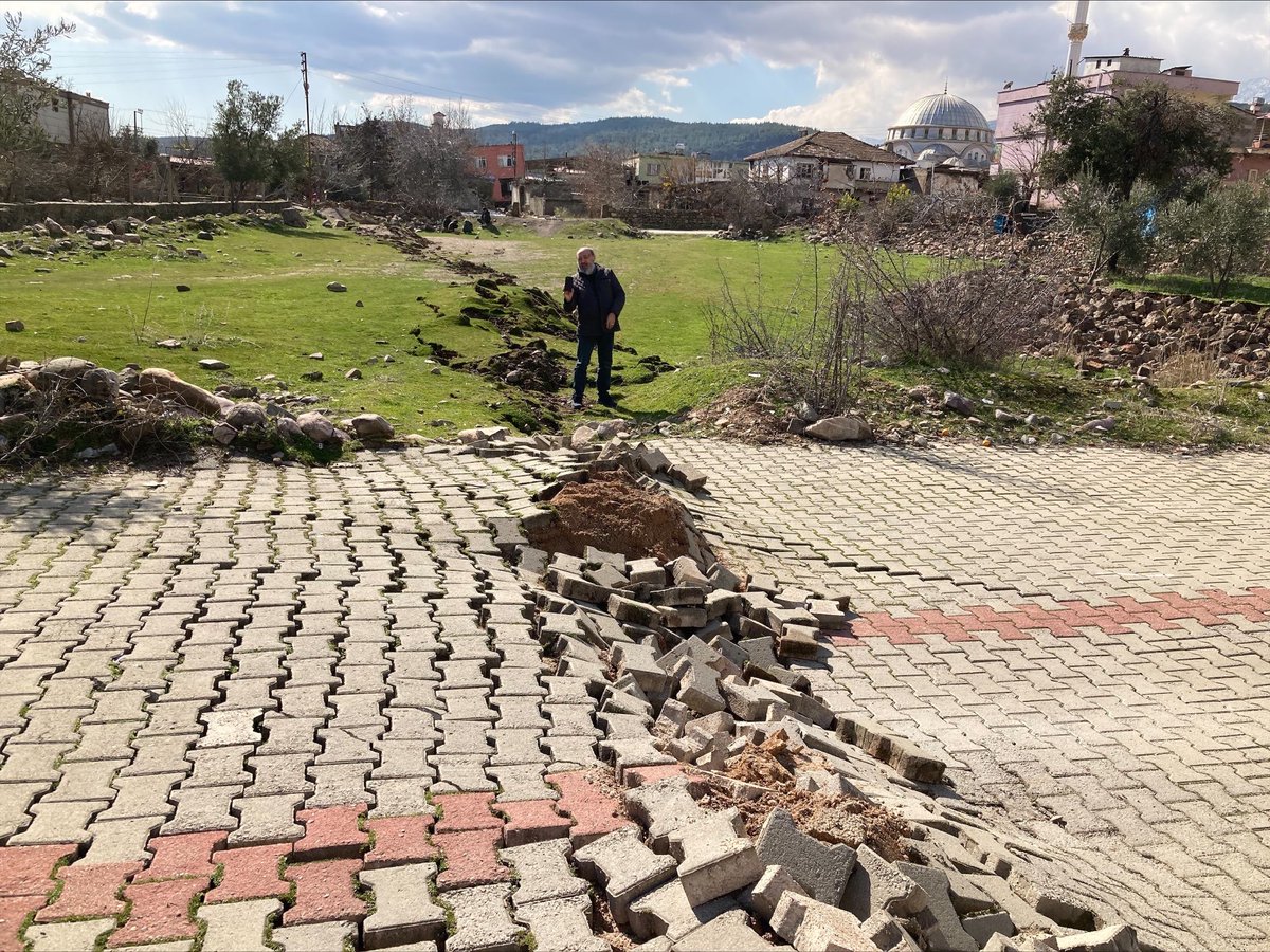
NEW: The cataclysmic quakes in Turkey remind us that, despite all our scientific advances, geologic forces operate beyond our control. They can, and will, wash us aside effortlessly, like sand grains at the mercy of eternal waves.
Me, for @TheAtlantic: https://t.co/UQyxwarVQR
My conversation with Cecilia Lei on the SF Chronicle's 5th & Mission podcast covers the striking tectonic similarities btwn Turkey's quake(s) & what we expect here in CA, w/extra context about what that means for those of us living here. Audio here: https://t.co/u1Bv3RO0G8
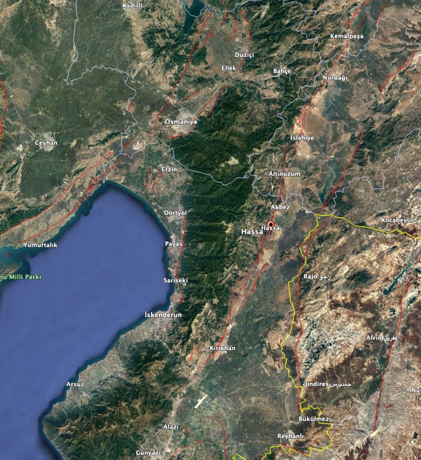
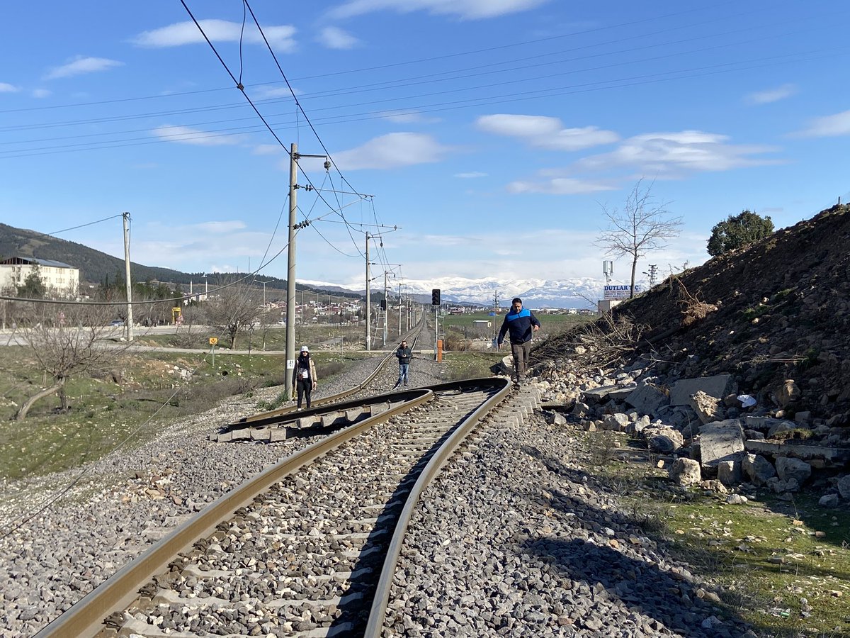
Prelim. observations of fault rupture in Turkey EQ sequence using satellite images & radar data. This provides a first estimate of surface rupture length– over 300 km (~185 mi) from both EQs. We expect to see more of the rupture as data become available @USGS_HDDS@DisastersChart
clearly visible fault rupture from the #Turkey#earthquake#deprem near #Nurdagi
Should be about 3-4m of horizontal displacement
image from google-earth and maxar
UGS Hazards Program is hiring! We’re looking for a Landslide Hazards Geologist. Great place to work, great coworkers (myself included 😎), and great opportunities for field work. Check it out 👉 https://t.co/BZJOIKL8u3
New paper alert 🚨🚨🚨
https://t.co/oRAgVEtrs2
@faultcreeper and I present our work on 3D trenching using iOS Lidar and Structure from Motion Photogrammetry in a study of the Dog Valley fault in Northern California. Published in @WeAreSeismica