The municipality has created a map showing areas affected by the storm. This is a live map that will be updated periodically as incidents of damage or flooding are reported. Once incidents are resolved they will be removed from the map: https://t.co/9mg1k32Mq7
Some of the totals through 8:20 pm ADT #NSStorm:
251 mm (Brookline Park, W. Bedford);
224 mm (Bedford);
206 mm (Waterberry Park, W. Bedford)
205 mm (Lewis Lake, W. Bedford);
185 mm (Stillwater Lake);
179 mm (Shore Dr, Bedford);
178 mm (Lwr. Sackville);
172 mm (Windsor Junct.)
AI-generated QR codes using ControlNet are insane.
This is going to be increasingly common in ads in the near future.
These examples blew my mind (try scanning them):
1. Ancient Village
For older generations, maps are more than just pieces of paper — they're symbols of where we've been and where we might go. But as GPS and cell phones take over, is map-reading becoming a lost skill? https://t.co/veOq6f7ZXi
Here’s a map showing areas affected by the #Halifax#wildfires. For the latest updates, pls follow @hfxgov or bookmark this page: https://t.co/UV9CnsOhxV
Thanks to all first responders & to our colleagues supporting damage assessment efforts. Stay safe!
Tantallon: crews are continuing to extinguish fire, no major change in conditions. All crews working very hard as they have all week. My read on things is it sounds like today has been a challenging day but all things considered a decent day so far.
We have a report of a new fire in the Sandy Lake West area of Hammonds Plains. Air and ground support are being rerouted to the area. This is all the information we have at this time, we will continue to provide updates as they become available.
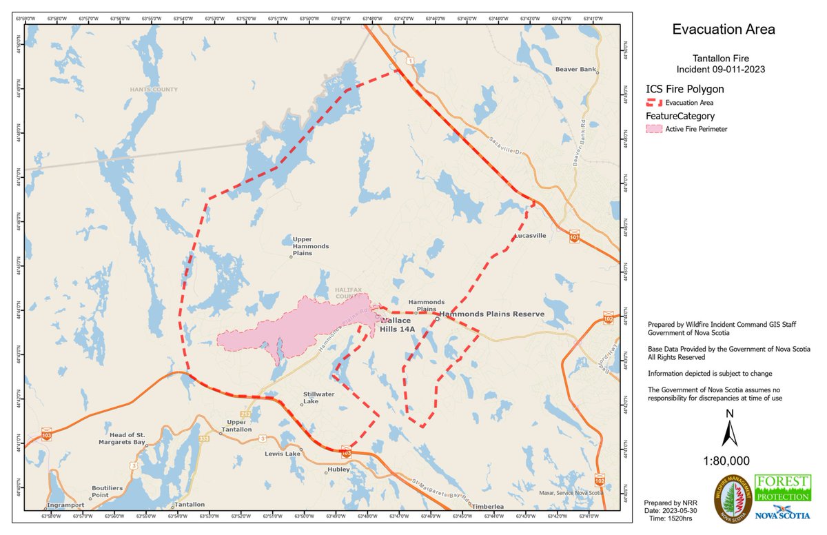
Here is the latest map (accurate at 3:20 p.m. on May 30) of the wildfire in the Tantallon area. The active fire area is shaded in pink, and the evacuation perimeter is the dotted red line.