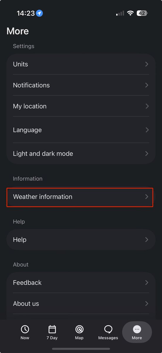
Thunderstorm outlooks are now available ⛈️☺️
You can find a link to them on your city forecast page, or visit https://t.co/Yj9vvqyNJ7 for the Atlantic Canada outlooks.
Theyre also on the app in More tab, under “weather information”.
#NSStorm#NLwx#NBStorm#PEstorm
The snow is certainly flying over parts of St. John’s as this @NTVNewsNL live camera over Admiral’s Green shows very well.
Still the potential for accumulating snowfall, primarily over higher terrain, throughout the remainder of the day! #NLwx
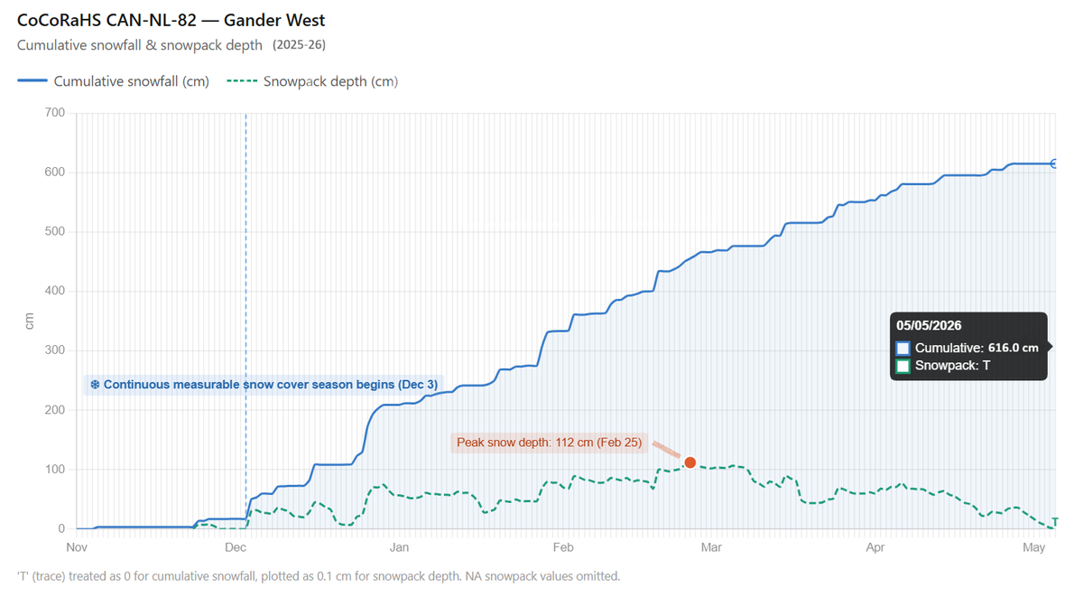
#GanderWest snow coverage now too low for depth to be measurable, thus marked as trace, ending 153-day run of measurable snow-on-ground (Dec 3–May 4).
Area's longest run since 2016–17 (168 days, Nov 28–May 14). Stark contrast w/ 2024–25’s max run (48 days, Jan 25–Mar 13). #nlwx
Would love some more snowfall observations from areas seeing the storm today! From GFW to the Avalon, including the metro area. It would be greatly appreciated! #NLwx
@TheNLWX Not sure where you’re getting the idea that rain is at all possible from this system. If, and that’s a big if, it comes close enough to the Avalon, it would be all snow… 🙃
Despite the look on radar that snow is moving in quick, there seems to be a considerable amount of virga ahead of this system.
Webcams over the southern Burin & Avalon show that although radar suggests snow has begun, it has yet to begin. It should very soon, however. #nlwx
Virga is the scientific term that describes precipitation falling from a cloud that evaporates before making it to the surface. The air between the cloud and the surface is too dry, causing the snow to evaporate.
That should change soon and snow will begin. It’s still coming!
@TheNLWX Not a malfunction. Crews had to do work on a tower nearby and due to safety reasons the radar gets blanked out in the sections that could pose a safety risk to those crews.
Should be back to full images later this afternoon or early evening.
@Newfie15243@EddieSheerr You’re welcome! We have a good amount of people that use #NLwx and I would hate to see people stop using it because of this decision.
If only the warning said something along the lines of “High-sided vehicles will be overturned by the wind.” *sigh* 🙃
Peak gust of 134 km/h in the Wreckhouse area as of 10:30 P.M. NST. #NLwx
⚠️ UPDATE (November 16, 2025, 10 :20 p.m.) : Channel-Port aux Basques RCMP advises that due to an additional incident and extremely high winds, both lanes of the TCH in the Wreckhouse area between Red Rocks and St. Andrew’s are now closed to traffic.
Police request that motorists throughout the Wreckhouse area drive with caution this evening as extremely high winds are creating dangerous conditions.