Drone Derived Data. Capturing life on the ground with drones in the air.
Experiments in Drone Remote Sensing, Analytics, and Open Sourcing from ex-Googlers
Beautiful, clear Sentinel-2 imagery of NE Kansas today, crossing at the same time as the Chinese balloon on @sentinel_hub -> https://t.co/o0XsKB9mTu My Toxic Trait is thinking I'll be able to spot it in the imagery... If it's as large as they say it is, it could be ~3 pixels!
Introducing the newest generation of our stratospheric Earth imaging robots, the Swifty 3. They take longer flights, capture wider-coverage, & are more nimble - allowing us to offer an even better & more customizable geospatial imaging solution.
https://t.co/Hywuc9F5VO @axios
The amount Elon Musk just paid for Twitter ($44 billion) is nearly equal to Biden’s proposed climate budget ($44.9 billion), in case anyone's wondering how seriously we’re taking the climate crisis
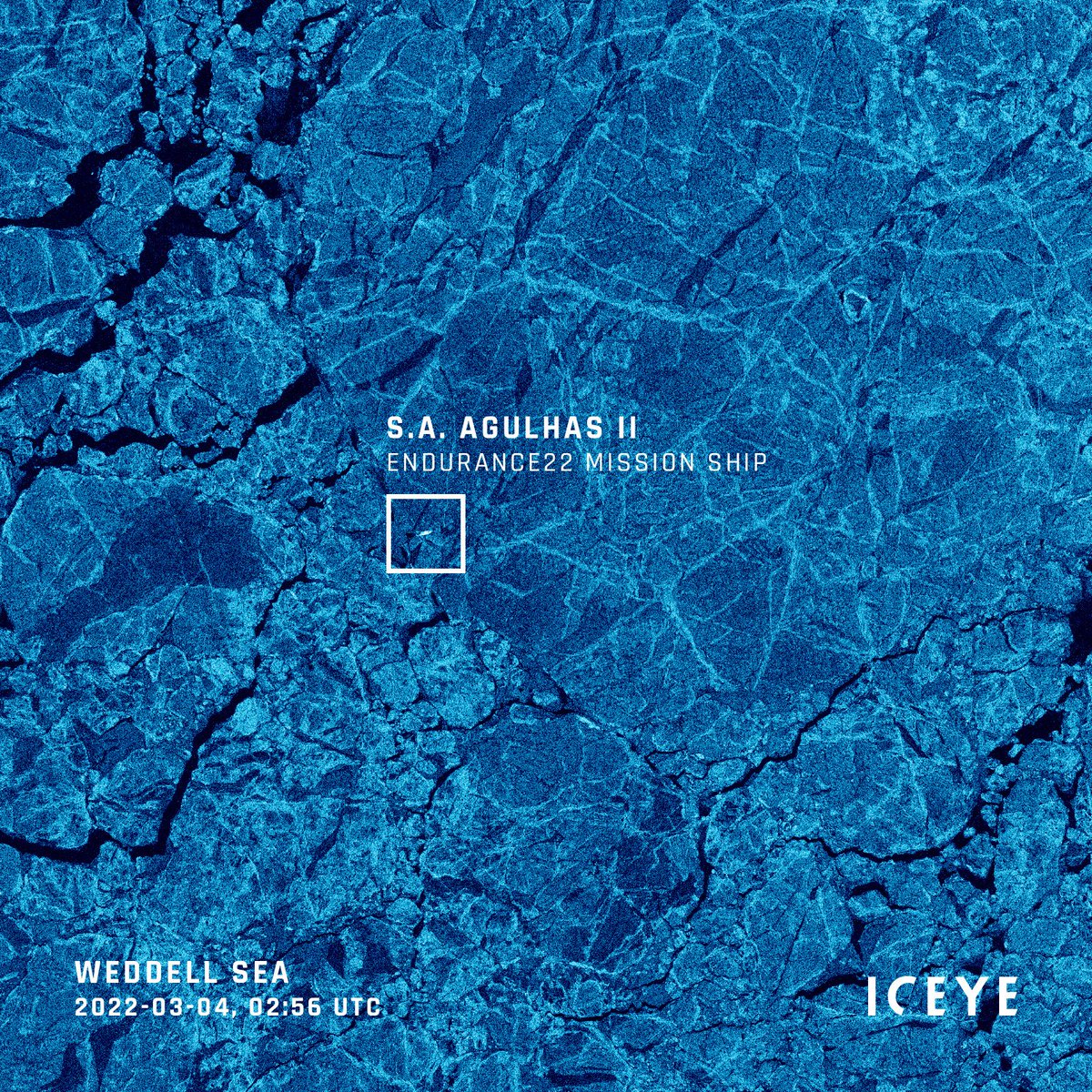
With only 1 cloud-free day in 3 weeks, #SAR data was crucial for the @Endurance_22 work. It helped avoid heavy ice even when it was dark & snowing, serving as a map for navigation.
Here is one of the SAR images the mission used to navigate the difficult sea and ice conditions.
The #HungaTongaHungaHaapai#volcano violently erupted on Jan 15, sending a huge ash plume into the atmosphere and tsunami waves across the Pacific.
This infrared imagery from #GOESWest shows both the volcanic ash cloud and the gravity waves produced by the massive #eruption.
@iazuleta Have you used the dehaze process in Lightroom? Also curious if you’ve used the “enhance” ML upsampling yet? Would be cool to see what addition features resolve in the planes!
@momofnorank Thank you. Those who know, know. This assessment rises to a higher level of consciousness on a subject that’s been hard to conjure words for. A weight has been lifted - finally the horror of these evil corns can be clearly understood with language - Bravo! 🎤⤵️