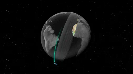
Google DeepMind just released one of the most important tools in geospatial data science.
It’s called AlphaEarth Foundations.
I want to break it down for you in intuitive terms:
Introducing soarXiv ✈️, the most beautiful way to explore human knowledge
Take any paper's URL and replace arxiv with soarxiv (show in video) to teleport to its place in the universe
I've embedded all 2.8M papers up until April 2025
Try it at: soarxiv dot org
🚀 GeoAI Tutorial 12: Wetland Mapping with Deep Learning and GeoAI! 🌍
Unlock the power of your geospatial data! Learn to train an wetland detection model and run inference on large datasets—all with just a few lines of code.
🎥 Watch the full tutorial here: https://t.co/p9BgNoJ5i3
📓 Explore the notebook: https://t.co/4vgir8vjDM
🛠️ Check out the GitHub repository: https://t.co/TBxio7GvtY
📚 Dive into the documentation: https://t.co/6zl0MjNf70
📺 Check out the entire YouTube playlist: https://t.co/KVHZDtgawR
#GeoAI #geospatial #AI #Python #DeepLearning
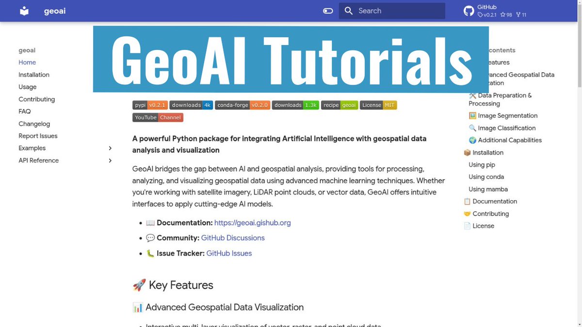
🚀 Exciting news! I'm launching a new #GeoAI tutorial series where I'll guide you through using the powerful GeoAI Python package for integrating AI with geospatial data analysis and visualization. 🌍✨
🔗 Check out the first tutorial here: https://t.co/cgrOnAv6CR
🛠️ Explore the GitHub: https://t.co/TBxio7H3jw
📚 Dive into the Docs: https://t.co/6zl0MjNMWy
🎥 YouTube Playlist: https://t.co/KVHZDtgImp
Stay tuned for more updates!
#geospatial #AI
halo @NTMCLantasPolri@dishubjakarta Jalan Garnisun Dalam dari arah Gatsu ke MRCCC Siloam apakah masih berlaku satu arah sehingga tidak bisa masuk dari gatsu? thx
Its plan is based on the "mandala", a form of highly symbolic, geometric design sacred in Buddhism and Hinduism.
There is no single layout or purpose to the mandala, but in the case of Borobudur it is seemingly based on mandalas that represent Buddhist cosmology.
Borobudur also references Mount Meru, the holy mountain at the centre of all universes.
Many Buddhist, Hindu, and Jain temples were similarly designed to imitate the form of a mountain.
The scale of Borobudur, however — each side is 120 metres long — is simply colossal.
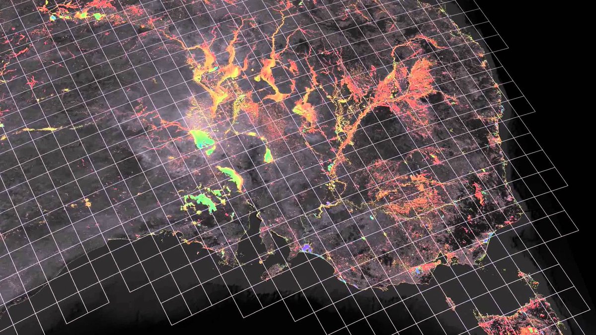
Heavy rain over Java Island in Indonesia caused flood and affected nearly 40,000 local people. On 20 March, Indonesia's National Research and Innovation Agency (BRIN) requested @Sentinel_Asia satellite observation.
https://t.co/GPeN0EbJe4
#indonesia#Flood
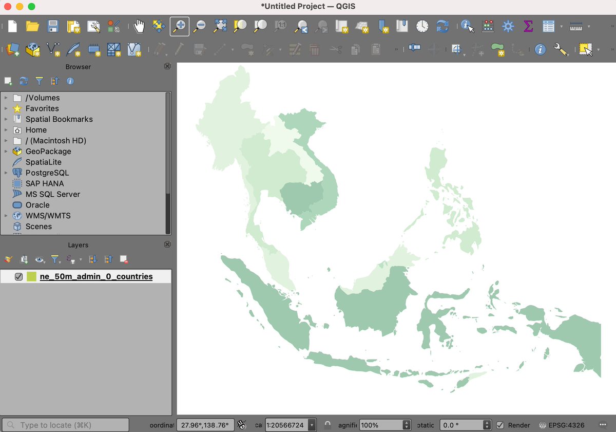
New #QGIS Tutorial: Basic Filtering and Styling with Expressions contributed by @newgeographer2. Glad to have Steve share his cartography tricks in this simple walkthrough that explores QGIS expressions for filtering data and creating a beautiful map. https://t.co/E1MszuekWM
@goraici Tapi Negara kita sudah mulai bergerak banyak program sektor WATSAN di level pemkot/pemkab untuk mencapai akses 100-0-100 kok, spesifik untuk sanitasi memang challenging karena terkait perubahan perilaku penduduk juga jadi ada tahapan edukasi dan pembiasaan tdk cuma infrastruktur
@noviechiuman@goraici Menarik ada yang angkat issue ini. Agak ironi memang namanya “PDAM” kalo sesuai nama harusnya air siap minum tapi sayangnya masih sebatas “air bersih” belum lagi mencapai kontinyuitas 24/7, kualitas, kuantitas dan keterjangkauan.