@PJNewWest Incredible things are happening behind the scenes. Lots of challenges ahead but the City stands united with you and New West council. Thanks for keeping us updated Mayor Johnstone! 👏
Encouraged to see how GIS is being introduced in high school! Grateful for inspiring educators like @eden_geo. Happy Friday 🥳!
On the Map with Andrew White https://t.co/t2HvP03V6j
#FMEAcademy Is there a badge for spotting bugs along a trail? 😏
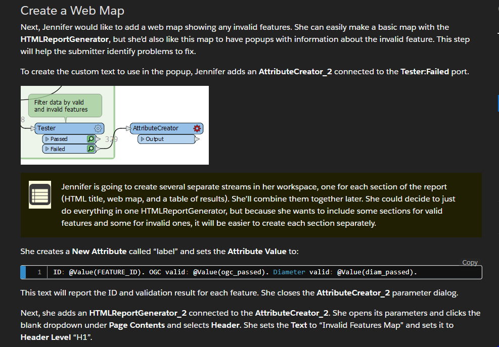
In the Digital Plan Submission module - Build a Validation Report Unit, under Create a web map, the text AttributeCreator_2 should be AttributeCreator, referencing the illustration below.
@SafeSoftware
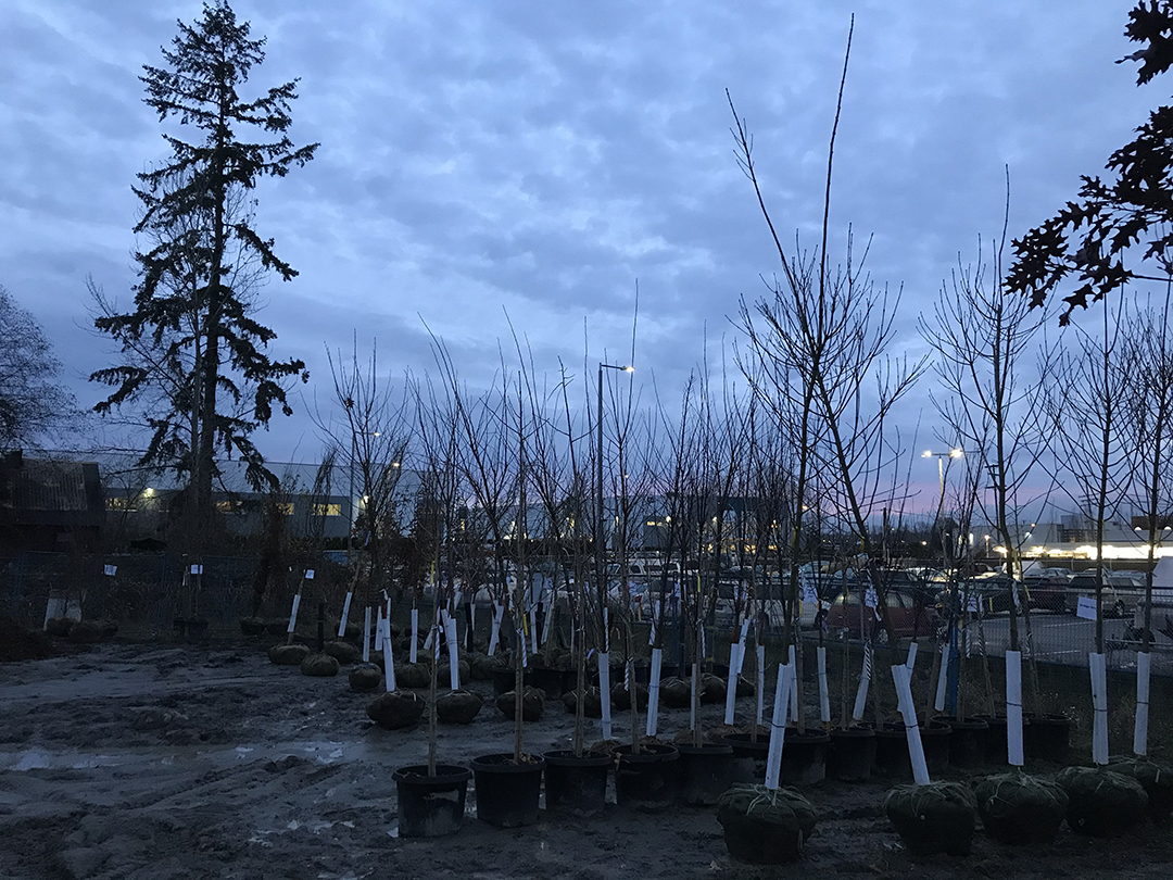
DYK we have a 10 year plan to plant 600 new street trees/year? Help our growing urban forest thrive by signing up to become a tree steward and commit to watering and weeding a new tree near you! Learn more and adopt a tree at https://t.co/5ERe37uYT7 #newwest
Inspired by some great examples of using Slideshow - navigating between maps to show dams by volume, reservoir size, hydroelectric power, and height. Brilliant! 💡
Also learned a lot about dams around the world. Thank you! #StoryMaps
📖 New resource!
Learn about the world's largest dams—by size, the water they contain + hydroelectric power they produce.
Then dig deeper into the impacts of #dams globally on local communities, wildlife & the environment. https://t.co/pEbPM6LEfL
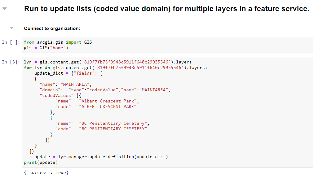
My first time using #ArcGIS Notebooks to manage @ArcGISOnline data. Here's a snippet of my code to update domains for multiple layers in a feature service. This will save me a lot of time from now on! Very happy with the results!😍
We're currently planting new boulevard trees in the Queensborough, Brow of the Hill and Sapperton neighbourhoods. You may see our contractor, Bartlett Tree Experts, planting in your area. Track tree planting locations on our interactive map!
https://t.co/ANtP9y3rRK #newwest
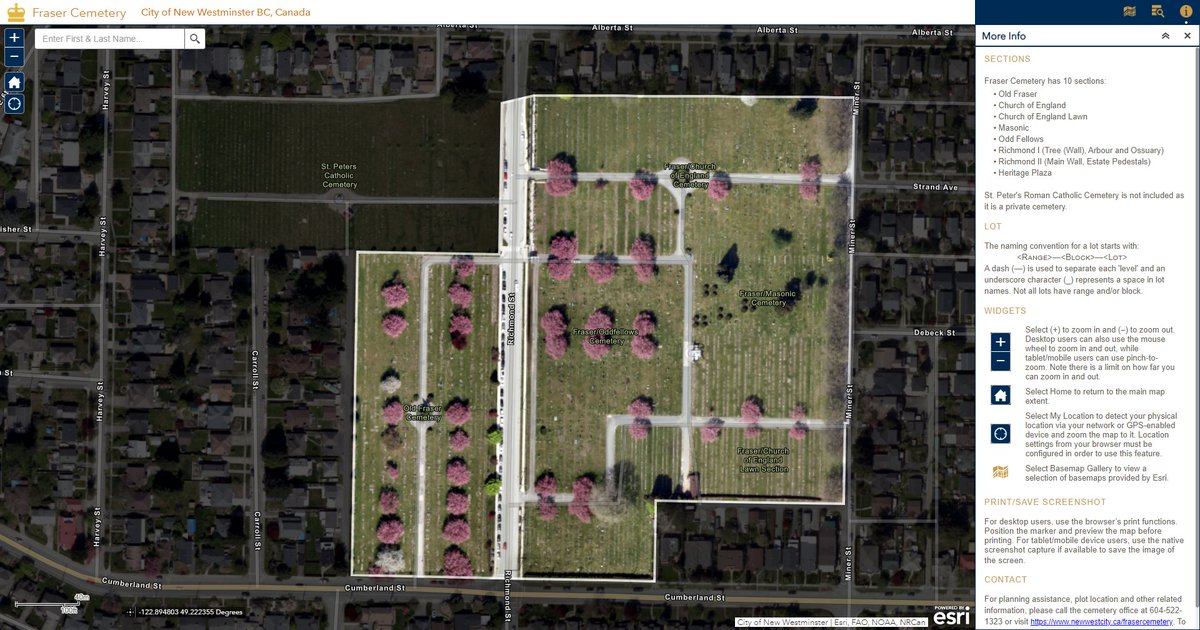
Added new basemap and semi-transparent dark overlay to a web map! Love the cherry blossoms and focus on the AOI. Would be nice if @ArcGISOnline supports multilayer symbols for a clean faded overlay effect too! 🙏
#Mapping#Cartography#ArcGIS
I had fun learning how to create #ArcGISDashboards. My first ever dashboard actually didn't show any maps, instead it became a useful reporting tool for keeping track of tasks. Sharing my example https://t.co/JYb12w3sX6 ❤️Dashboards!
@GIS_Bandit