#EOS_SAT-1 captured its first images!
Equipped with cutting-edge optical imaging #payloads, the #satellite captured the beauty of Cape Town in 11 spectral bands with a spatial resolution of 1.5m with a swath of 44 km – an unprecedented spatial, spectral, and swath combination.
Calling all #AI4EO nerds! As part of our road monitoring project, we would like to support anyone interested in applying for an @NRF_News Postdoctoral Fellowship for 2024. The deadline is this Friday 19 May, so please urgently contact me at [email protected] if you're interested!
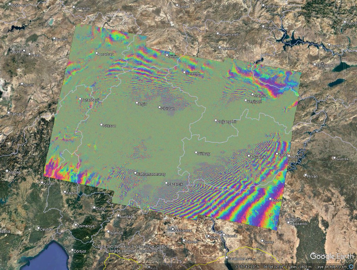
Very happy to announce that our team at the Dept of Geography & Environmental Studies at @StellenboschUni has been awarded a #NEOFrontiers grant to develop AI tools for mapping and monitoring South Africa's roads. With @UPTuks, @CSIR, @DBSA_Bank and @geosmartspace 🛰️🛣️
Very happy to announce that our team at the Dept of Geography & Environmental Studies at @StellenboschUni has been awarded a #NEOFrontiers grant to develop AI tools for mapping and monitoring South Africa's roads. With @UPTuks, @CSIR, @DBSA_Bank and @geosmartspace 🛰️🛣️
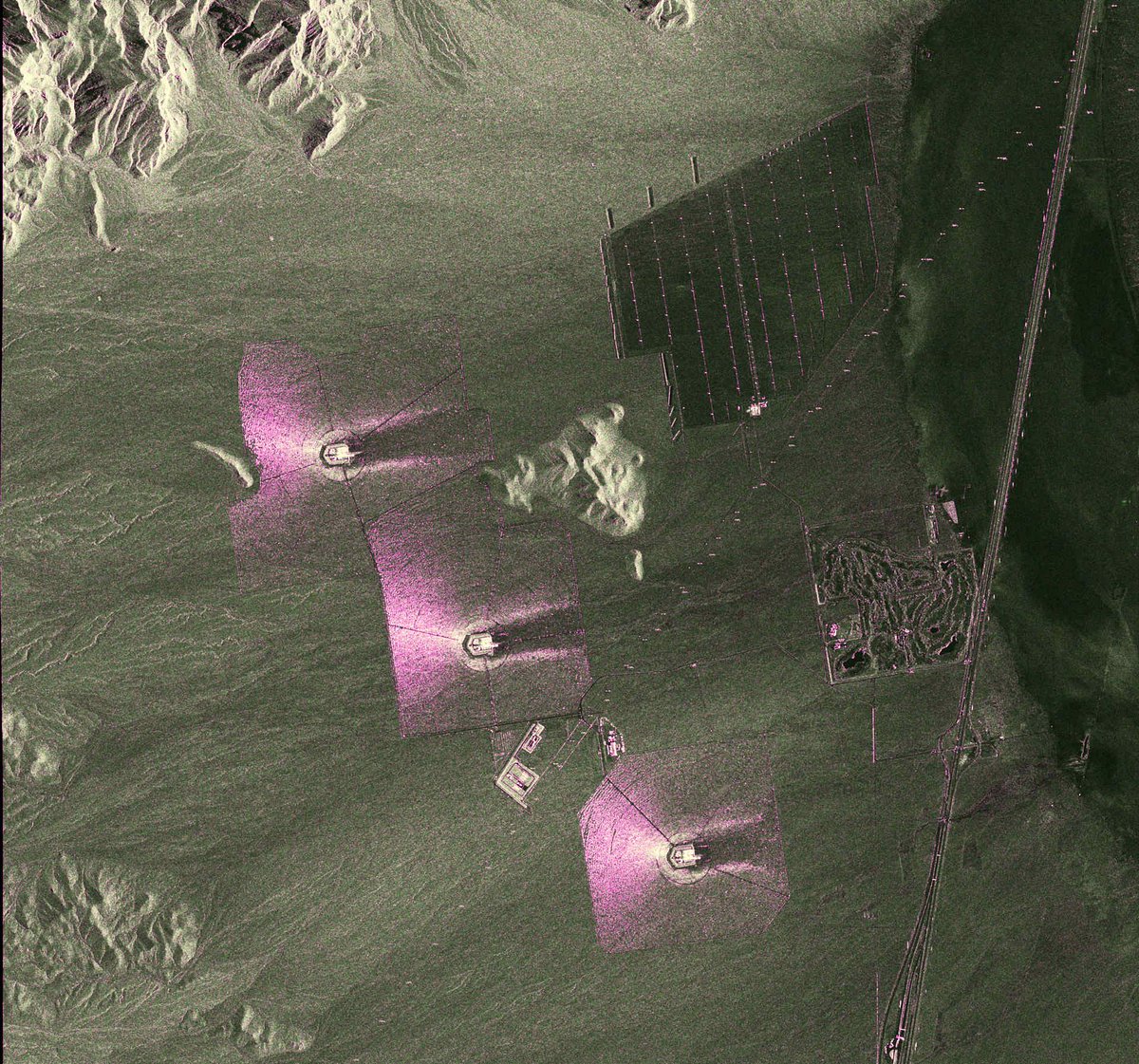
☀️ Sonniger Blick auf die Erde! Die Satelliten #TerraSAR-X & #TanDEM-X schicken uns neue Foto-Highlights aus dem All. 🛰️ Im Fokus: Solarthermische #Kraftwerke. Links: Khi Solar One Power Station, Südafrika. 🇿🇦 Rechts: Ivanpah in den USA . 🇺🇸 Hintergründe: https://t.co/huuUNzLFjV
Hello world! I look forward to engaging with you all in the wonderful world of geospatial sciences, earth observation, SAR, data science & machine learning and other exciting things 🙂 #earthobservation#SAR#geospatial#machinelearning