New sticker commemorating 30 years of clippin', zippin', & shippin'! Check out what we were up to in 1992: https://t.co/xjzcsfgrr1 Thank you @TownMeetingTV for making this incredible archive available.
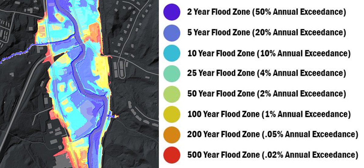
💧💧New Data Release💧💧 We're excited to announce that new lidar derived floodplain data are now available thanks to some amazing work by our partners @uvmvermont#OpenData
https://t.co/nlPiehhfIC
After much anticipation, @USGS Landsat 9 products are now available! Download data via EarthExplorer, M2M, and LandsatLook.
🕫 Read the full tech release at https://t.co/cfrlgQ1zmq
Landsat is a joint mission of the @USGS and @NASA_Landsat [🧵1/4]
How far we've come! A look back at the 2021 GIS work of state agencies and partners in Vermont: https://t.co/Tv7HhpLz0s Thank you for all that you do. #gis#Vermont
How do you use lidar derived elevation data to create better flood maps? We asked Rebecca Diehl of @UVMGeog@GundInstitute and Kristin Underwood @UVM_CEE https://t.co/6fkcUeQtg0
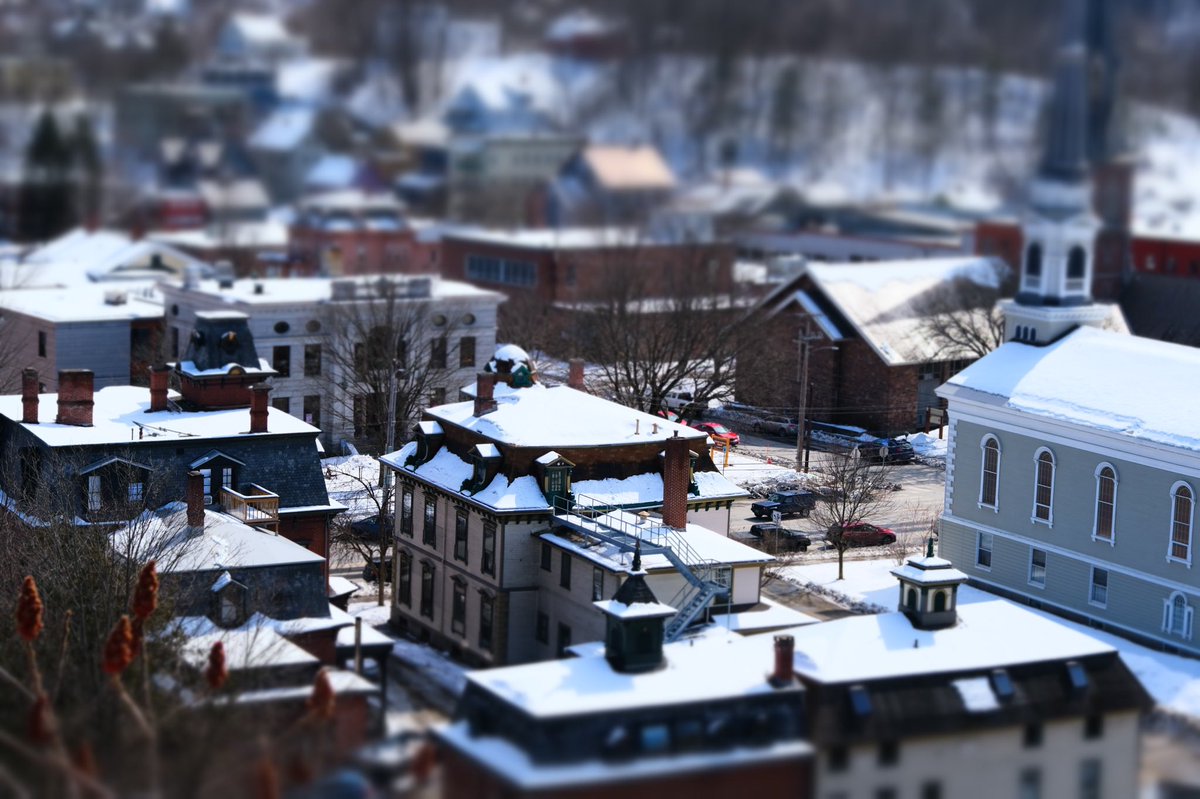
@en_dash I believe all the proceeds @SenatorLeahy received from Batman movies went to the library in this photo. (Here’s a tilt-shifted shot from same vantage point on Cliff street in Montp.)


![USGSLandsat's tweet photo. After much anticipation, @USGS Landsat 9 products are now available! Download data via EarthExplorer, M2M, and LandsatLook.
🕫 Read the full tech release at https://t.co/cfrlgQ1zmq
Landsat is a joint mission of the @USGS and @NASA_Landsat [🧵1/4] https://t.co/fiJA7De4b4](https://pbs.twimg.com/media/FLQG-b_WYAkoU_-.jpg)