Emmy winning meteorologist @wafb from Long Island, NY. Met degree from Penn State. AMS/NWA seals. Happily married and proud father. Worked in SATX, HOU.
No...this isn't somewhere up north! This is Lafayette, Louisiana, getting near blizzard conditions as they are under a Blizzard Warning! Baton Rouge NOT under that warning, but still a Winter Storm Warning. 4-8 inches expected. https://t.co/At5R7ie6se
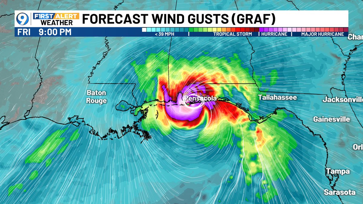
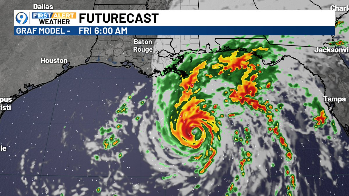
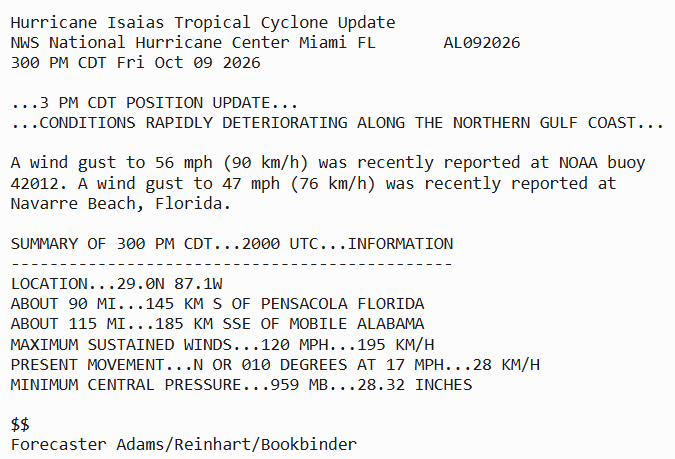
830 PM CDT Friday Oct 9 Update: Isaias makes landfall near Destin, Florida with maximum winds near 105 mph. Follow the latest on #Isaias at https://t.co/GrztW6nozt
The wrath of category 3 major Hurricane Isaias has arrived in Fort Walton Beach to Destin, Florida with winds gusting over 80 mph. Ears popping with wind surges
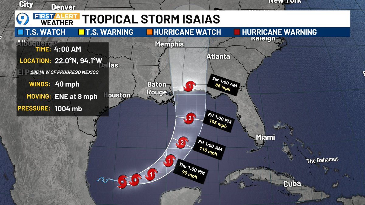
BREAKING...HURRICANE ISAIAS NEARING CATEGORY 3! As of 4AM, max sustained winds are at 110 mph. Cat 3 starts at 111 mph, so just one more mph and we'll have a major hurricane. Still looks like landfall will be Friday night near the Florida/Alabama line.
WE JUST MISSED A 121-YEAR RECORD BY MINUTES! The latest-arriving first hurricane in recorded Atlantic history occurred on this day, October 8th, 1905. Isaias became a hurricane last night at 11:30PM...if it was upgraded 30 minutes later, we would have tied that long record!
1030 pm CDT -- Air Force Reserve Hurricane Hunter Aircraft indicate that Isaias has become a hurricane with maximum sustained winds of 75 mph. The minimum central pressure is down to 982 mb.
Tropical Cyclone Update: https://t.co/TwSzBidP7e
@LittleKondor I'm fully aware of Mississippi as it's a part of my viewing area. What I'm doing....is telling people that the outer boundaries are from New Orleans, which isn't in Mississippi, and Gulf Shores, which also isn't in Mississippi...There, I just said it three times. Is that better?
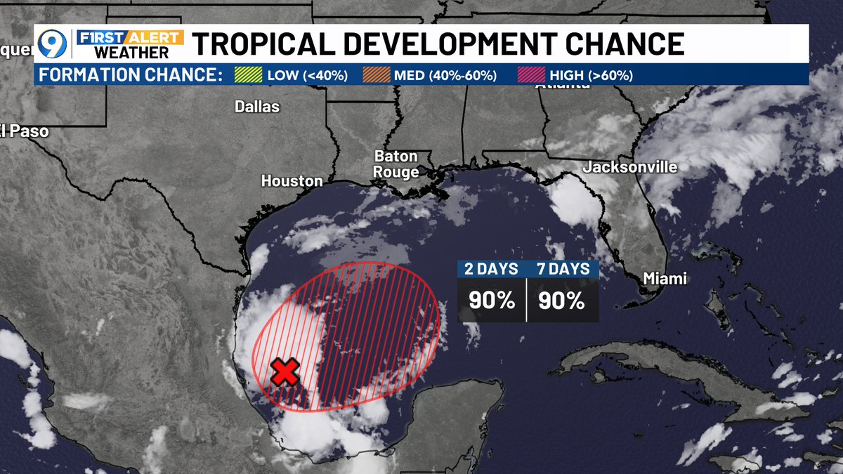
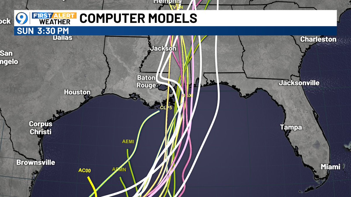
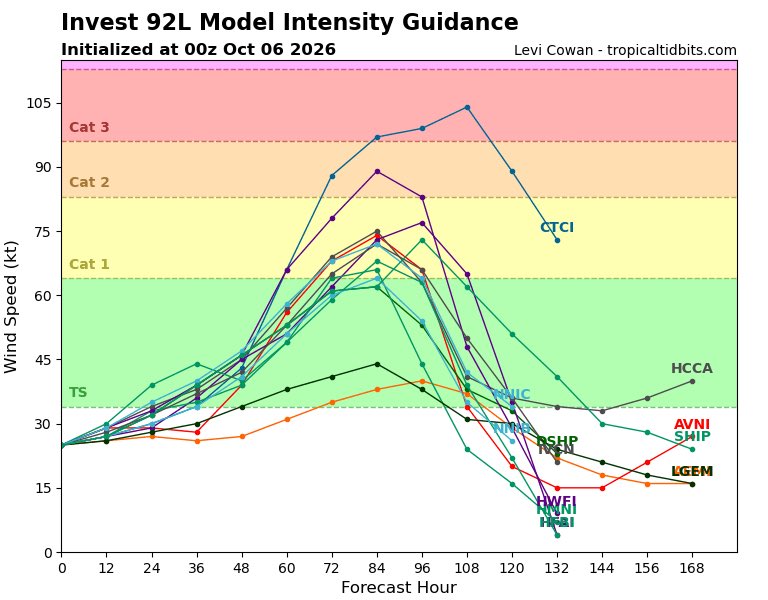
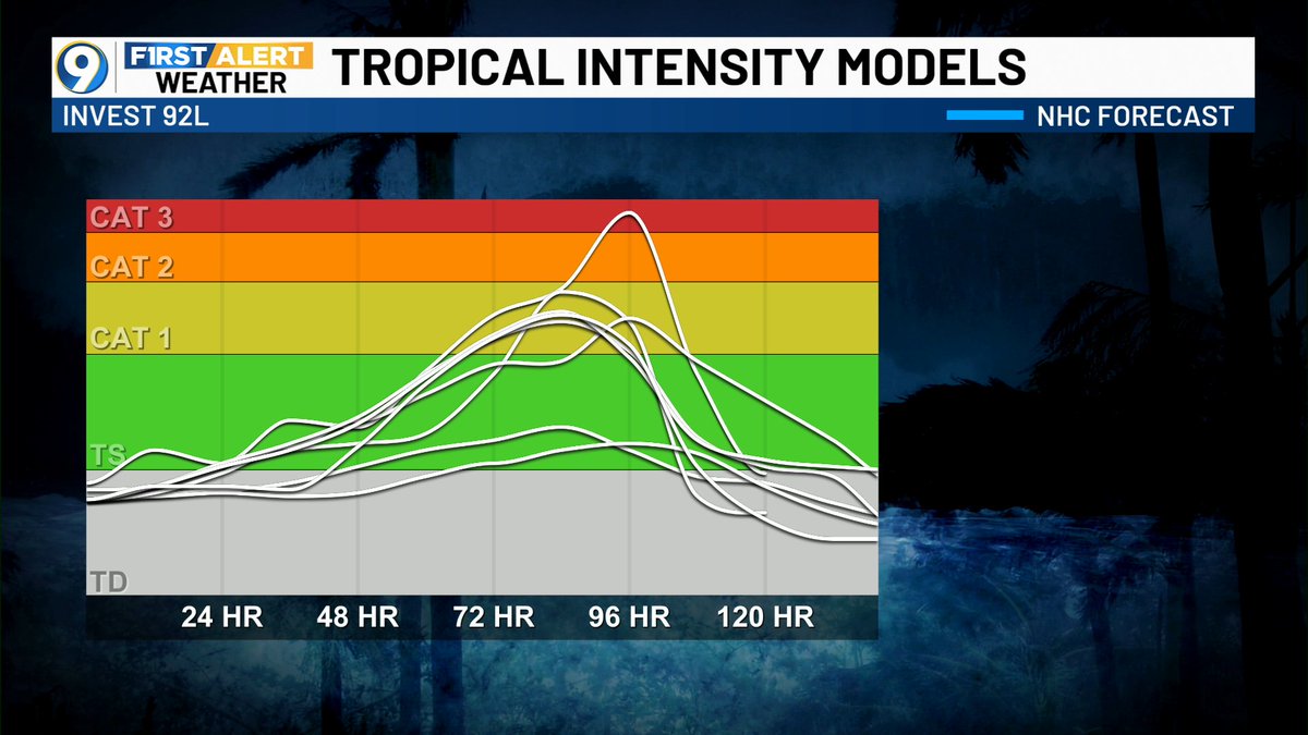
The 7AM update is out, showing the Gulf low has a 90% chance of development. Tuesday computer models move the Gulf storm east of Baton Rouge, but it's still too close for comfort. Spaghetti plots show a landfall late Friday into Saturday between New Orleans and Gulf Shores.
The track of Tropical Storm Isaias has shifted farther to the east this Wednesday morning! The new landfall area is now on the Alabama side of the Alabama/Mississippi border. In fact, it could even get closer to the Florida panhandle. Stay tuned.
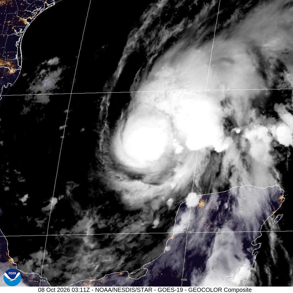
BREAKING...TROPICAL STORM ISAIAS HAS FORMED IN THE GULF...And now the NHC official track has slightly shifted a bit more to the east, with landfall near the Alabama/Mississippi line late Friday night. The storm is still expected to reach a category two.
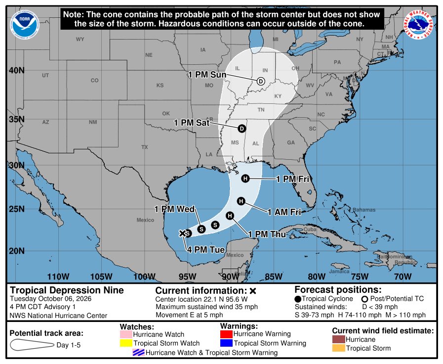
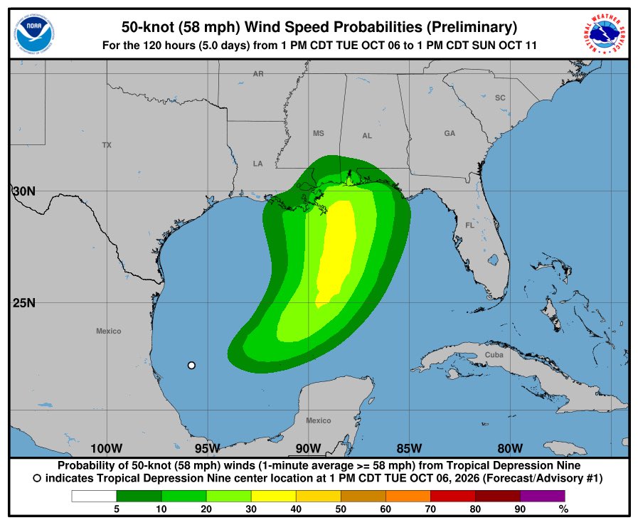
Tue Oct 6: Here is the latest update on newly formed Tropical Depression #Nine from the National Hurricane Center:
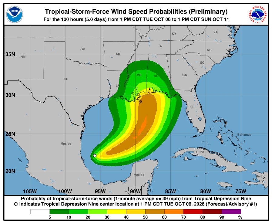
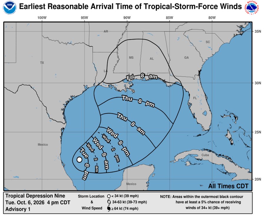
TD #Nine in the western Gulf is forecast to strengthen. There is an increasing risk of dangerous wind & storm surge impacts along portions of the northern Gulf Coast. Watches could be required on Wednesday. The system will bring areas of heavy rain to the central U.S. Gulf coast Friday into the weekend, with flooding possible. Residents from Louisiana to the Florida Panhandle should monitor the latest forecast updates & ensure they have their hurricane plan in place.