2025 was a year of weather extremes for Oklahoma and western north Texas: record-breaking cold and heat to record rainfall and rapid drought onset to record number of June tornadoes (OK).
Explore our end of year StoryMap for a deep dive: https://t.co/2Jx9oljPbF
#okwx#texomawx
NOAA’s GOES-19 satellite officially began operations as GOES East today!
Find out how the satellite is providing critical new data to forecasters:
https://t.co/g5INvr1CbJ
@NOAASatellites
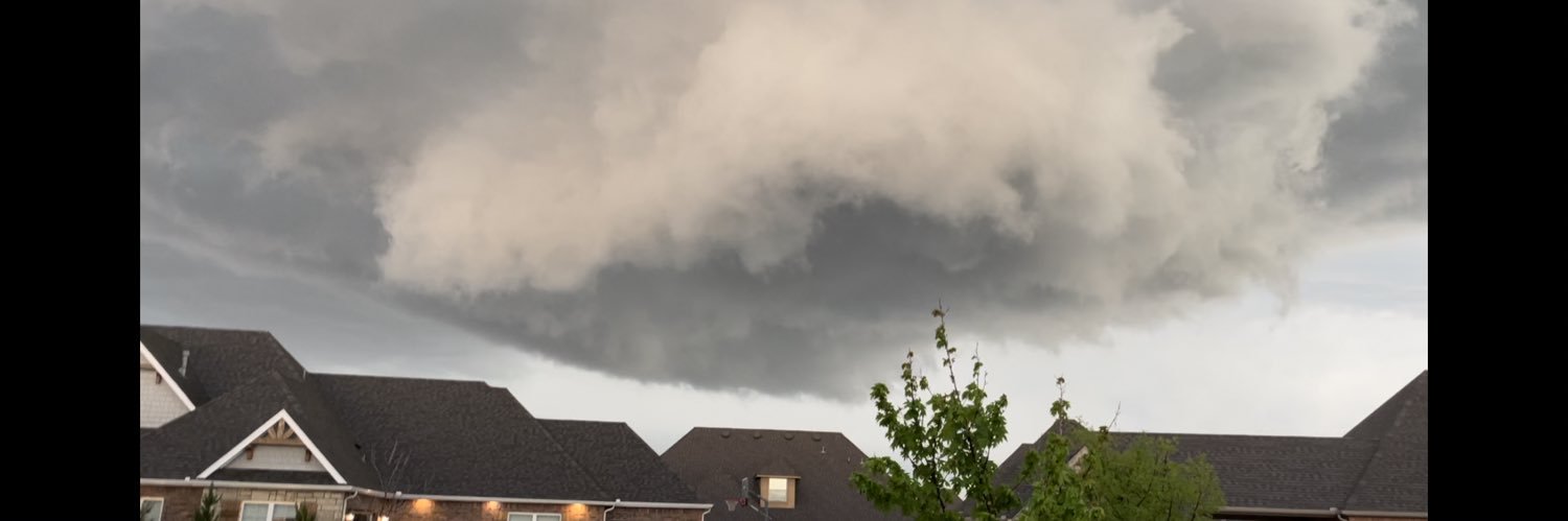
We're looking at a potentially very unusual overnight wildfire environment. We've received a lot of questions about the best ways to receive alerts for nearby fires. A short thread of options available:
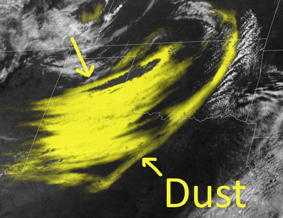
If you think that first wave of dust was bad...you ain't seen nothing yet. Or you won't be seeing nothing when the second wave gets here! This special satellite product shows significant dust (yellow) that's been lofted into the atmosphere. #okwx#okmesonet
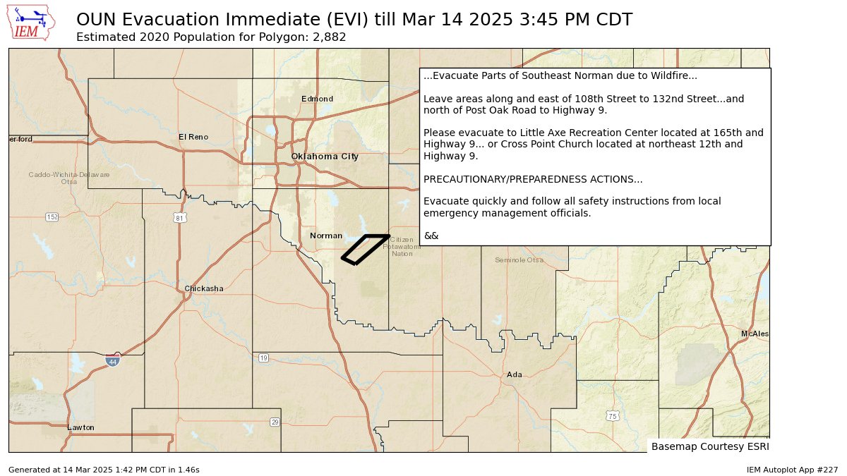
141 PM - Per Norman emergency management: Due to wildfire, residents along and east of 108th Street to 132nd Street and north of Post Oak Road to HWY 9, EVACUATE to Little Axe Recreation Center or Cross Point Church #okwx
Driver unharmed after truck flips over just outside of Garden City Kansas today. Western Kansas experienced winds in excess of 80MPH creating hazardous condition for drivers.
LSC Viewer: Juan Neri
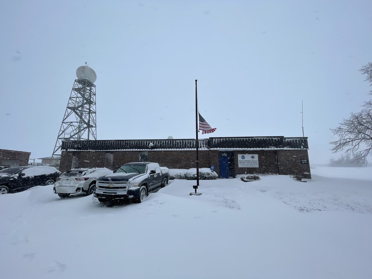
Here we go. Weather models and services could be impacted by the firing of NWS/NOAA meteorologists that started today. Effective immediately and until further notice, the National Weather Service (NWS) is indefinitely suspending weather balloon launches at Kotzebue, Alaska
Now that the snow is melting, how about a look back at the bigger weather events of 2024? From January snow to November tornadoes, here's a look back https://t.co/LrRdqQV6hu #okwx#texomawx
Strong tornadoes and then heavy rainfall and surge. I can’t imagine. What a mess. 🙁 Thoughts and prayers for those affected and the meteorologists working this stressful event.
Here’s a radar snapshot of Milton approaching Sarasota.
Starting to receive several reports of street flooding across coastal communities in southwestern Florida.
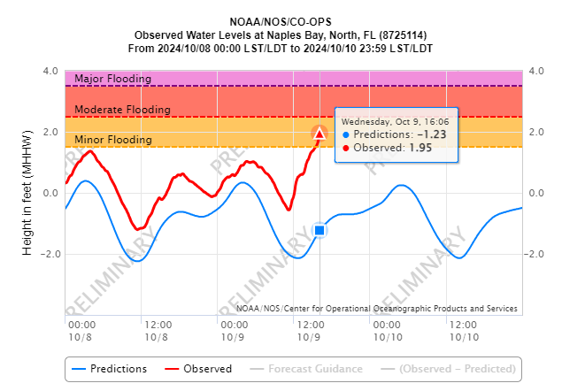
Given #Milton's fast forward speed, the increase in water levels may be sudden.
DO NOT DRIVE THROUGH SALTWATER!
This video is a very helpful visual of a 10-15 foot storm surge.
Reminder: Evacuations orders are in place in for Level A, B and C in Sarasota County. You are urged to follow these orders and leave now.
Updates and FAQs: https://t.co/rLQagdVJTv
We have partnered w/@Uber to provide Floridians free rides to & from shelters in counties evacuating for #Milton. Get a ride:
📲 Open the Uber app
👤 Tap Account on the bottom right & tap Wallet
✅ Add promo code MILTONRELIEF
Find a state-approved shelter: https://t.co/TV1CfO7sA6.