Never gonna give the rain up
Never gonna stop comin' down
Never gonna run around, and be dry too
Never gonna see blue sky
Never gonna say it's dry
Never gonna see high temps that warm you
Just kidding. We get a break from the rain and the chill Sunday & Monday. #rainrolled
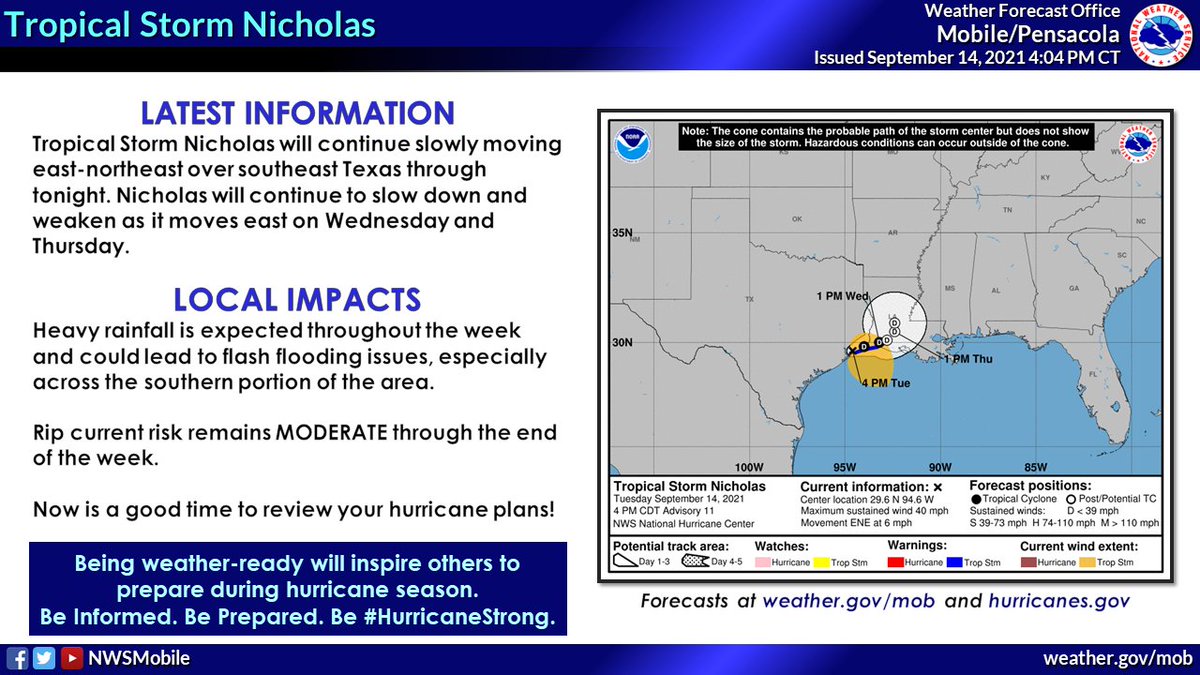
⚠️ 4pm Forecast Update - We are becoming INCREASINGLY CONCERNED about the potential for SIGNIFICANT flash flooding (thanks for Tropical Storm #Nicholas) on Wednesday and Thursday across the southern portion of the area (locations shaded in red). (1/2)
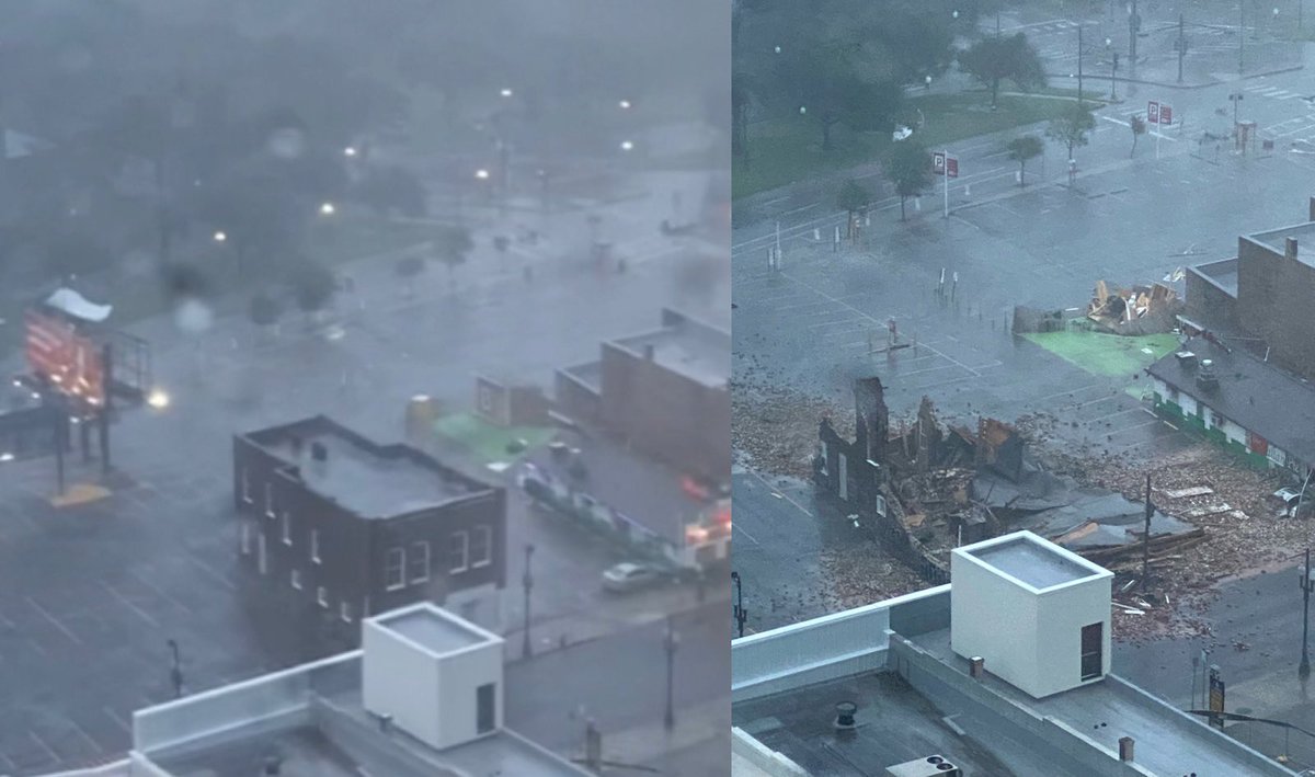
An entire building has just collapsed in New Orleans. These pictures were taken less than 2 hours apart, the first at 5pm and the other at 6:50pm. #HurricaneIda
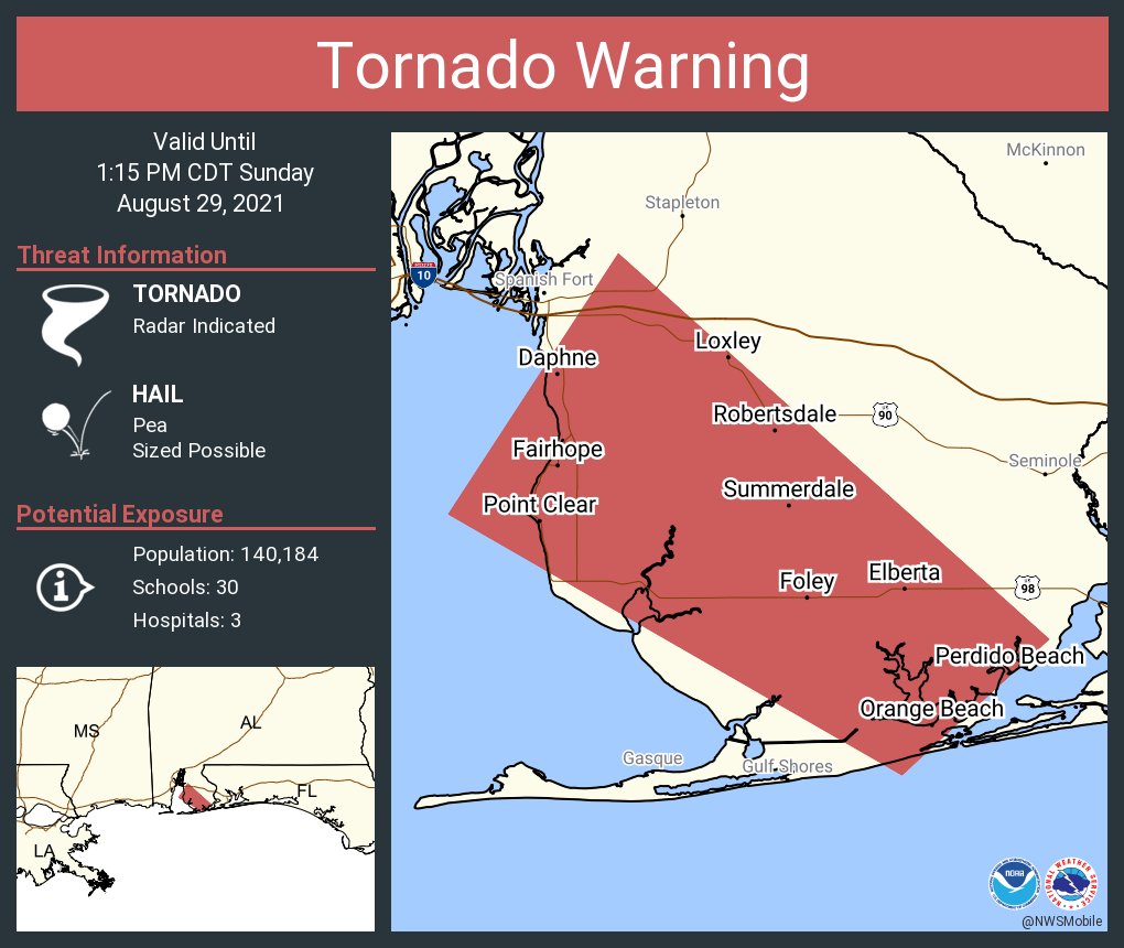
1232pm - TORNADO WARNING for a storm north of Orange Beach heading toward the northwest at 35mph toward Foley and Elberta.
SEEK SHELTER NOW IF YOU ARE IN THE PATH OF THIS STORM!
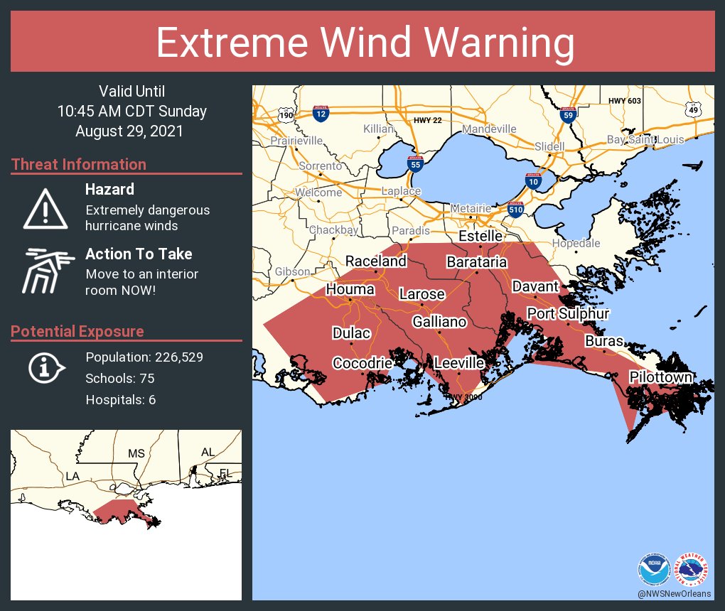
An extreme wind warning is in effect for Houma LA, Bayou Cane LA, Estelle LA until 10:45 AM CDT for extremely dangerous hurricane winds. Treat these imminent extreme winds as if a tornado was approaching and move immediately to an interior room or shelter NOW!.
WOW now expected to be a cat 4 with 140 MPH winds at landfall… Please make sure you have a plan put in place and if you are in the path to think about evacuating.
I don't say this lightly as I don't like hyping for clicks - but I'm very concerned for Louisiana.
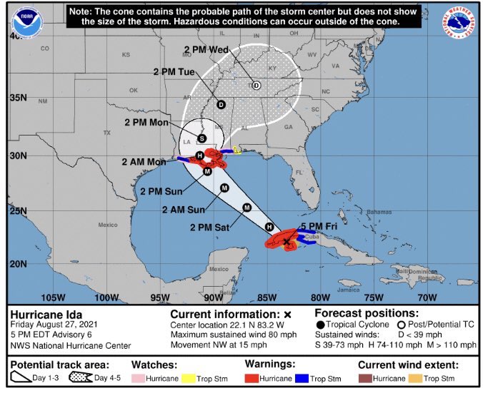
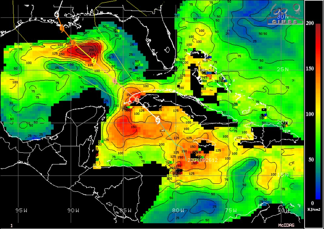
#Ida will traverse the highest Ocean Heat Content (OHC) in the basin, coupled with low wind shear & plenty of upper-level outflow. Category 4 is likely, 5 not out of the question.
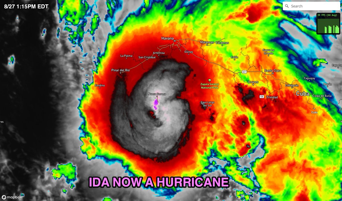
BREAKING NEWS: #Ida is now a hurricane. Data from an Air Force Reserve Hurricane Hunter aircraft indicate that #Ida has strengthened to a hurricane, with maximum sustained winds of 75 mph.
Potential Tropical Cyclone Six is located just east of the Lesser Antilles and will likely become a tropical depression or storm tonight into Tuesday. The forecast takes this potential system into the extreme southeast Gulf through Saturday afternoon and will be closely watched.