@ReedTimmerUSA You should have stayed bud! The south is notorious for big time nighttime tornadoes. Gulf very warm too will likely keep temps in the 70’s overnight with this warm sector. Plus storms are beginning to look the best they’ve been all day. Dangerous night ahead!
@BigJoeBastardi Ridge over troubled waters JB! Models trying to sniff out a sub tropical storm off the southwest coast early next week backing into Florida!
@BigJoeBastardi JB this is going to intensify fast once it makes the bend. The strongest storms that make this bend in this area take off! Rita, Katrina, Irma, I could go on and in. Water temps still in low to mid 80’s. Very warm last 3 weeks has lead to a rise in SST’s around Florida.
@BigJoeBastardi Wind effects in Orlando could worse with this than what we saw with Ian. GFS has 974mb storm just south of Orlando early Thursday morning. That pressure to me suggest 90 to 100mph winds right here in Orlando spreading toward Tampa later in the day
@BigJoeBastardi Remember the bend west? Those that take this bend intensify rapidly. GFS led the way and now other models are following. Likely a cat 2 or 3 on the way to the Florida East Coast. People here many don’t even know there’s a storm coming JB!
@BigJoeBastardi GFS has a interesting set up taking place over Florida late this weekend into early next week. Maybe something sub tropical forms and backs westward into Florida.
@ReedTimmerAccu@ChasinSpin Hi Reed!
This storm will hit Sarasota as a 3 or 4 then move north northeast toward Paavo and Sumter Counties. Again born and raised here these storms with lifting troughs force the storm just south of Tampa for Landfall. Could move inland and slow to nearly a stall near Orlando
@ReedTimmerAccu From experience these storms like Irma and Charley for instance both got turned by a departing trough. This scenario seems similar. Both times NHC had those hurricanes going to the Florida Panhandle but ended up getting pulled into Florida.
@BigJoeBastardi Euro is locking onto a tropical wave developing in the Central Atlantic. Everything seems to be falling into place like you said months back. Euro control bringing a solid storm into FL down the road
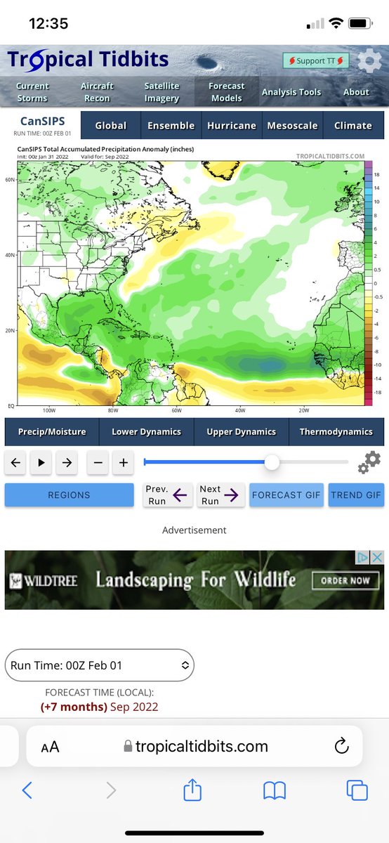
@BigJoeBastardi Precip patterns on the CanSIPS model suggest a big season for Florida. That angle coming up from the Caribbean to over Florida is worrisome.