If I am experiencing information overload about the upcoming winter storm, I know you almost DEFINITELY are too.
Check out the Winter Storm Severity Index from WPC. It helps answer the simple question of “how bad will it be where I live” which at the end of the day is probably the question you wanted answered the most.
As if today just wasn't enough! It looks like we have more on the way for Monday. There is a chance this system gets nudged to the north ever so slightly, but regardless, this snow looks to be much lighter. Bitter cold will accompany this next round. Return to sender? Please?
Here's a look at the push of rain that will be sweeping across the center of the state over the next couple of hours! This will be our most steady rain that we will deal with today. This evening and overnight will be reduced to spotty showers.
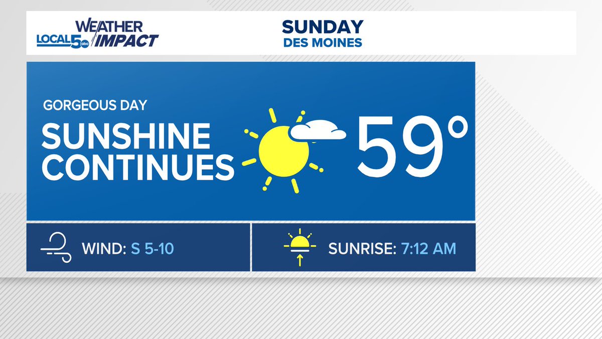
Don't worry if you feel like you didn't get your chance to spend time outside today. Tomorrow looks to be just about as beautiful! We won't see many locations hit the 60s like today, but sunshine and the upper 50s is close enough for me! Enjoy!
Radar has looked a little wild at times this morning! However, most of this just isn't reaching the surface. We can thank dry air in the lower part of the atmosphere for that! A couple sprinkles have made it through that so far, but not much.
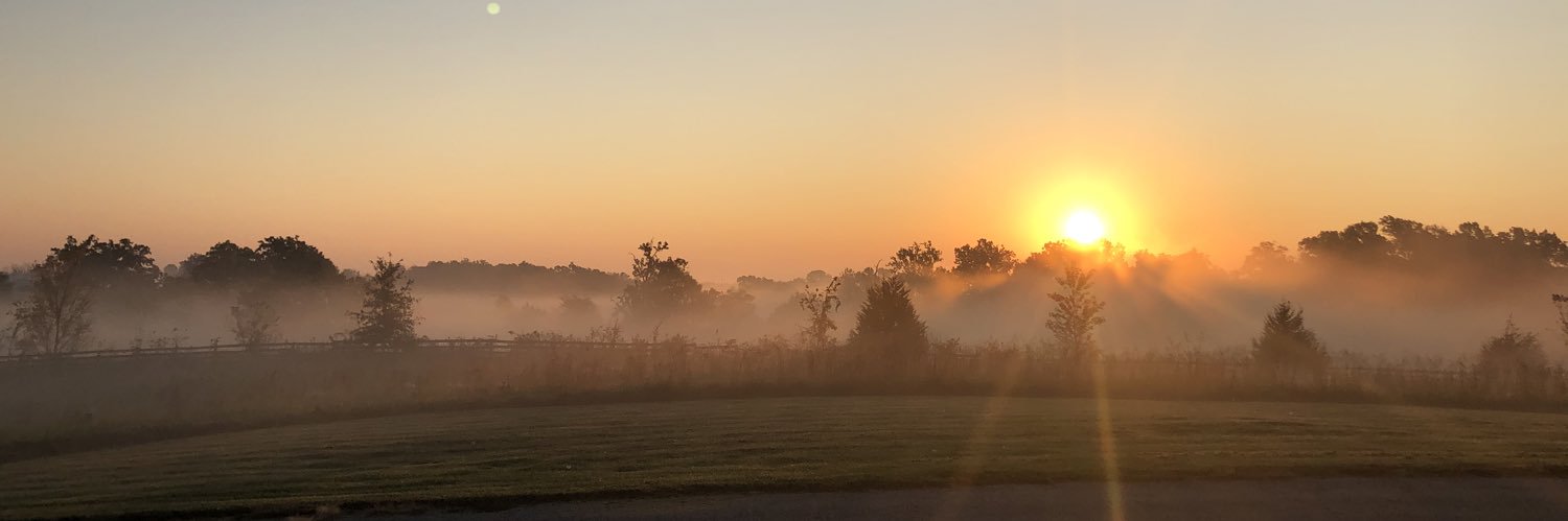
Happy Friday everyone! We can see clearly to start the day across central Iowa! Beautiful little sunrise going on. No fog, but clouds look to stick with us throughout the day. But hey, we'll take a fog free morning drive!
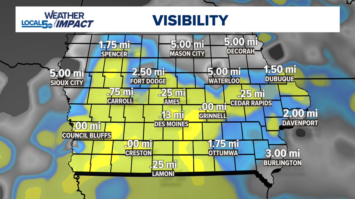
Visibility continues to be an issue across central Iowa with this pesky fog! Take it a little slower this morning on the roads. This DOES look to go away, but we may continue to see it through the noon hour.
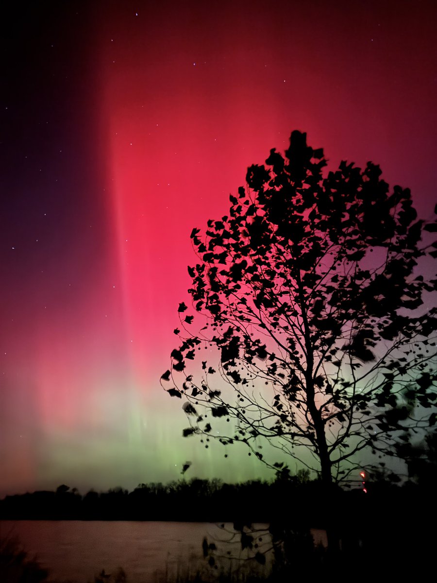
INCREDIBLE northern lights display tonight. Captured this at Big Creek State Park north of Polk City, Iowa. Unbelievable!
All the photos I’ve been seeing have been stunning! What an experience!
From deadly floods in Europe to fires and drought in the Amazon, here's what you might've missed in extreme weather this week. W/ @weatherchannel#ICYMI#weather#climate#NEWS
Even though these storms are causing headaches trying to leave Atlanta, converging outflow boundaries are one of the more beautiful loops to watch on radar!
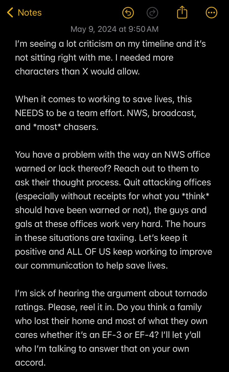
My thoughts on what’s been going on lately. A lot of hard, and amazing work, has been done the last few days. 4 tornado emergencies if I’m not mistaken just this week.
Take a look at this! Coastal flooding is in progress here in Portland, Maine. High tide is coming in just a bit, but for perspective, locals have told us this doesn’t happen during high tide. This nor’easter is causing some surge! Live coverage on @weatherchannel this AM! #MeWx
Truckee, CA, continues to get hammered this Sunday morning! The worst conditions happen in waves. Periods of blizzard criteria with the convective nature of the snow bands developing up the Sierra mountains! We are live on @weatherchannel covering this amazing snow! #CAwx
A little bit before sunrise this morning in Truckee, CA, about 5800ft in elevation. Incredible stuff going on here in the Sierras! Heavy snow and blizzard conditions continue through today and into Sunday tomorrow! #CAwx
I had the privilege of working with this legend. Dick, I’m so happy for you. You deserve a happy retirement closer to your kids and grandkids. Cheers to the 🐐
I did a deep dive on hail reports in the U.S. annually back to the beginning of the database in 1955.
Today I’m setting up a little talk with a meteorologist at the SPC to talk about my findings and pick their brain on the “why’s”
This is what dreams were made of when I was 11!