Mizzou's kicker has now missed 2 FGs today, one was on a significant turnover on the kickoff...Blake Craig's FG % is now at 68% for the season...It should be Mizzou up 19-10. Instead it's 13-10 against Texas
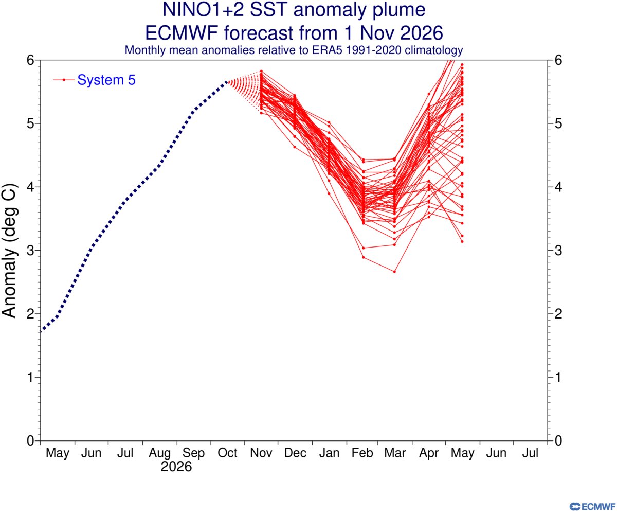
New ECMWF outlook continues to highlight the potential for a twin peak El Niño in the eastern Pacific, similar to the 1982-83 event, but potentially more extreme.
A huge amount of warm water needs to dissipate before this El Niño ends, and there’s a long way to go.
Wind shear over Kansas City will support severe winds & even some rotation on Monday, but the instability/storm fuel will be low. 🌩️ That should limit the intensity of our several rounds of storms expected from 3 PM - 12 AM Monday evening. @fox4kc#KCwx#MOwx#KSwx
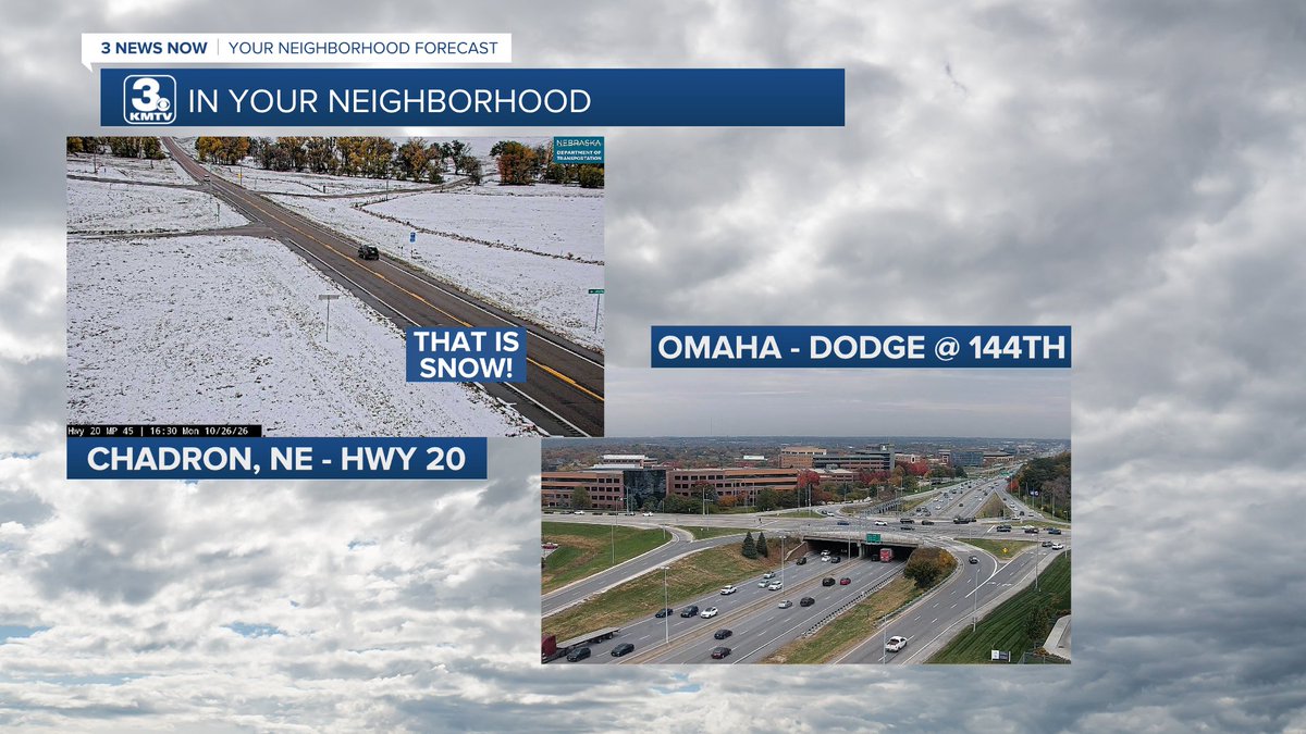
I mean...I guess it is almost that time of year?? Accumulating snow earlier today in western Nebraska. This is from the NDOT cam near Chadron, compared to the camera we have here in Omaha.
I’ve really never understood why SX avoids St. Louis all the time. The Dome is always packed and the riders all love the dirt. RC, James, they all say it’s the best dirt in SX 🤷🏼♂️
Being from STL, I could also see how the Dome Mgmt group could’ve also screwed it up
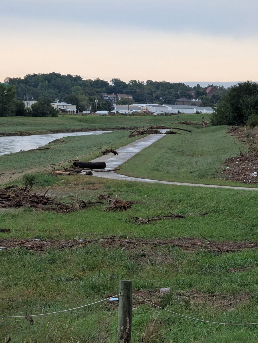
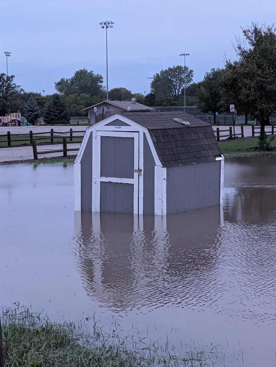
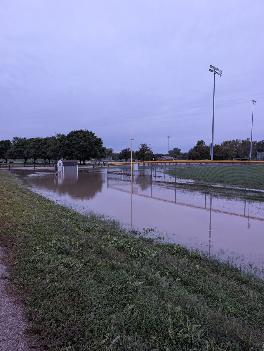
No significant flooding in Papillion that we are aware of, but lots of pooling in low-lying park areas and many trail underpasses are under water. Please don’t attempt to traverse any trails that are under water. Our crews are clearing debris on the Papio Trail where water topped the levy east of 96th Street.
Big thanks to the @PapioNRD for all the measures they’ve put in place to keep our community safe from flooding!
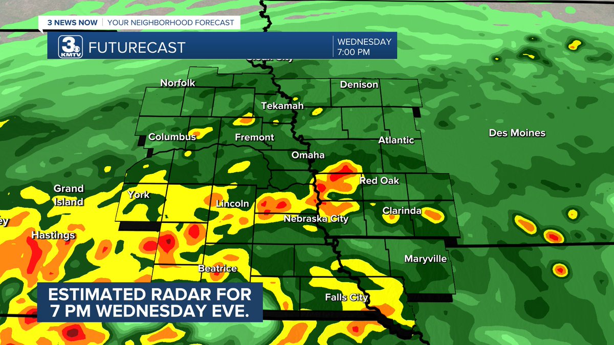
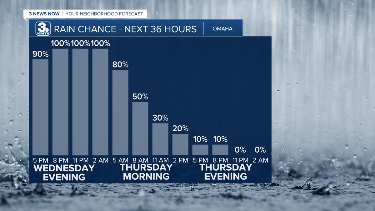
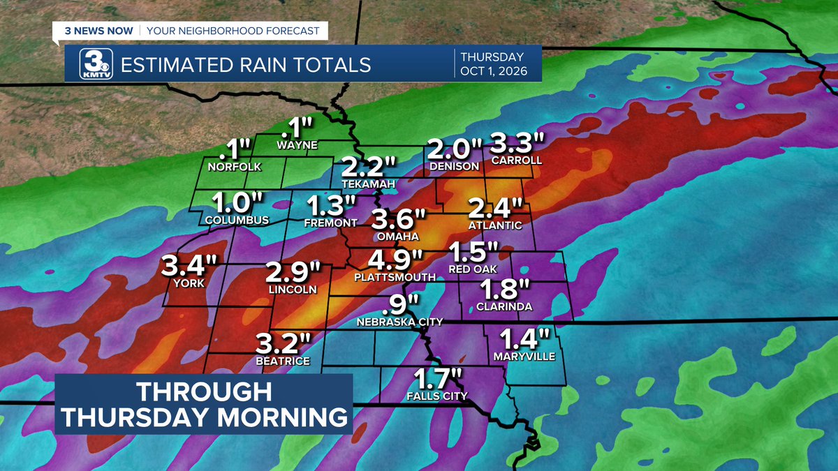
TRENDING: HEAVY RAIN FOR OMAHA TONIGHT - Model data has a band of heavy rain across and just south of the Omaha metro later tonight! Flash flooding Wednesday night - Thursday morning possible ("flood-prone" areas will be affected the most!) 1-3" possible up to 6+" in some areas
@MikeSteveRitter I just don’t know what was up with Simmons tonight. Our defense looks porous. And the way Miss St has lit up both Minnesota and S. Carolina I don’t think that a gimmie anymore.
9/18 7:00 PM - Heads up Omaha! This storm is about to move into the metro over the next hour! Not looking severe at this time, wind gusts only to around 30-45 MPH
Elkhorn - 7:10
Bennington/Gretna - 7:20
Millard - 7:40
Central Omaha - 7:45/8:00
@NEStatePatrol@NDOTomaha section of roadway is missing in right lane on EB I-80 exit bridge connecting to NB I-680 bridge in west Omaha. Just hit it with my car, major damage done…Motorists should use extreme caution while using exit ramp until fixed
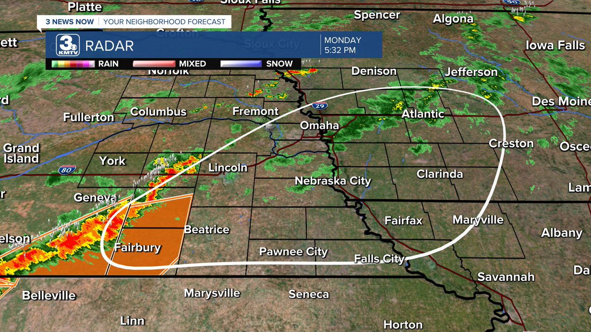
(9/14/26 5:30 PM) This is where I have the best area for severe weather across southeast Nebraska from now through 8-9 PM, focused along/south of I-80 where the CAPE/SHEAR gradient is maximized. Omaha included.
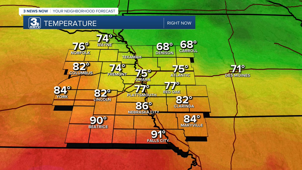
(9/14) 3:00 PM - Latest SFC obs show temps in SE Nebraska already at 90º south of Omaha/Lincoln. Meanwhile still only at 75º in Omaha. However, Dew Points have also jumped from 50s to 70s over the last few hours.
I am not in the least bit concerned about there being a tornado anywhere near Kansas City tomorrow.
Even the SPC Outlook, which is pictured, has less than a 2% chance