🚨#BREAKING: A Confirmed large and extremely violent tornado is on the ground 📌#Sigourney | #Iowa The National weather service has issues a PDS tornado warning meaning particular Dangerous situation as a confirmed large and extremely violent tornado is on the ground heading towards Sigourney, Keota , and Hedrick Iowa This is a life threatening situation take shelter now! Incredible video taken by @TimJonesWeather on facebook
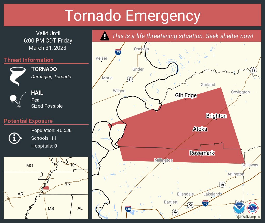
A confirmed large and dangerous tornado is on the ground crossing the Mississippi River right now! A tornado emergency has been issued. This storm will move into Haywood and Madison counties between 6 and 8pm.
Unfortunately yep - likely violent tornado on the ground. Extremely high end couplet with intense debris ball. Tornado emergency probably about to be issued.
View from Little Rock Baptist moments ago! *video shot by Kristal Benton from the 7th Floor of Medical Towers 1.
#arwx@NWSLittleRock @KATVToddYak @KATVJames
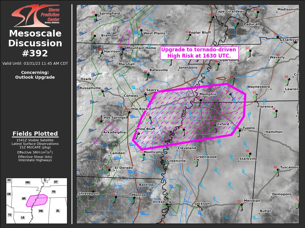
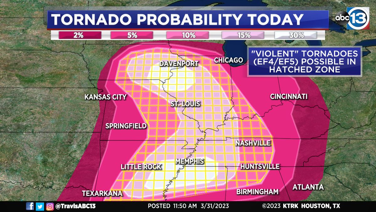
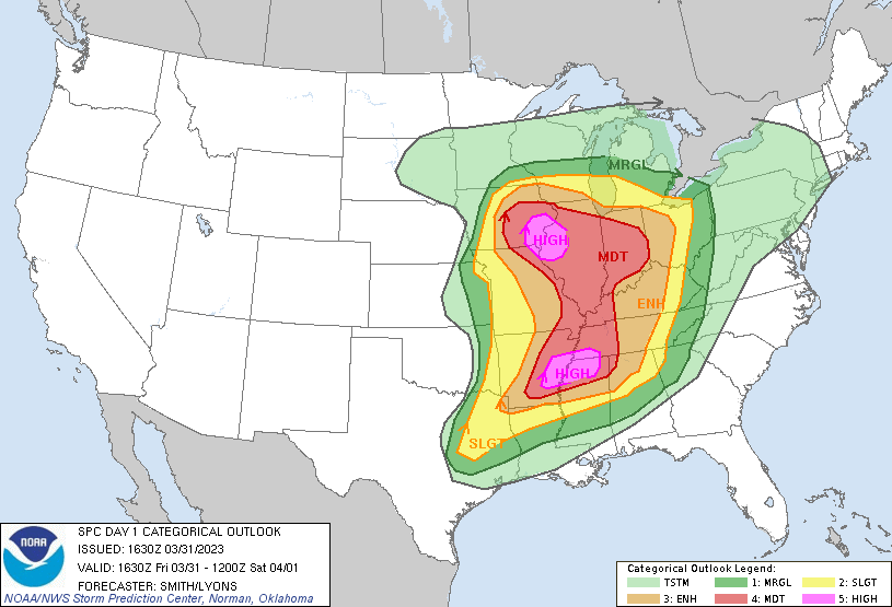
A major tornado outbreak could unfold over the next several hours with two rare "high risk" zones just issued by the Storm Prediction Center, one near Memphis, TN, the other near Davenport, IA. "Violent" EF4/EF5 tornadoes are possible.
Full Forecast: https://t.co/kYz1z4P7gd
⚠️The Storm Prediction Center has increased the severe weather risk to HIGH for the below areas. PDS (Particularly Dangerous Situation) Tornado Watch likely within 1-2 hours in IA/IL/MO. Make sure you and anyone you know in these areas are staying informed.
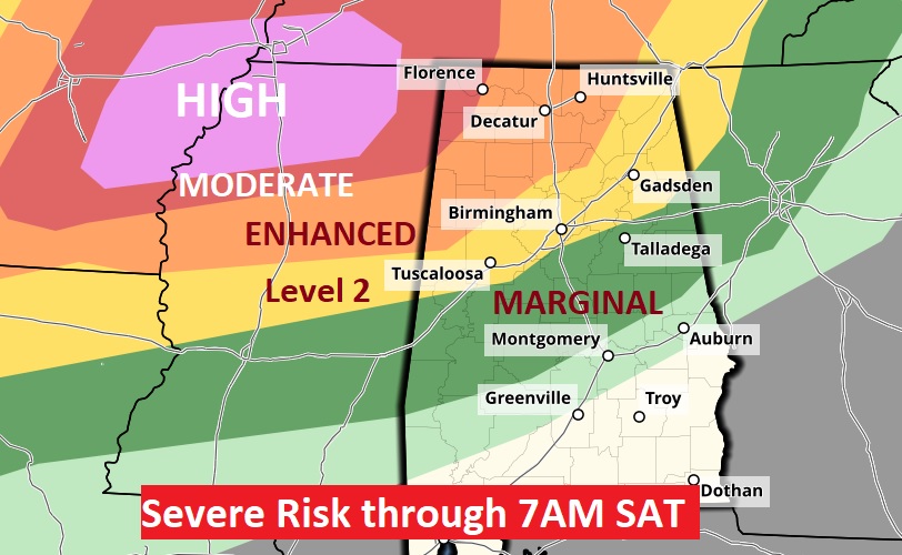
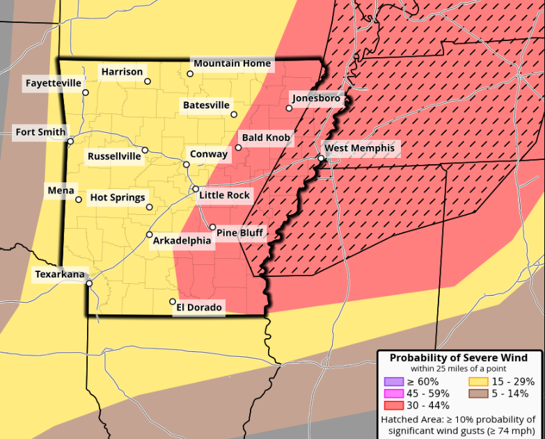
Rare High risk (level 5/5) issued to our west today in the latest update from the Storm Prediction Center. This includes a significant risk for strong to violent long-track tornadoes. We’ll deal with a much more muted risk locally tomorrow, mainly for strong wind gusts.
Oh snap!!! The Storm Prediction Center is going to be upgrading areas of the Central US to the rare high risk category for violent, long-track tornadoes soon!
Big weather day, y'all. If you're in the areas under a hazard potential, listen for warnings & remember - duck n' cover!
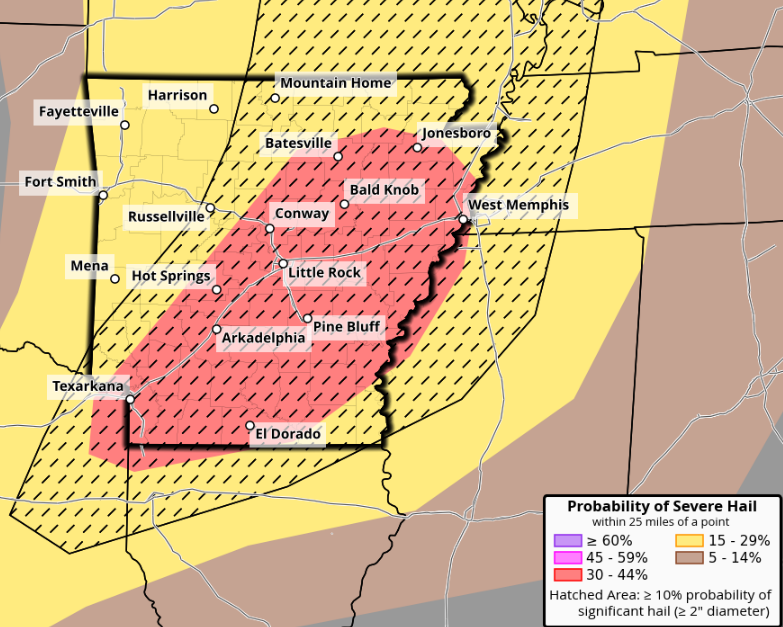
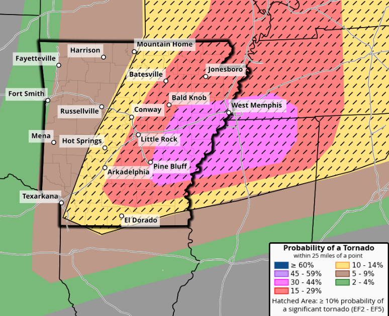
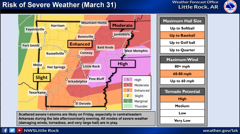
Severe Weather Upgrade: Increase of tornado possibilities, especially across the east-central area of Arkansas has prompted the Storm Prediction Center to issue a HIGH risk across locations just east of the Little Rock metro. All hazards remain for most of the state. #arwx
7:27am CDT #SPC Day1 Outlook Moderate Risk: Eastern parts of Iowa/Missouri/Arkansas Illinois western parts of Kentucky/Tennessee, and northern Mississippi https://t.co/TgJgC6cQZw