Nah. The whole city should be taller, yes, but skyscrapers should be in four clusters only: Golden Triangle, Metro Center, Union Station, and L’Enfant Plaza.
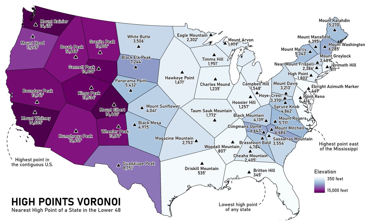
#30DayMapChallenge Day 3 - Polygons. I wanted to try my hand at Voronoi polygons, so I used a dataset I was working with recently: the high point of each state. I've been to four of them!
Also, I pushed my code to github, including some code I used for yesterday's map. (But so far the maps themselves are made in ArcGIS.) https://t.co/CPSfWlW27S
So they named it after the Palisades, the rock features which form the summit of... Squ*w Peak, ironically. I wonder if @palisadestahoe or the Washoe Tribe have asked @usgs to rename the mountain (and creek and valley)? Will trail maps just omit the name?
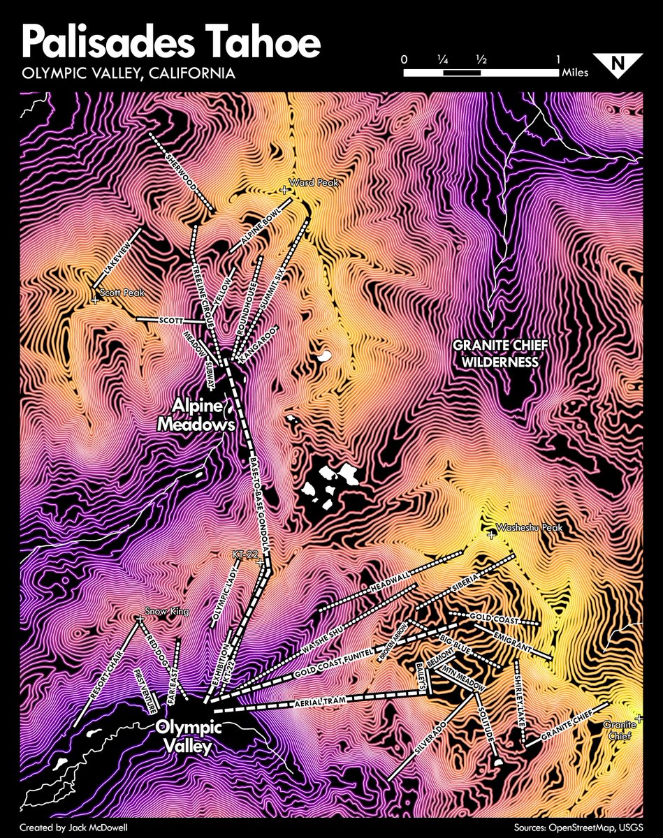
#30DayMapChallenge Day 2 - Lines. Contours, ski lifts, streams, and more contours! In anticipation of the new base-to-base gondola at @palisadestahoe, I made a map showing how the gondola connects the two mountains.
Also, I learned that Sq**w Peak, featuring the Palisades themselves, was recently renamed to Washeshu Peak. (I was originally planning to label it Palisades, as it is on the trail maps.) https://t.co/sZZTmaw838
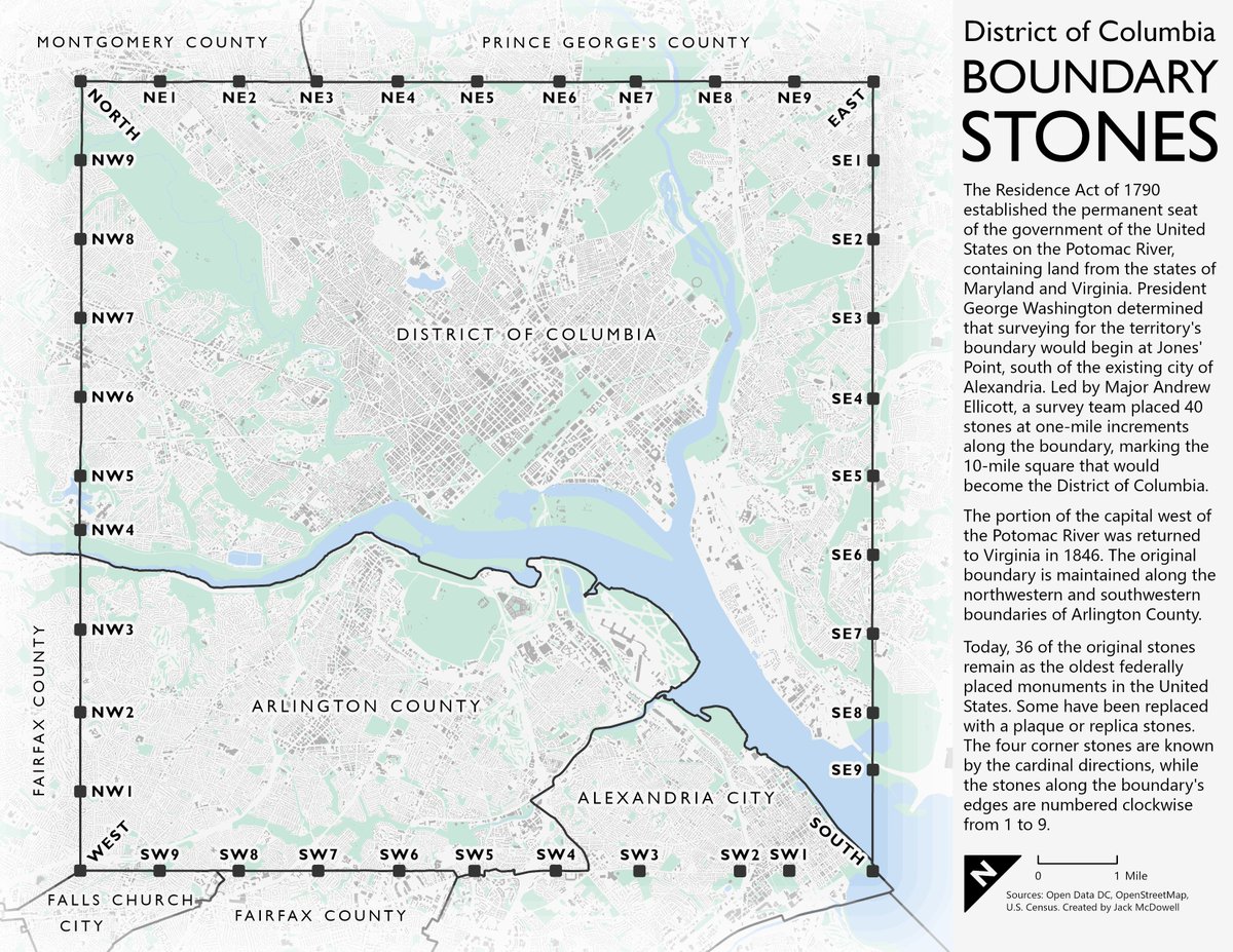
Interestingly, this dataset was missing SE4, so I had to add it manually. The DC survey of these stones was conducted in 2011, before the replica stone for SE4 was placed in 2015. https://t.co/kuXhIttACa
#30DayMapChallenge Day 1 - Points. I had a lot of fun making this, even if it technically bled into day two! I need to put a LOT less effort into my maps if I'm going to keep this up...
I love maps of DC that rotate it 45 degrees. I was also so drawn to how the city looked with no roads and only buildings that I kept it that way - love it or hate it!