Lead Scientist, Earth Observ. Insights Unit, @ABbiodiversity. Satellite #remotesensing mapping & monitoring. Love #scicomm, #sciart. Tweets/views are my own.
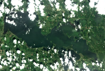
The Harmful Algal Blooms monitoring project has had a successful second field season. Though we faced more challenges when it came to collecting our samples (more cloudy and smokey days), we still managed to nearly meet our goals.
#satelliteimagery#algalblooms#Sentinel2
Join our team as the new Machine Learning Scientist and contribute to our province-wide biodiversity monitoring program.
Apply by May 1, 2024 at Midnight MDT: https://t.co/OKL8GFHOpN
#hiring #albertajobs#spatialanalysis #remotesensing#geospatialscience#AI#machinelearning
Join our team as the new Machine Learning Scientist and contribute to our province-wide biodiversity monitoring program.
Apply by May 1, 2024 at Midnight MDT: https://t.co/OKL8GFHOpN
#hiring #albertajobs#spatialanalysis #remotesensing#geospatialscience#AI#machinelearning
Join our team as the new Machine Learning Scientist and contribute to our province-wide biodiversity monitoring program.
Apply by May 1, 2024 at Midnight MDT: https://t.co/OKL8GFHOpN
#hiring #albertajobs#spatialanalysis #remotesensing#geospatialscience#AI#machinelearning
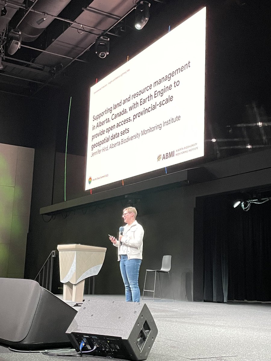
What an inspiring week! Thanks to all the #GeoforGood23 speakers, attendees & volunteers - we couldn’t do it without you. Stay tuned to watch sessions on-demand later this month on https://t.co/DZjULoeoPj
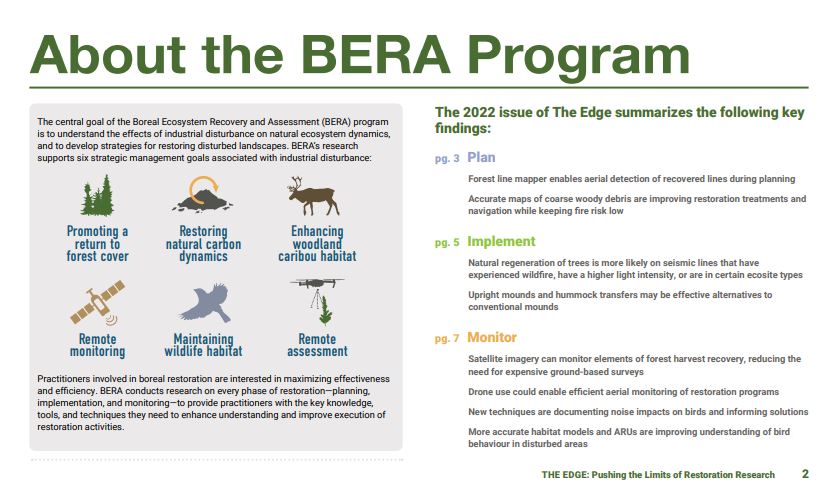
We are excited to share the first edition of The Edge: A synthesis of the @BeraProject research. Follow the link to learn more about how we are planning, implementing, and monitoring the restoration of industrial disturbances in Alberta! https://t.co/ISmeLhOo0L
Nov 24, our last drone mission of the year: thermal mapping of a mixed boreal forest stand where we did a trial to simulate MPB attack on lodgepole pines. We will assess to what degree we can detect it with thermal before the crowns show visible signs. Results next year 🤞
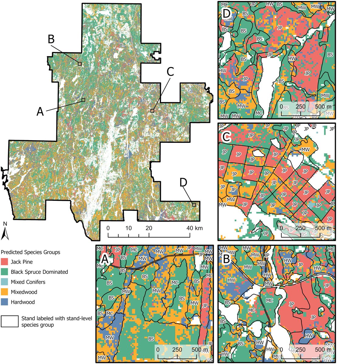
📢NEW PAPER! Mapping Dominant Boreal #TreeSpecies Groups by Combining Area-Based and Individual Tree Crown #LiDAR Metrics with Sentinel-2 Data
📖(#OpenAccess): https://t.co/1atIs59XfS
@Joanne_C_White@FORM_ETHZ @naomibschwartz
Join us as a Geospatial Data Scientist! ABMI's Earth Observation Insights unit leverages #remotesensing data and technology for environmental #monitoring in AB. Current work: wetland/upland mapping, algal bloom monitoring, and forest regeneration. #hiring https://t.co/LhroNL5CfW
Calgary is only one of many examples around the globe where tree canopy cover in urban areas is not equal across diverse neighbourhoods with different demographics. I'm glad to see someone has been looking at this locally, though!
https://t.co/QrbX01gb64
🚨#JobOpportunity! We're looking for someone to help develop, implement and manage #geospatial data analyses in support of #Alberta environmental #monitoring and reporting! Apply by Nov 17. More info 👇
https://t.co/4OE7ML2zHO