Family man, cord cutter, fire weather snooper. CTO of Rego Consulting, CEO Relevus, founding team member/reporter for Watch Duty. I spend my time on the Bsky
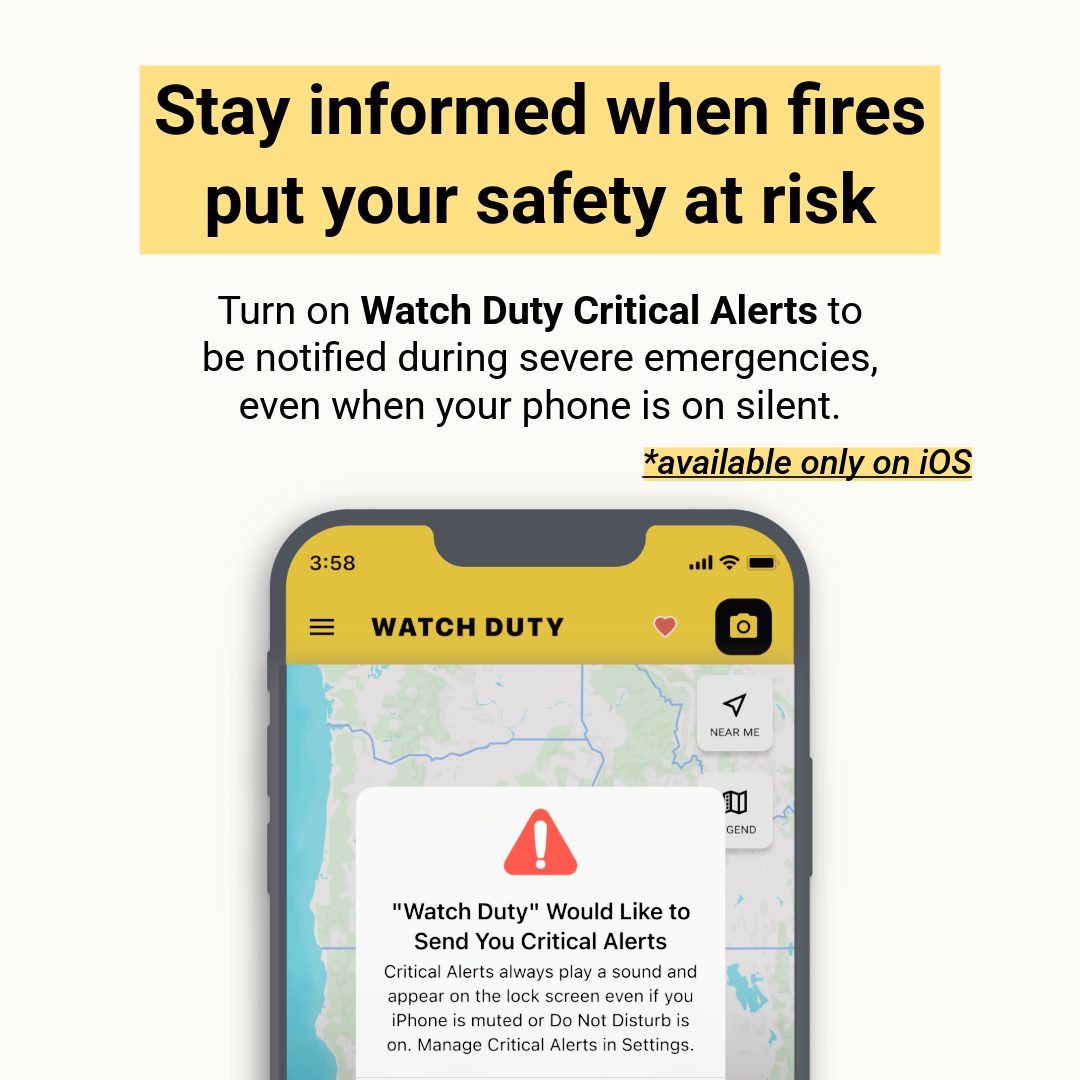
What if your phone was on silent during an urgent fire evacuation notice?
We're introducing Critical Alerts on iOS. For select rare and urgent situations, these alerts can bypass Do Not Disturb mode with an emergency sound, ensuring you receive life saving notifications when they matter most.
@CaliFireTracker@disaster_db We already have a free app on the market that does that with Watch Duty. Why spend the time and energy on something that millions of people use and love?
🎉 Introducing Watch Duty Teams – a new way to manage your organization’s memberships with discounted pricing, starting at just 25 users!
⚪ Consolidated Billing and Invoicing: Manage all users (basic and pro) under one account with a single invoice, simplifying accounting and renewals
⚪ User Management: Easily add, remove, and assign memberships to users within an organization
⚪ Single Sign-On (SSO) Integration: Seamlessly and securely connect with existing identity providers to manage user access
⬆️ To purchase or upgrade your account, simply open the left main menu (☰) in the app and click on “Membership” or reach out to us directly at [email protected].
🔥 And coming this summer to Watch Duty Pro:
⚪ GIS/ESRI Layer Import - Soon you’ll be able to upload your own internal map data directly into Watch Duty, making it accessible to your Pro users. In early testing, organizations have successfully imported everything from power lines and fire stations to a wide variety of other critical assets. With this new capability, your team can achieve shared situational awareness to enhance field safety and infrastructure protection—right within the app you already know and trust.
⚪ Fire Progression Models - We’ll be bringing the incredible work of the fire science research community directly into Watch Duty Pro. You'll be able to view and compare many of the widely used fire progression models right within the app. You will be able to see and compare many of the generally available models right within the app.
⚪ Fuel Types and Moisture Readings - View the comprehensive FBFM40 (40 Scott and Burgan Fire Behavior Fuel Models) classification system as a new base map layer to view the vegetation types and fuel loads. Additionally, view recent fuel readings that include moisture, fuel type, and fuel category.
⚪ Weather Stations and Alerts - We are not only adding over 600,000 weather stations like RAWS to our map, we will give you the ability to alert on individual thresholds. For example, want to know when relative humidity (RH) drops below 5% in a given region? Or when gusts top 70 MPH on a nearby peak? Now you can stop the guesswork and get ground truth data, rather than prediction, sent directly to you.
Introducing our non-profit member benefits! Get three of your most requested features for only $25/yr
- Air tanker tracking
- Saved map locations
- Unlimited county monitoring
As always, maps and alerts will remain free. All membership dues will go towards keeping it that way
Watch our very own @MichaelWX18, photojournalist and pyrogeographer, TONIGHT a 6PM PST on the OG @wildland_zko’s "The Lookout" Livestream where they discuss being inside the LA firestorms
https://t.co/TkBuo7Vi9a
Forward progress has NOT been stopped on the #PalisadesFire! The radio traffic this person repeated was from VFIRE-23 which is assigned to Division Charlie of the #EatonFire, according to the SoCal incident comms plan. This type of reporting is straight up dangerous and negligent
@NWSBayArea@NWSBayArea can you help explain why the middle of Sonoma County is always the target zone for coastal flooding as opposed to a region around Jenner? This has never made sense to a lot of us that live out here.