Apply for #PhD funded (UK home only) research @EoCdt@SEELeeds on increasing resilience of cities to geo & climate hazards using the latest earth observation data & machine learning techniques with me, @CScottWatson & Caroline Nichol. Apply by 30th June https://t.co/iT7yIvGeuE
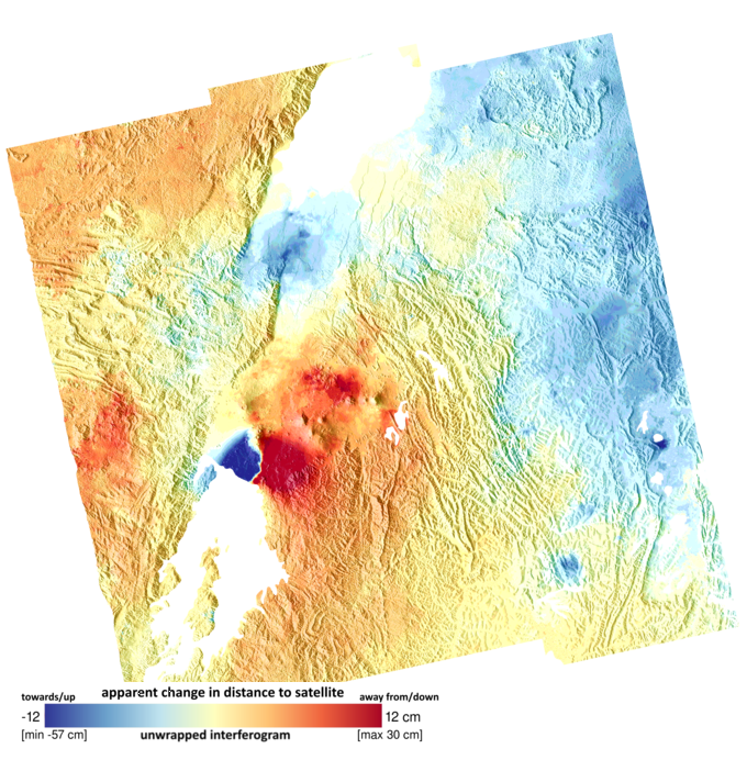
Preliminary release of our open land subsidence @NERC_COMET data portal https://t.co/jklxIFkhGO showing initial subset of 100 areas of Iran rapidly subsiding – measurements from #Sentinel1#InSAR from PhDs by @ar_watson & @Jess_ca_98 Find us at #LPS22
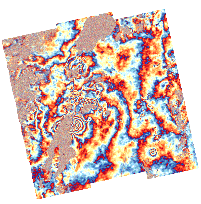
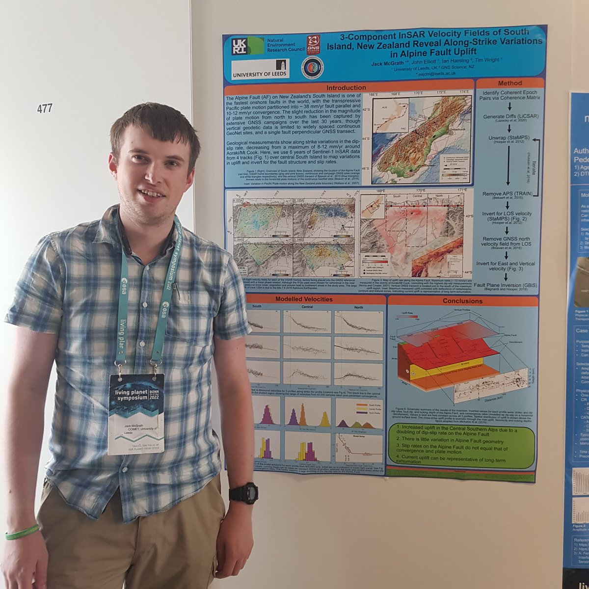
Want to find out about using 3-component velocity fields from #Sentinel1#InSAR to measure variable slip rates on New Zealand's #AlpineFault? Come find my poster 478 at #LPS22
Interested in #PhD research for understanding crustal deformation and active #tectonics of Afghanistan https://t.co/teyF7xG5Qs with me, @RichardThomasW Richard Styron @GEMwrld & @GeoAndyHooper at @PanoramaDTP@SEELeeds for Oct 22 start. Apply soon: https://t.co/mHcy6NutWE
Want to do #PhD research on cities from space using the latest earth observation data & machine learning techniques to increase resilience to geo & climate hazards with me, @CScottWatson & Caroline Nichol? Apply to @EoCdt to come to @SEELeeds next October https://t.co/iT7yIvoDD6
Many congratulations @EdnaDualeh on your brilliant first paper! Analysing explosive volcanic deposits from satellite-based radar backscatter, Volcán de Fuego, 2018: https://t.co/nEXit7fayc
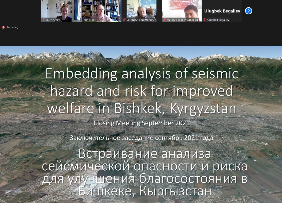
Great discussions in today's meeting with our team from Kyrgyzstan and across the UK. We have some ideas of how to share our findings on seismic risk with local government in Bishkek, and interesting science to do in the future! @jrelliott82@CScottWatson@ekh_sci @RichardThomasW
📢 Our new paper is online and typeset!
https://t.co/uRGJQK1DSp
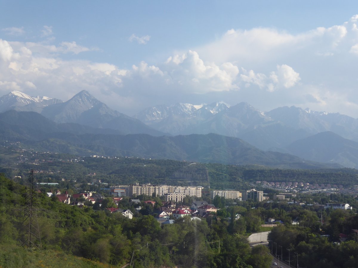
We use high resolution satellite imagery to map faults around Almaty, Kazakhstan + then use @GEMwrld’s OpenQuake to calculate shaking, damage + losses to the city from earthquake scenarios
Here’s what we found
🧵
My first paper during my PhD career has been published on GRL🥳:
https://t.co/cof9lYSDWr
If you are interested in how the InSAR time series can improve the detection and modelling of shallow continental earthquakes, please have a look!
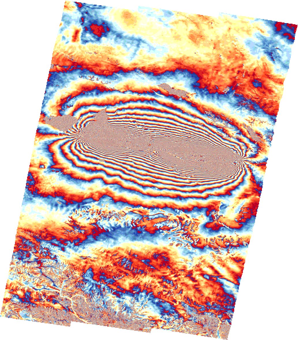
@BerndAndeweg @timwright_leeds The alignment of the individual features though is perpendicular to the fault as they run downslope from the higher topography in the south associated (and probably due to) the faulting. Collectively they align with the fault in terms of occurrence (via the topography).
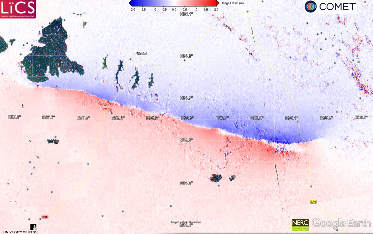
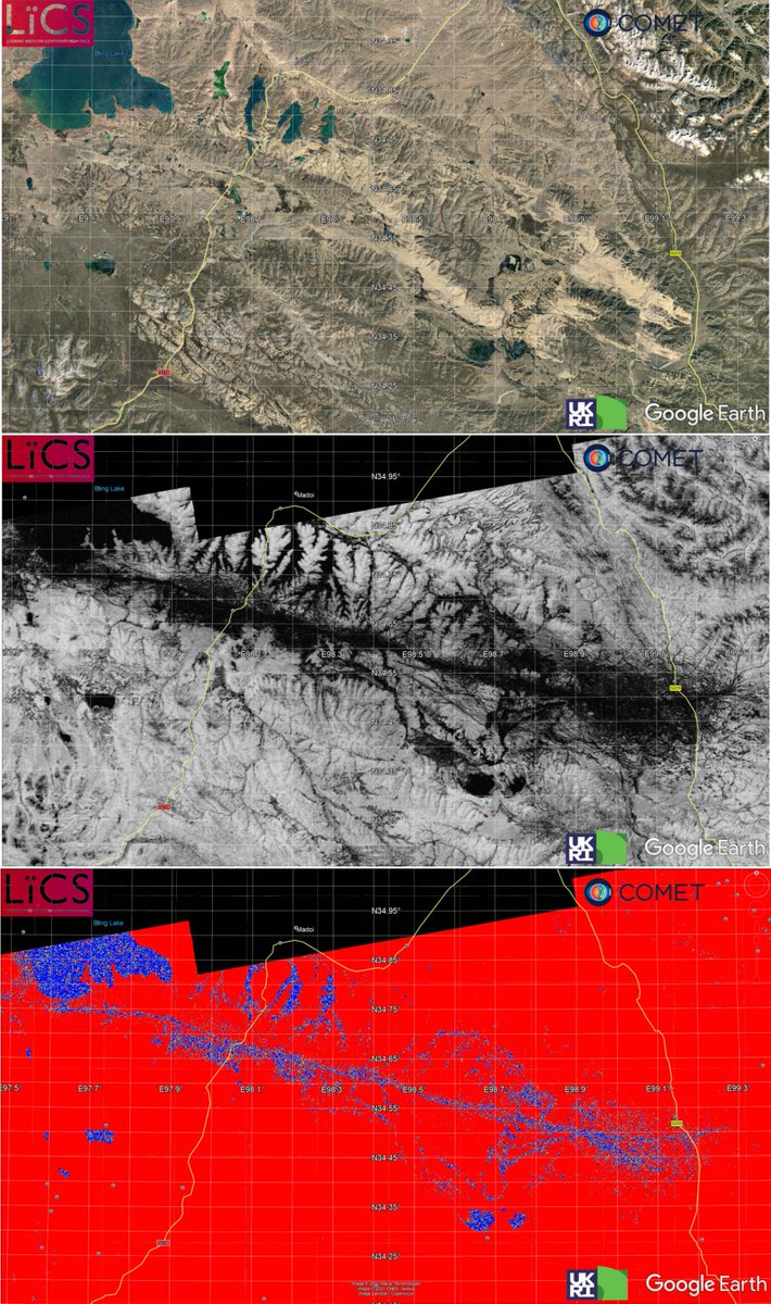
Qinghai, China #Earthquake rupture delineated from #Sentinel1 SAR offsets (in range) indicate 156 km long rupture with single major trace rupture along most of length except in the east with a second splay #COMET - download kmz https://t.co/cI92mubvpw
For completeness here are the SAR range offsets for the descending #sentinel1 track. Kmz also available to download (along with azimuth offsets which do not show much given perpendicular to strike).