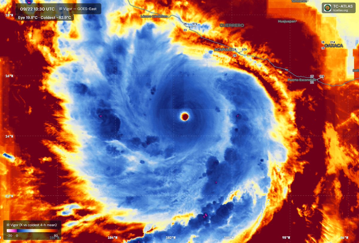
Hurricane Polo likely received a relatively direct boost from the strongest El Niño on record.
Surface waters near Polo are around 88°F (31°C), while an El Niño-fueled Kelvin wave has left water warmer than 80°F (26.5°C) extending about 240 feet below the surface.
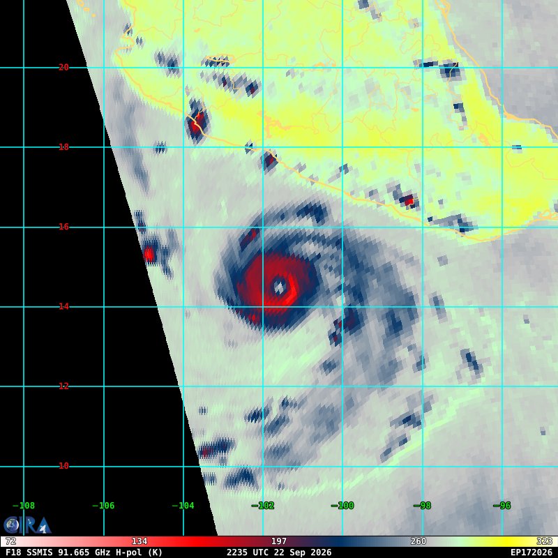
Category 5 Hurricane Polo undergoing renovations tonight with "eyewall replacement cycle" underway
However, the structure remains quite robust at 905 mb and 145-knot winds.
No shear + very warm waters = minor fluctuations ahead for the next few days.
Hurricane Polo Advisory 10:
Polo has showed signs on satellite presentation that weakening has been occurring over the last several hours from an eyewall replacement cycle merger which has been completed. It could attempt to regain strength overnight, but is uncertain due to how long it has remained over the same spot which is likely causing some upwelling meaning the sea below is cooling off from the rain and wind.
But giving how far and deep the very warm temps extend below the surface (200 or so feet), this may have little effect. Shear is expected to slowly increase as it moves towards the NW later on, but for now remains a very powerful category 5 hurricane. Coastal impacts are beginning or about too very shortly along the Mexico coastline.
🌀 Después de quedarse varias horas como estacionario, al parecer en huracán #Polo ya comienza a tomar la trayectoria pronosticada al noroeste.
Estén pendientes en Guerrero y Michoacán.
A rare collection of 8 different close up views of the world’s most powerful super storm with winds of up to 175 mph at the moment.
#Hurricane#Polo#MrMBB333
HURRICANE POLO AND ODALYS COULD TRIGGER THE FUJIWHARA EFFECT
This could get wild. Category 5 Polo is dominating the Pacific, and now Odalys is turning back toward it.
If they get close enough, the storms could begin pulling on each other. Not colliding, but actually spinning around one another.
Their tracks could shift. Odalys could get whipped around Polo, or the stronger storm could eventually pull the weaker system into its circulation.
That’s the Fujiwhara effect, and it could completely change what happens next. Swells from both systems could also combine into dangerous, confused seas near Baja California.
Two storms. One increasingly unusual setup. And if they get close enough, neither may follow the path it would have taken alone.
👇 Anyone along the Pacific coast keeping an eye on these two?
#MrMBB333 #FujiwharaEffect #HurricanePolo
From a tropical storm to a Category 5 hurricane in less than 24 hours!
That's what Polo just did near Mexico's west coast — an absolutely remarkable display of rapid intensification.
Polo has competed an eyewall replacement cycle merger with a tightly compact deep core and will likely try to attempt to get even stronger overnight and into tomorrow as it will finally start to go on the move.
Next recon plane won't be in until early tomorrow afternoon.
Recon is on its way to #Polo (#17E), and they could find an extremely intense system (as if Category 5 wasn't intense enough). Recent microwave satellite imagery suggests that an eyewall replacement is actually not imminent, which means further strengthening is on the table.
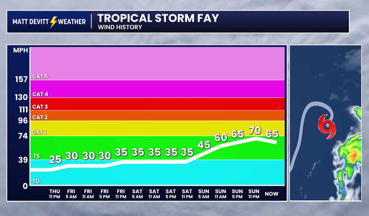
Tropical Storm #Fay fell just short of becoming the first hurricane of the 2026 Atlantic season. Strong wind shear has ripped the storm apart, fully exposing its low-level center on visible satellite.
It looks like the record streak without an Atlantic hurricane will continue…
Close, but no cigar. #Fay peaked at 70 mph, but failed to reach hurricane status as strong wind shear is now weakening the storm. The hurricane-free streak continues...
Tropical Storm Fay could make a run at reaching hurricane strength southwest of the Azores. Prior to 1950 records are sketchier, but the last time an Atlantic hurricane season went past 11 Sept before its 1st hurricane was in 1941 (1907 & 1914 had 0 hurricanes—@philklotzbach).
Fay formed overnight, Fay is getting stronger, Fay is in the middle of nowhere. BUT this may be our best shot at a hurricane this season. The record is still going - can we go an entire season without a hurricane? 🧐🧐