@DrNealDunnFL2 Who was President from July 4, 1776-March 4, 1789? I'm really interested in knowing, as is everyone else who knows that George Washington became our first President on March 4, 1789.
***NOAA suspending critical hurricane-forecasting satellites***
This is not a political post – but rather a notice that a vitally-important satellite used to probe and track hurricanes will be discontinued within a week.
This will have noticeable negative impacts on hurricane forecasts and forecasting in general.
The National Oceanic and Atmospheric Administration announced Wednesday that they will be cancelling the ingest, processing and distribution of data from the Special Sensor Microwave Imager Sounder (SSMIS).
"This service change and termination will be permanent," wrote NOAA.
SSIMS is flown on the United States Air Force Defense Meteorological Satellite Program (DMSP) F-16, F-17, F-18 and F-19 satellites; the latter stopped producing useful data in February of 2016, but the first three satellites are vital.
The agency did not elaborate on why the otherwise-usable satellites will be discontinued. There is no replacement scheduled.
The SSMIS satellite are extremely important; as a forecaster, I use the constantly. The microwave satellite imagery allows us to peer under the overcast of a storm, probing the inner structure of a tropical cyclone. It's especially important at night. Visible and infrared satellite imagery capture cloud top details, but not what's happening *inside* a named storm.
By resolving changes in a cyclone's inner structure, we're able to see how a storm is evolving – and potentially rapidly strengthening. The absence of this data creates an enormous hole in hurricane forecasting.
We may be less knowledgeable of changes in a storm's strength.
Early in a storm's life cycle, microwave satellite imagery also helps us pinpoint where a center of circulation is located. "Pinning the tail on the donkey" is extremely important, because getting the center point correct means better model output. If we're off a bit early on, then that error grows exponentially the farther out we forecast for.
Please be aware that this change can and will have a negative impact on the forecasts relied upon by Americans living in hurricane-prone areas.
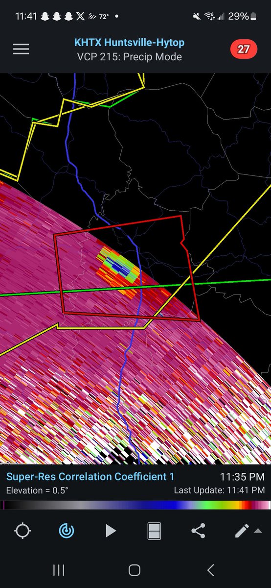
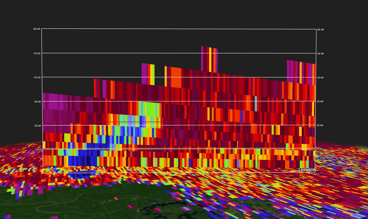
Debris height on the tornado in Eastern KY is around, if not over, 30,000ft!
With a max VROT of over 75kts, this easily falls into EF4+ potential intensity.
🚨 KENTUCKY TORNADO
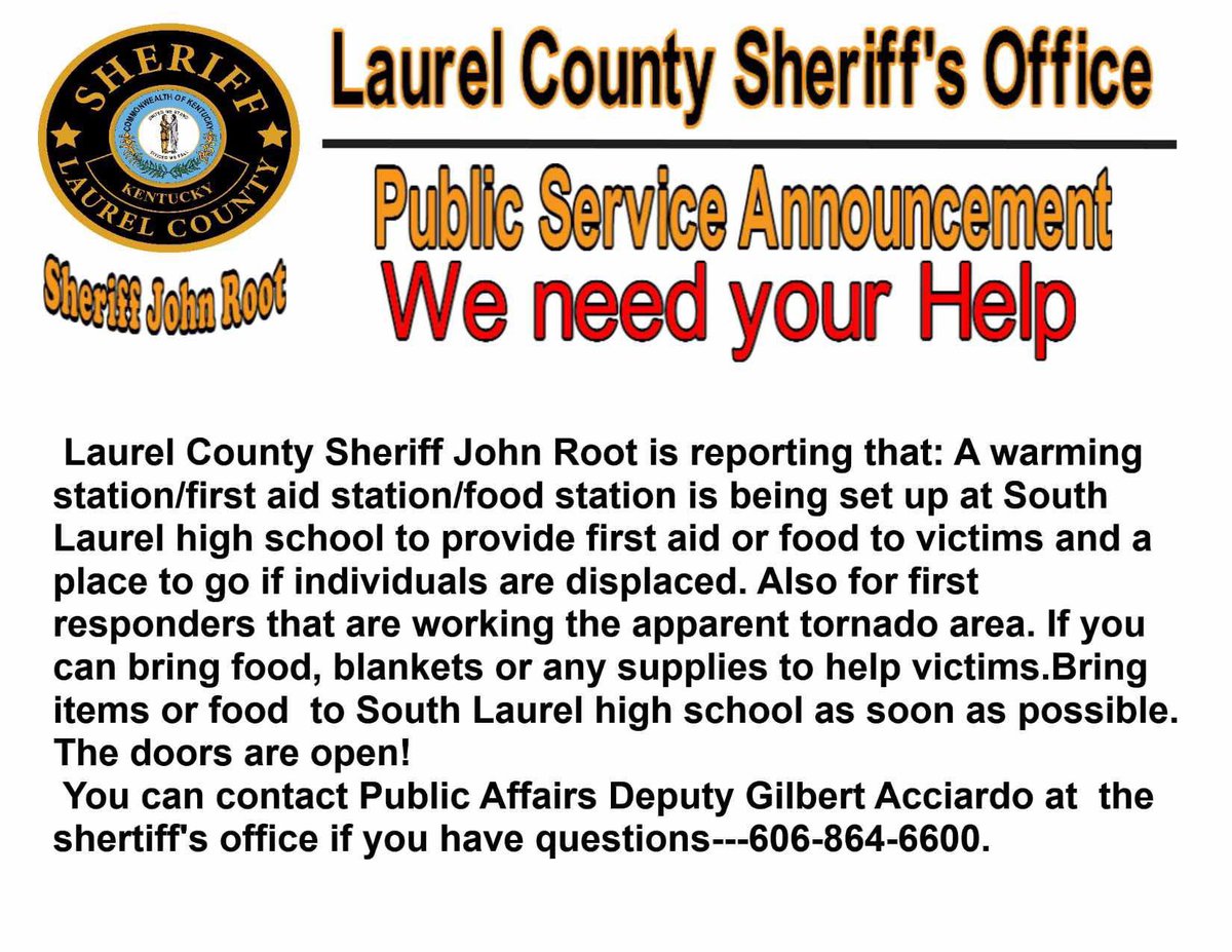
There are reports of a MASS CASUALTY event occurring in Somerset, KY, after this tornado ripped through the town.
Did The Trump and @DOGE cuts to the National Weather Service likely cost people their lives tonight?