🏔️ A Different Climate at the Top of the Carolinas
At 6,684', Mt. Mitchell has a climate unlike much of the Carolinas! Temperatures are often colder than surrounding valleys, with snow, ice, strong winds, & rime ice common in the colder months. Elevation makes a BIG difference!
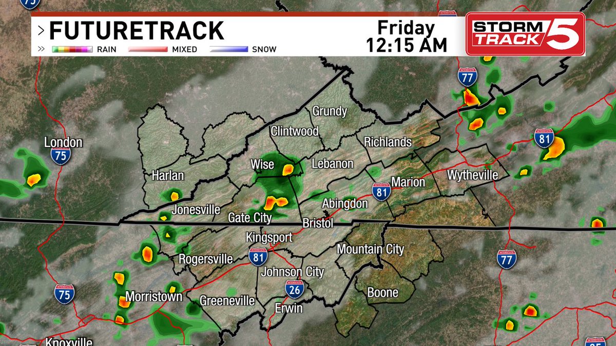
The main caveat to the lunar eclipse is going to be cloud cover. It looks like decent chances of showers and storms move in tonight. Areas to the east of the Tri-Cities have a litter better chance to see it, for several of us, it will be iffy.
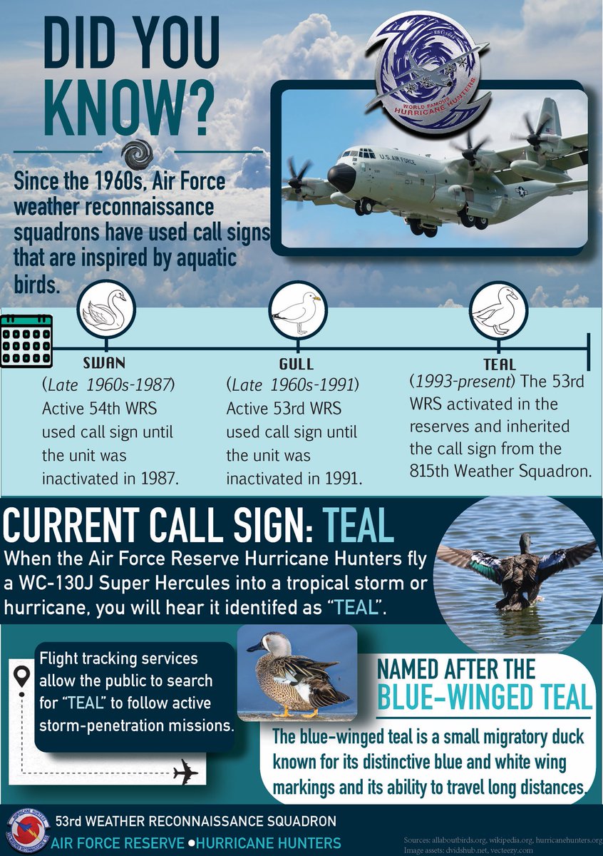
Did you know? 👀
When you see “TEAL” on a flight tracker, you’re not watching just any aircraft- you’re watching the Air Force Reserve Hurricane Hunters in action! 🌀✈️
📊Infographic by Staff Sgt. Stacey Thornburg
#WeatherReady#hurricanehunters#afrc
This is video you HAVE to see!
A landspout… turned waterspout… turned tornado…
This was yesterday in St. Lucie County, south of us.
Was rated an EF-0 by my friends at the NWS office.
Video thanks to Kevin and Leslie Donovan, and my buddy Glenn Glazer;
EL NINO UPDATE: The "Super El Niño" hyperbole is off the charts this week. Many are posting those really bad Chat GPT graphics promising days of doom, gloom, death, and destruction this winter. Many on TikTok continue to tell you that "mankind will be wiped out" by next summer.
This is an update posted on Saturday August 22 in an effort to provide a sane voice crying out in the wilderness.
The graphic posted here is a current look at the warm equatorial waters, associated with a very strong El Niño ENSO phase underway.
NOAA's current probabilistic outlook gives 100% odds of El Niño continuing through January-March 2027, with a 97% chance still in place for February-April and 82% for March-May. The event is forecast to peak during late fall and early winter, then gradually weaken during spring 2027.
For Alabama, El Niño is generally a wet/cool signal for the cool season, particularly when the event is moderate or strong like the current situation. The most likely implications:
*Above-average precipitation: El Niño winters tend to favor a more active southern storm track, increasing the odds of frequent rain across Alabama.
*Temperatures leaning cooler: The odds favor a cooler-than-normal winter compared with La Niña winters, although that does not mean persistent cold.
*More storm systems: A stronger subtropical jet can send more disturbances across the Gulf Coast and Southeast. Alabama's tornado season (November through May) should be considerably more active than the last one, which was very benign.
*Better opportunities for winter weather: El Niño increases the opportunity for snow, sleet and freezing rain events in Alabama, but it absolutely does not mean Alabama is going to have a snowy winter. The details of individual storm tracks and temperatures will determine that.
*Gulf Coast storms/rainfall: A more active southern jet can mean several significant Gulf Coast low-pressure systems.
This is the important point: I would not use El Niño alone to make a confident tornado, severe-weather, snow, or ice forecast for Alabama. A strong El Niño can load the dice toward a wetter southern U.S. winter and a more active subtropical jet, but it does not tell us exactly when cold air and Gulf moisture will overlap.
Likewise, a very strong El Niño does not guarantee an exceptionally wet Alabama winter. NOAA explicitly cautions that even the strongest ENSO events do not produce their typical impacts everywhere.
Time will tell how this plays out. But mankind will be here next summer, and you don't need to be consumed with anxiety.
A tropical wave is expected to move off the west coast of Africa on Monday, and an area of low pressure could form in association with the wave early this week. Formation chance through 7 days at 50% percent. Google DeepMind AI gets it close to the Caribbean by early September.