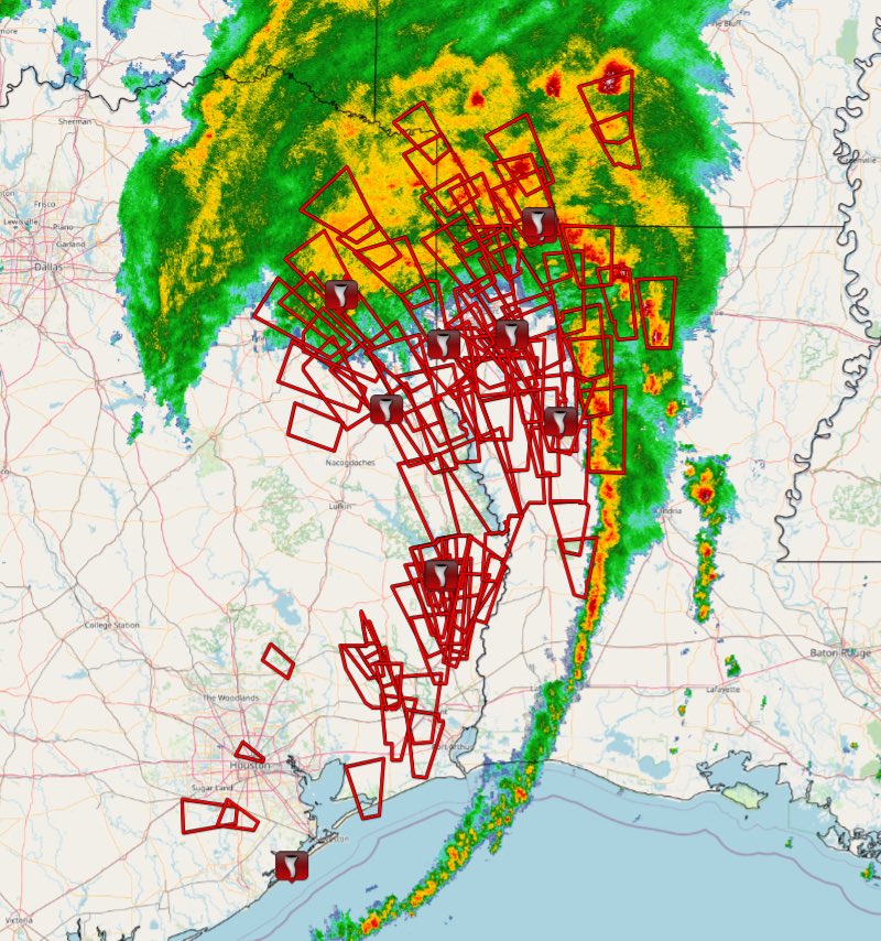
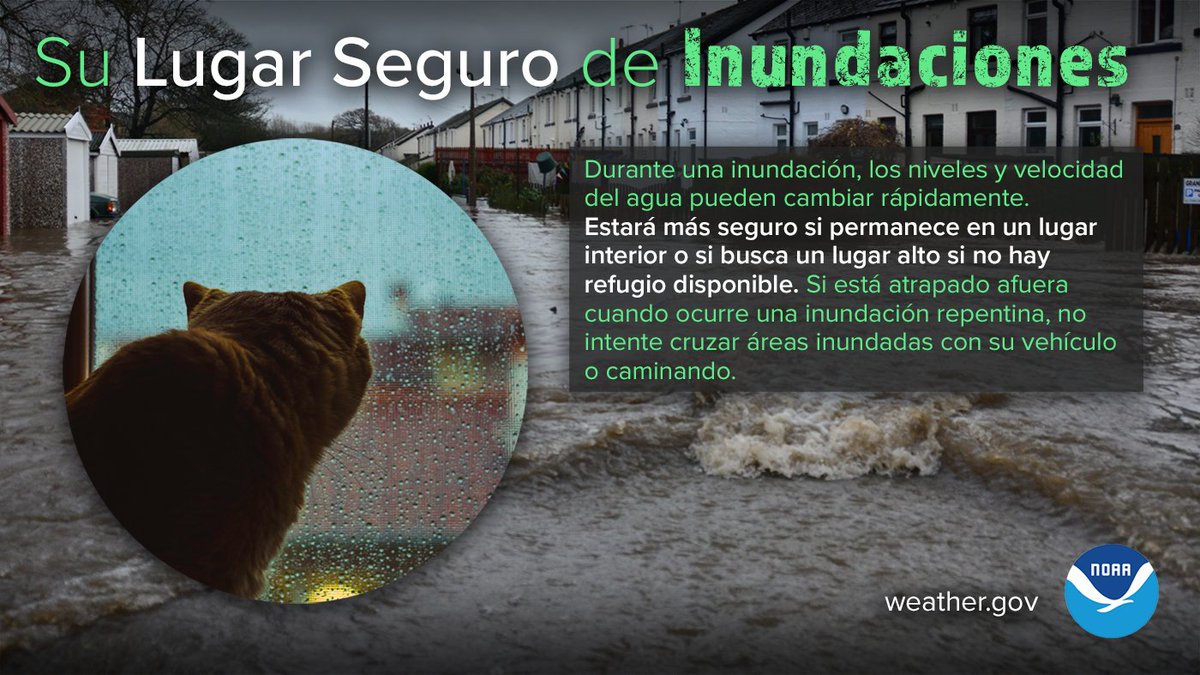
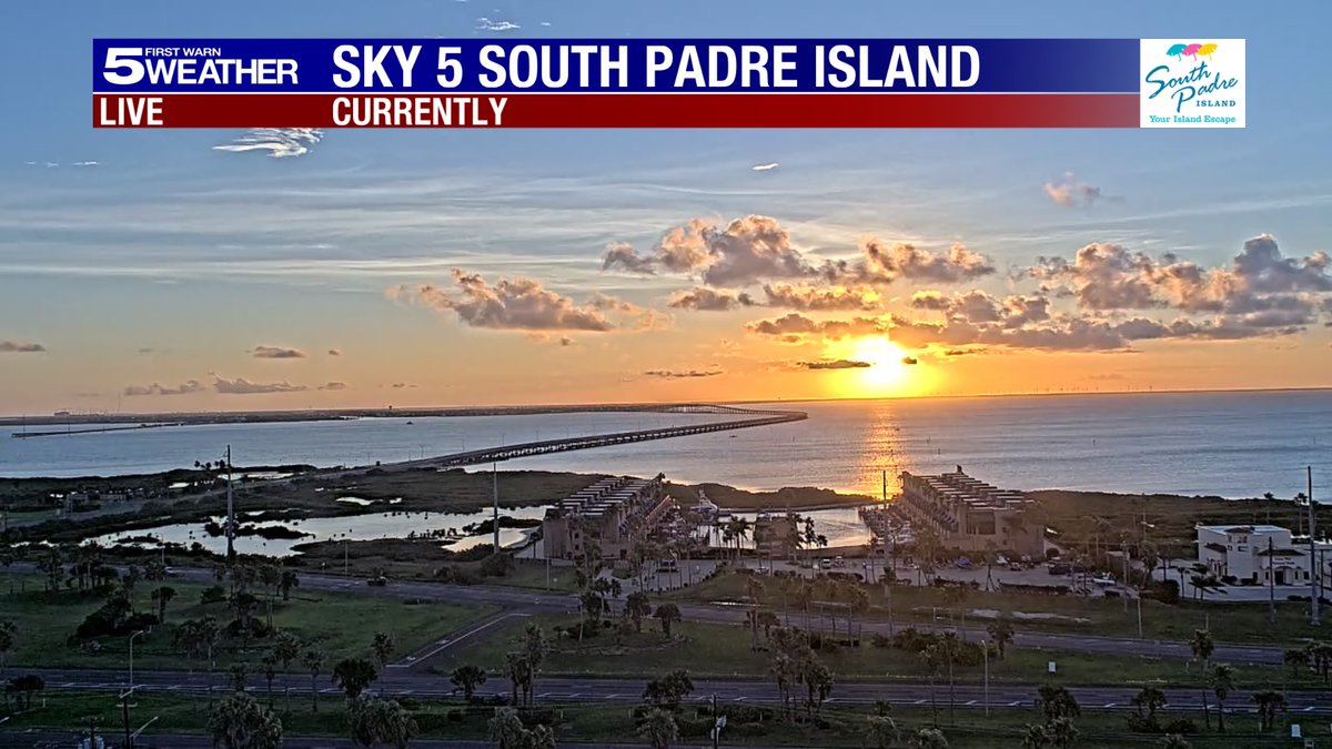
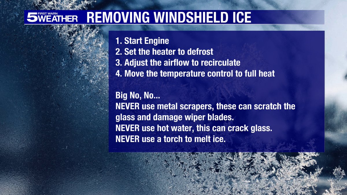
Amazing what we can see on Sky 5! The first front of the season will move through the RGV during the overnight hours. Could be a shower or t'shower with the front then windy and cooler for Wednesday (in the 70s)!
#rgv#rgvwx
If you look closely, you can see a human walking around the base of the rocket.
Each Raptor rocket engine produces twice as much thrust as all 4 engines on a 747.
There are 33 Raptor engines powering the Starship rocket booster.
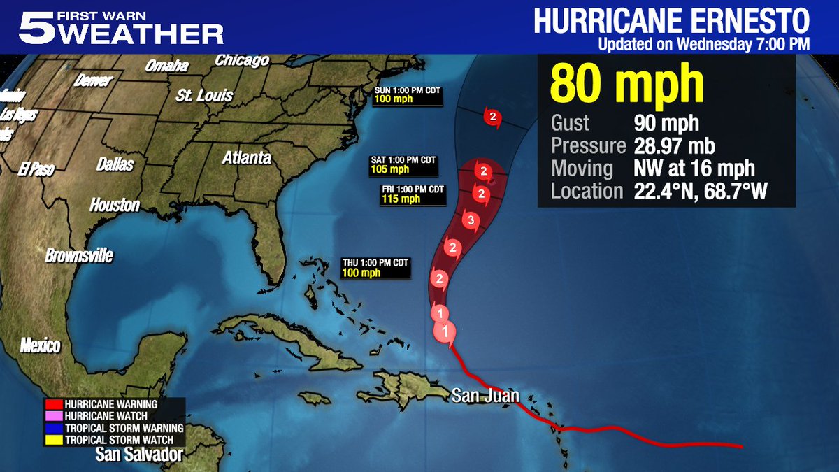
{7:09PM Wednesday} Hurricane Ernesto's maximum winds are up to 80 mph, as of the 7pm advisory from the National Hurricane Center. Ernesto was centered about 720 miles south-southwest of Bermuda and is no threat to the mainland U.S. Elsewhere, the tropics are quiet. #RGVWX#TXWX
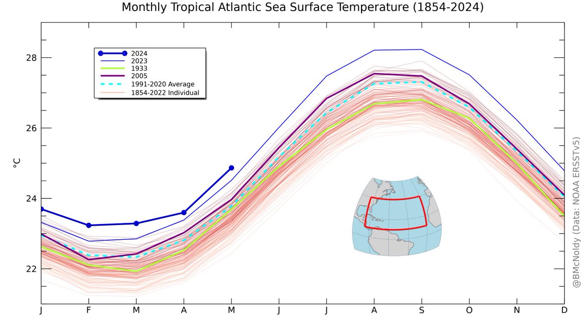
I had a great time discussing hurricanes and rapid intensification this morning on the NTWC+ podcast with @hurricanehal_, Bill Read, @KRGV_TimSmith , and @alexgarcia_wx. One listener question was about the tropical Atlantic SSTs in 1933 compared to now (2005 added as a bonus)...
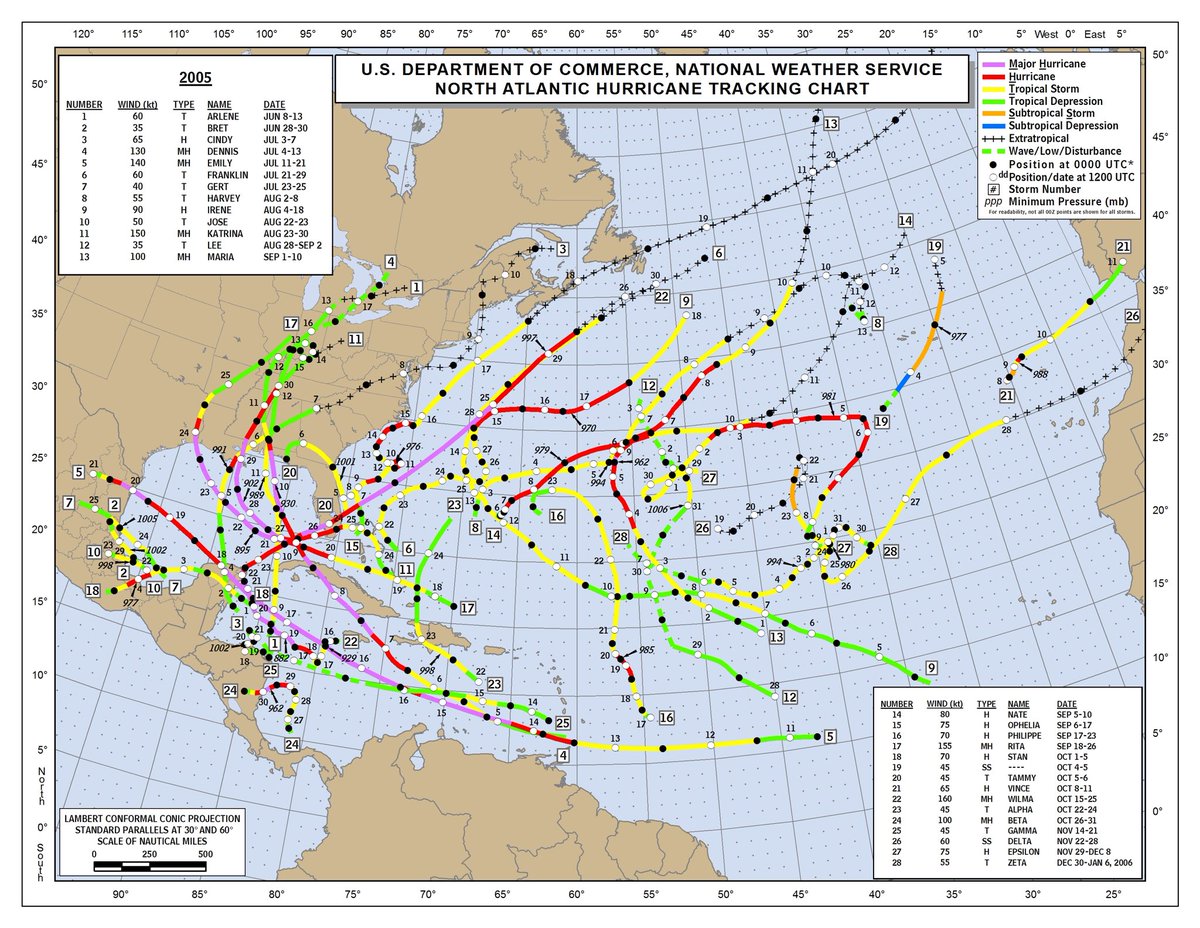
We generally think of 2005 as the overactive, nonstop season. But after Dennis and Emily, at least there was a month break between hurricanes before the peak of season majors. Intraseasonal variability is a real thing. Even if a sizeable break after #Beryl, peak will be busy.
A 24 Hour Difference
The first shot is around 5pm yesterday when the probe was deployed, then first light around 7am shows approximately 3-5 feet of surge on the backside of the storm, only to be mostly gone by 5pm today.
Sargent, TX - County Rd 201, looking SE.
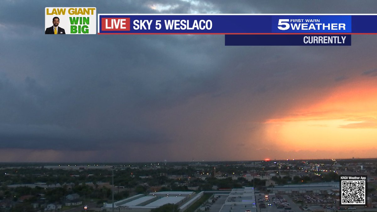
[8:25PM Monday] What a beautiful sunset to end the day - from our Sky 5 Camera in Weslaco. Hope your evening is as beautiful as this picture! #rgv#rgvwx
[3:30pm Monday, July 8] Thunderstorms with heavy rainfall dotting the RGV this afternoon. This is the view from Sky 5 in Weslaco looking toward the East. Brief heavy rain along with some thunder and lightning around the RGV today. #rgv#rgvwx
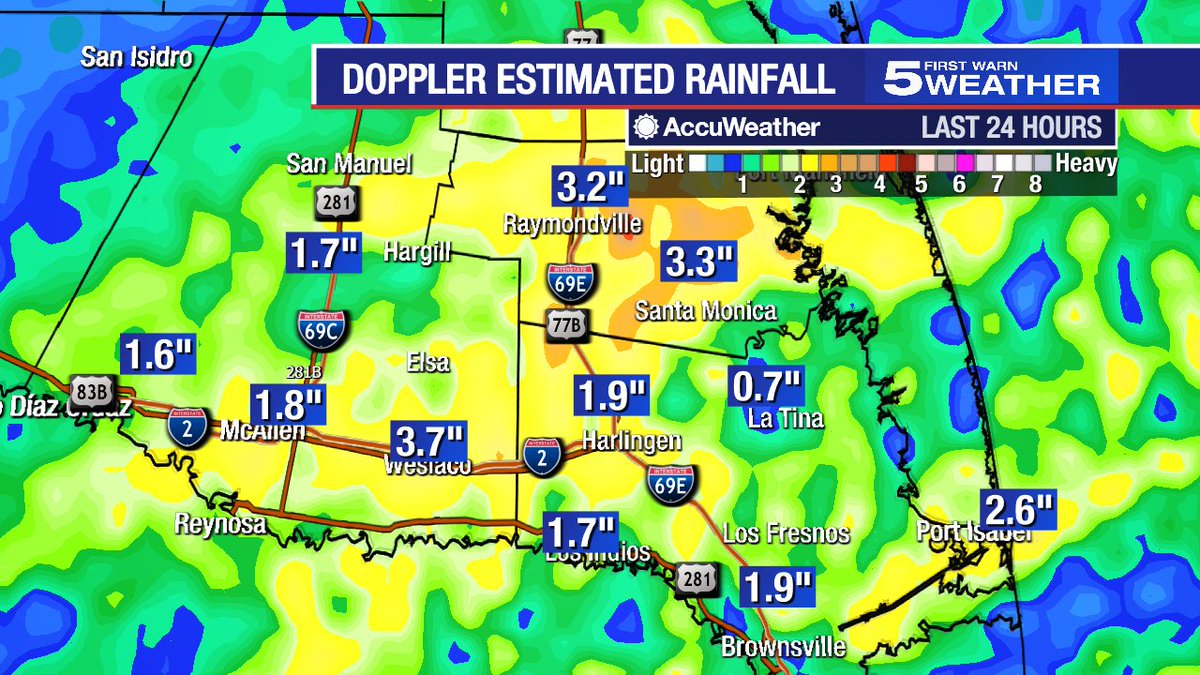
Here are some doppler estimated rainfall totals across the RGV as of 5:30pm Wednesday. The heaviest rainfall has been in Willacy County. Here at our studios, we've measured just over 3 inches of rain. More is on the way. #rgv#rgvwx
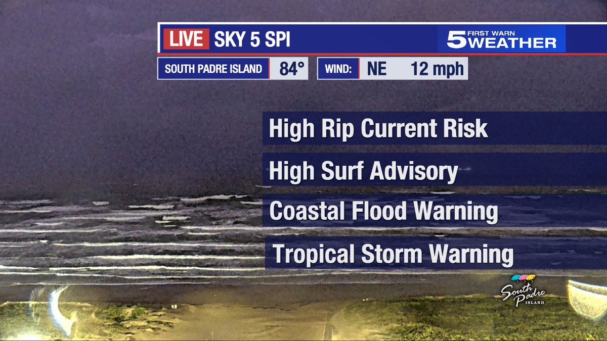
South Padre Island is a beautiful place to watch a storm, but it's not a good time to go in the water. Dangerous rip currents, high surf, large waves and, at times, gusty winds - will be the rule for Wednesday at the beach. Lots of warnings and advisories in place. #rgv#rgvwx
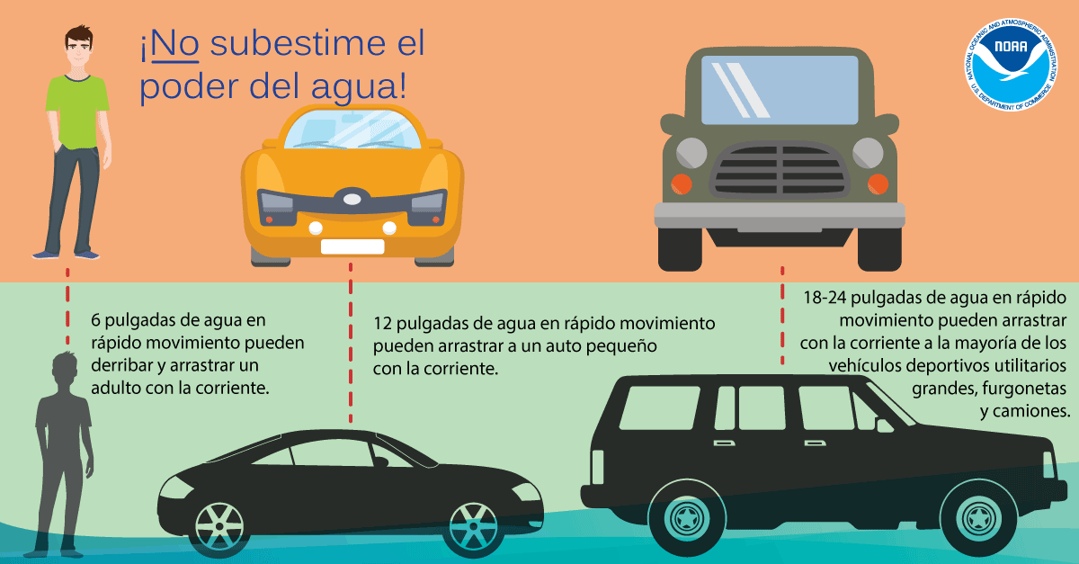
As the #rgv readies for a period of torrential and potentially flooding rain up to several feet in poor drainage locations, we urge everyone to be safe if driving . It's becoming clear that potential flooding rain is Wednesday morning into afternoon. If you can stay home, do so.




![KRGV_TimSmith's tweet photo. [8:25PM Monday] What a beautiful sunset to end the day - from our Sky 5 Camera in Weslaco. Hope your evening is as beautiful as this picture! #rgv #rgvwx https://t.co/jH48HkxTt3](https://pbs.twimg.com/media/GSAjTq3WoAAIZ-o.jpg)
![KRGV_TimSmith's tweet photo. [3:30pm Monday, July 8] Thunderstorms with heavy rainfall dotting the RGV this afternoon. This is the view from Sky 5 in Weslaco looking toward the East. Brief heavy rain along with some thunder and lightning around the RGV today. #rgv #rgvwx https://t.co/nlyhiINcYC](https://pbs.twimg.com/media/GR_gtsXa8AA40hF.jpg)