@bcsmaps I finally got around to booking my tickets to this today. Looking forward to both days and catching up with other mapping people in the UK! 🌍 🗺️
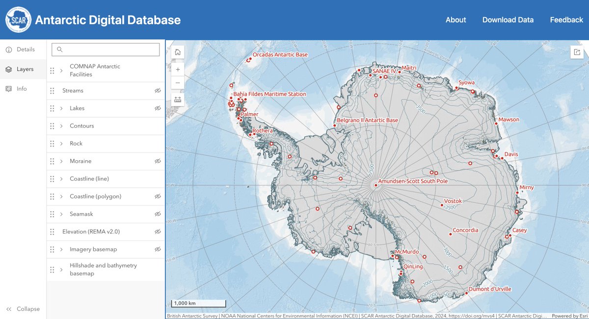
What's that? A new map viewer bringing together all the data of the Antarctic Digital Database? Freely available?!
Go enjoy yourself zooming into bits of Antarctica, map lovers ⬇️
https://t.co/DWwaghwzUh
The BAS ✨MAGIC✨ team looks after this project for @SCAR_Tweets.
These updated Arctic & Antarctic maps were the last ones I completed before starting maternity leave and I’m so happy to see them officially released! Thanks to my team at @BAS_News for sharing the story. Mapping these fast-changing and fragile environments is always fascinating.
Today our cartographers released new Antarctic and Arctic maps - with lots of changes to these fast changing and fragile places:
🧊 ice sheet loss
🌊 new sea ice data
📌 using indigenous town names in the Canadian Arctic
#WorldOceansDay#climatechange
https://t.co/GNfe2F5BEF
Excited to share this project that I worked on with Cambridge composer @ewan_a_campbell, who wrote a haunting piece of music onto a map tracing the path of iceberg A22 from the Filchner Ice Shelf to the South Atlantic 🎶❄️ Full details in this blog: https://t.co/SWNHHv8BLG
This #WorldWaterDay2023 we're excited to share a new composition from @ewan_a_campbell inspired by the 21-year journey of the A22a iceberg.
It follows the lifecycle of the iceberg from calving to break-up, drawing attention to the threat of climate change.
Here’s an extract 🎺
ICYMI, we've contributed our coastline and contour datasets from the Antarctic Digital Database (ADD) to ArcGIS Living Atlas of the World 🌐
Shout out to our Mapping and Geographic Information Centre, appropriately known as ✨MAGIC, who manage this topographic data.
Before and after 🤓
Here's a super sharp view of the vast new #iceberg breaking away from the Brunt Ice Shelf in #Antarctica.
📸 Sentinel-2 @CopernicusEU & thanks to @USGSLandsat for the before shot from 20 Jan.
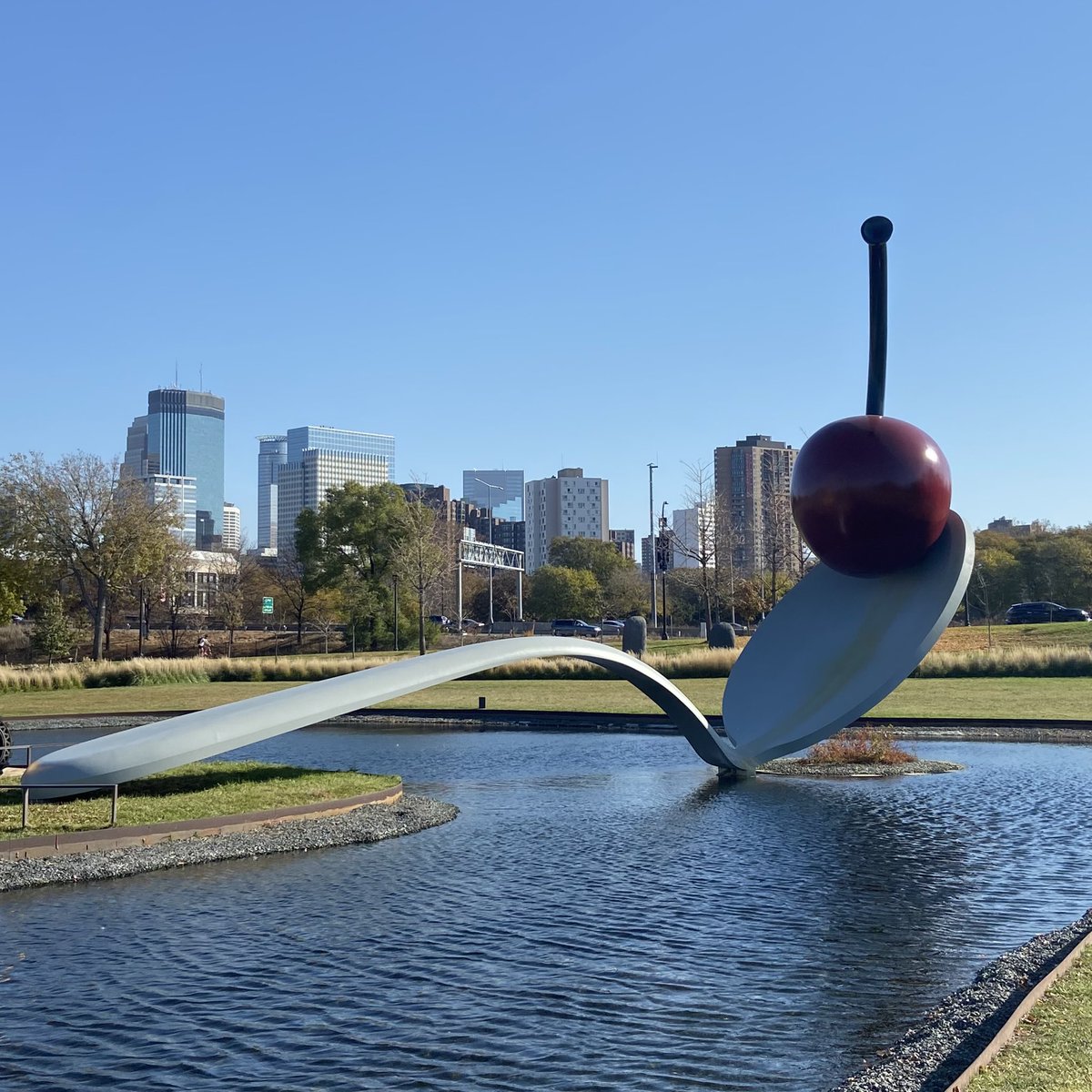
What a fantastic last week at the #NACIS2022 conference in Minneapolis. Thanks to everyone I met for being so welcoming - it was a great conference to present at and I was inspired by some of the interesting talks that were given. Also enjoyed some sightseeing in the city today!
Iceberg #A76 - calved from the Ronne Ice Shelf in May 2021 as the biggest iceberg in the world at the time. It has now reached the tip of the Antarctic Peninsula & the edge of the sea ice! Still 140 km long. Heading towards Elephant I. but likely to follow previous tracks shown.
I'm currently updating @BAS_News's published Arctic map and I'm using the fairly new @CopernicusEU GLO-90 #DEM to update the elevation data, and isn't it just beautiful😍 I love working with DEMs and even without any other datasets, these quick screenshots show so much!
Come and work with us at @BAS_News providing geospatial support to our scientists and operational teams! Fantastic opportunity for a GIS Specialist to join us for 6 months, working on a variety of interesting projects. Please share! 🇦🇶🗺️❄️#GISjobs
https://t.co/5pkyufW4P0
Under the polar darkness of winter, Antarctica is frequently aglow with the southern lights—aurora australis: https://t.co/MhAiM4BS3G
VIIRS imagery from July 18
@IceSheetMike @jediabetical @betacellpodcast @IceSheetMike well done for sharing your story here. I am sorry that it happened to you. Your situation is much worse, but as a type 1 diabetic who has also been prevented from working in Antarctica, you have my sympathy & I can only hope things will improve as we speak up more.
Proud that some of our @SCAR_Tweets Antarctic Digital Database datasets are now part of Esri's @LivingAtlas 🥳🎉 Working in such a fast-changing environment will always keep us busy and the longer I work on 'mapping Antarctica', the more I realise there is to map!
BAS' Antarctic Digital Database is now more accessible than ever as part of the @ArcGISApps Living Atlas of the World 🗺️ Check out the latest ADD map of the Conger Ice Shelf and find out more on the BAS website: https://t.co/WPdeIY5fVF #Antarctica#Research#PolarScience
Job opportunity! Just under a week left to apply for this fantastic opportunity to be an #EarthObservation Specialist in our team at @BAS_News! Please share far and wide. 🛰️❄️ #remotesensing#gisjobs
https://t.co/LAl8y25X0Z
Continuing my ship hunting...I've been following the progress of @Endurance_22 & I'm amazed to see they've reached the approx. site of the ship. I thought I'd look at the conc. of sea ice at their location, & it's pretty concentrated! No wonder @thehistoryguy says they are stuck!
Are you interested in Remote Sensing in Antarctica? New vacancy for an Earth Observation Specialist at @BAS_News to work on a wide range of activities in one of the coolest teams around! Please share with interested groups. #remotesensing#EO#gisjobs https://t.co/LAl8y25X0Z
@geologicalJo@BAS_News@NERCscience Thank you Jo! It’s always a pleasure to support your fascinating research and make maps of the amazing places you’ve been 🏔 ❄️
Nice @ESA_EO#Sentinel1 image acquired just a couple of hours ago showing the #RRSSirDavidAttenborough travelling through sea ice close to the Stange Ice Shelf in Antarctica, as part of its ice trials during the first season south. @BAS_News@gm0hcq