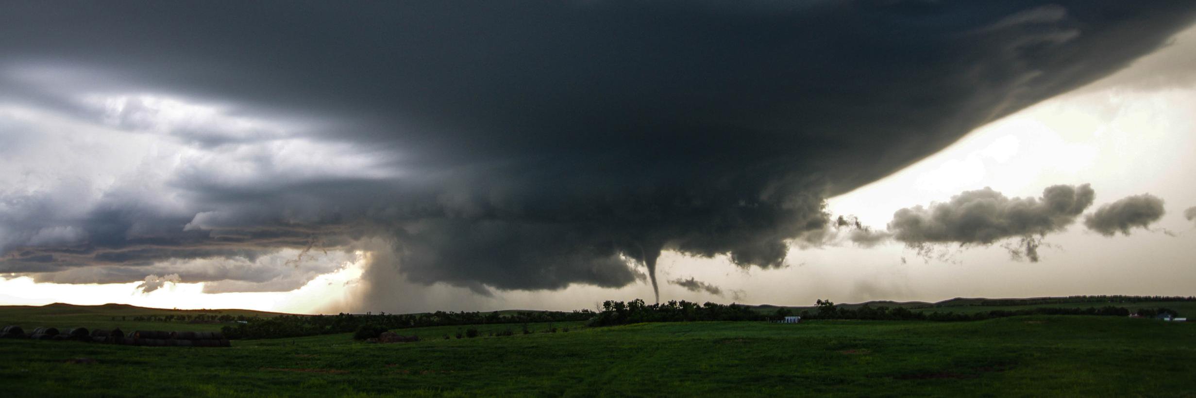
@danfetter78@scottdkehler@NTP_Reports Yes it did touch down for a few minutes in a field northwest of Dufrost. In my first picture in the first tweet you can see dirt and vegetation swirling under the funnel just to the left of the power pole.
Looking through images from the tornado near Dufrost MB yesterday. Vortices were rotating around the main funnel/tornado. First picture is of tornado and ground circulation. Second and third of satellite vortices. Taken at 3:44 PM CDT 4 km W of Dufrost looking north.@NTP_Reports
Today is the most dangerous severe weather setup I have seen in southern Manitoba in a long time. Storms could produce tornadoes, destructive winds, and very large hail. If thunderstorms approach, take shelter immediately. #mbstorm
There is a risk of severe thunderstorms tomorrow in eastern Saskatchewan and western Manitoba. These storms could produce large hail, damaging winds, heavy rain, and tornadoes. The risk of severe weather is expected to continue on Sunday in southern Manitoba. #mbstorm#skstorm
We’re expanding our team and looking for two talented Meteorologists. If you’re passionate about atmospheric science, we want to meet you!
Learn more: https://t.co/bwdRaydTOE
We’re hiring for Summer 2026! 🌩️
Weatherlogics is looking for our next Meteorological Assistant. If you are passionate about severe weather and data analysis, we want to hear from you.
Apply here: https://t.co/bwdRaydTOE
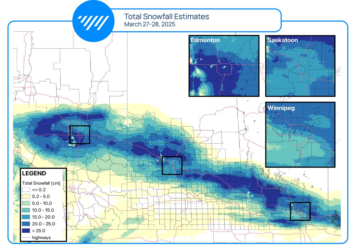
A significant spring snowstorm is coming to an end across the Prairies. Here are estimated total snowfall amounts across the region up to 12 PM on Friday, March 28. #abstorm#skstorm#mbstorm