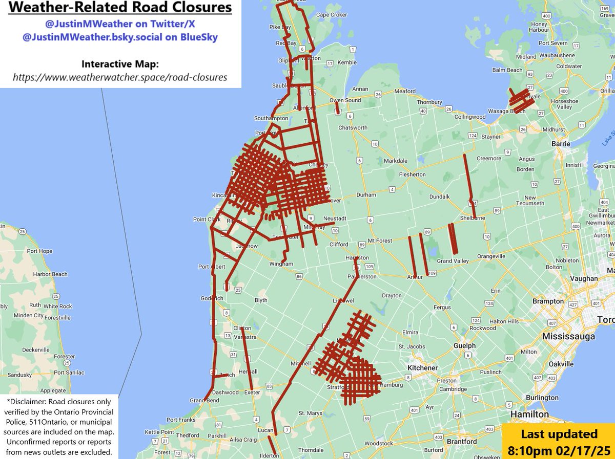
Updated road closures as of 9:10am #onstorm#onwx
Reopened Grey/Dufferin 124
Closed Hwy 6 b/w Durham and Williamsford
Plows remained pulled from Bruce County
https://t.co/1Kk1mC4Dns
Cleared: Weather conditions on #HWY21 Both Directions between Amberley Road (County Road 86) / Ashfield Huron Townline Road [ near Amberley ], AMBERLEY and Bruce Avenue [ near Kincardine ], KINCARDINE. All lanes closed. #Closure#ONHwys
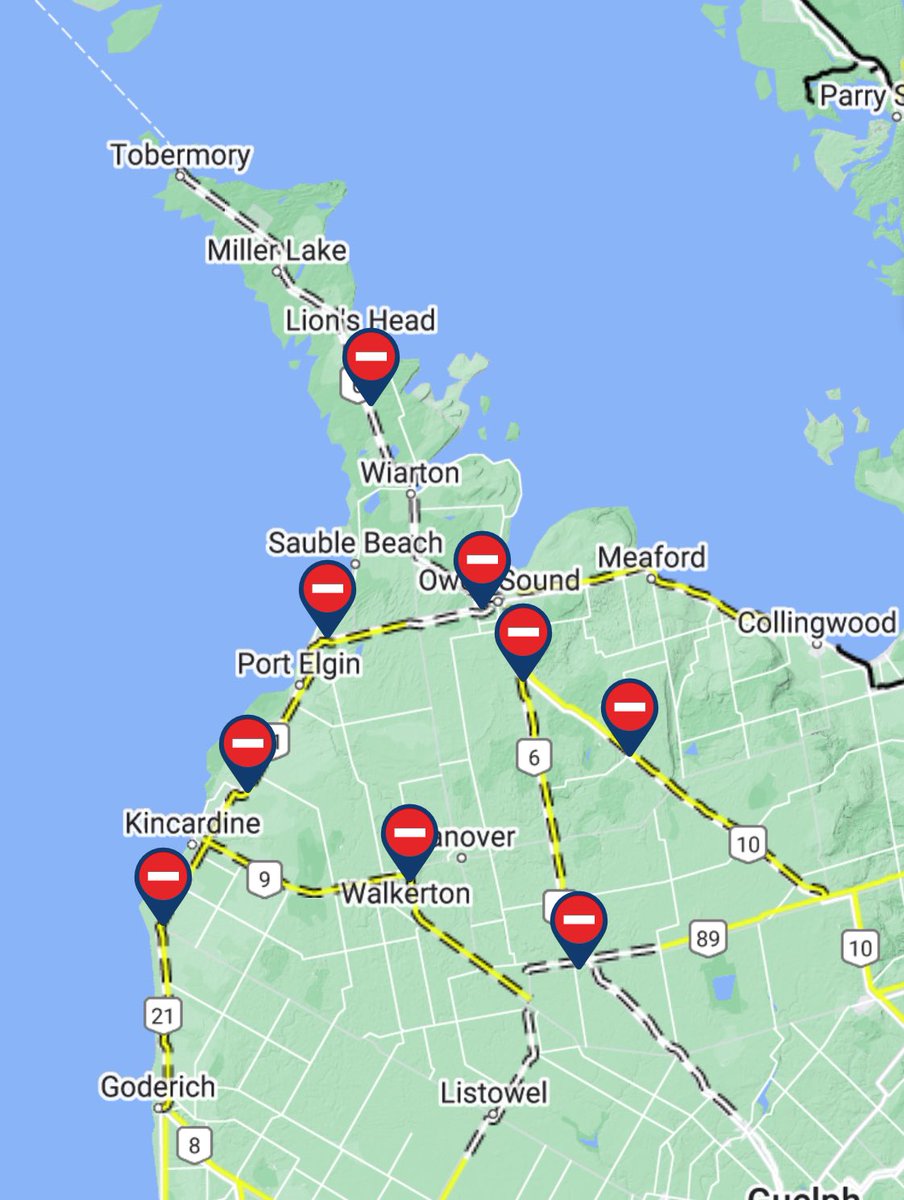
#ONStorm#ONwx ⚠️ HIGHWAY CLOSURES ⚠️
1:41 PM - Sunday, January 14, 2024
Many highways have been closed throughout Grey and Bruce counties due to the reduced visibility being caused by snow squalls.
Current list: https://t.co/D6ynZkUGko
** Remember, driving on a closed road is ILLEGAL. Ignoring a road closure carries a fine of $110 plus three demerit points. It can also affect your insurance. The roads are closed for your safety and emergency services may not be able to reach you should you get stranded. **
Please be safe if you must travel today through the affected areas. If possible, just stay home until conditions improve.
- Brennen & Cole
Road Conditions on #HWY21 Both Directions between County Road 15 [ near Tiverton ], TIVERTON and Amberley Road (County Road 86) / Ashfield Huron Townline Road [ near Amberley ], AMBERLEY. All lanes closed. #Closure#ONHwys https://t.co/zFlajXkts5
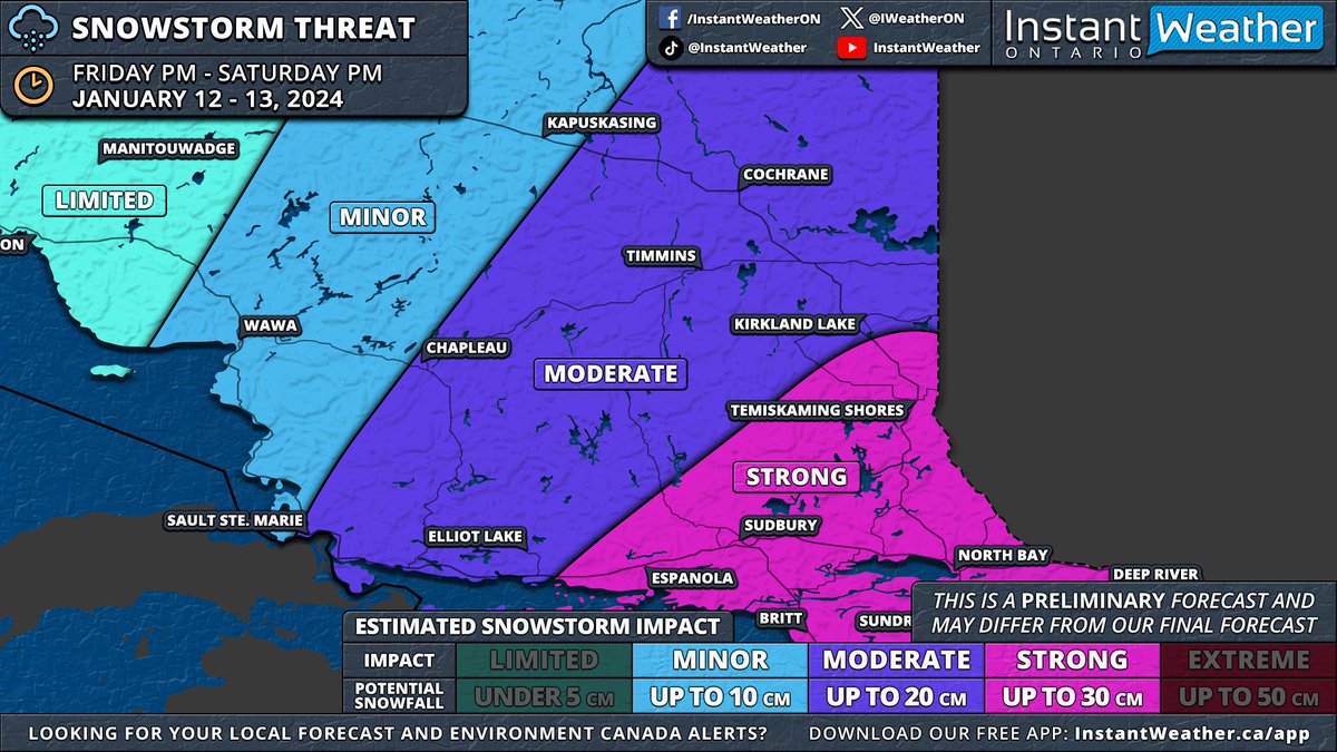
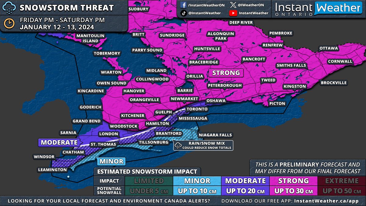
#ONStorm#ONwx ❄️ SNOWSTORM PREVIEW: Widespread Significant Snowfall of Up to 30cm on the Way for Most of Southern & Northeastern Ontario
📅 Friday, January 12 - Saturday, January 13, 2024
——
After reviewing the latest model data from this evening, it appears increasingly likely that Southern Ontario will experience its first widespread significant snowstorm of the season starting Friday.
We'll publish a detailed forecast article in the morning. For now, here's an early look at the forecast maps based on this evening's model runs. Remember, this forecast is preliminary, as the storm is still about 36 hours away. Although there's time for model adjustments, any changes should be minor given the high confidence in this event.
Before Friday's main event, a weaker system will pass through Southern Ontario on Thursday morning and afternoon. While significant accumulation isn't expected, a few centimetres may cover Central and Southwestern Ontario, including the Greater Toronto Area. Lake enhancement east of Lake Huron could increase totals to 3-6cm in the Owen Sound to London corridor, tapering off by late afternoon.
The main storm is expected to start between 2-5 PM on Friday, beginning in Extreme Southwestern Ontario. Initial bands could bring heavy snowfall, with rates of 5-10cm per hour, and the potential for thundersnow, a phenomenon we haven't seen since last winter's major blizzard. ⚡️
Strong wind gusts of 60-80km/h, locally reaching up to 90km/h, will likely create treacherous driving conditions. Areas might experience localized blizzard conditions, especially in Southwestern Ontario, the Golden Horseshoe, and parts of Central Ontario.
These heavy snowfall rates will move through Southwestern Ontario, affecting London, Kitchener, and Hamilton by early evening. The Greater Toronto Area will experience this intense snow later in the evening, eventually spreading northeast to Central and Eastern Ontario, continuing overnight into early Saturday.
While the heaviest snowfall will be brief, moderate snow will persist behind the initial band throughout the night into Saturday. Around the Lake Ontario and Erie shorelines, a brief surge of warmer air Friday night into Saturday morning could lead to a temporary changeover to rain, potentially reducing snowfall totals in the Niagara region and parts of the Greater Toronto Area near the lakeshore.
A sharp cooldown early Saturday morning will bring temperatures back below freezing, switching precipitation back to snow and creating a risk of flash freezing. Icy road conditions are likely on Saturday morning.
By Saturday's end, most of Southern Ontario, excluding Deep Southwestern Ontario and the Niagara region, can expect 15-30cm of snow. The Lake Erie shoreline and Niagara region are projected to receive 5-15cm, while the Greater Toronto Area could see 10-20cm, with higher amounts further from the lakes.
This event will also affect Northeastern Ontario with over 20cm of snow on tap for Sudbury, North Bay and Temiskaming Shores starting late Friday evening and continuing through Saturday.
As the system exits, lake effect snow will intensify late Saturday around Lake Huron and Georgian Bay, with snow squalls likely into next week. This could result in substantial snowfall over the week in areas like Goderich, Kincardine, Hanover, Owen Sound, Wiarton, Barrie, Orillia, Midland, Bracebridge, Huntsville, Parry Sound, Britt and Sundridge
We'll provide more details in our full forecast article on Thursday morning and a final forecast with precise totals either Thursday evening or Friday morning.
- Brennen
Perth County Roads are mostly bare and wet at this time. Snow has started, and colder temperatures are coming, be prepared for changing Road conditions, Crews are out applying materials. #PerthCounty#DriveSafe
Thanks BRELAND for spending 244 minutes with me in 2022. I couldn’t stop listening to Strawberry Wine - Spotify Singles. #SpotifyWrapped https://t.co/gF4tNSrWdh
This Canada-wide Rogers outage really highlights the dangers of monopolized industries. When one malfunction can put half of a country’s economy on pause, we have a big problem.